
ANNAPURNA

9th - 31st March 2015
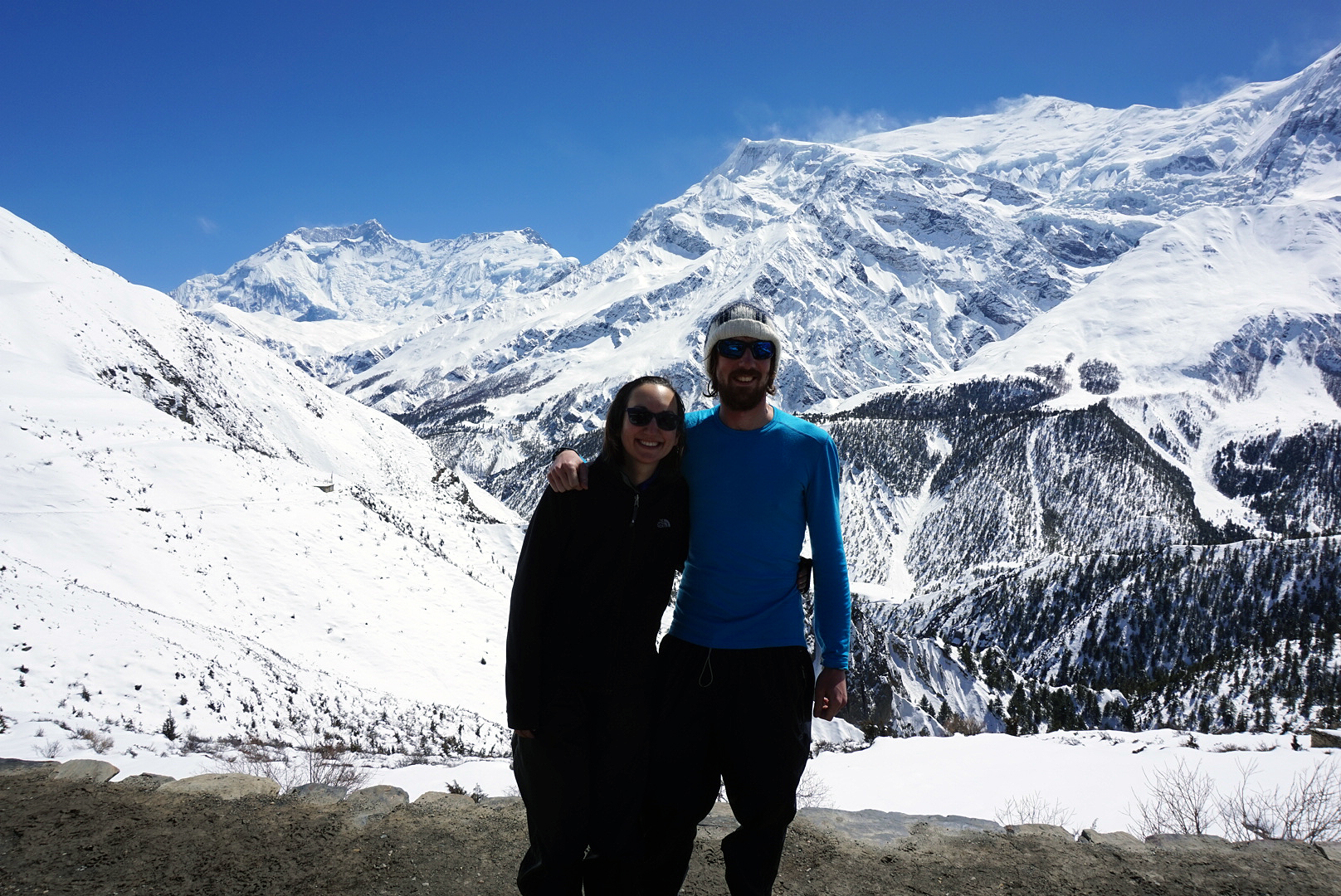
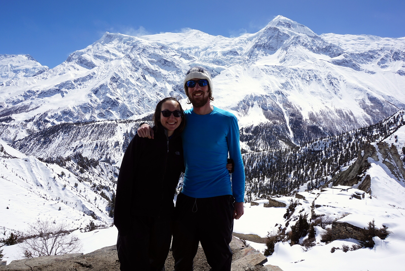
Before we get started this is a mammoth post. We really wanted to capture this Himalayan adventure in as much detail as possible. Some of the days have been written by me and some of the days have been written by Helen, sorry if that gets a bit confusing. I'll let Helen start off...
In the weeks before we set off on our round the world trip, hiking the Annapurna Circuit occupied my mind 98% of the time. (The other 2% was filled with renting our flat, selling the car, packing up our lives, leaving our jobs and saying goodbye to loved ones) I was hungry for information, trying to find out how long we would have to walk each day, what we needed to pack, the route we would take, I was just dreaming of the Himilayan mountains and scaring myself shitless with the unknown.
We finished the trek two days ago, and I am sat in the Kiwi Backpackers Hostel in Pokhara, the sound of building work and squawking birds filling my hungover head. The Annapurna mountain range should be visible from where I sit, but the afternoon clouds have covered them up, making the trek seem like a distant memory. Last night a few of us that joined forces at one point or another on the trek met up for pizza to reminisce, which later saw us move to the Blues Bar, for some Nepali cover band madness (the 20 minute cover of Led Zep's 'Whole Lotta Love' has to be experienced to be believed) and we devoured an entire bottle of gin and a few beers.
To begin to describe our 23 day journey through the most breathtaking scenery I've ever had the privilege to see with my own eyes, is difficult, and is not made easier by the incessant banging and my gin hangover, but here goes...
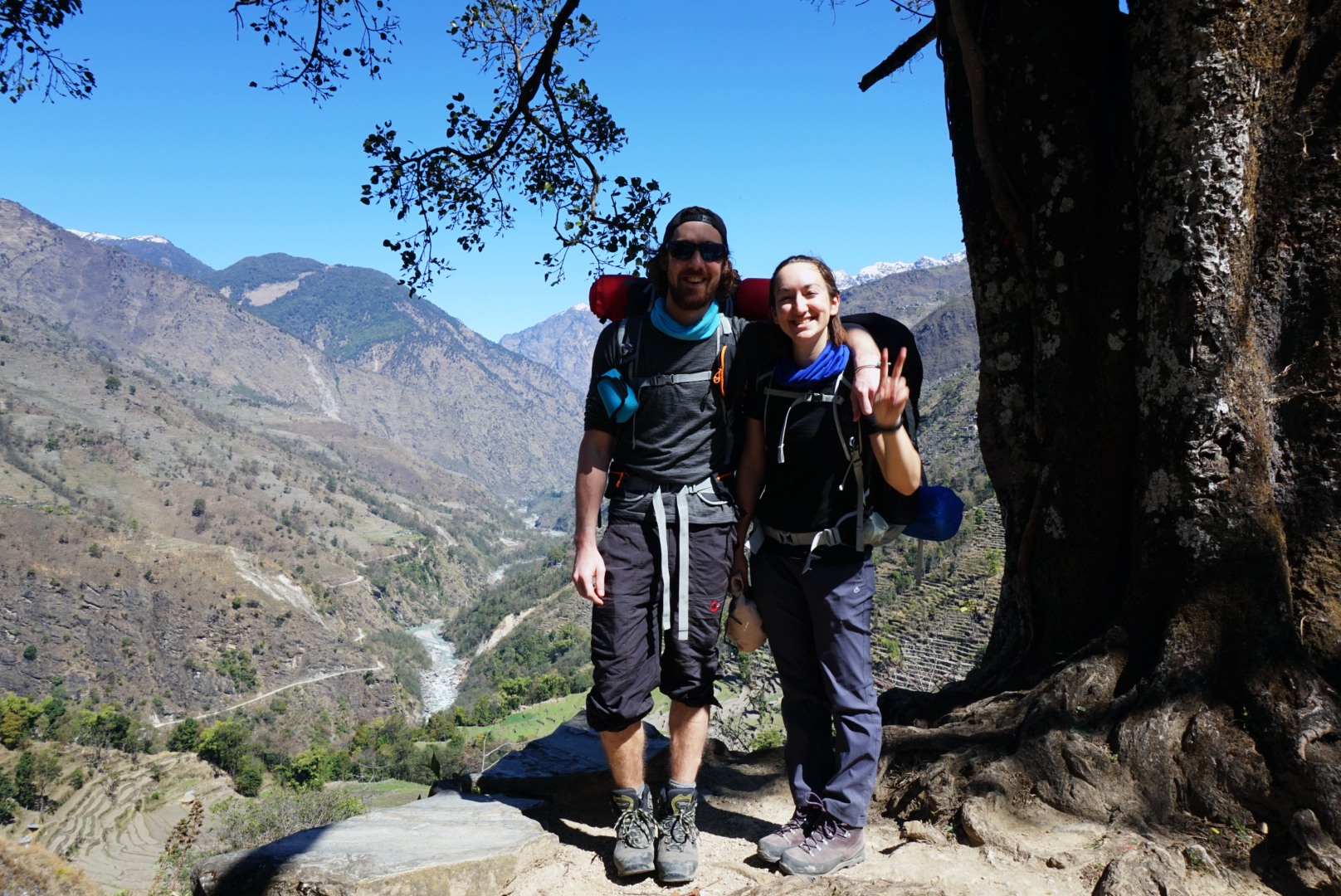
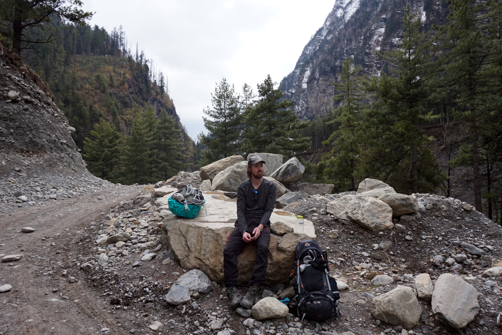
Back in October, when we had booked our flights, and the whole trip seemed a little more real, we started researching this trek. Neither of us had done anything remotely like this before, and we were enticed by the promise that this was an 'every mans trek' and we liked the fact that it was a circle - no going back on yourself, with a new place to call home every night. It sounded tough but achievable, and we loved the simplicity of carrying only what you needed. It seemed the perfect way to start our round the world travels, about as far away from our lives in London as is possible to get.
We started buying the kit, walking up the escalator on the tube instead of standing on the right, and eventually in January, we started walking the 6 miles to work most days in training. We als headed out on day trips to places like Box Hill, and to Wales to attempt to climb Snowdon (we failed) and we also walked the Malverns in preparation. However, knowing that the heights of the Thorong La pass were over 4 times the height of even the highest heights of the UK, our preparations seemed, well, silly. We had to hope that raw stubbornness and Mars bars would get us through.
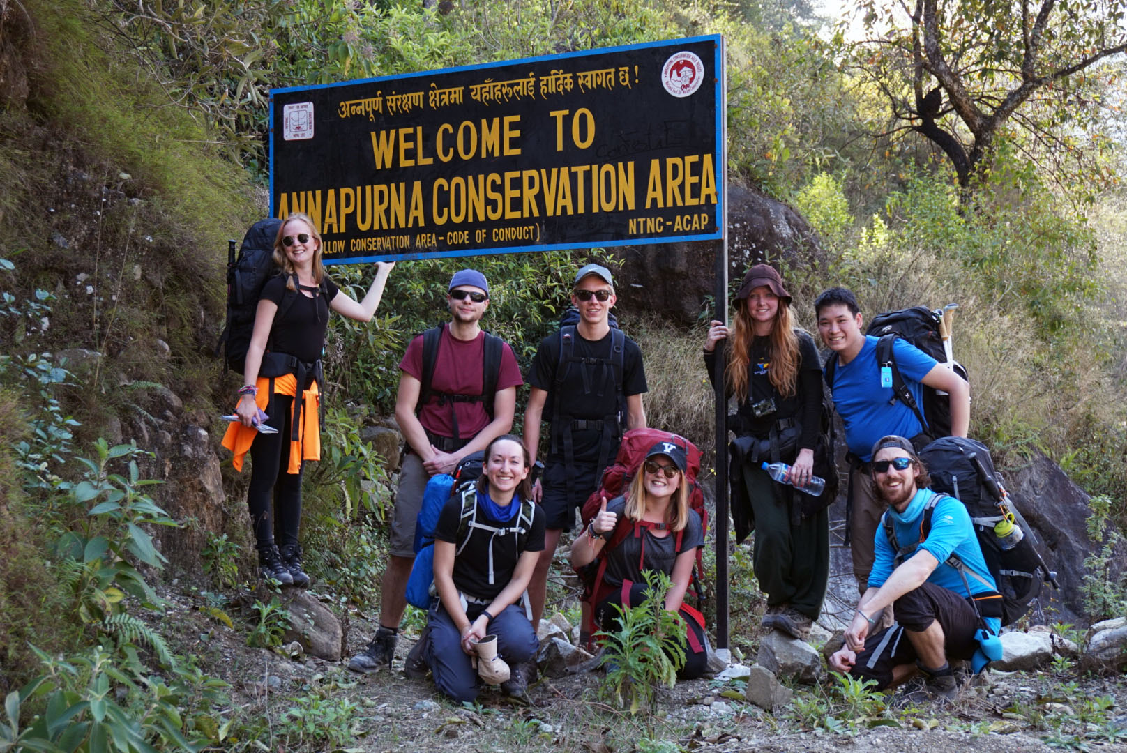
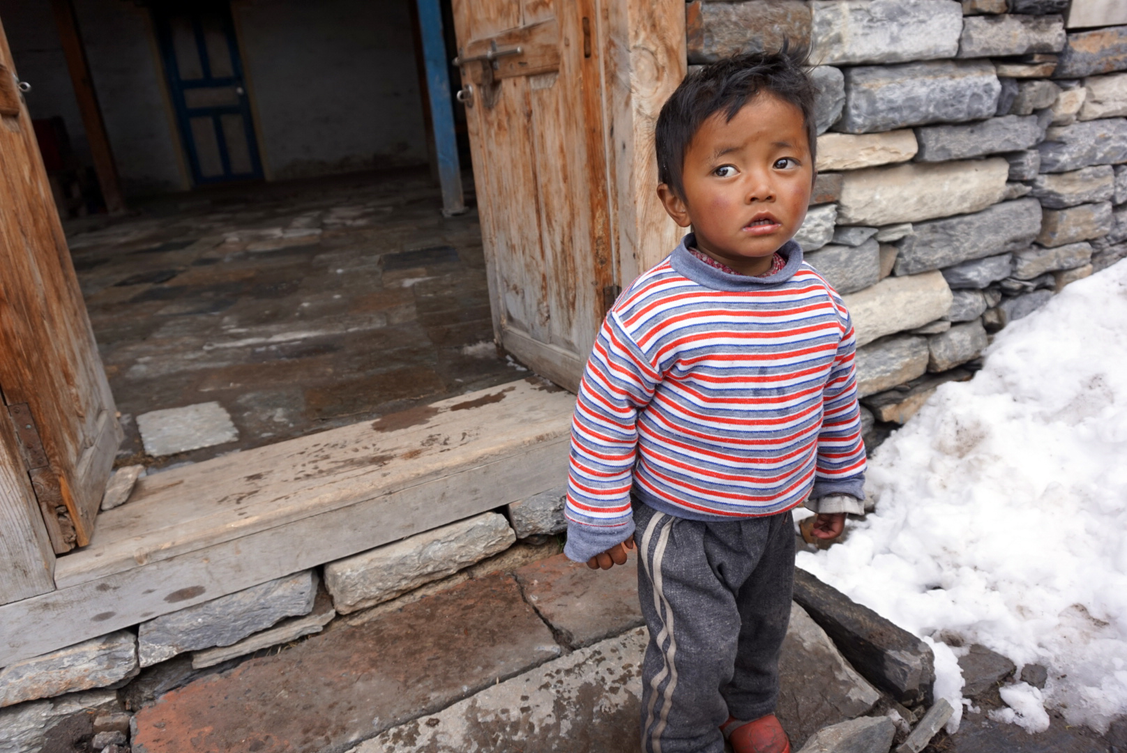
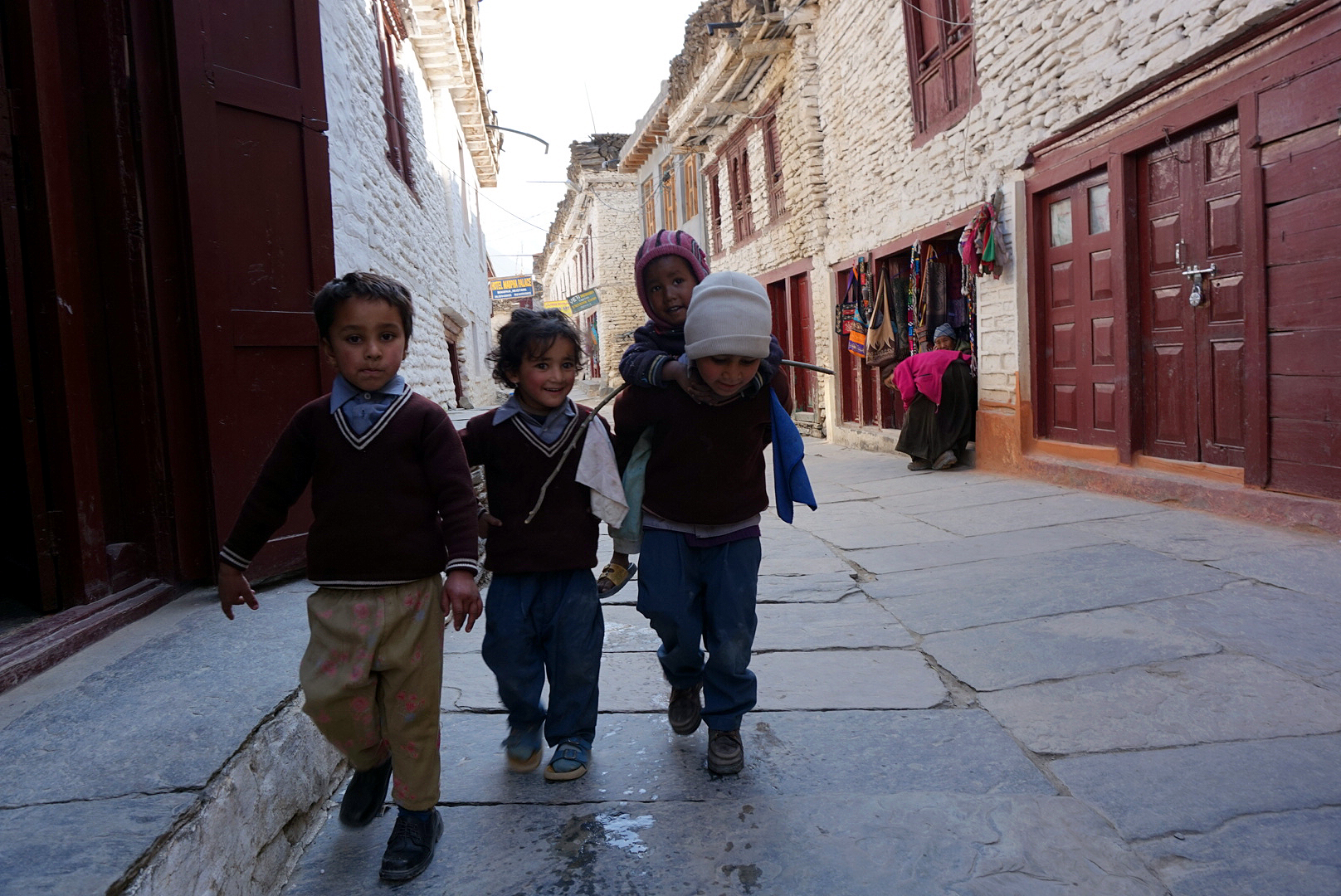
We arrived in Kathmandu on 2nd March 2015, having left from London Heathrow on the night of Sunday 1st March 2015. See Wills post on the madness that is Thamel, Kathmandu, but it goes without saying that we were not in London anymore. Bikes whizzed past us, missing us by inches, Tiger Balm sellers surrounded us, we were offered wooden flutes and hash, there were cows in the road and water being thrown out of shop doors. It was, in a word, insane.
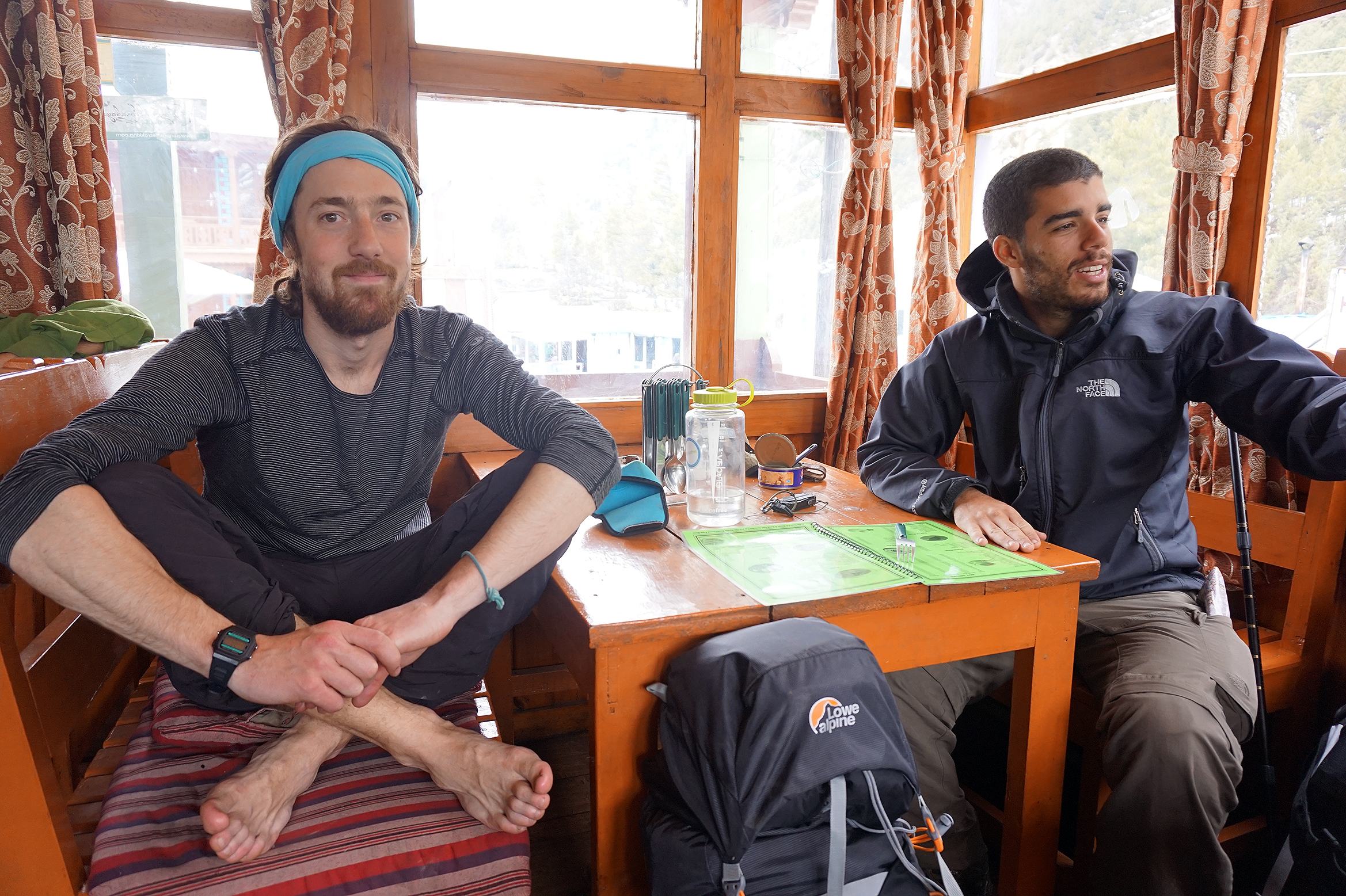
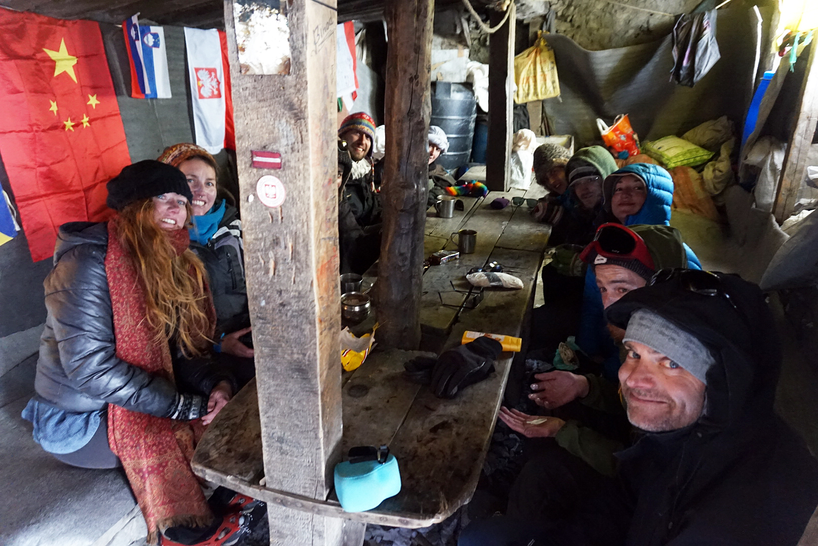
It was in Hotel Silver Home in Thamel that we met a group of would be trekkers like ourselves that formed the group that was later to become known as The Fellowship. I was named Samwise and Will was Frodo. But more on that later.
DAY ONE
Besisahara 750m to Bhulbhule 840m - 9km
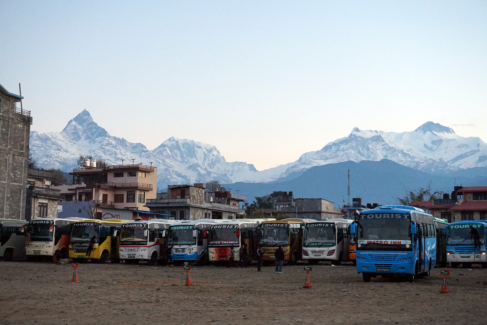
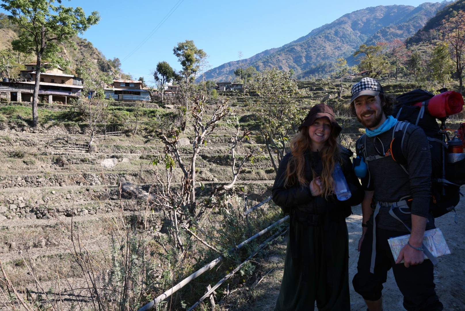
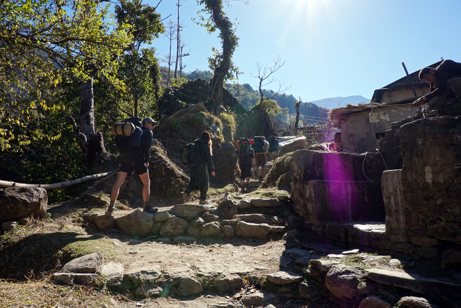
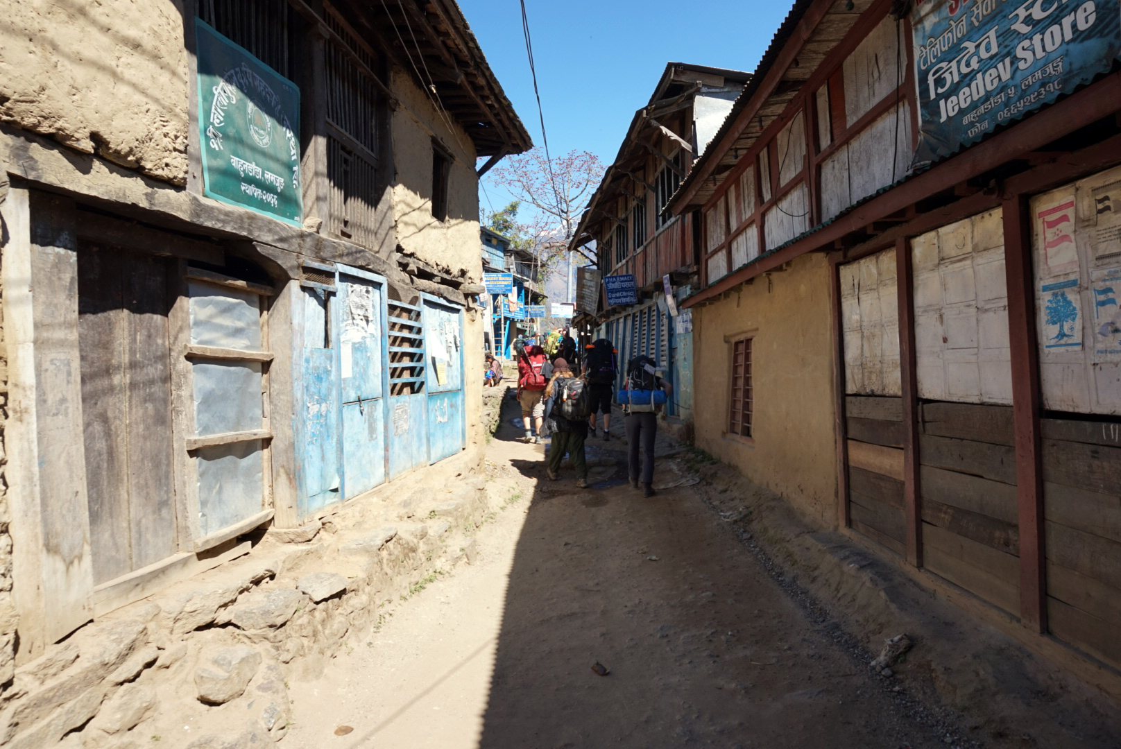
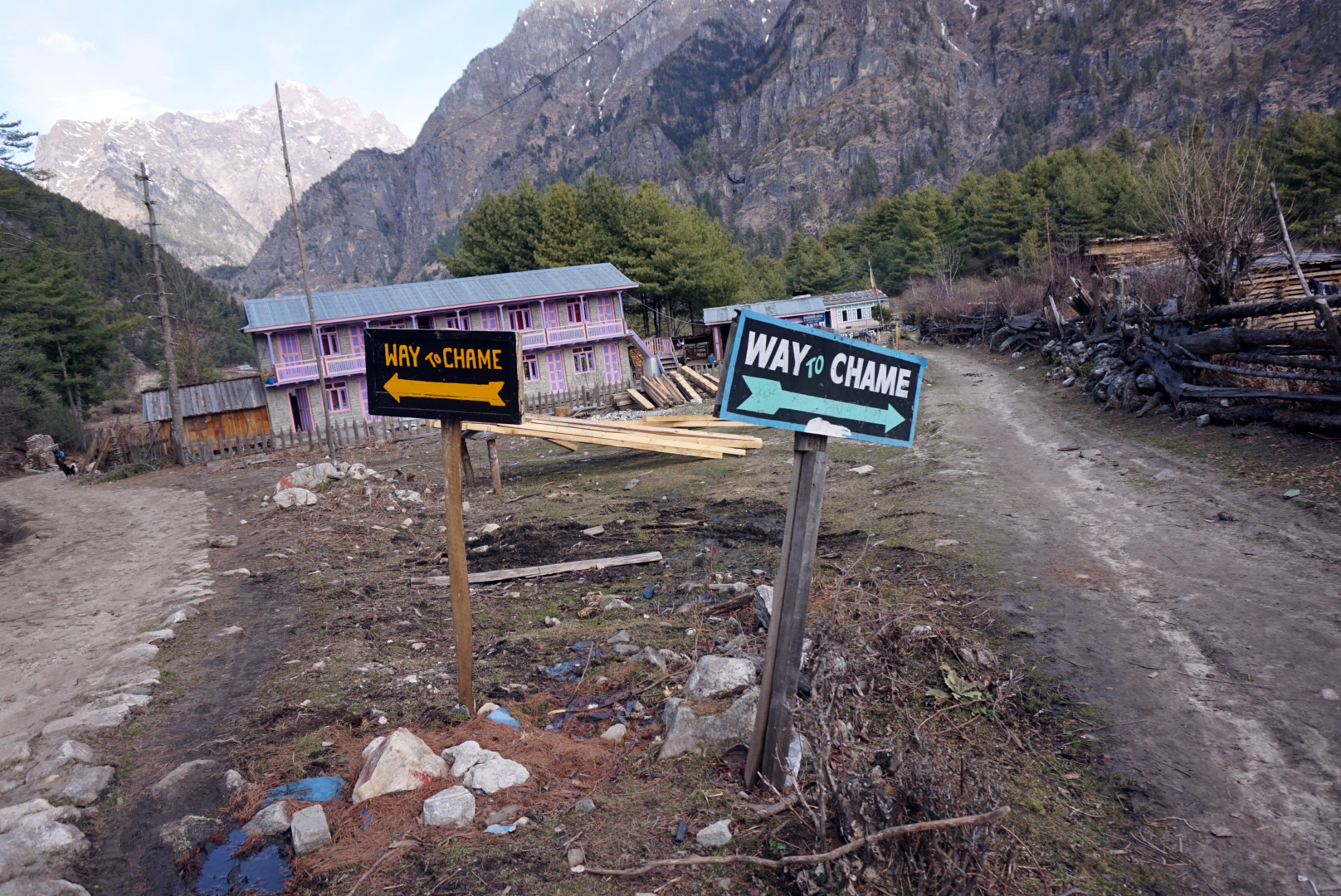
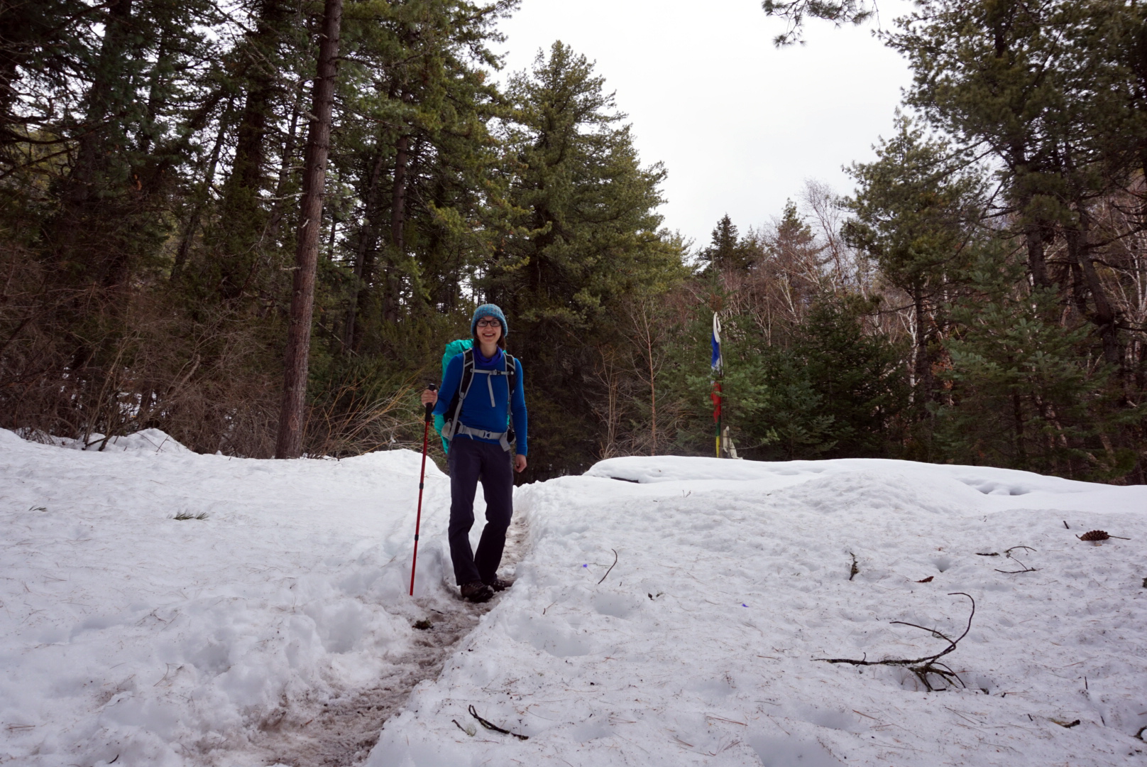
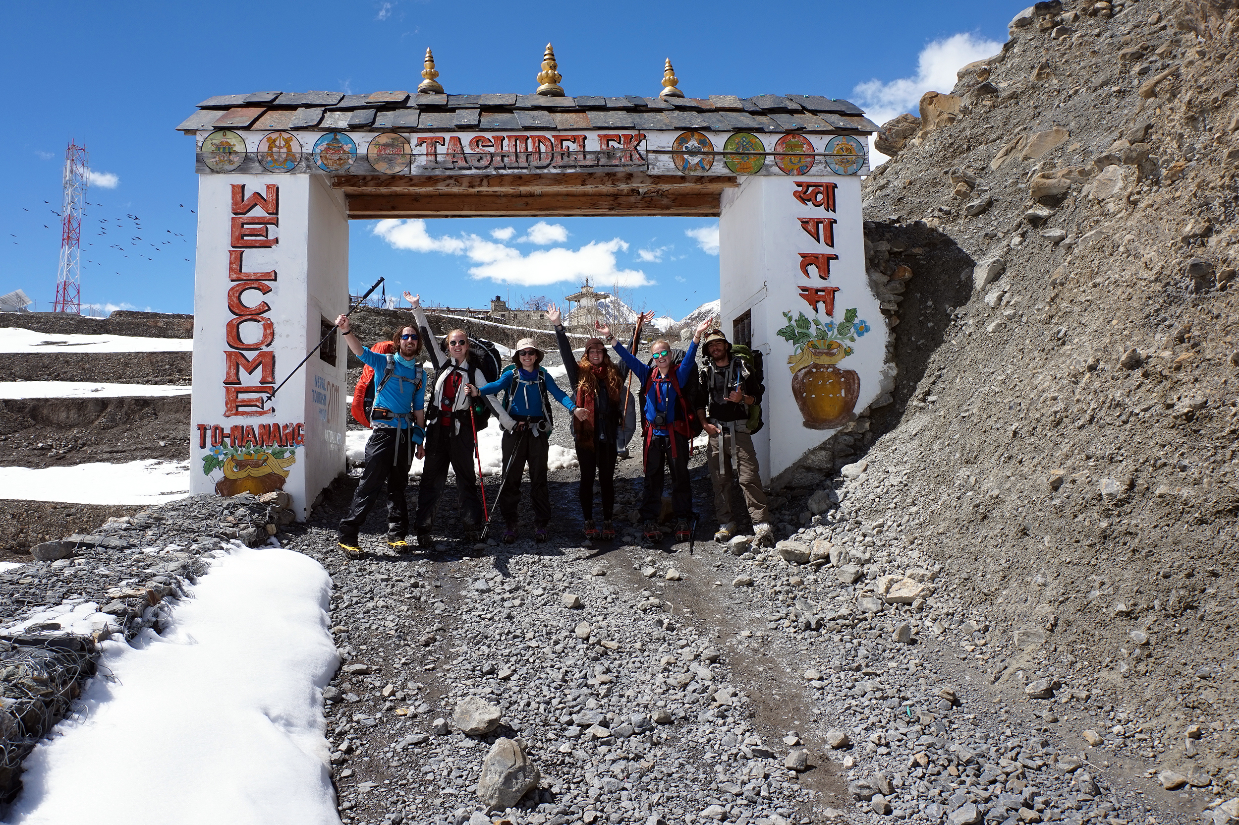
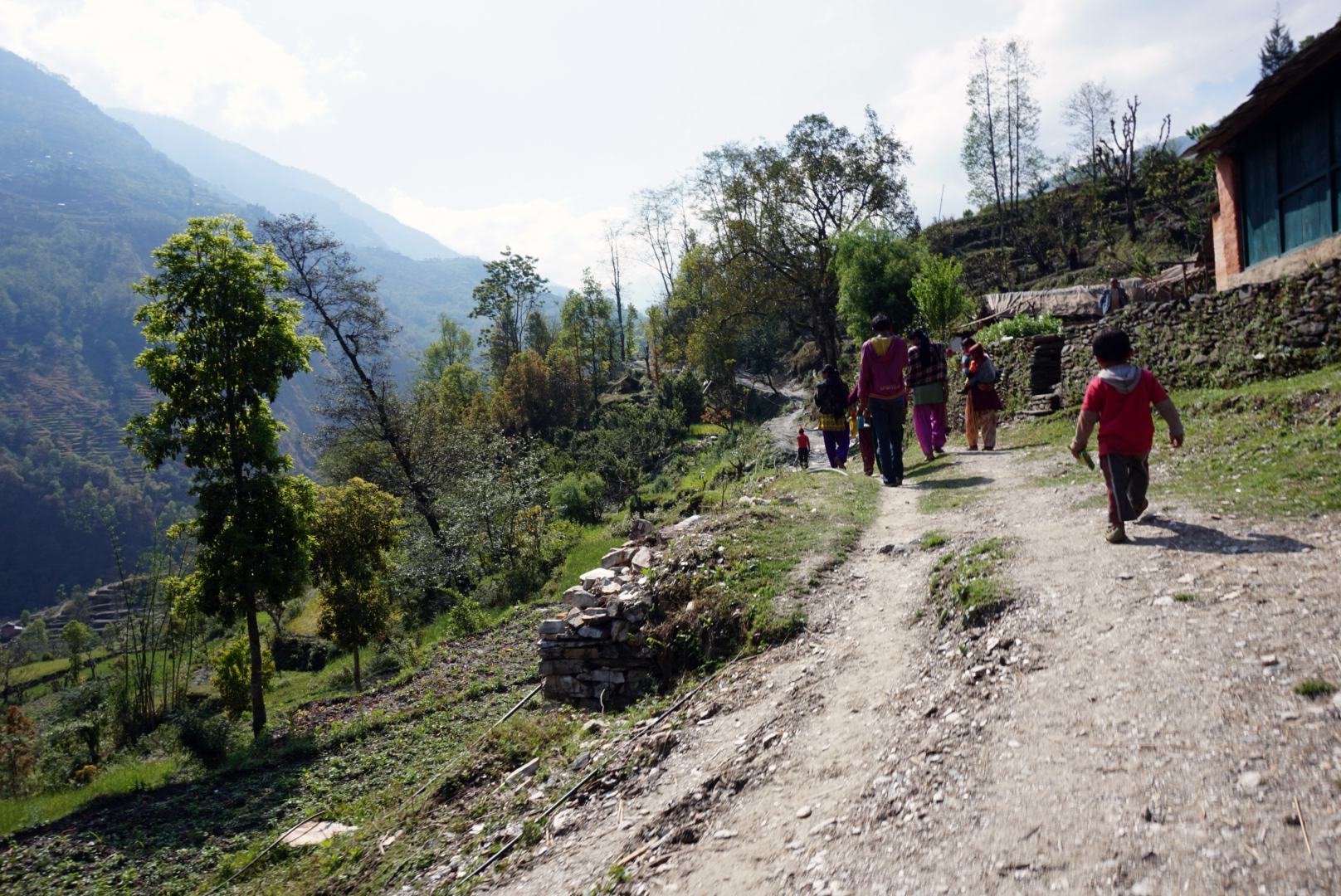
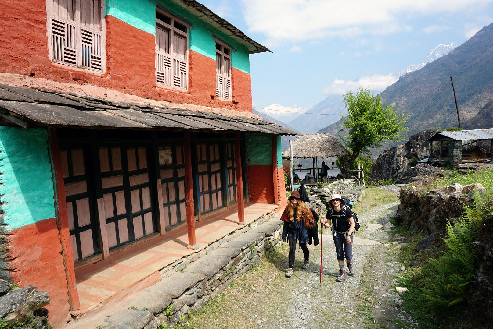
Standing in Pokahara Bus Station in the warm morning light, now glinting off the distant snowy mountains, it was hard to fully understand what we were getting ourselves into. Our little quintet from Kathmandu, each as inexperianced as the next, had grown to eight just before bedtime. Whilst enquiring about bus times the night before, we gained two Sweeds called Ellen & Louise and an Aussie called Bhrett. The general conscious was not to get any guides or porters and just see how we got on. We responsibly compared our maps to find they all were slightly different, this was a promising start. Within a few minutes our bags were strapped to the roof of the bus and we were bumping and snaking our way to the foot of the Himalayas.
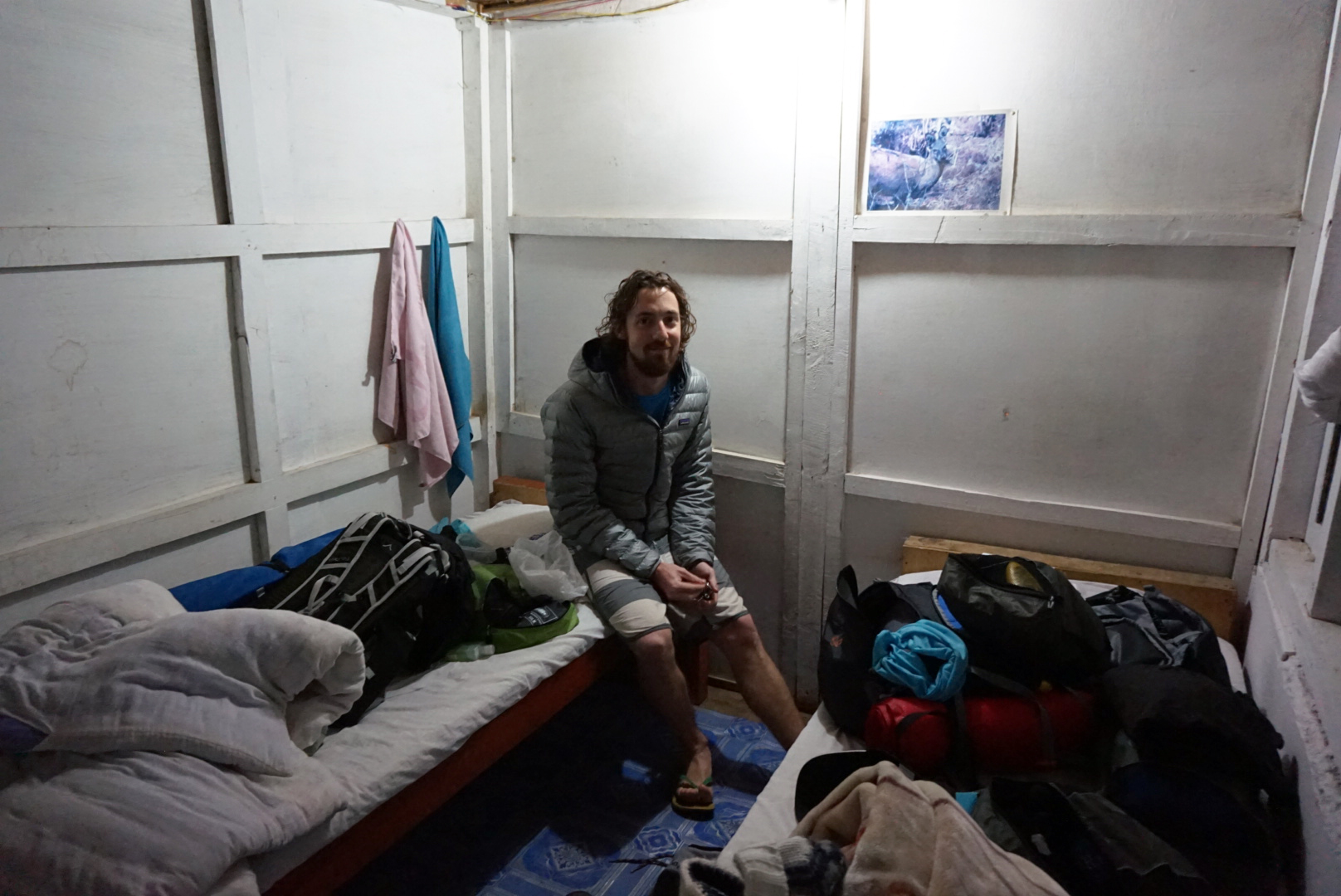
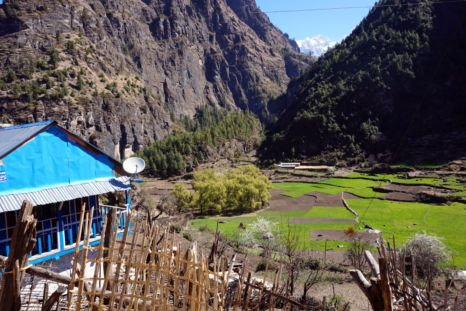
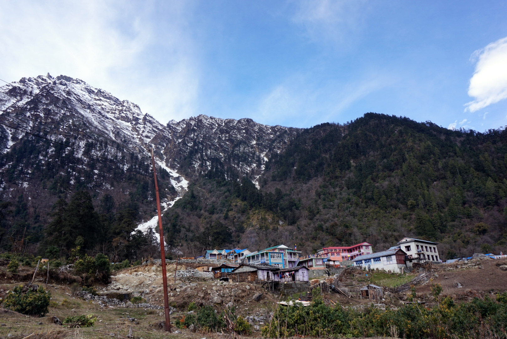
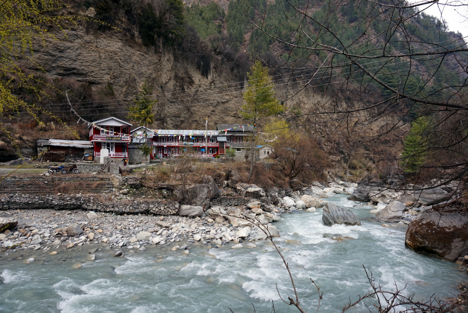
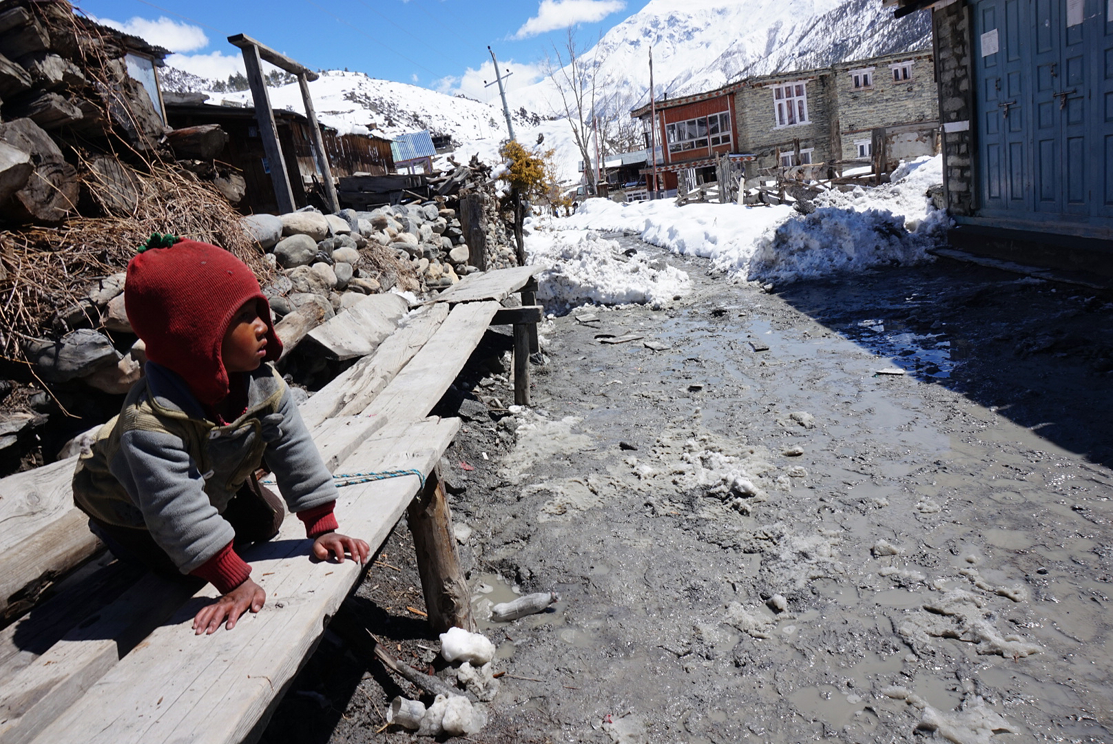
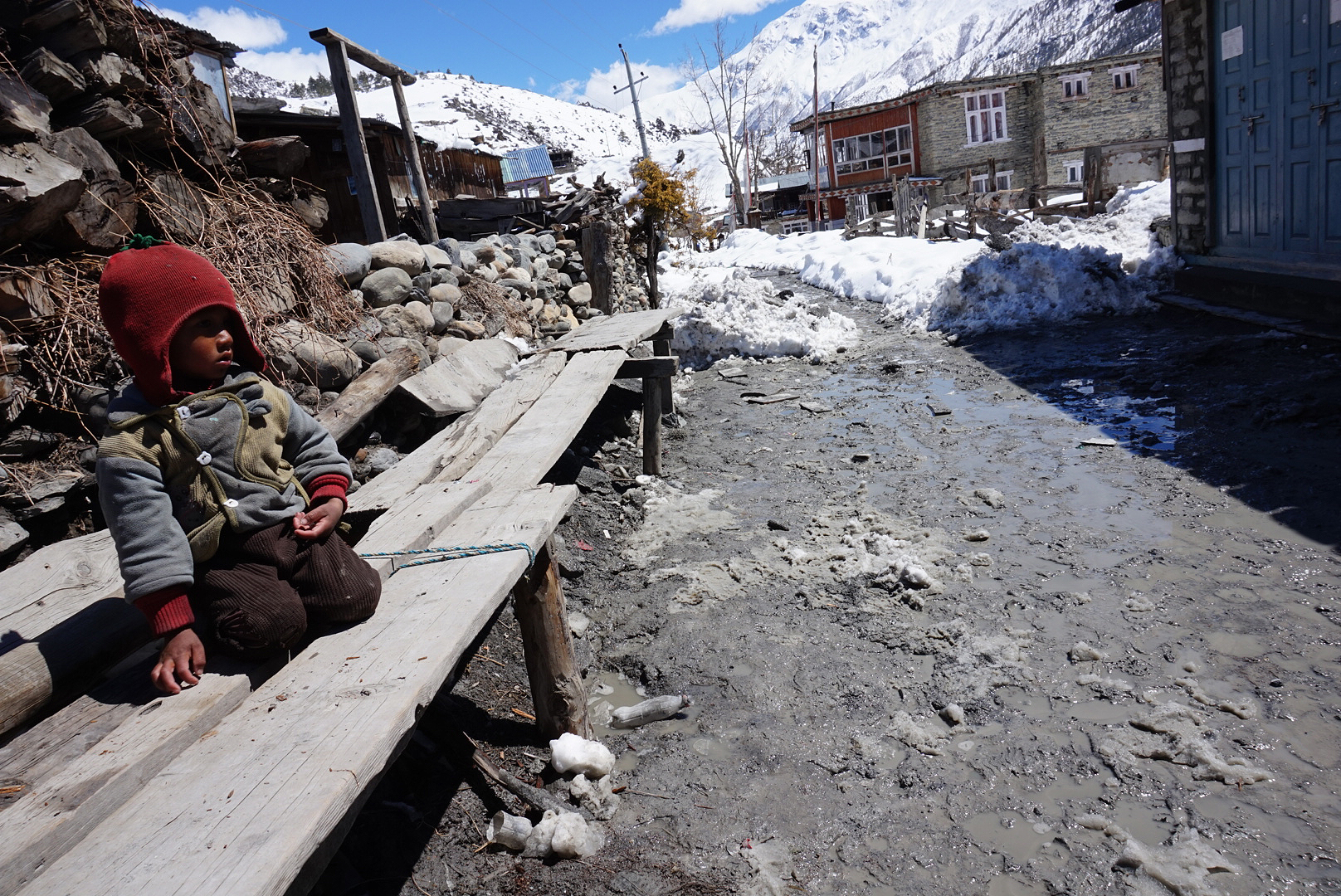
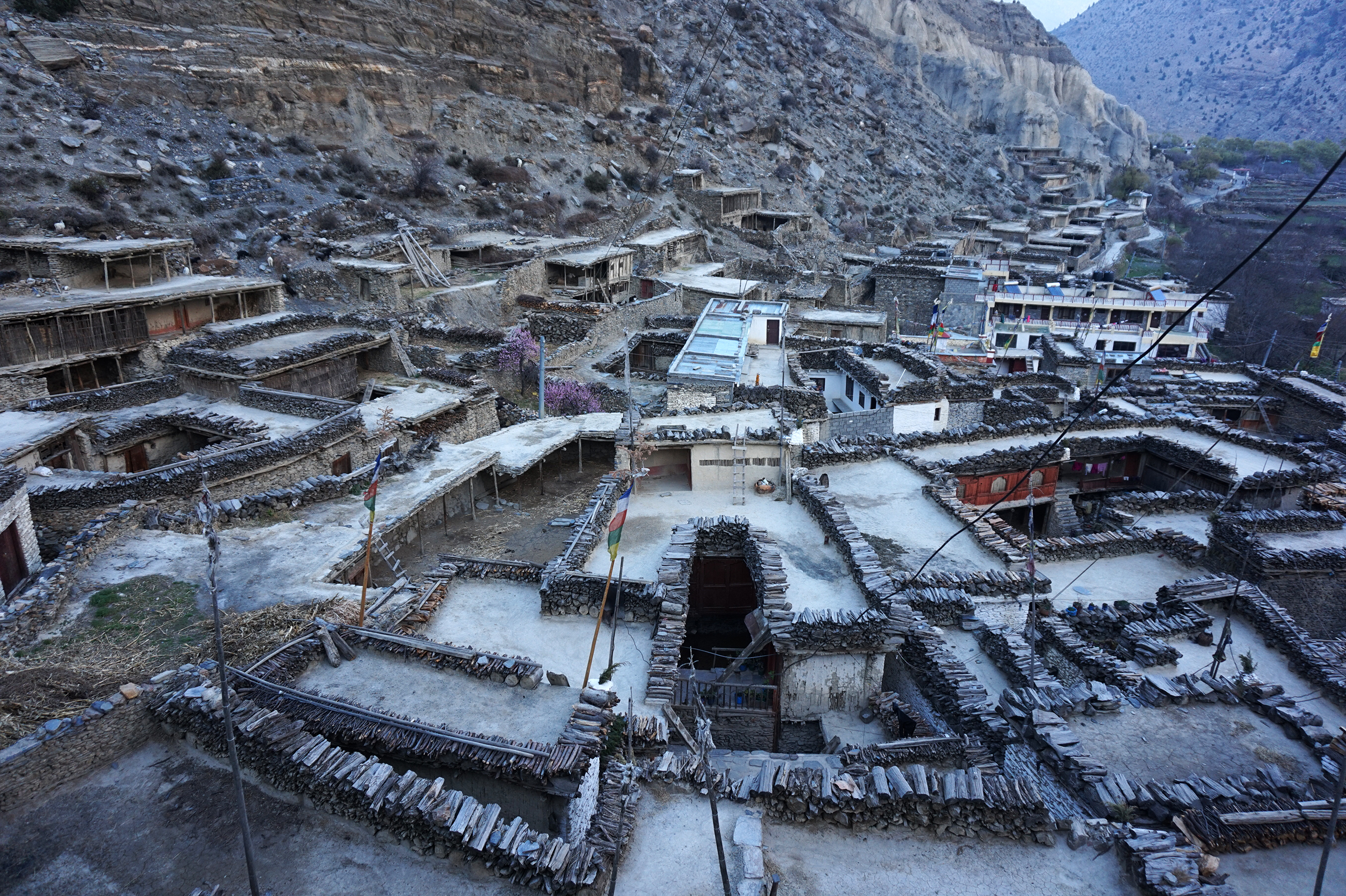
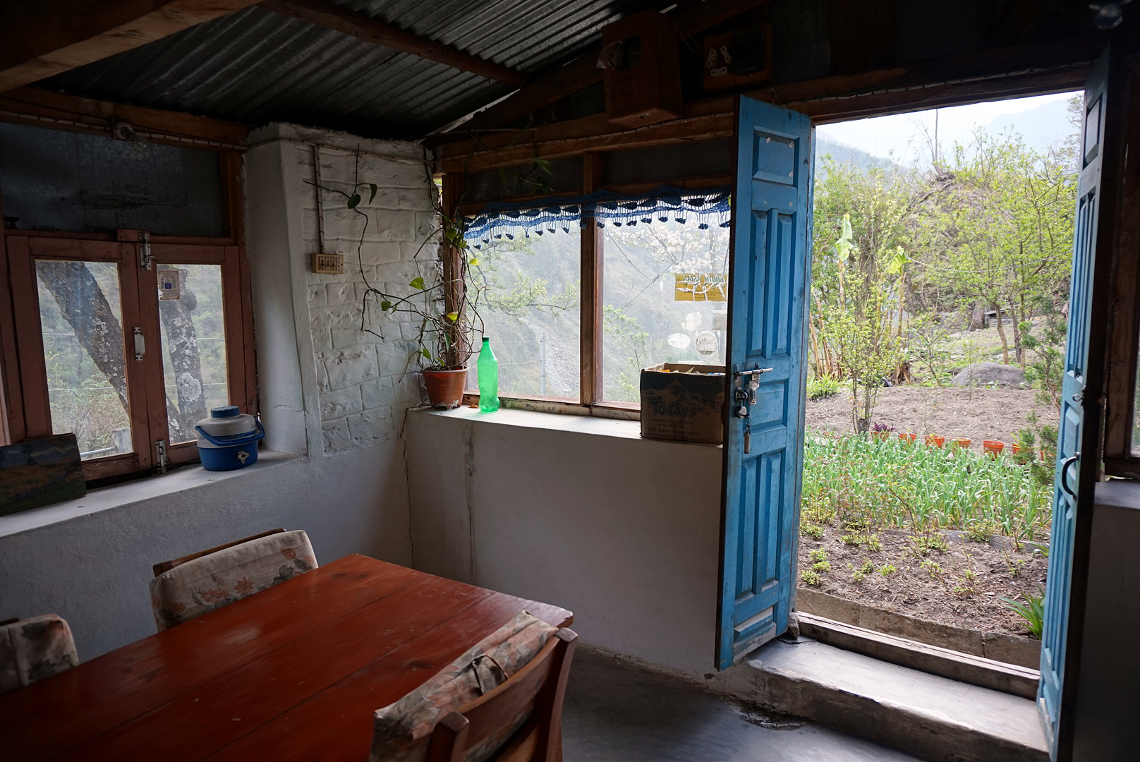
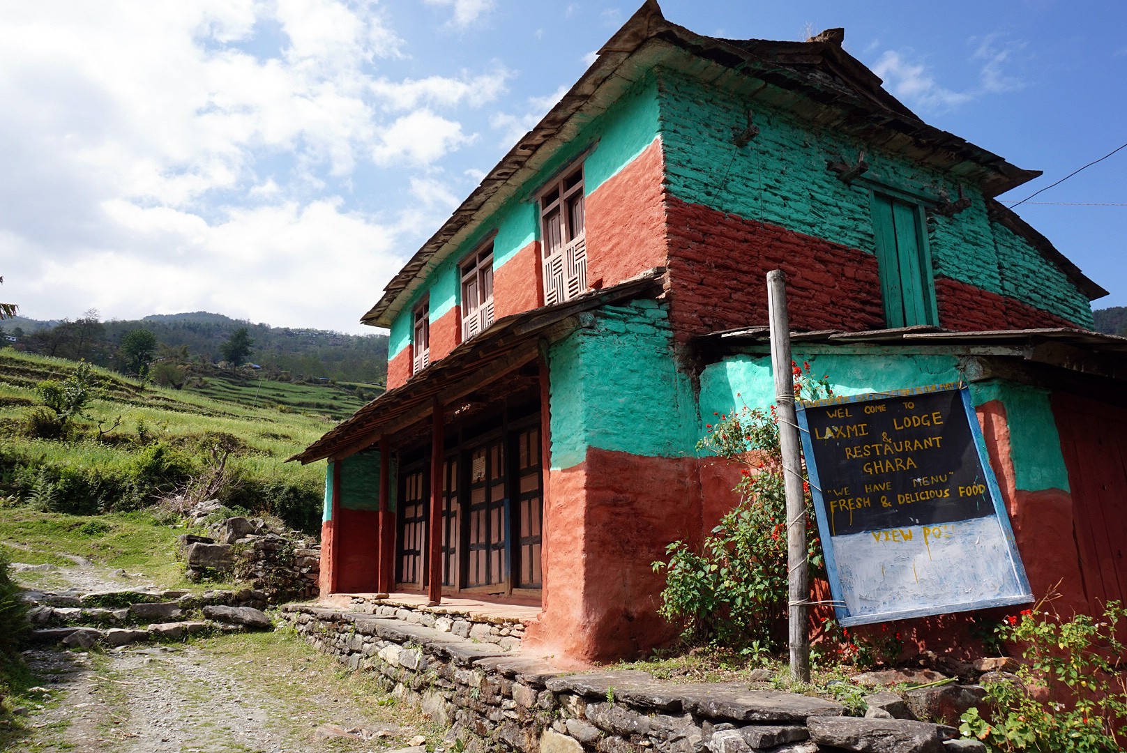
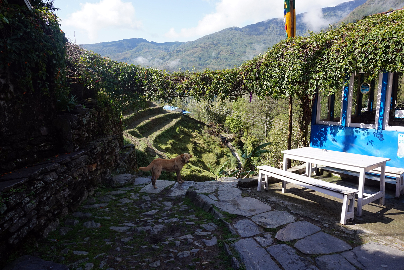
After getting our permits stamped and leaving the bus station we immediately got lost and went round in a massive circle. Lesson one, forget the maps, ask the locals. Once back on the right path we were following a big river upstream that snakes all the way down from the mountains. The first part is on a dusty road. We could have avoided this and got a bus to the next village but we wanted to trek from the start. The hillside surrounding the road was lush and full of life, which more than made up for the odd dusty jeep or bus that rattled by. We made it to the town of Bhulbhule round four ish and checked into the Thorong La Guest House. It was clean and fairly well built, perched on the hillside above the bubbling river below. We ate our first Dal Bhat for dinner (local thali dish of potato and veg curry, lentil curry and rice) it is eaten everywhere and is really good for energy. The Nepalese have a saying... Dahl Bhat power, 24 hour.
Bhulbhule is an onomatopoeic name for the sound the river makes as it slides by.
As we were rising early, we slept with the curtains open. Our room looked down across the river valley and the sky was overflowing with stars.
DAY TWO
Bhulbhule 840m to Ghermu 1130m - 22km
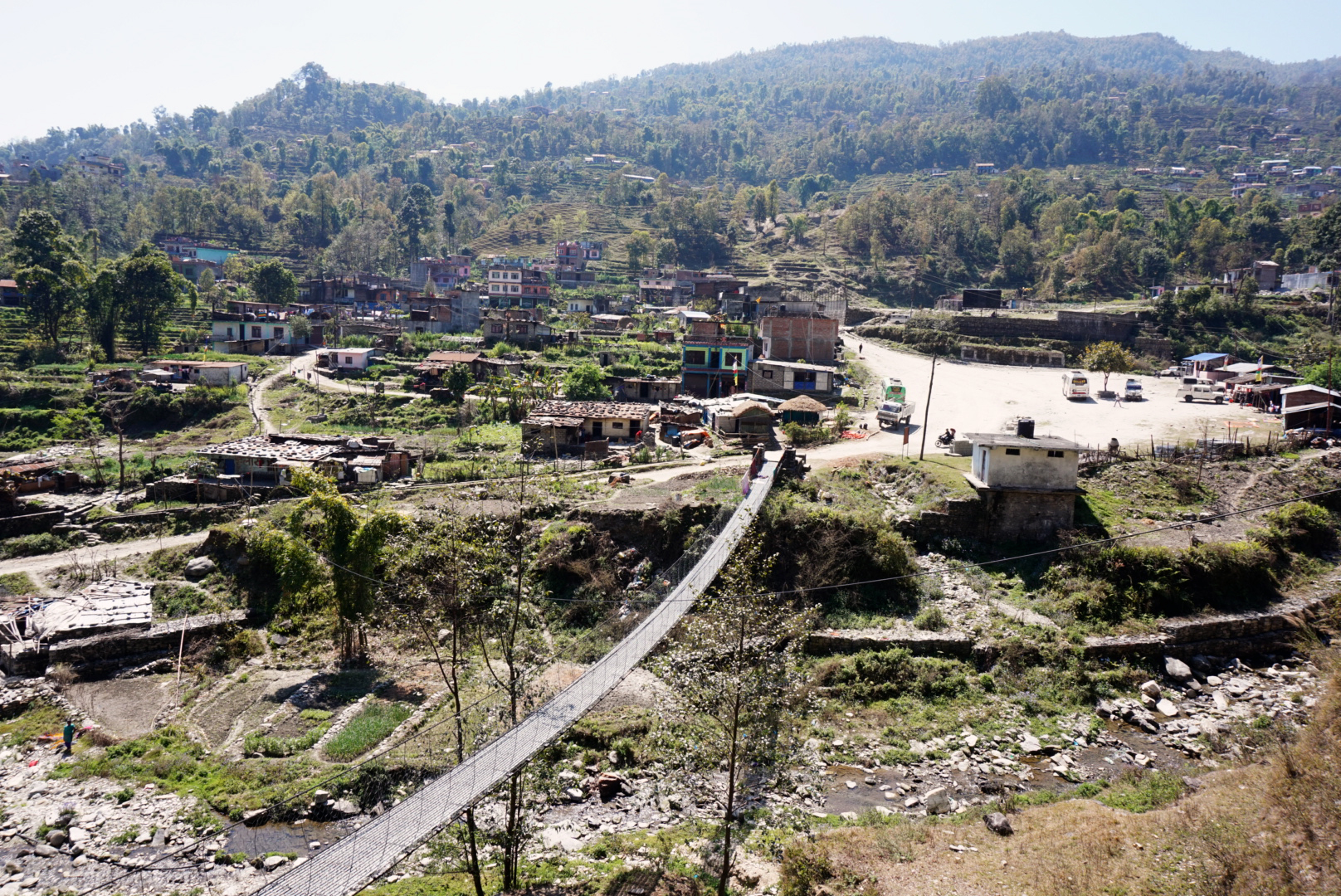
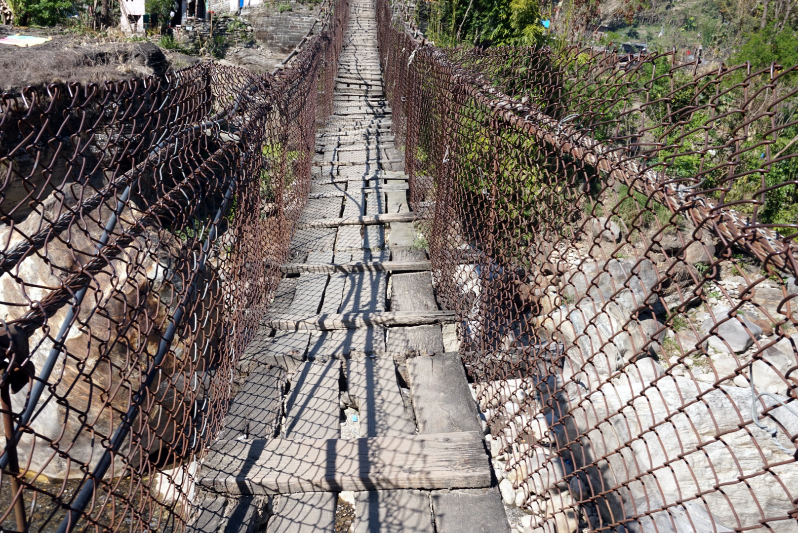
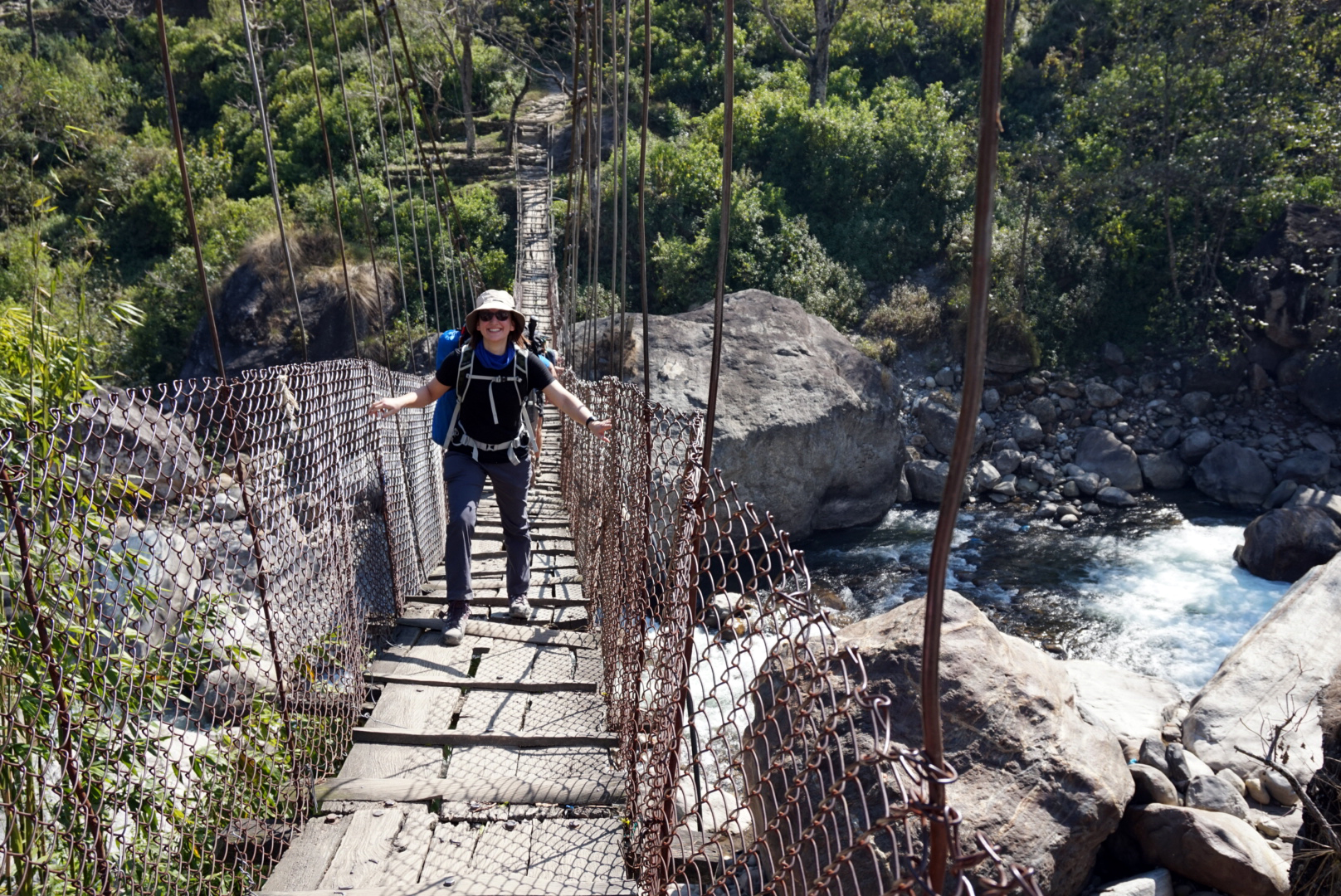
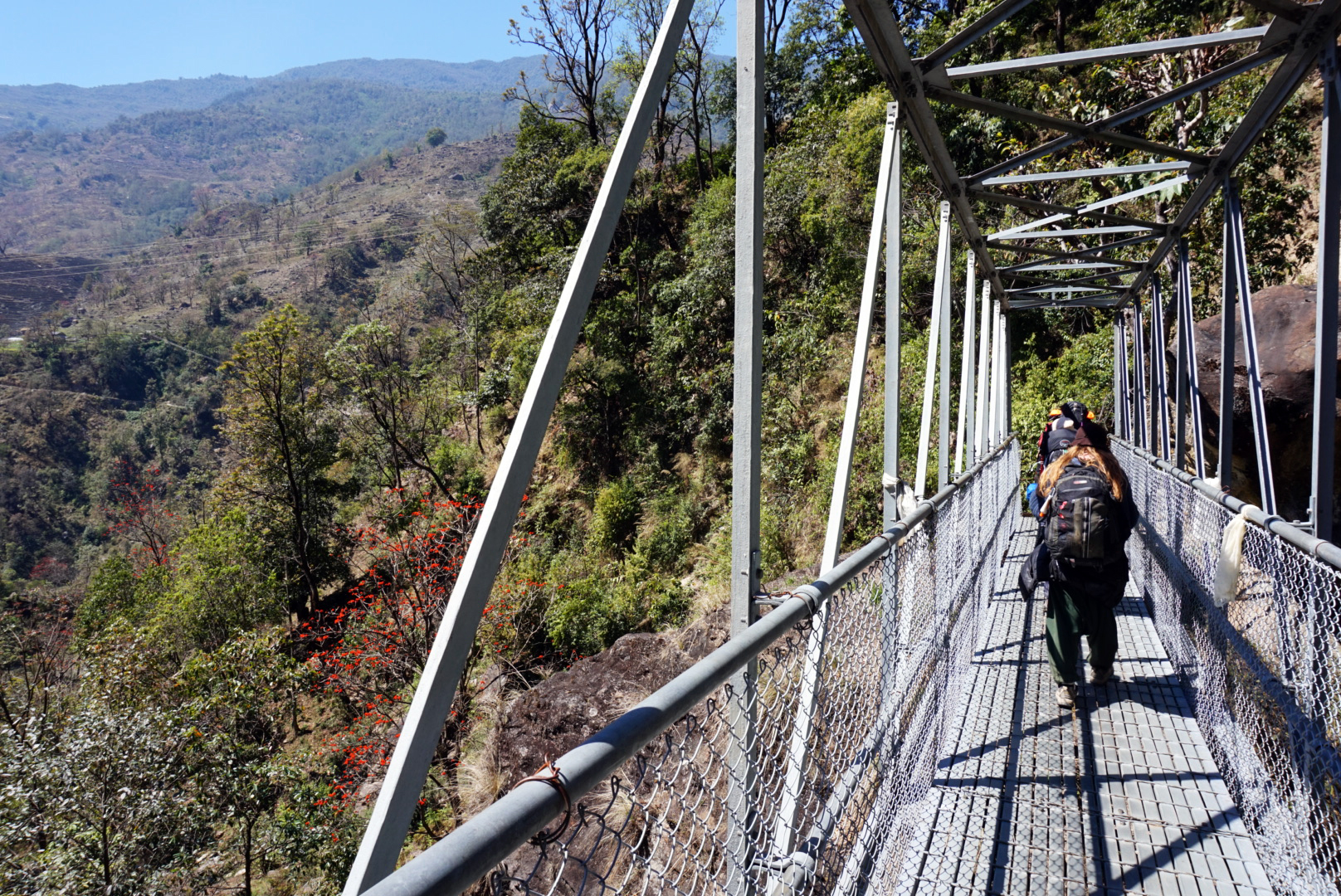
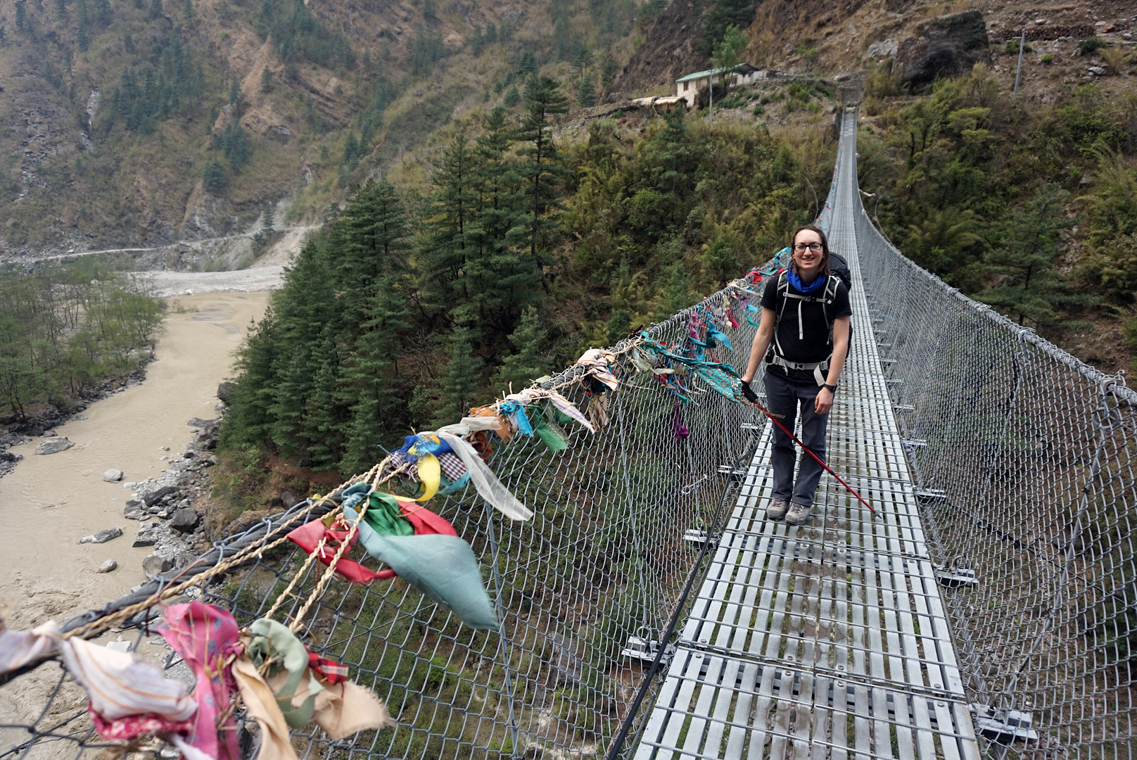
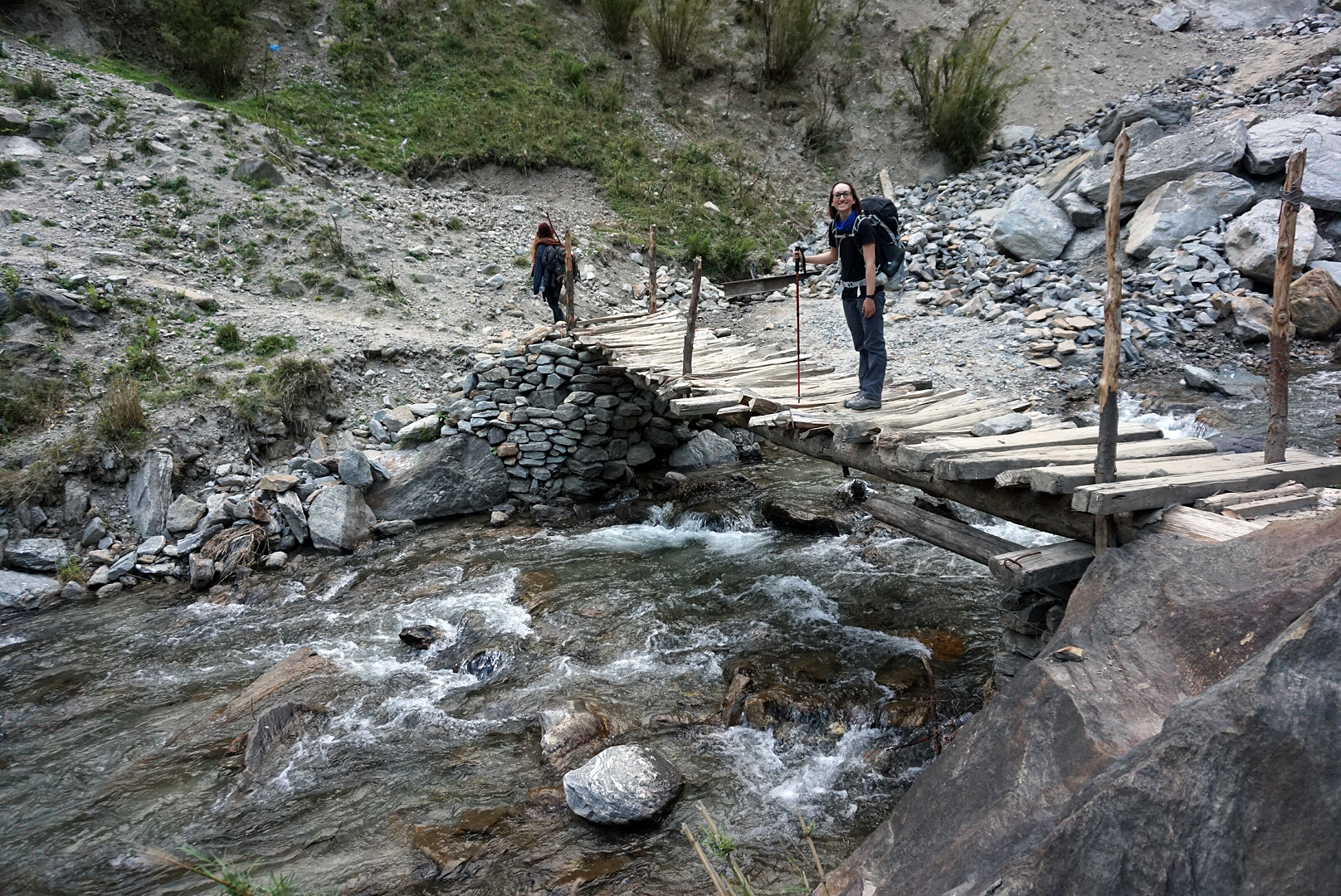
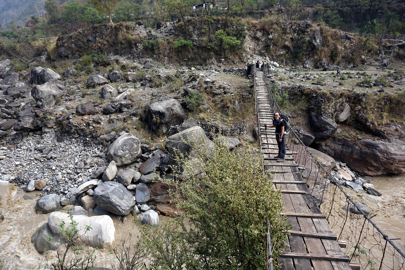
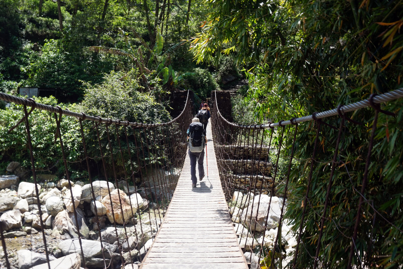
A rude Cockerel made sure we were awake by five, however after seeing the rising sun over the valley we quickly forgave him. We crossed a rickety suspension bridge across the turquoise waters joining a small dusty road again hugging the opposite bank.
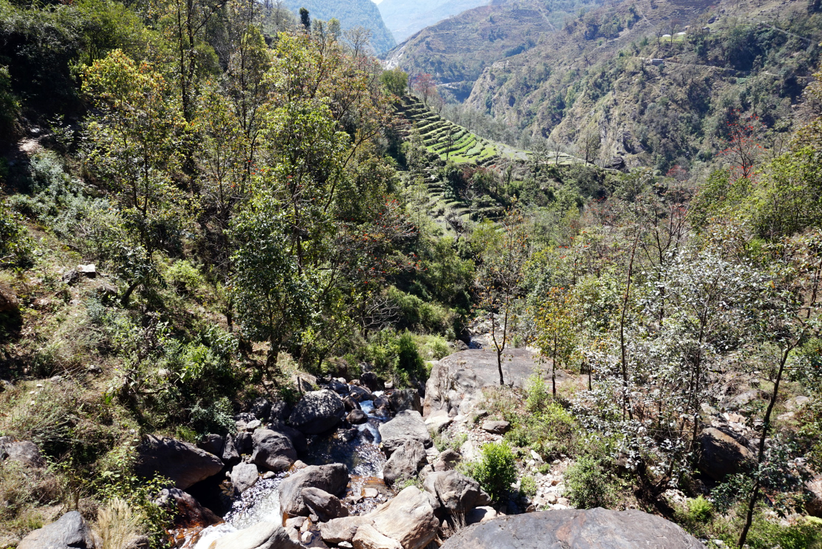
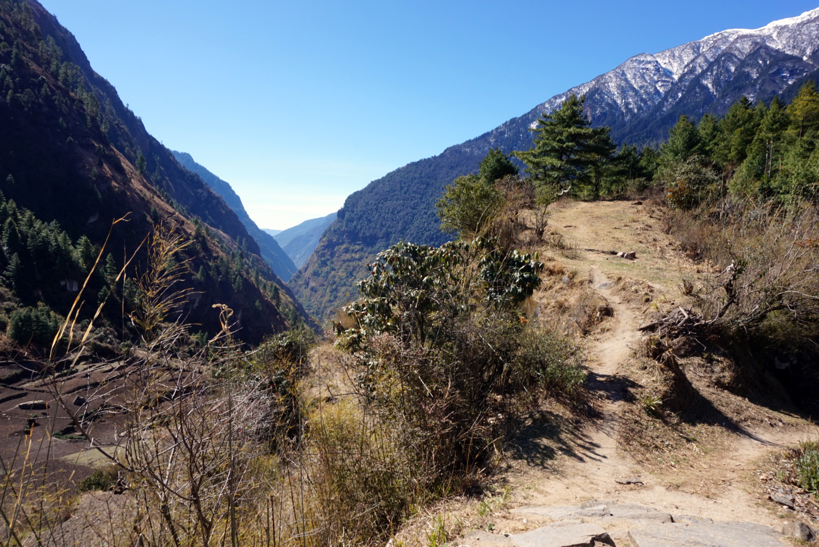
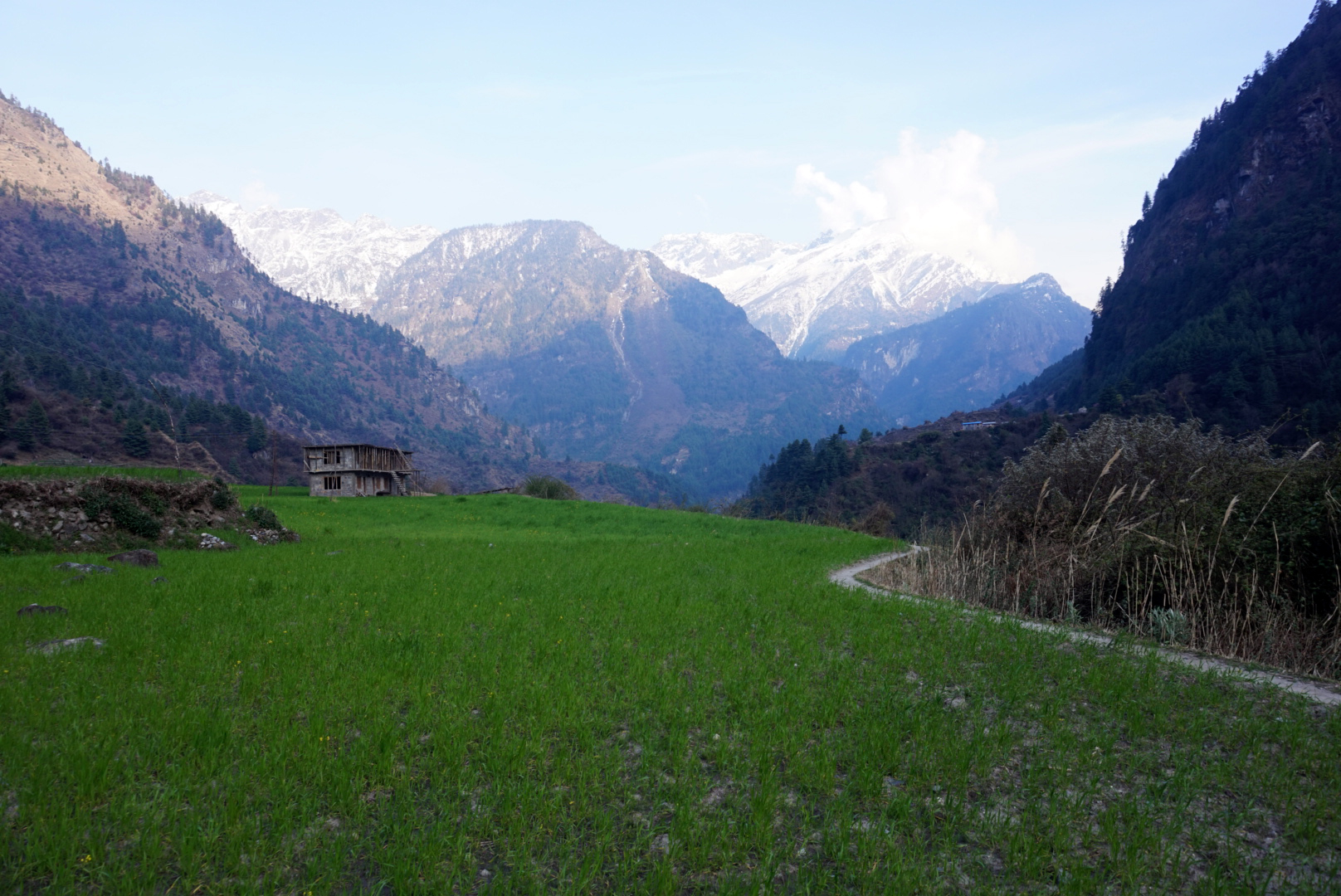
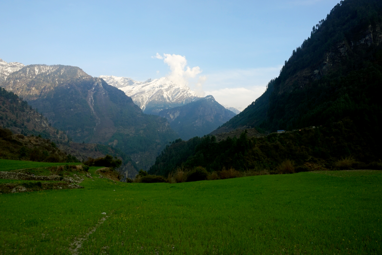
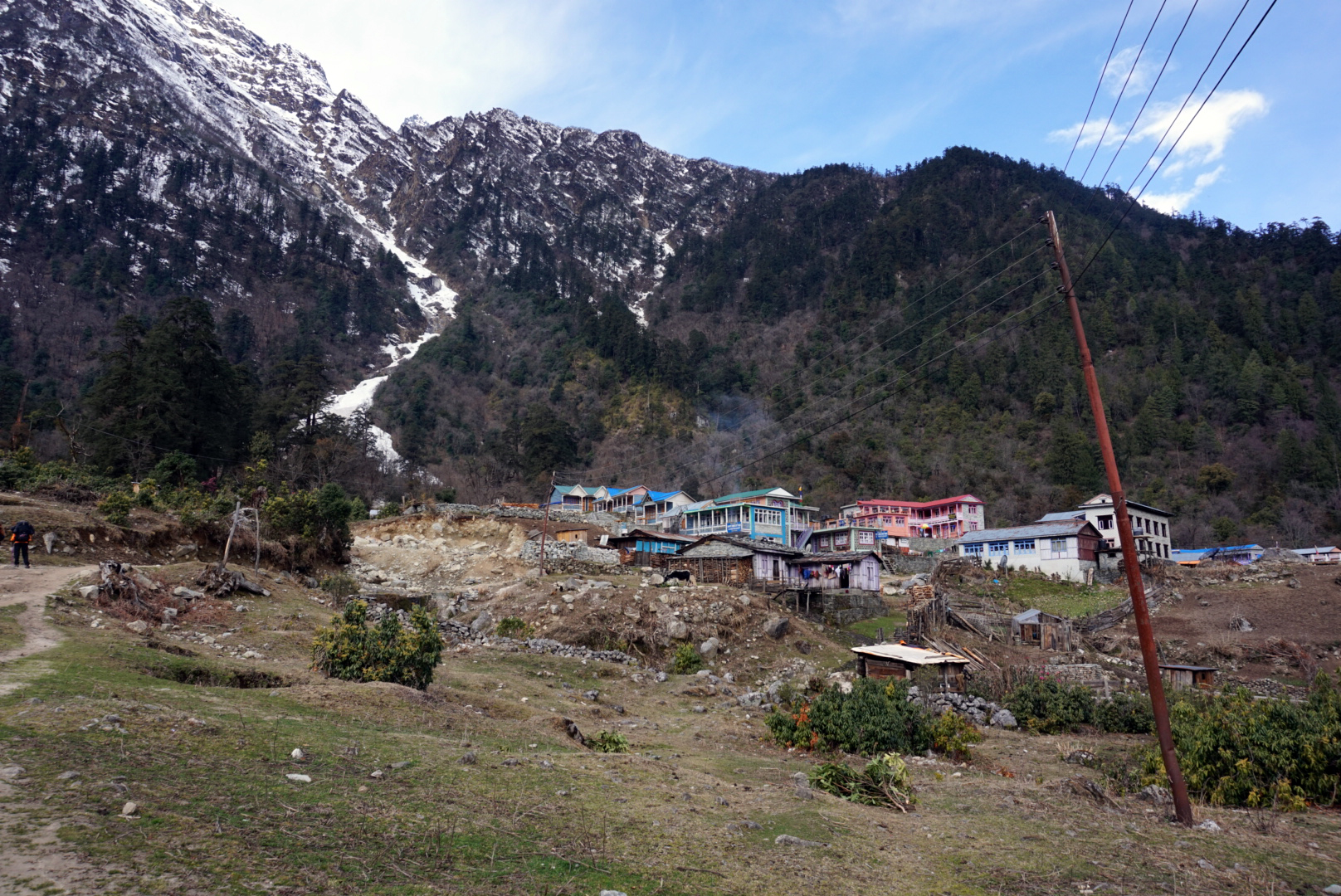
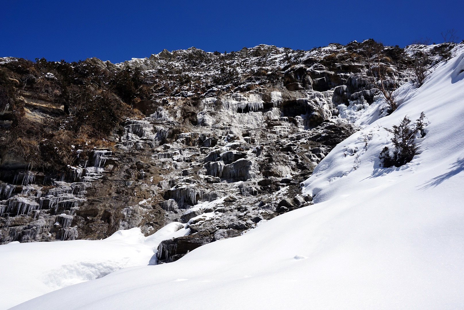
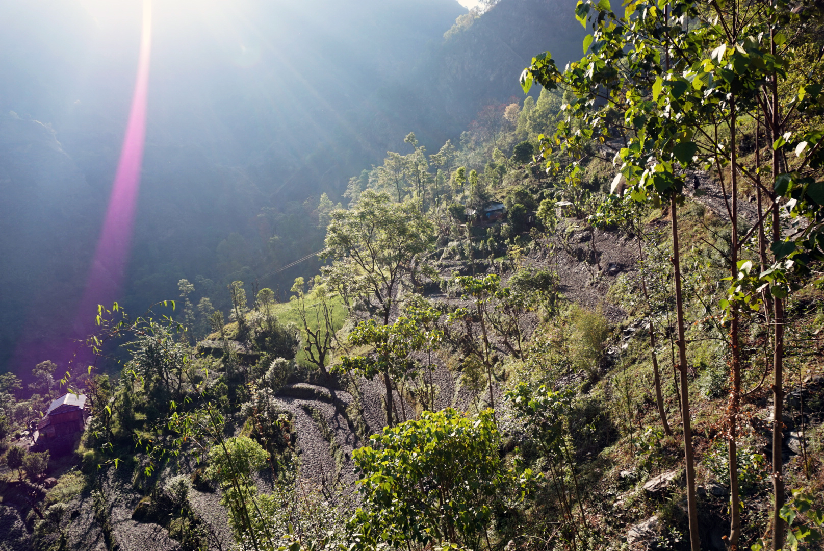
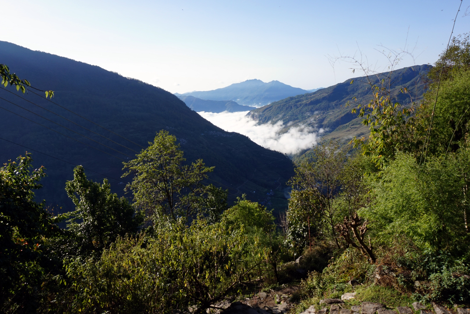
The Nepalese are building a hydro electric plant so the first hour was quite hot and dusty with massive lorrys roaring past, but soon we passed the plant and the road became a wild rocky path. It twisted and turned along the river bends creating some breathtaking views. We crossed a couple of small streams and waterfalls and eventually ended with a very long steep climb up to a little village that peered down over the picturesque hillside.
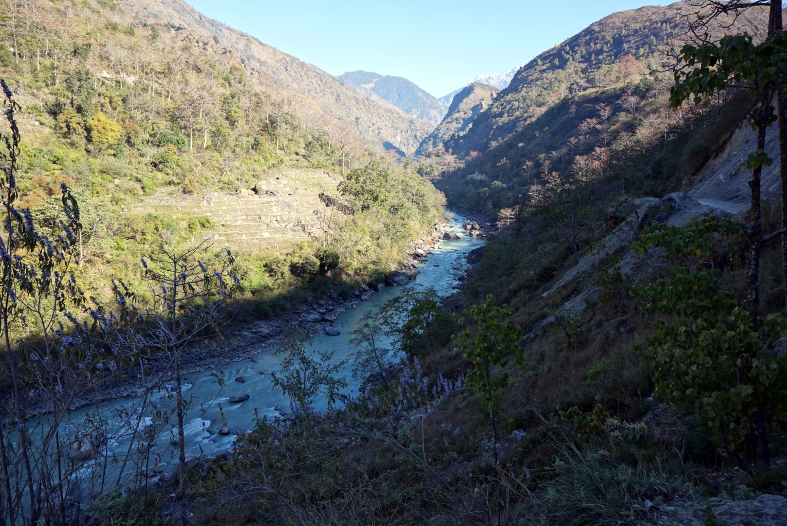
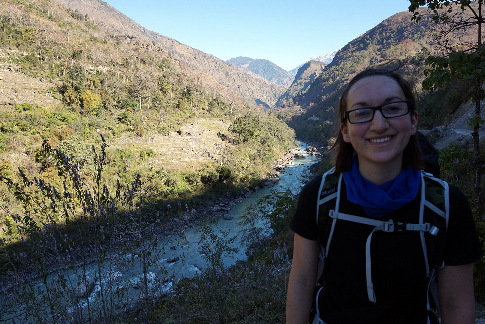
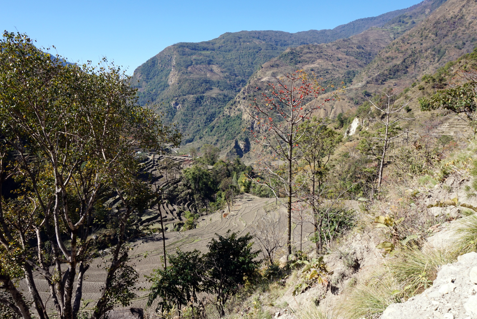
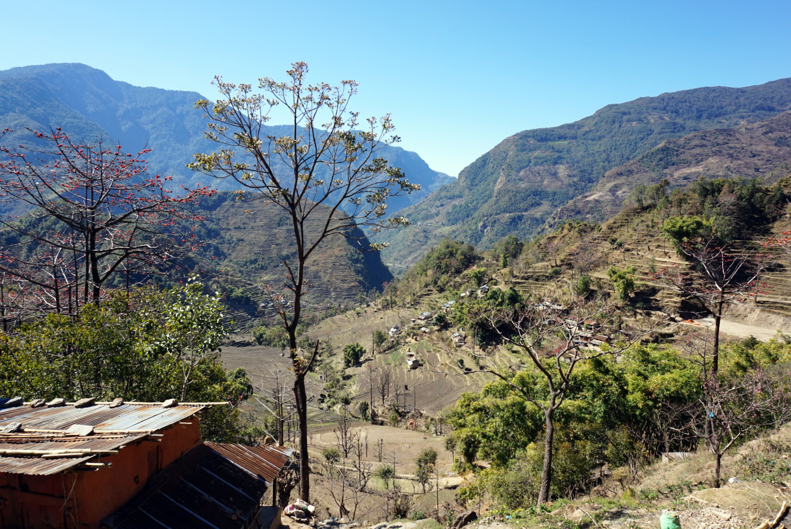
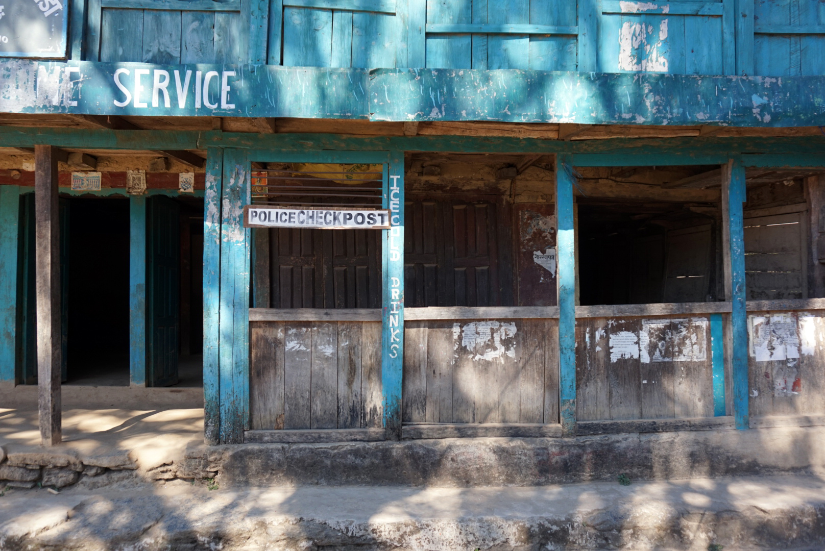
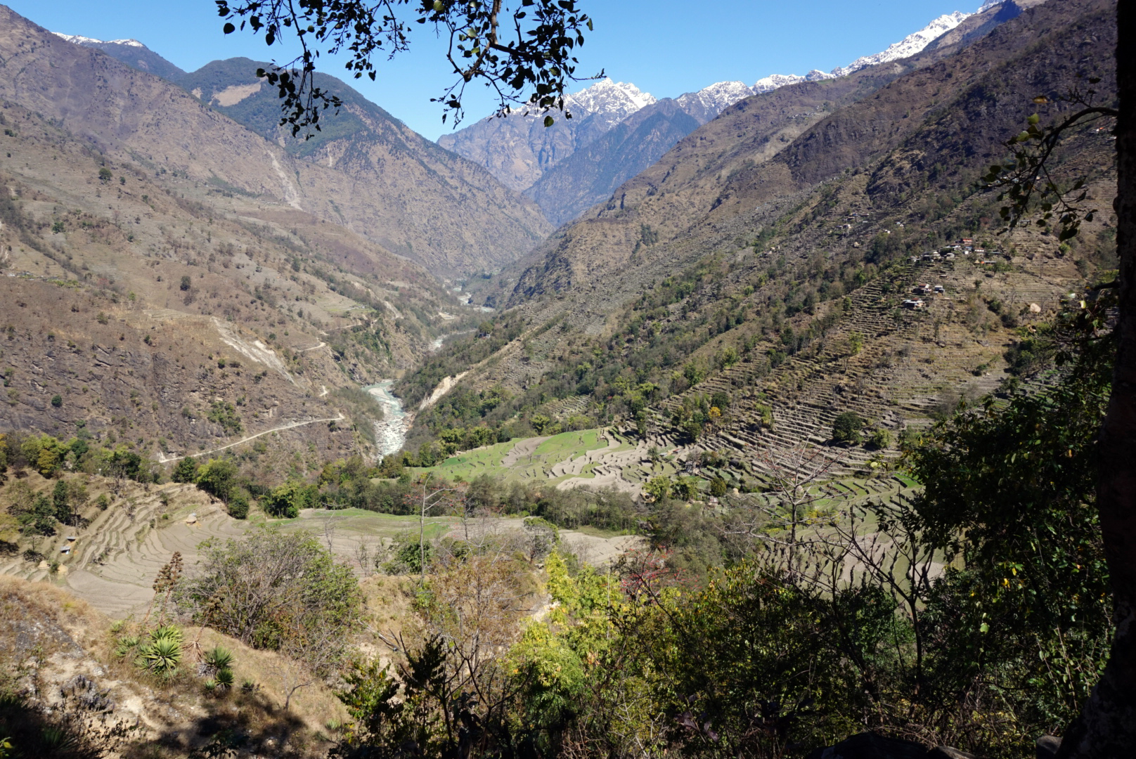
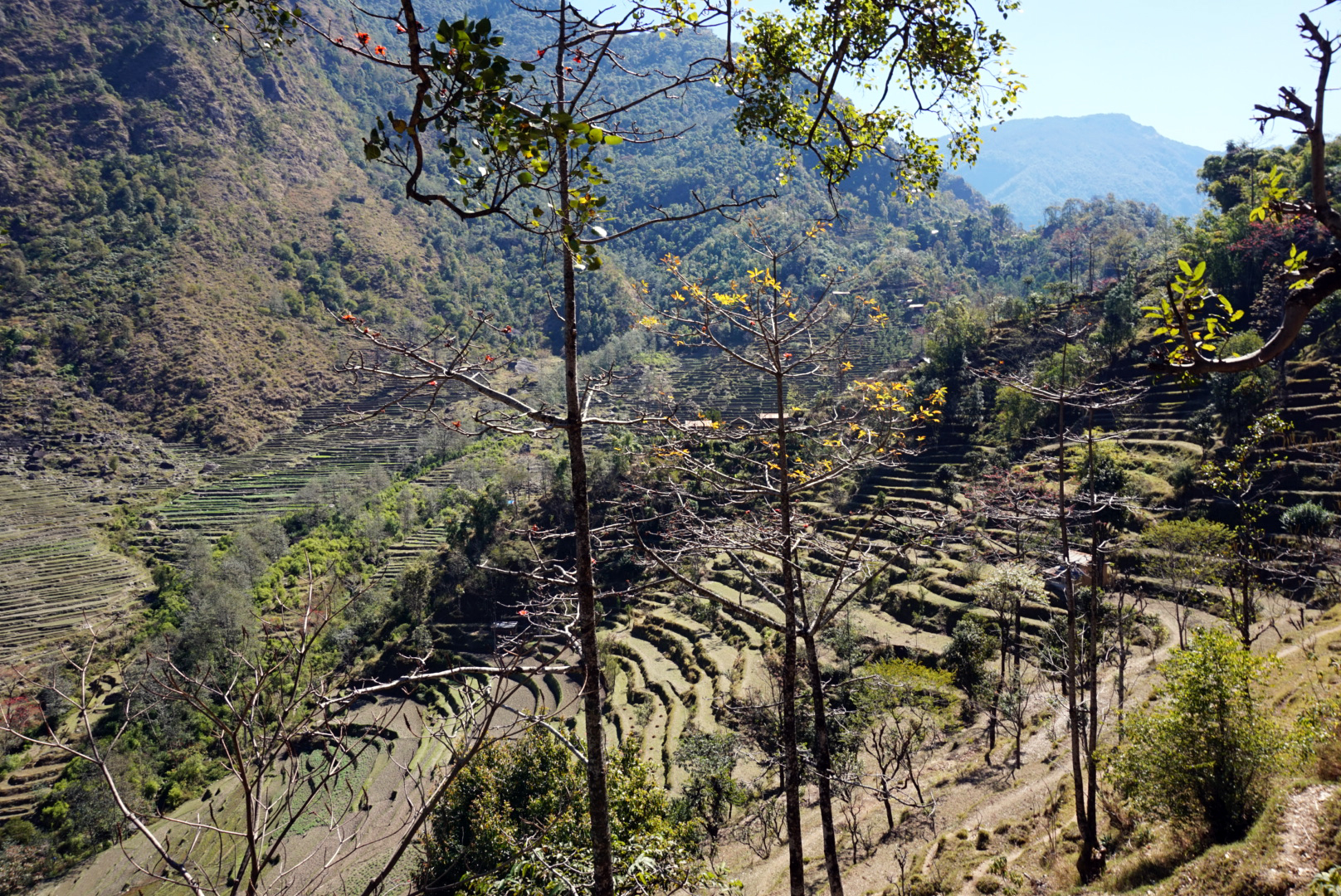
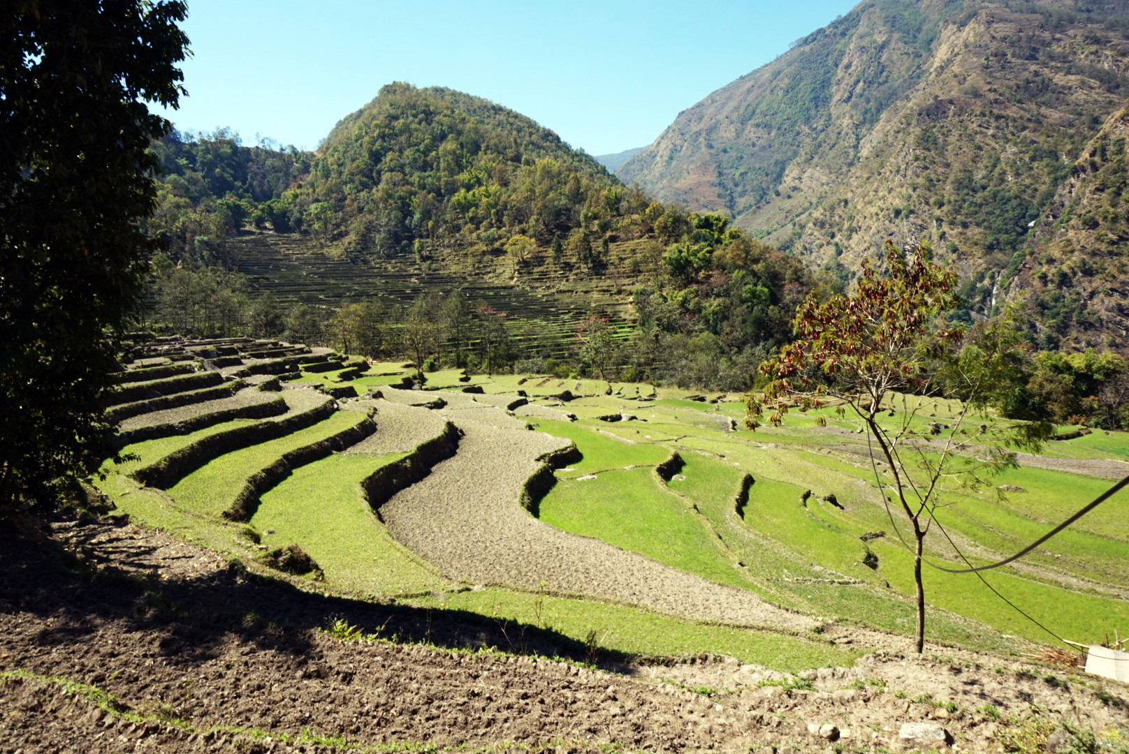
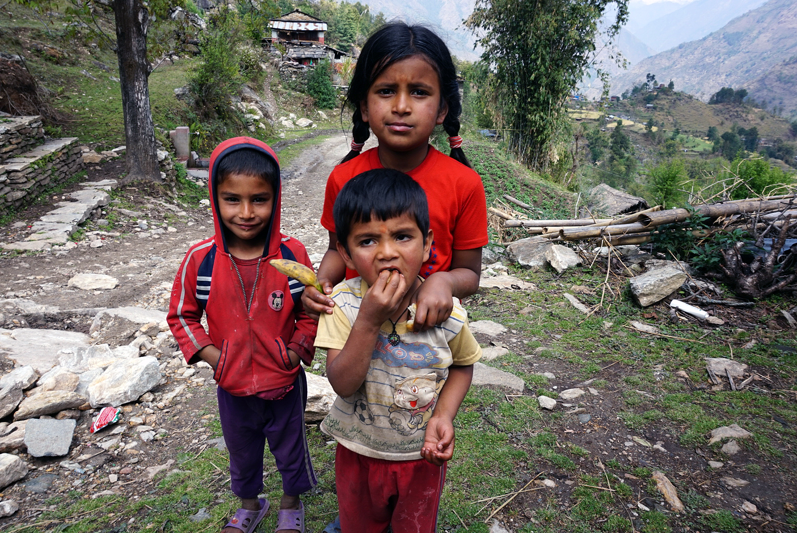
The view back down the valley from the top of the climb looked like you had walked into the cover of National Geographic. Vivid green rice paddies & other freshly sprouted crops stretched off into the distance, underlined by the glistening river. We got our permits stamped at the checkpost and carried on along the path. The route was highlighted by little red and white paint splodges. They are fairly easy to spot and it's always comforting when you catch sight of one. We climbed steeply again up to the next village in the midday sun and were all knackered when we reached the top, however three local women were casualy chatting as they walked by with heavily laden baskets of wood on their heads.
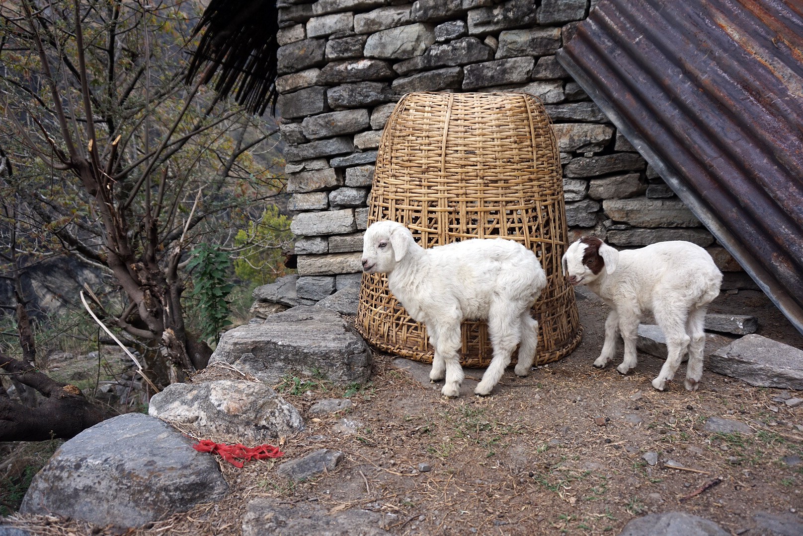
A happy man with a small goat heard cooked us all Dahl Bhat for lunch collecting all the ingredients from his little hillside garden. It was a very tranquil place with a lovely slow pace of life.
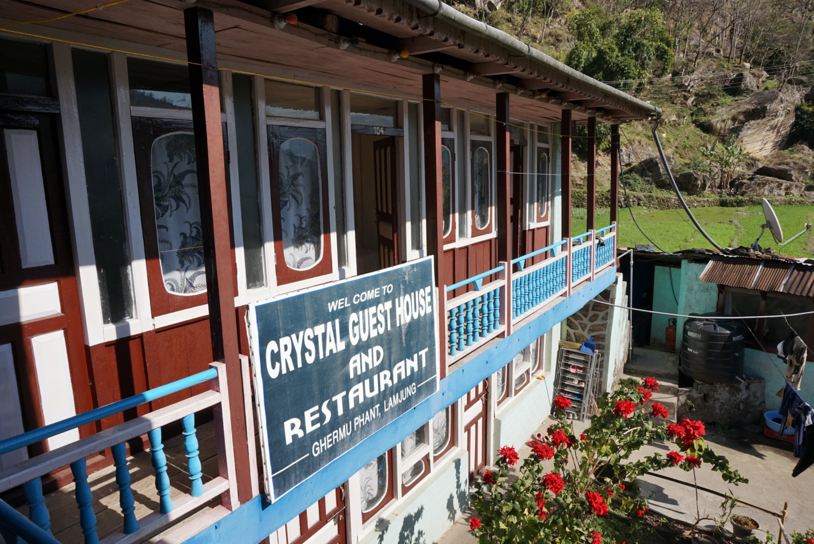
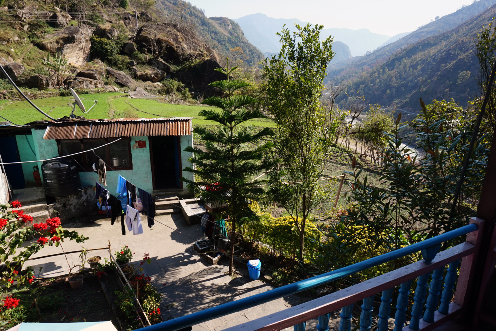
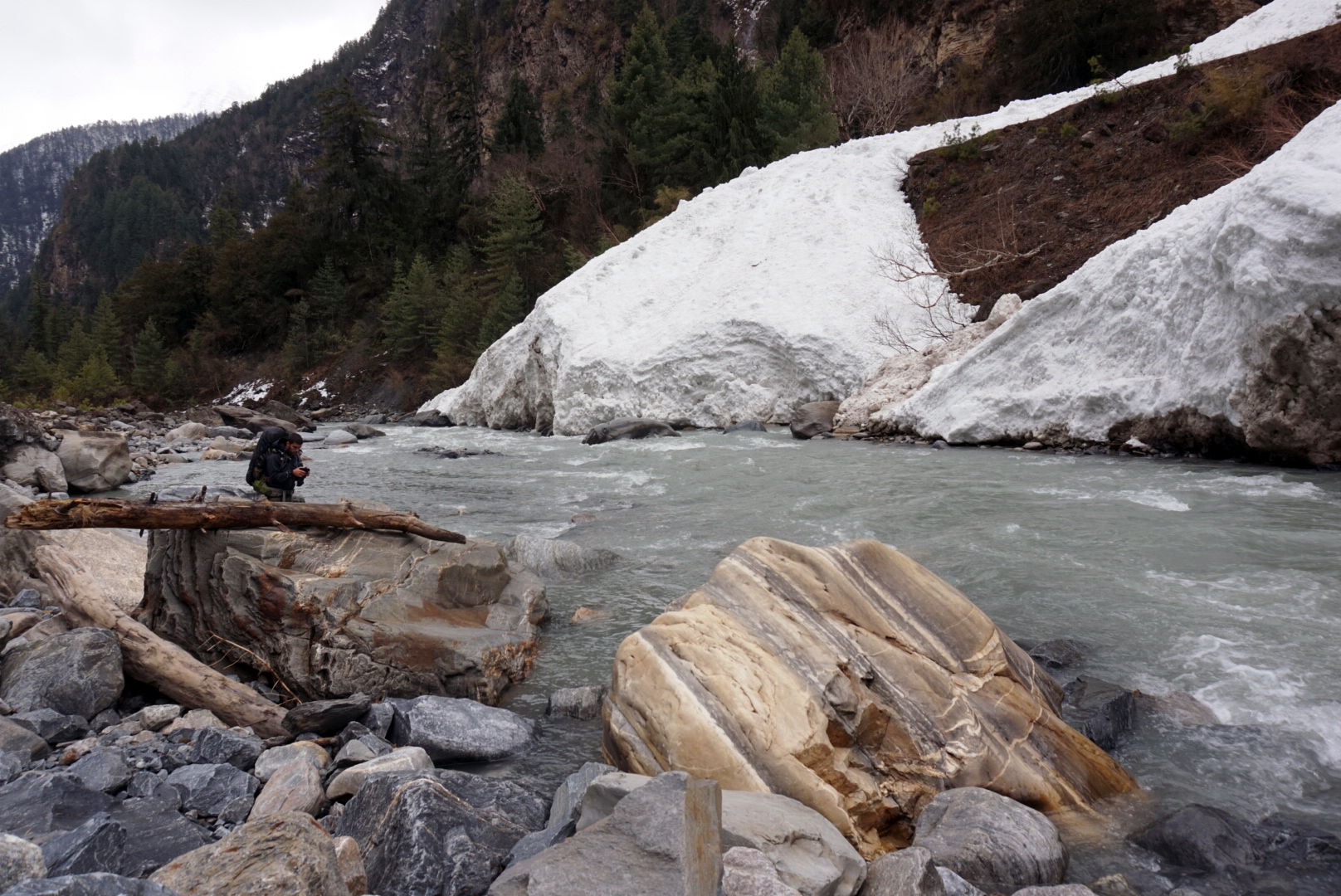
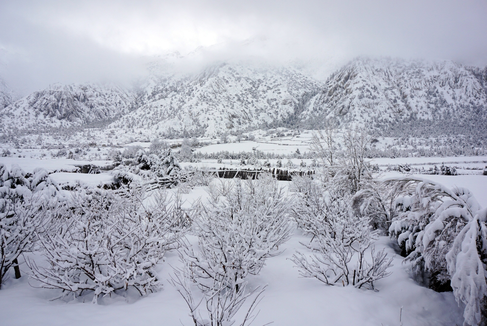
The afternoon sun became pretty unbearable, so when we reached the first guest house in Ghermu round three ish we were very happy to stop. Du was feeling unwell so we checked in and chilled out. We bumped into an American guy called Jackson returning from further up the mountain. Apparently there had been a lot of snow and the mountain pass we needed to cross was closed. We just had to hope that the weather would improve so that the pass was open when we got there in a weeks time. In such a hot, lush setting its was hard to think there would be snow in the days that lay ahead.
DAY THREE
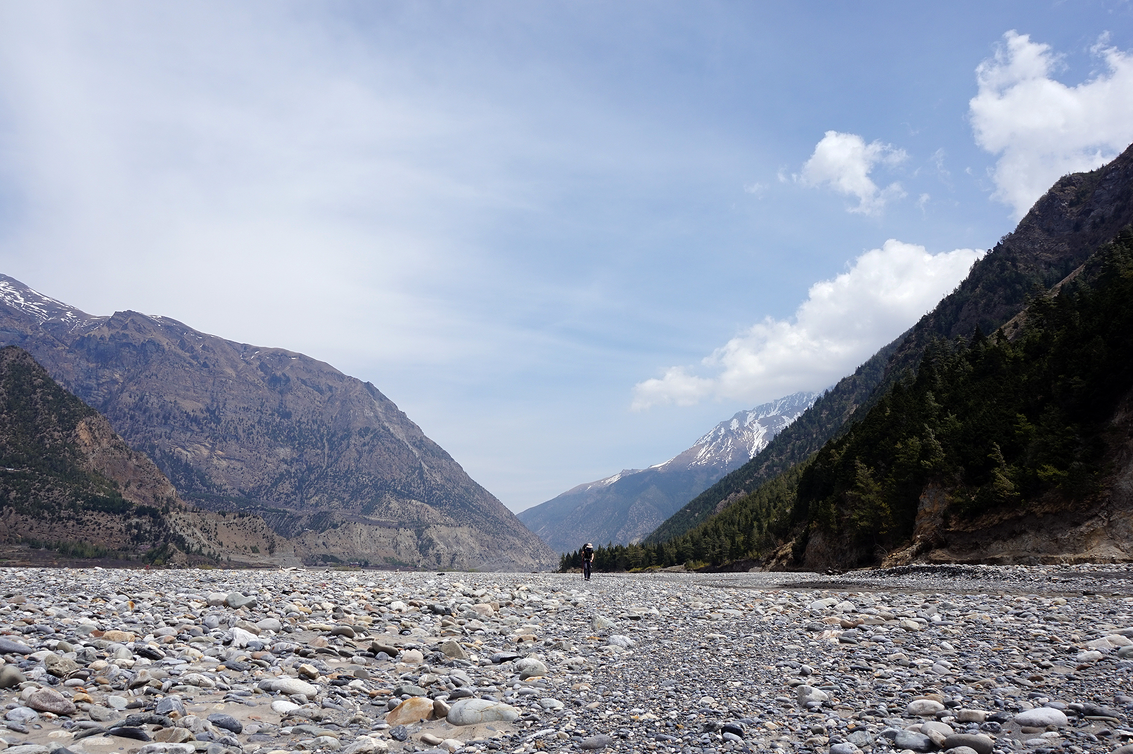
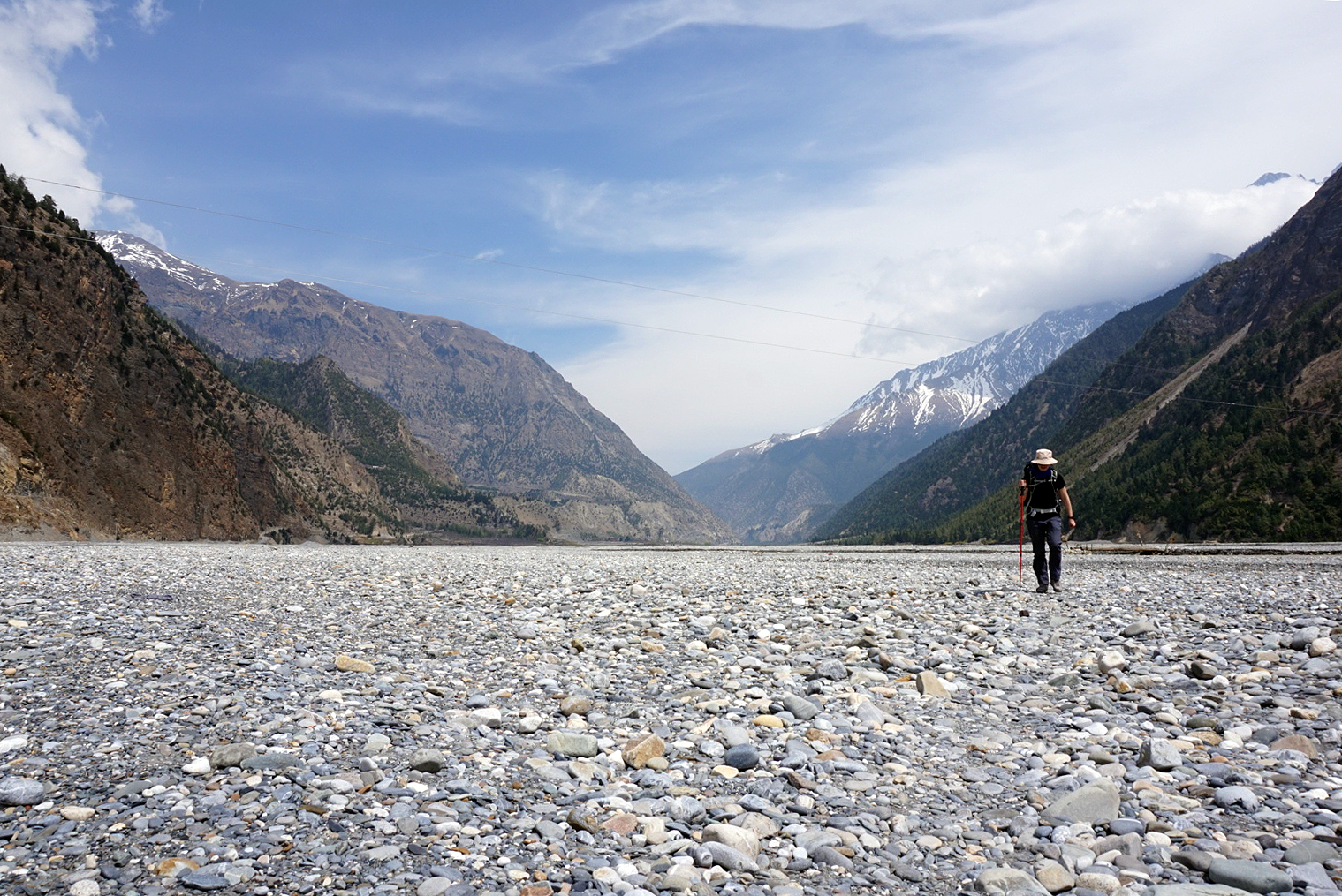
Ghermu 1130m to Tal 1700m - 34km
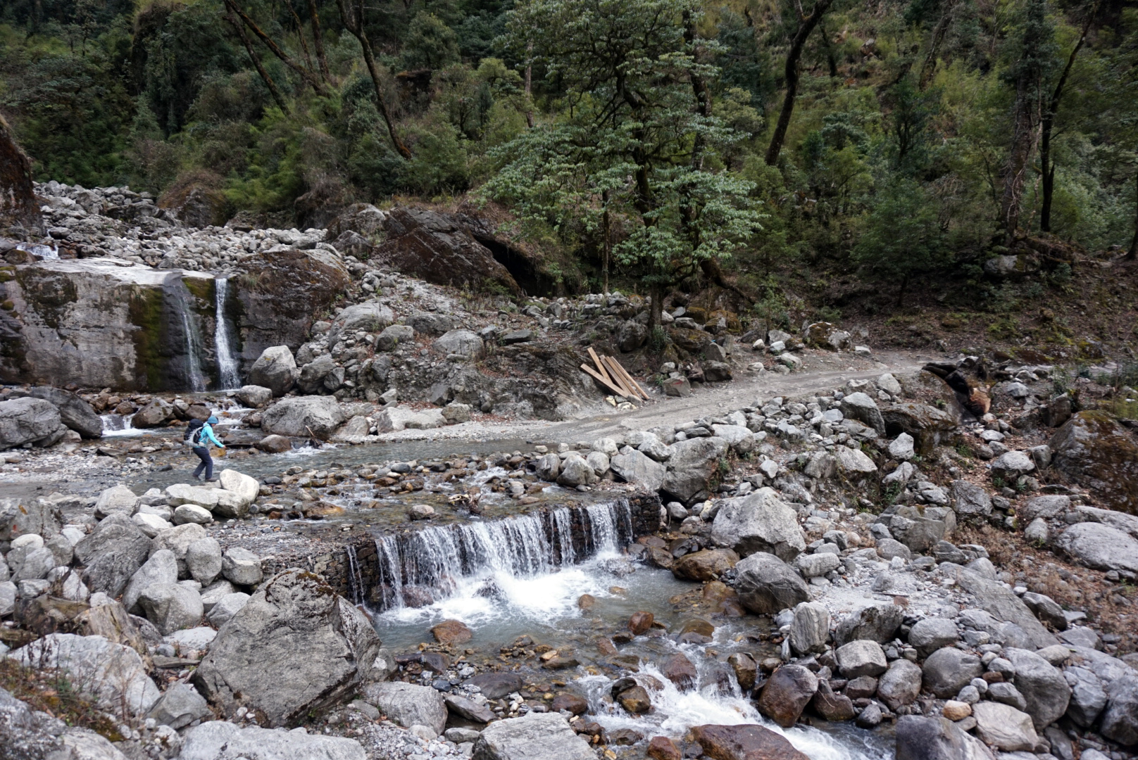
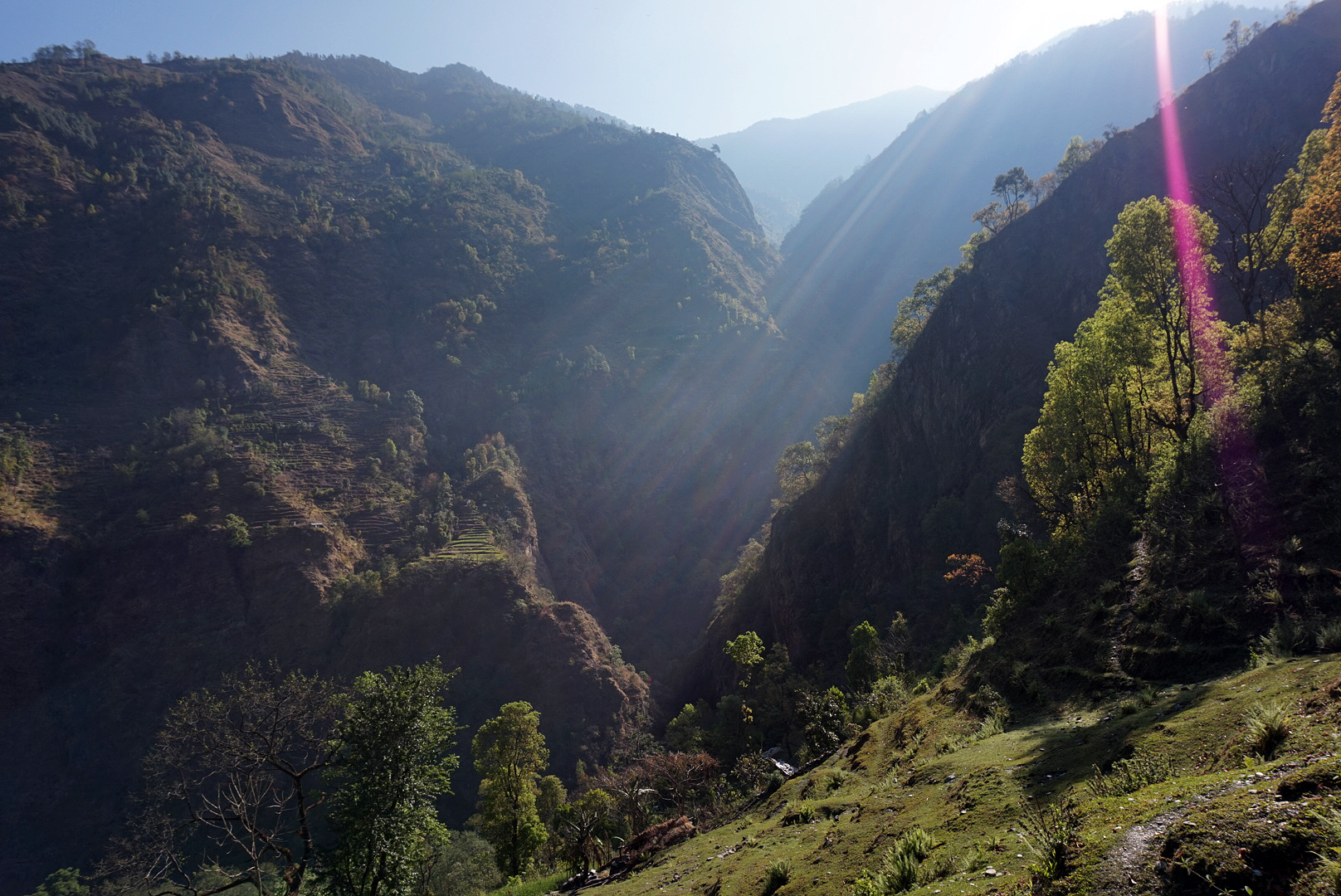
After porridge at half five we were on the path by half six. The rising sun was changing the landscape every second. This part of the circuit was more like a tropical rainforest than a stereotypical snowy Himalayan scene. There wasn't a snowy peak in sight, just vibrant plants and lush green hillsides. We took a slightly less direct side route pretty much up a steep waterfall / stream to the village of Chamche. It was a gruelling climb but so worth it. Wild clumps of bamboo kept framing different scenes, each more breathtaking than the last. Soon we were nibbling on a plate of Tibetan bread in the Rainbow Tea House precariously perched with an array of stilts over the sheer mountain side. Directly opposite was a thundering waterfall creating a rainbow haze in the valley.

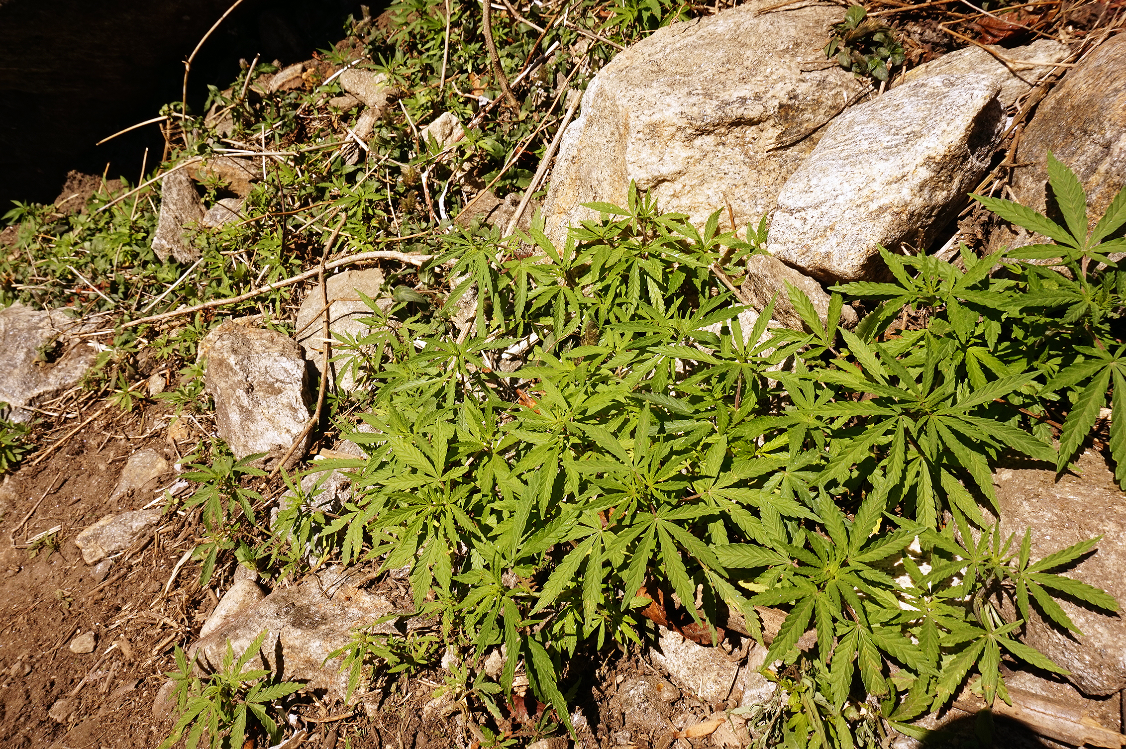
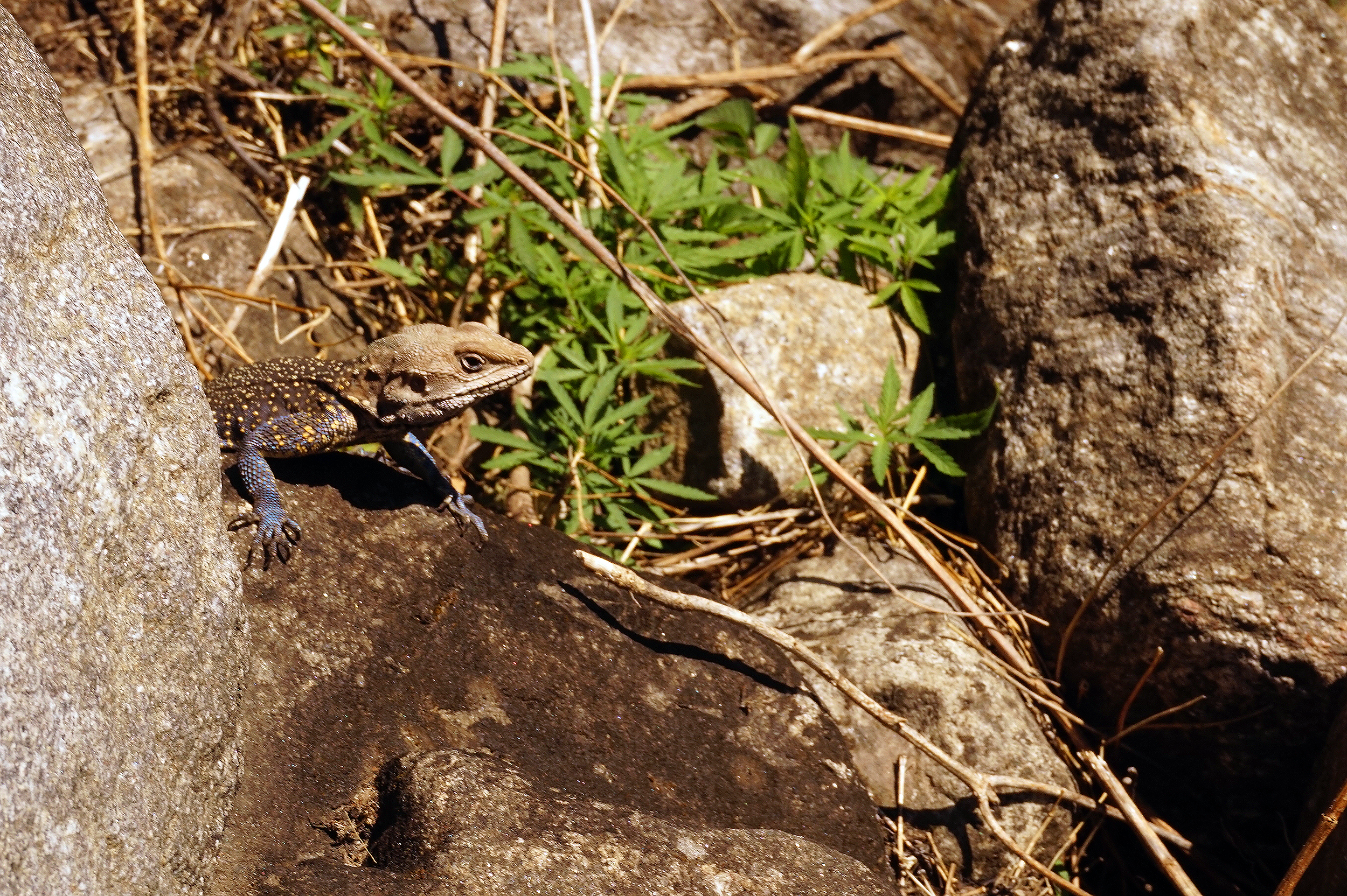
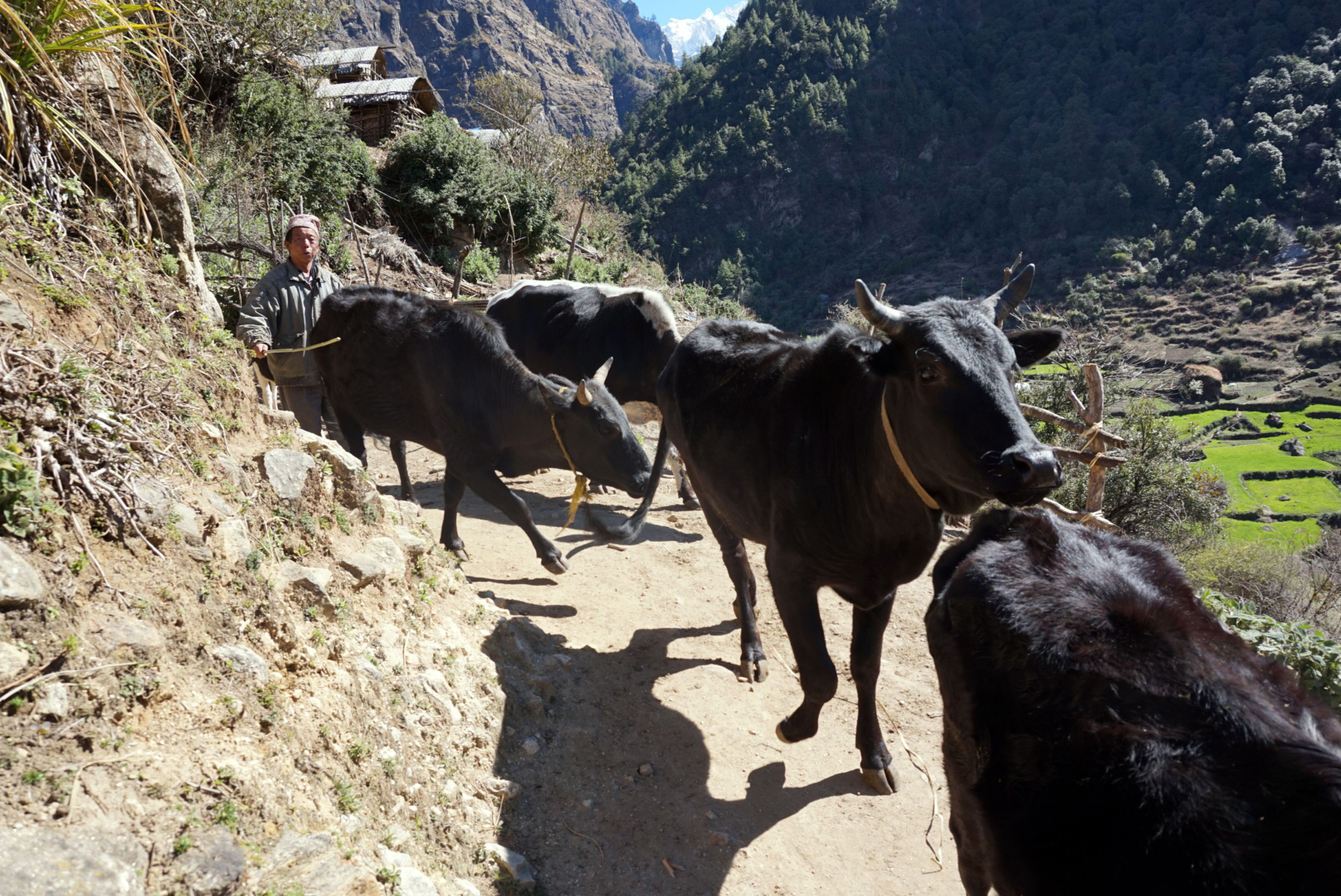
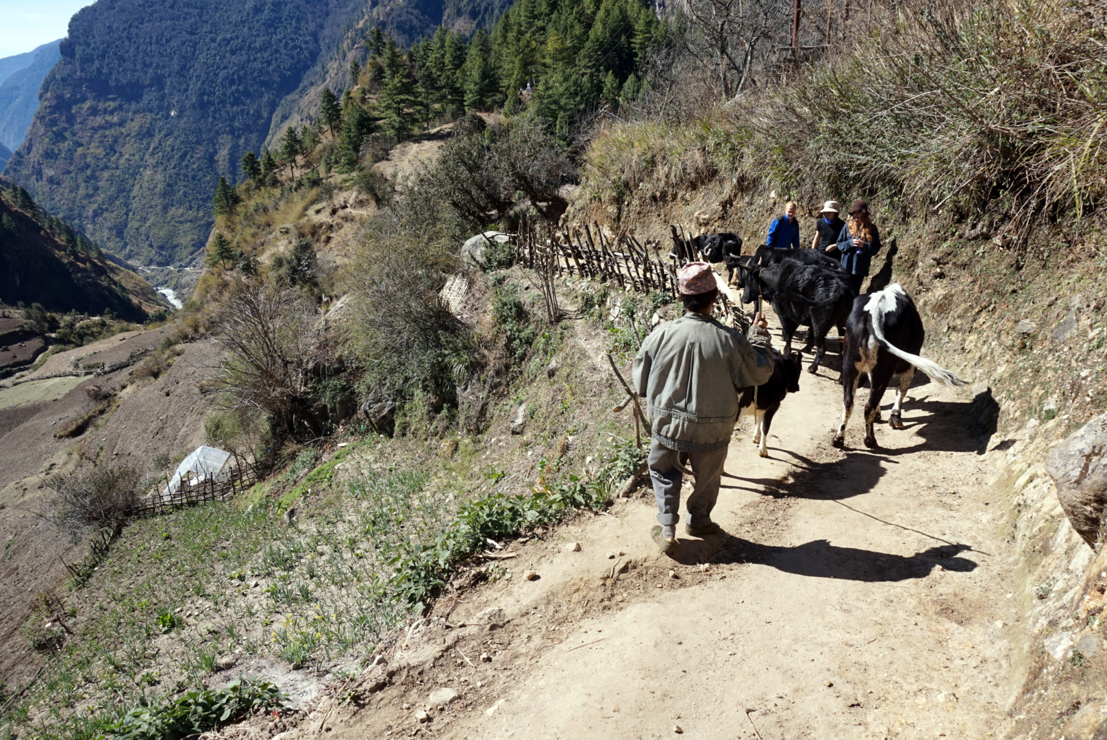
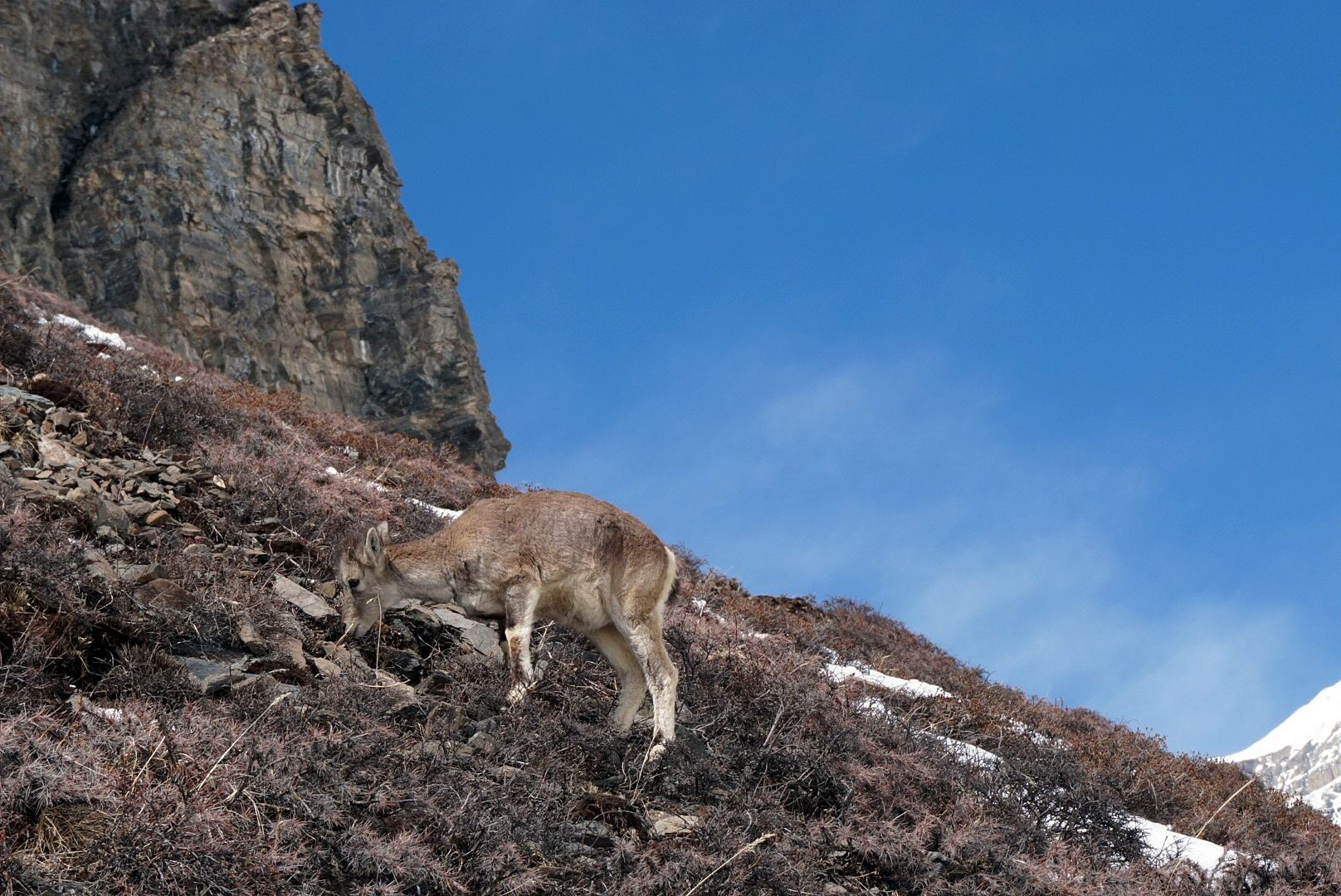
The scond part of the day was a two - three hour hike through a winding valley somtimes pretty steep. At times the path was only a couple of feet wide with unwelcomng drops on the river side. Every now and then, cows, herds of goats, or lizards would take you by suprise. Lesson two, always pass animals (or people you don't like the look of) mountain side. Amongst the greenery of the hillside was loads of wild Cannabis plants, it was odd seeing them literally growing as a weed. I weed on them as I thought it would be fun to say later. (No one really cared and looked at me blankly). Then turning yet another winding bend the valley beautifully framed our first sight of a monsterous snowy peak towering over us.
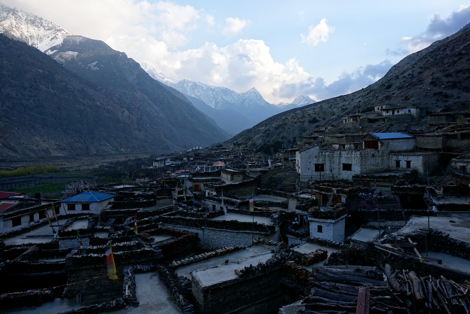
At the top of about a half hour steep ascent we were rewarded with our first glimpse of the brightly coloured village of Tal nestled at the foot of the hillside round a river bend. T
al means lake in Nepalise.
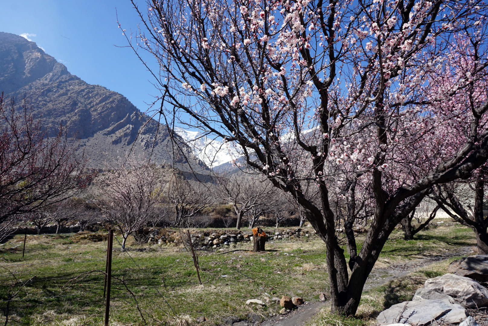
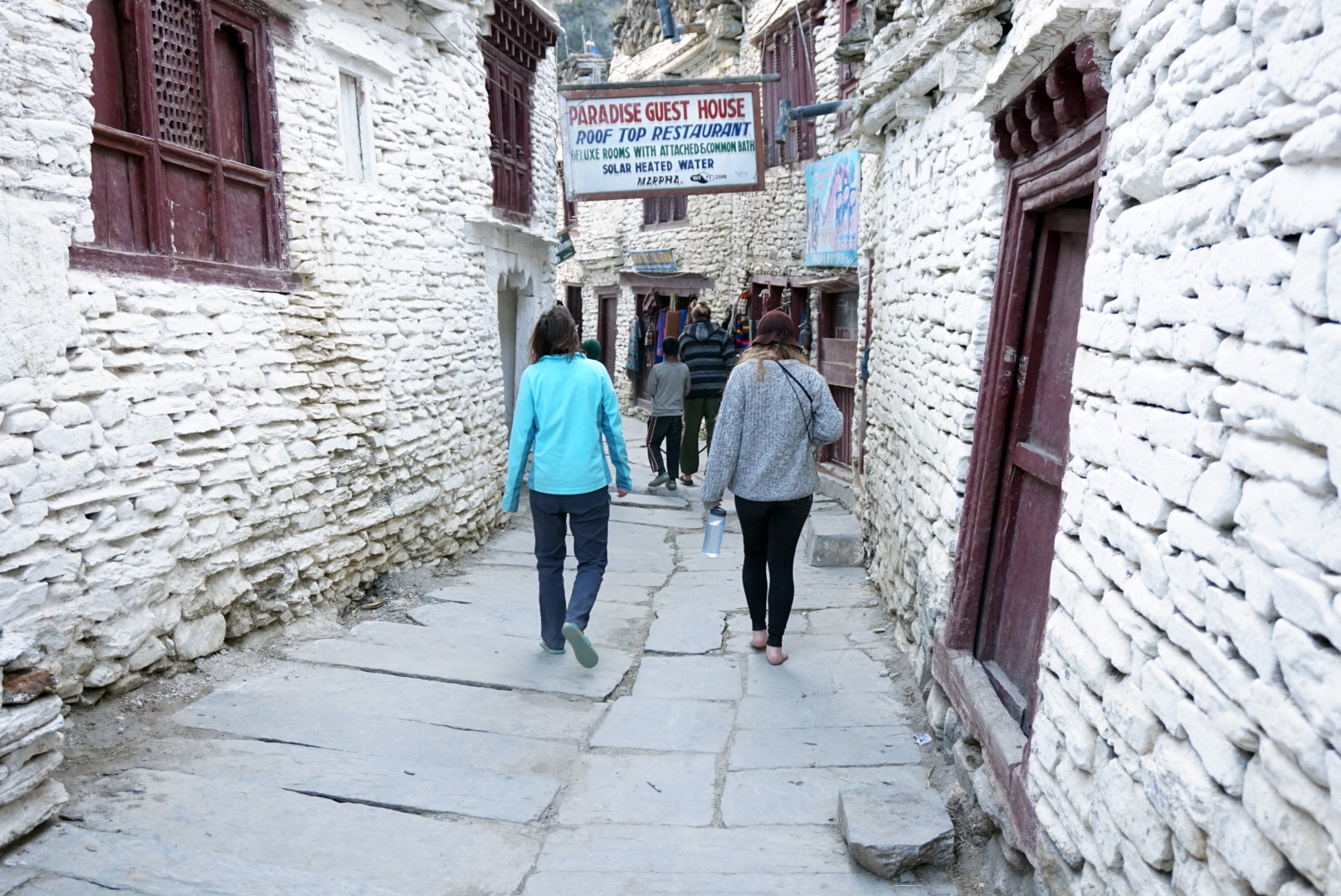
It was odd after such a climb to see a massive white stoney flood plane, stretching off into the distance. We checked in to the Paradise Guest House situated at the far end of the village below a huge waterfall. It was a really nice place and the owners were lovely. We also added a new traveler to our rag tag ensamble. An Israeli soldier & photographer caller Eli.
DAY FOUR
Tal 1700m to Danakyu 2190m - 44km
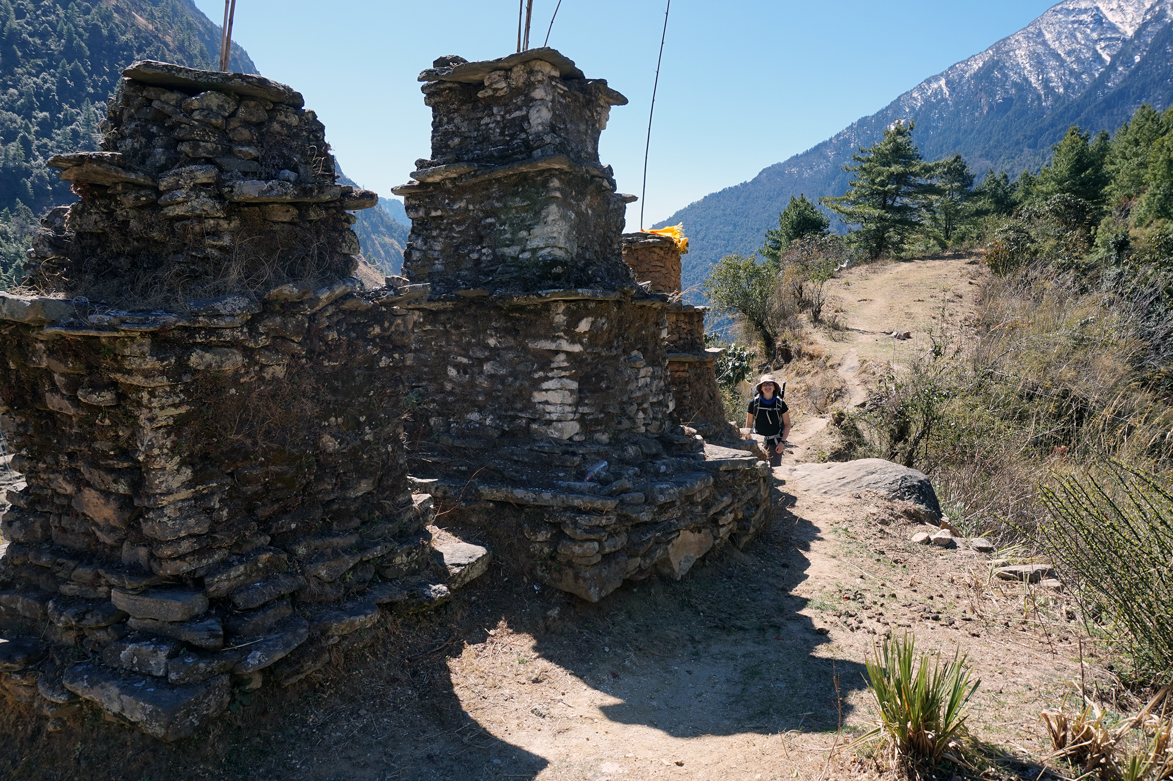
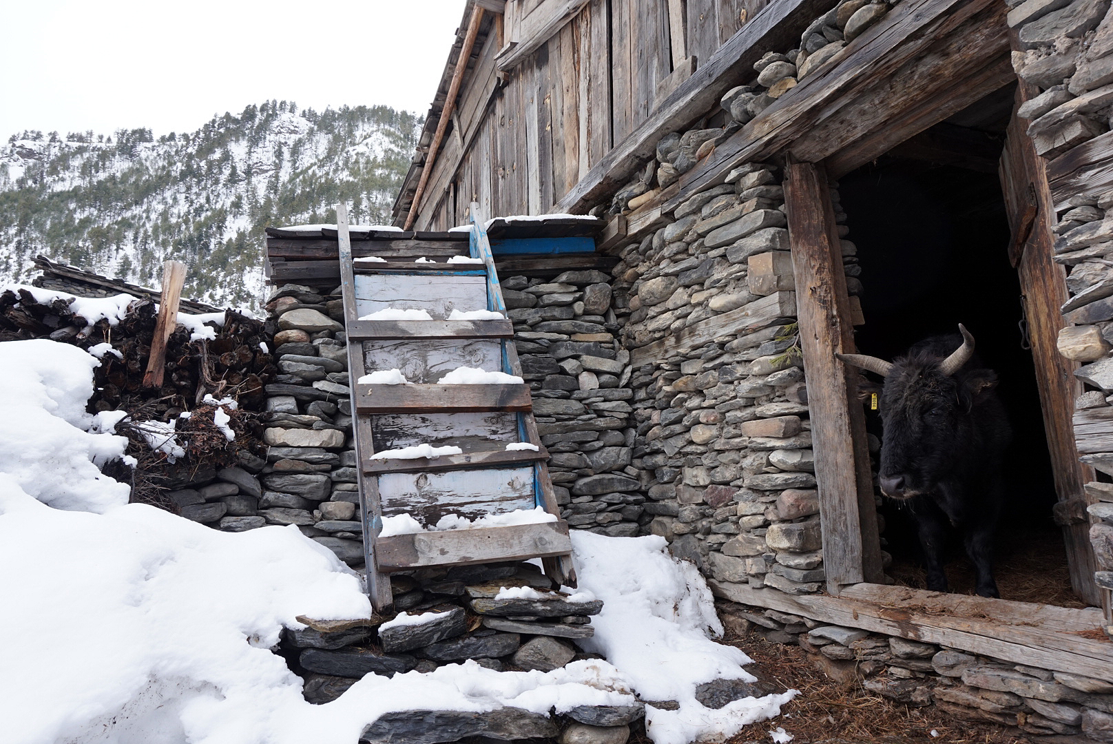
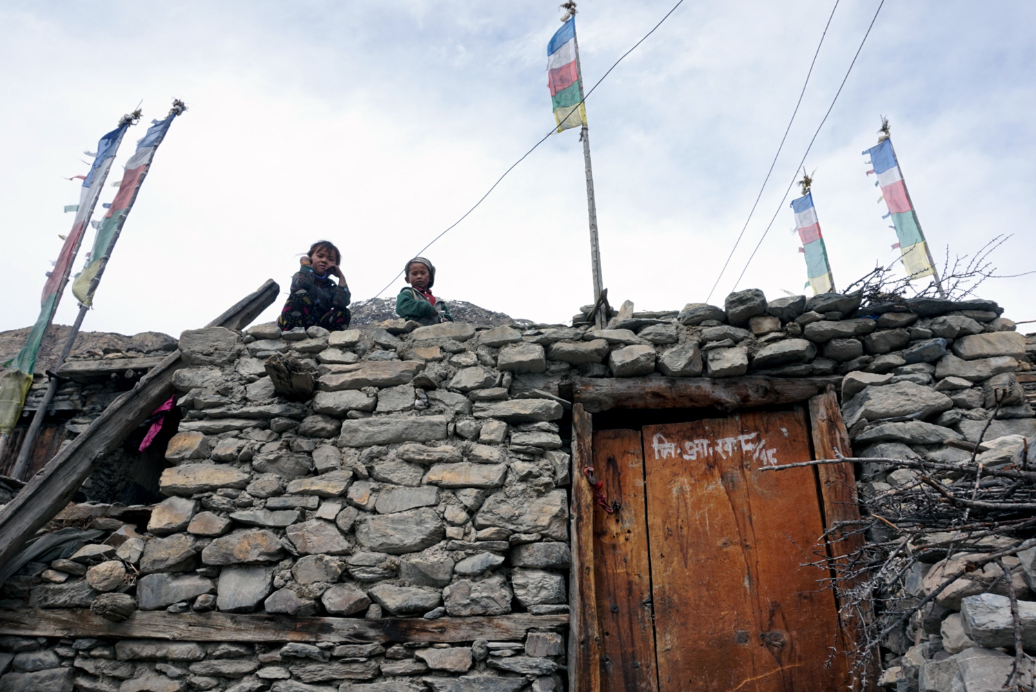
After 5am apple porridge we were back en route following the rocky path to the village of Kote. We decided to take a side trek to the village of Nachai. It is balanced on top of a 700m ascent which we thought would be good training for the pass. It is not part of the main circuit and is rarely visited by tourists. After a tiring hours climb we reached the village guarded by three ancient Buddhist Stupas watching over the hillside. It was like walking into a medieval film set. Animals were wondering around everywhere, the tumble down buildings were a mixture of stone, bamboo or mud creating the higgledy piggledy street. Some with four walls some none. There were no shops, cafes, adverts, anything, just what must be a traditional Himalayan village where the villagers live off the land, but what a wonderous land they live off.
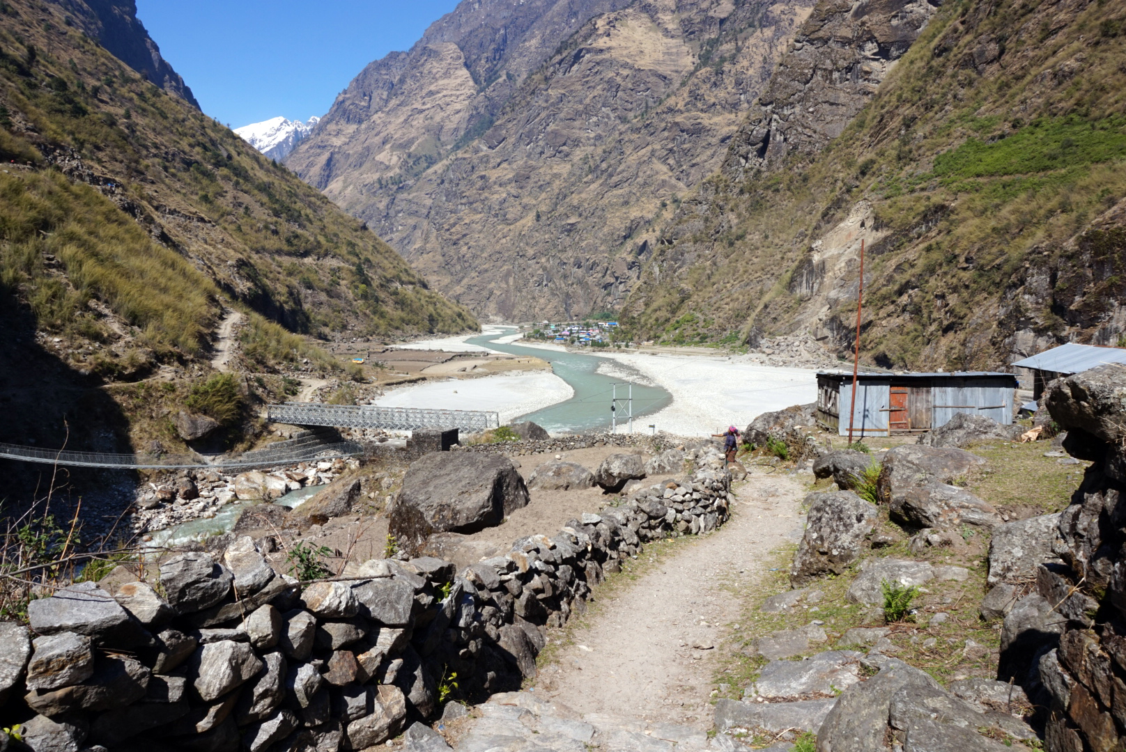
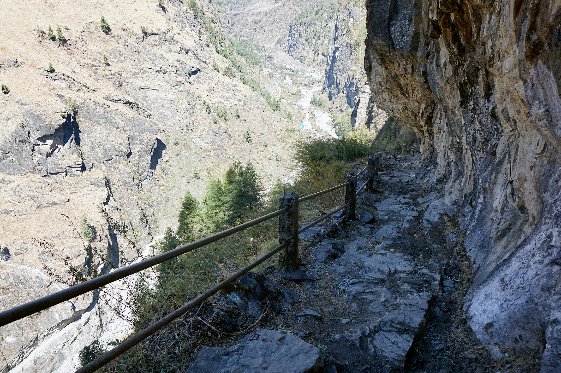
We hiked back down, at one point crossing a path that had been blasted out of the cliff, it had a Lord of the Rings feel about it, which added to The Fellowship references. The path was breakneck and loose stones caused you to easily loose your footing. Eventually we made it down crossing another sketchy suspension bridge to the village of Dharapani very much in need of some Dal Bhat power.
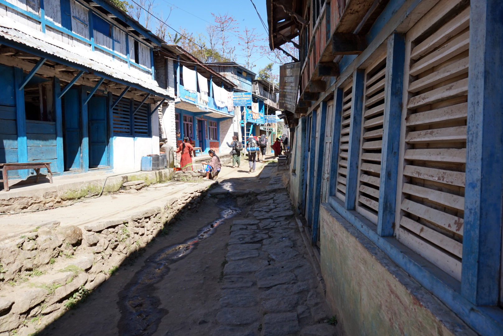
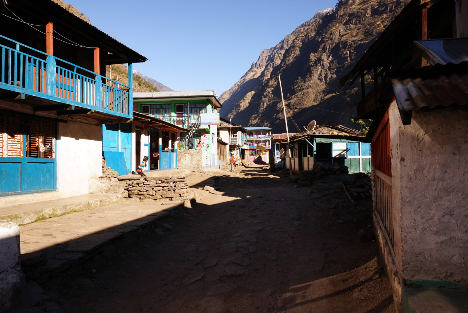
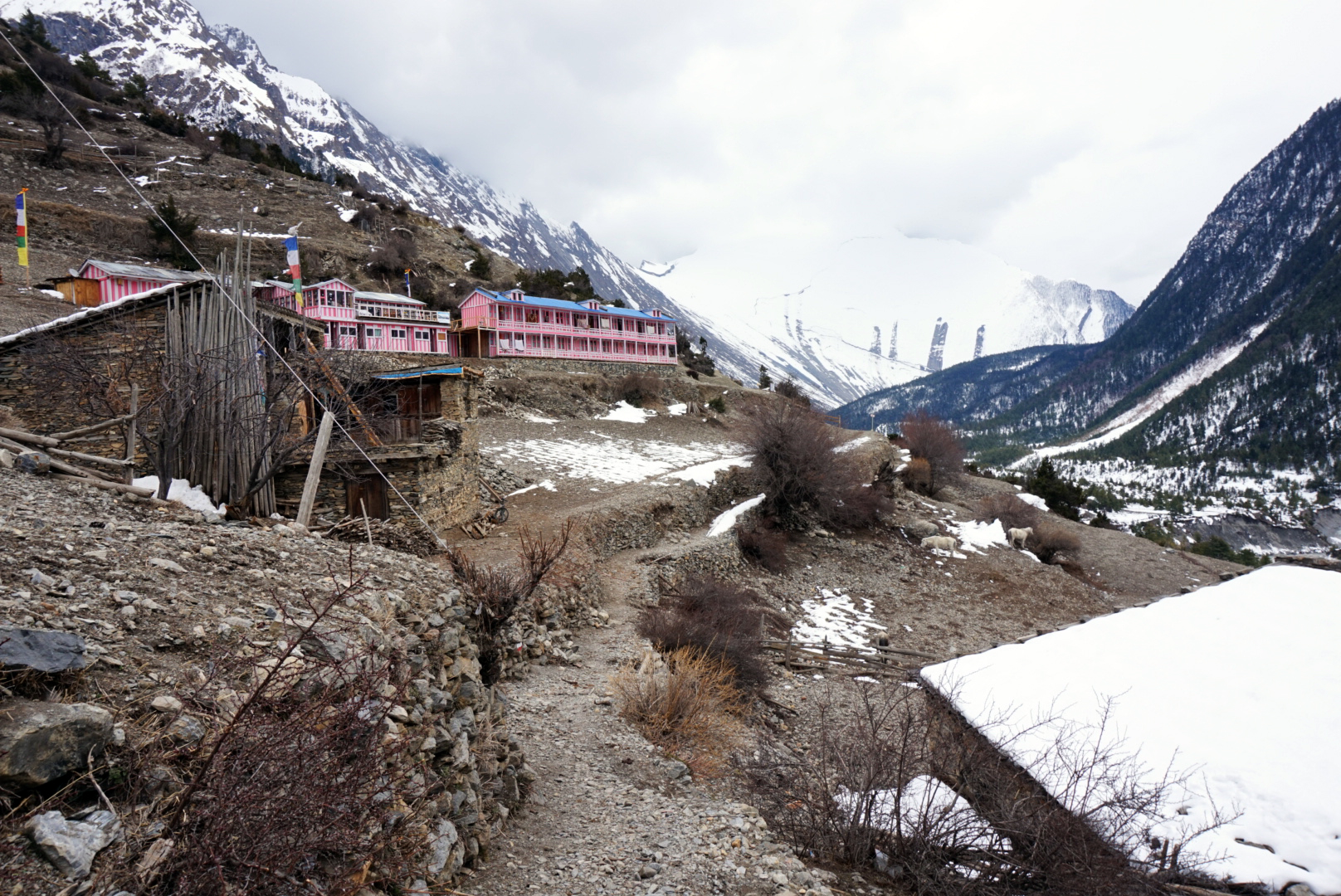
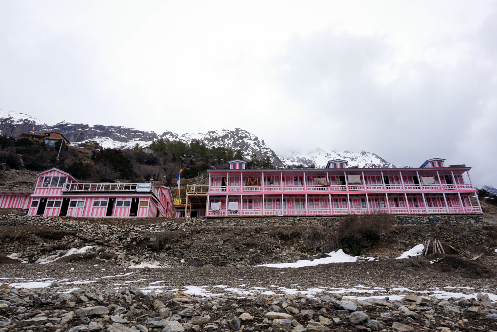
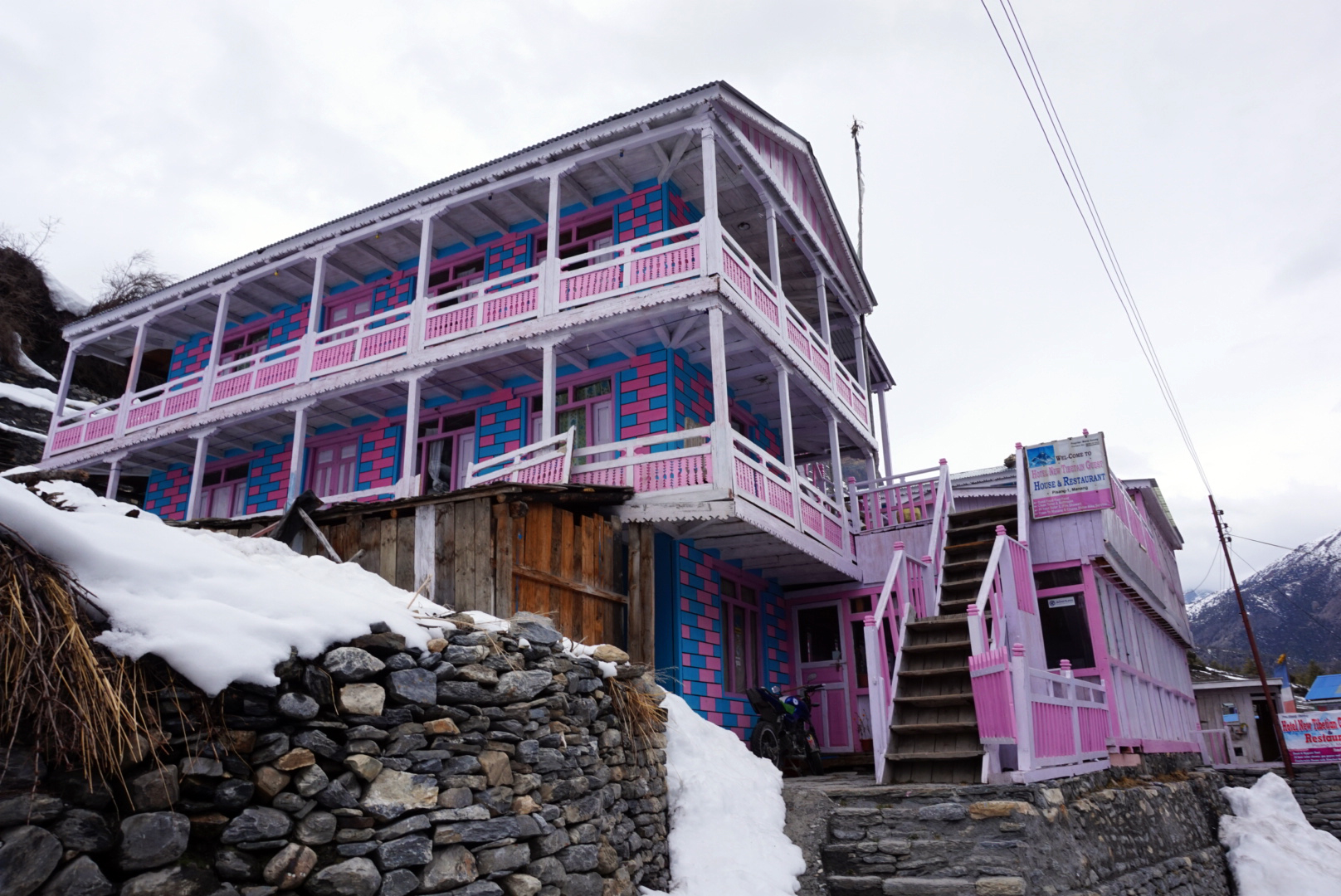
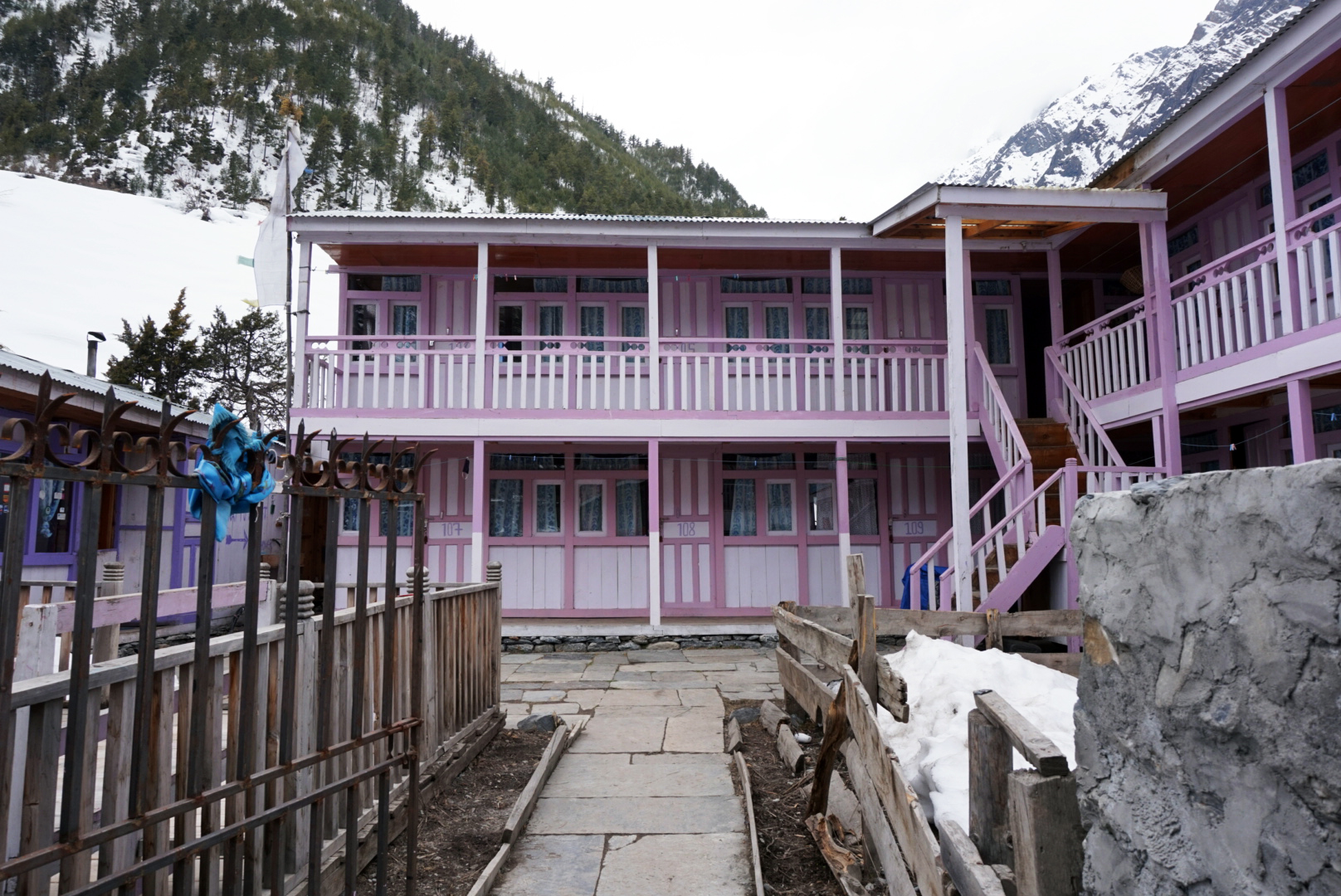
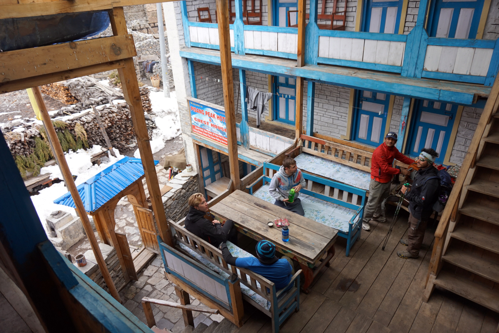
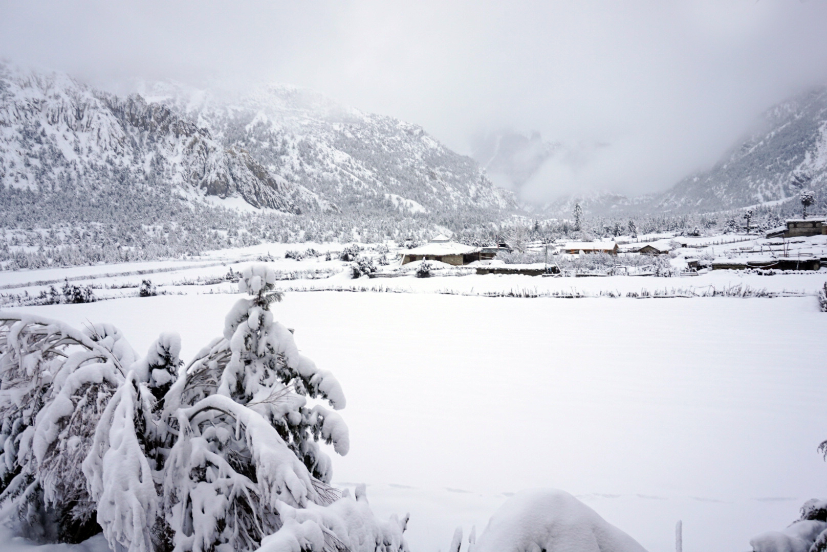
In the afternoon we took the shady route on the south side of the river, passing through another check post. The tea houses in the villages were beautiful. They reminded me of British seaside beach huts quietly huddling together high in the mountains, except they have
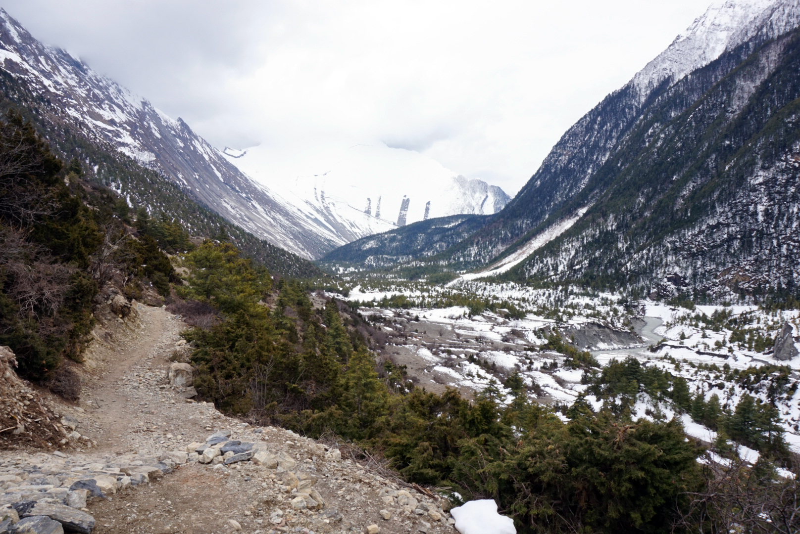
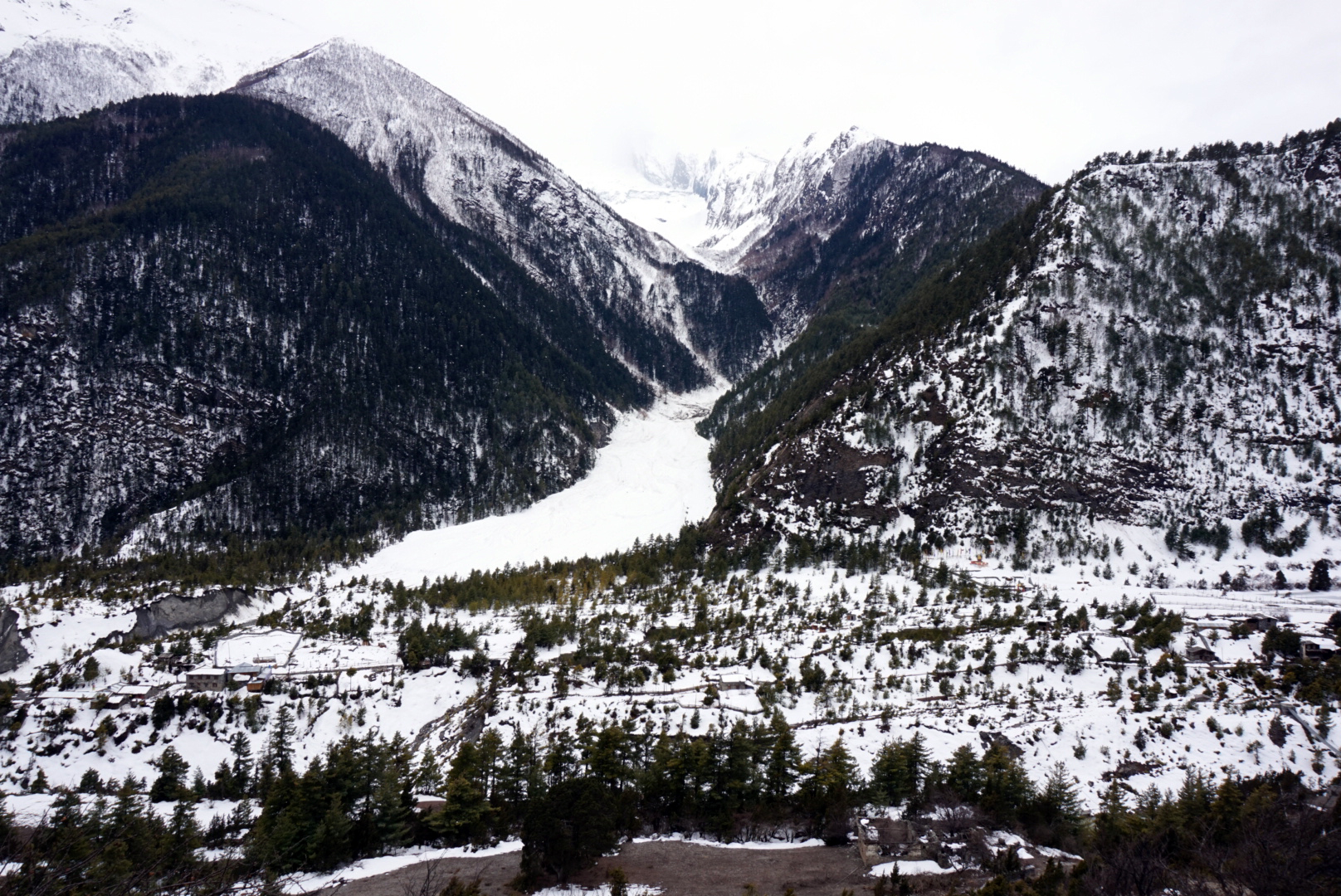
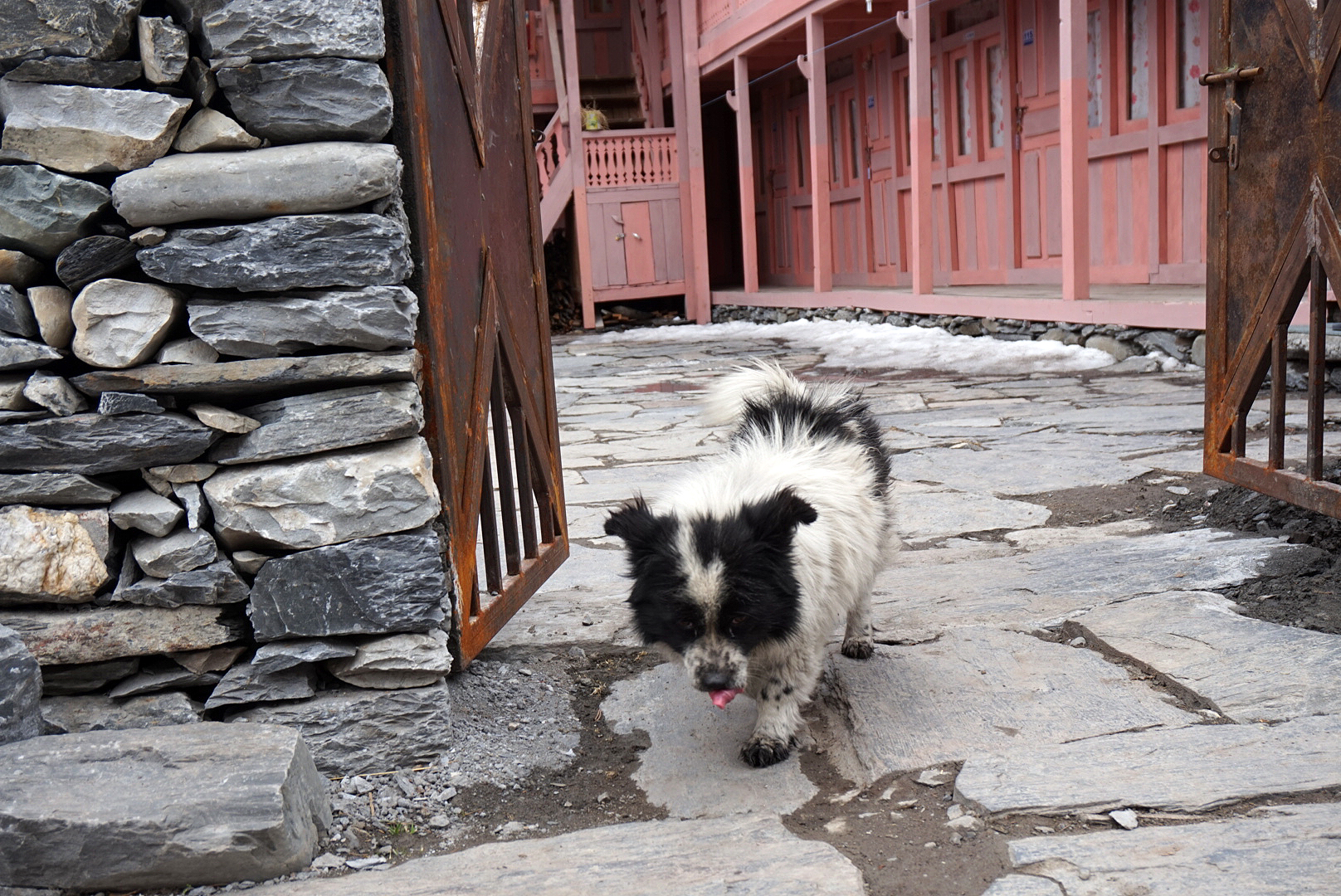
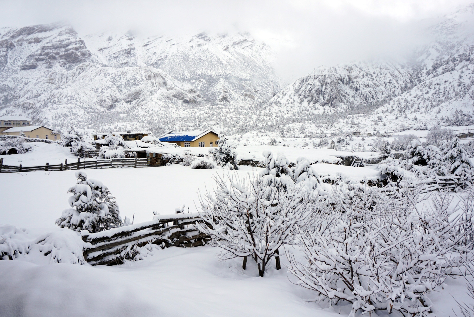
extensions and balconies cobbled onto the sides. I love the bright toy town colours juxtaposed with the harsh landscape, reminiscent of a Wes Anderson film set. We arrived in Danakyu round six ish and checked into a bright pink tea house.
In the early evening a handful of us hiked up to the rice fields on the other side of the river to see the sun set. The vivid green shoots created a vast rich blanket below the rocky snow dusted peaks that soared above. It was all very magical and picturesque.
DAY FIVE
Danakyu 2190m to Chame 2670m - 56km
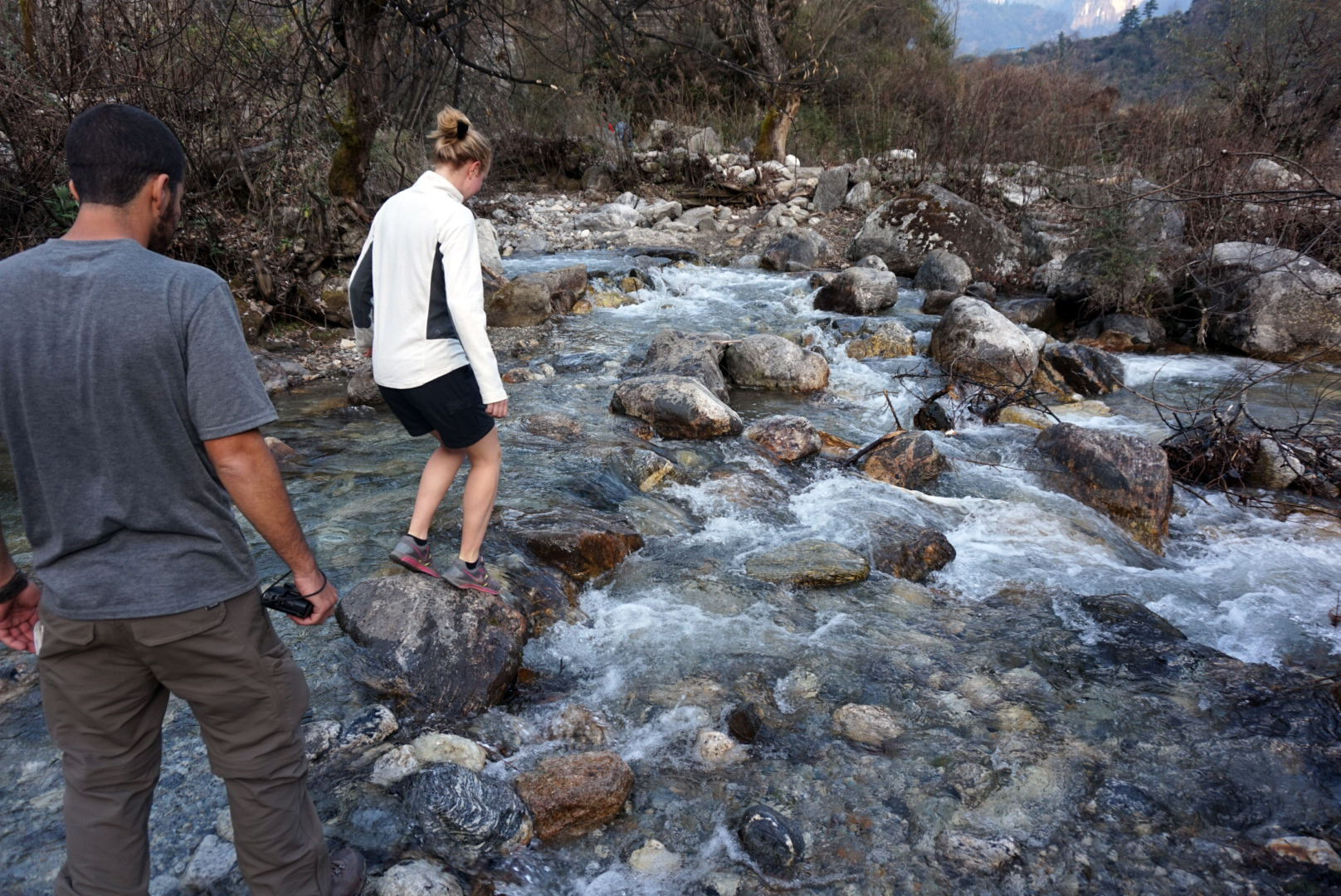
Early start again, after using stepping stones to cross a waterfall / stream we
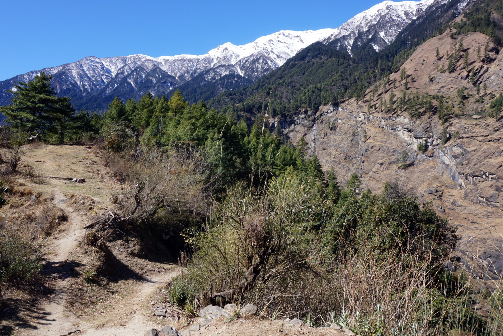
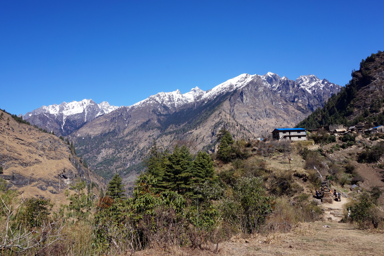
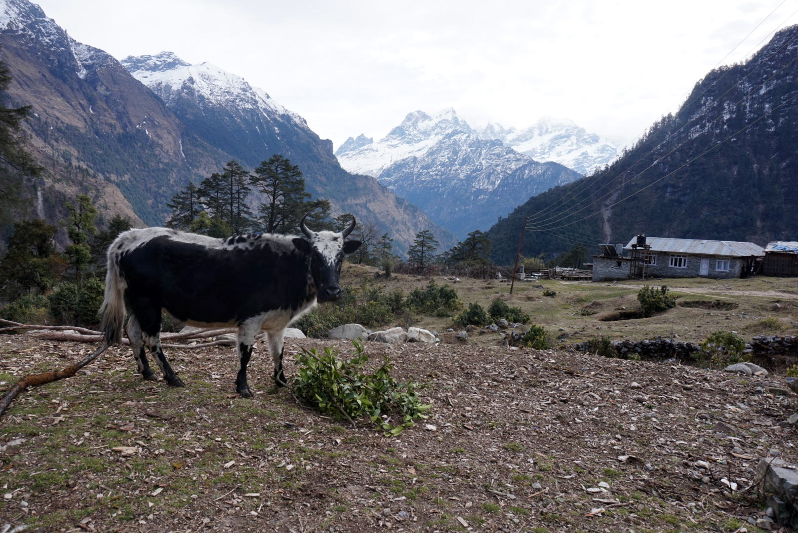
climbed up a steep sketchy route to the village of Temang, at times testing our bouldering skills. After a short break we plodded on descending slightly to the village of Chame for lunch. We found a really nice place tucked away on the north bank of the river and decided we would all spend the night. All the rooms looked out across the river with the impressive icy peaks towering above, losing their summits to the gathering cloud.
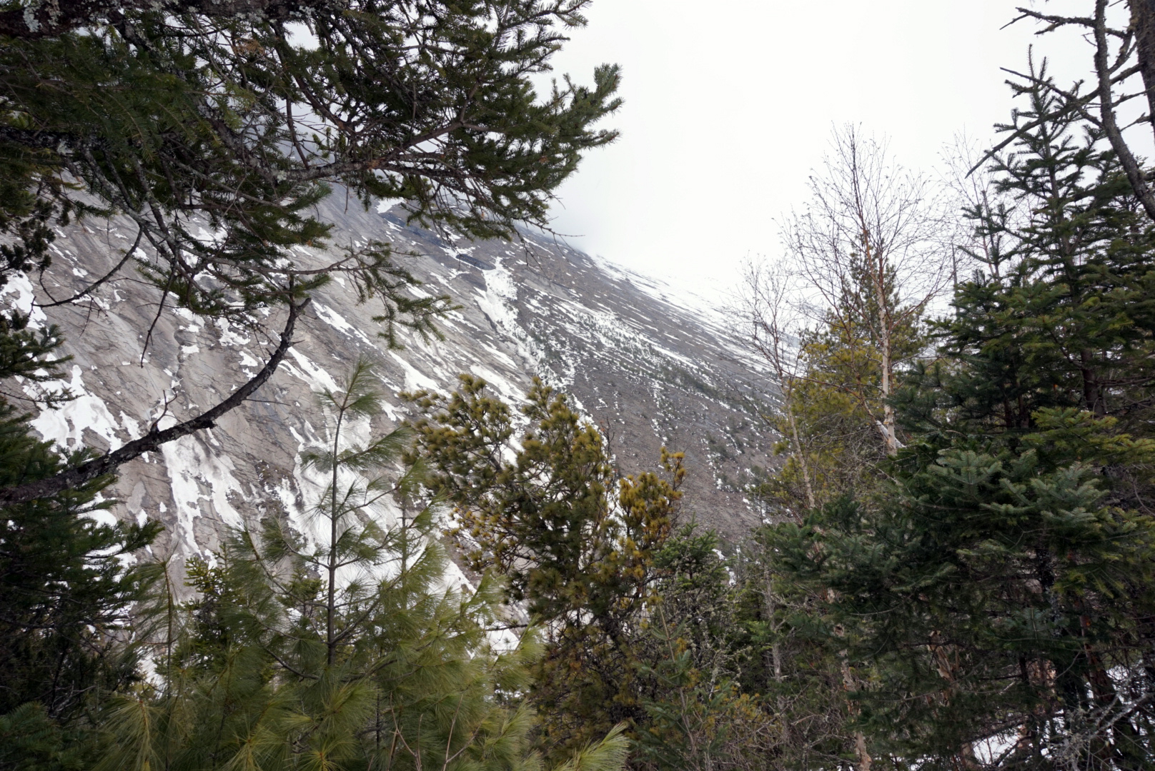
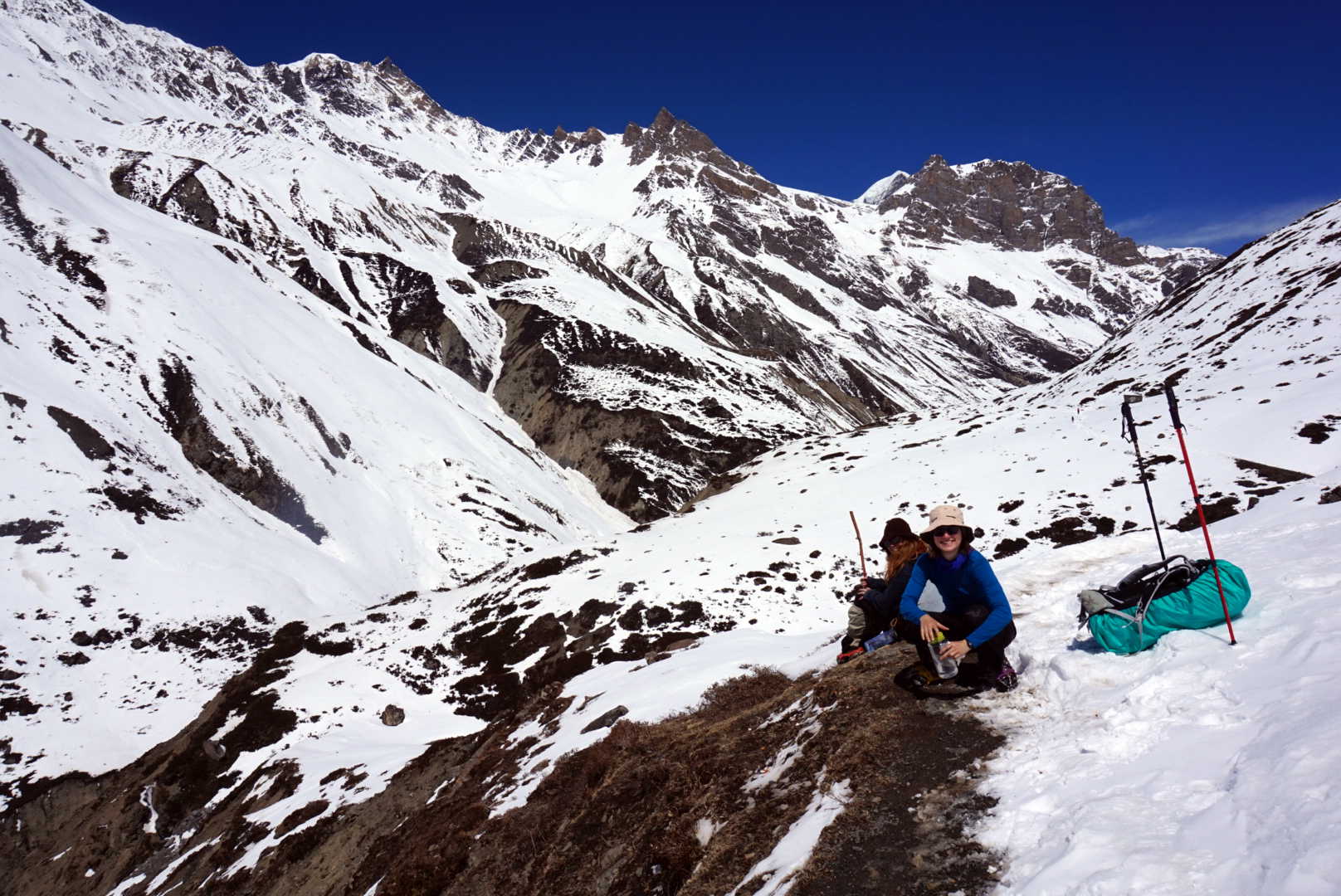
Through out the day we saw many people returning from higher up, saying the snow was too deep, averlanches had been reported and the pass was closed. Some people claimed you couldn't get to the higher villages that precede the pass. This wasn't good news and more snow was apparently forcast. Thick clouds had begun to gather, concealing the mountains entirely from view.
In town we met a group of American doctors on their way to Manang. They are volunteering at a health post where they charge Trekkers $40 for a consultation and use the money to treat the local people. We spoke for a while with Remi and Lara who were not just hiking to Manang they were mountain biking! They said they were also running altitude sickness talks weekdays at 3pm which we decided we would definitely go to... if we make it that far.
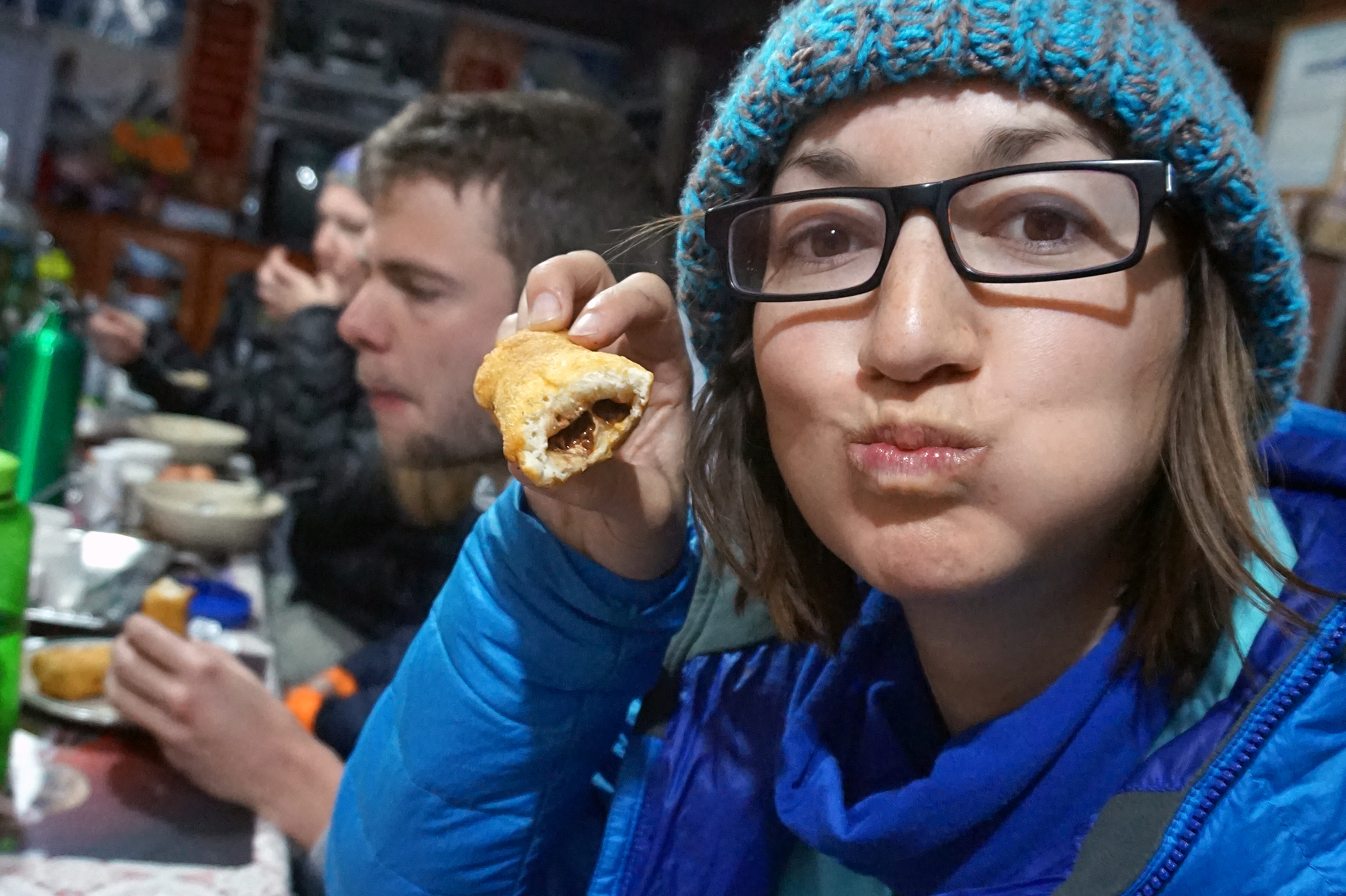
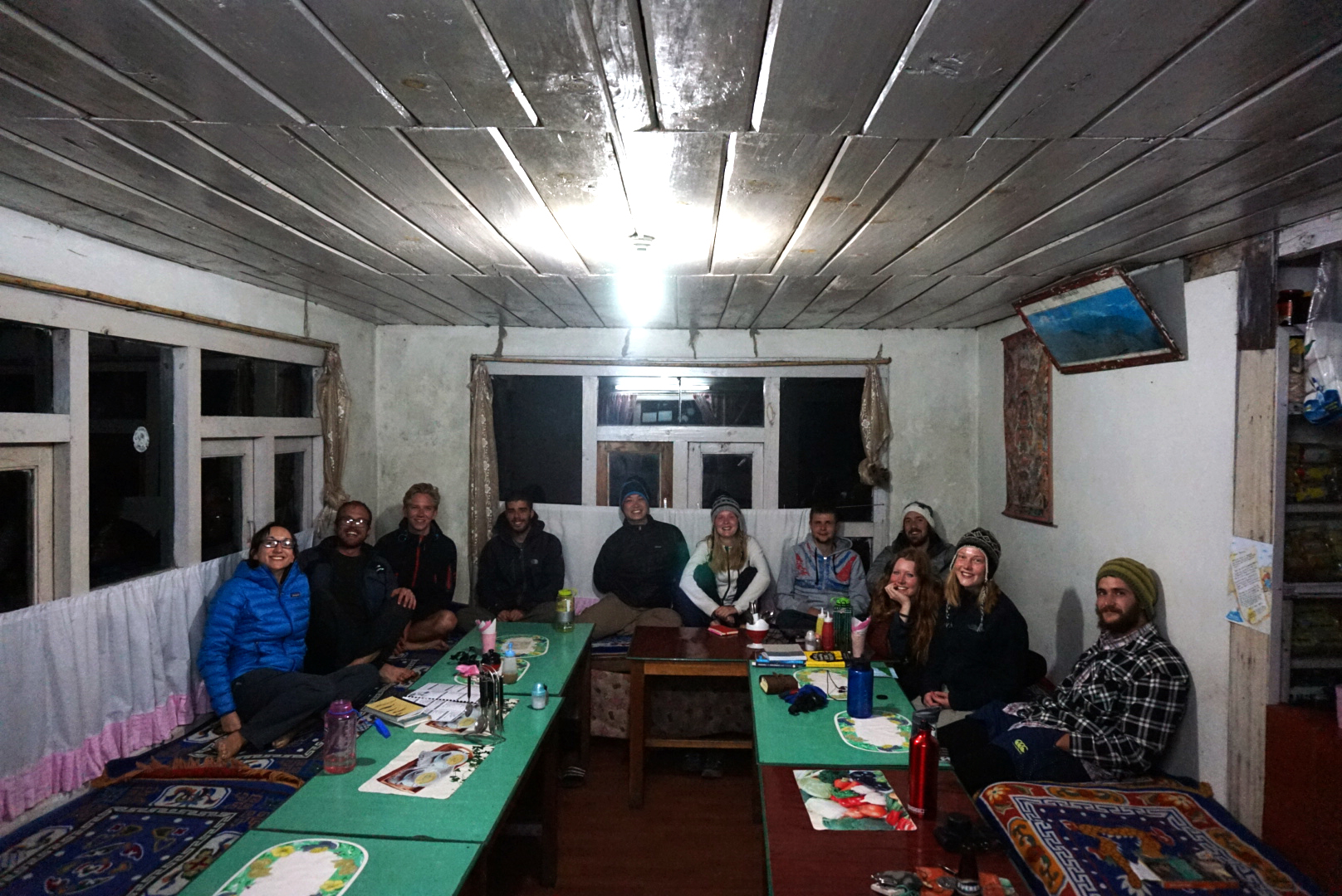
The evening gave us all our first taste of the famous Annapurna snickers rolls. We had seen them minding their own business on menu's in various tea houses, but not had the courage to try one. It was fucking amazing! Why had we waited so long to try it. It is a Snickers wraped in Tibetan bread and fried. Sounds disgusting, tastes fantastic. After many rounds of ShitHead (that's a card game mum) we were taught some Israeli army games by Eli, that had us in fits of laughter. One was a card game called elevens that ended in sore hands and the other was called sheep which was just super silly but bloody funny. Ask me about it next time we have a few beers. (Jamie if you're reading this... I think this game is for you)
DAY SIX
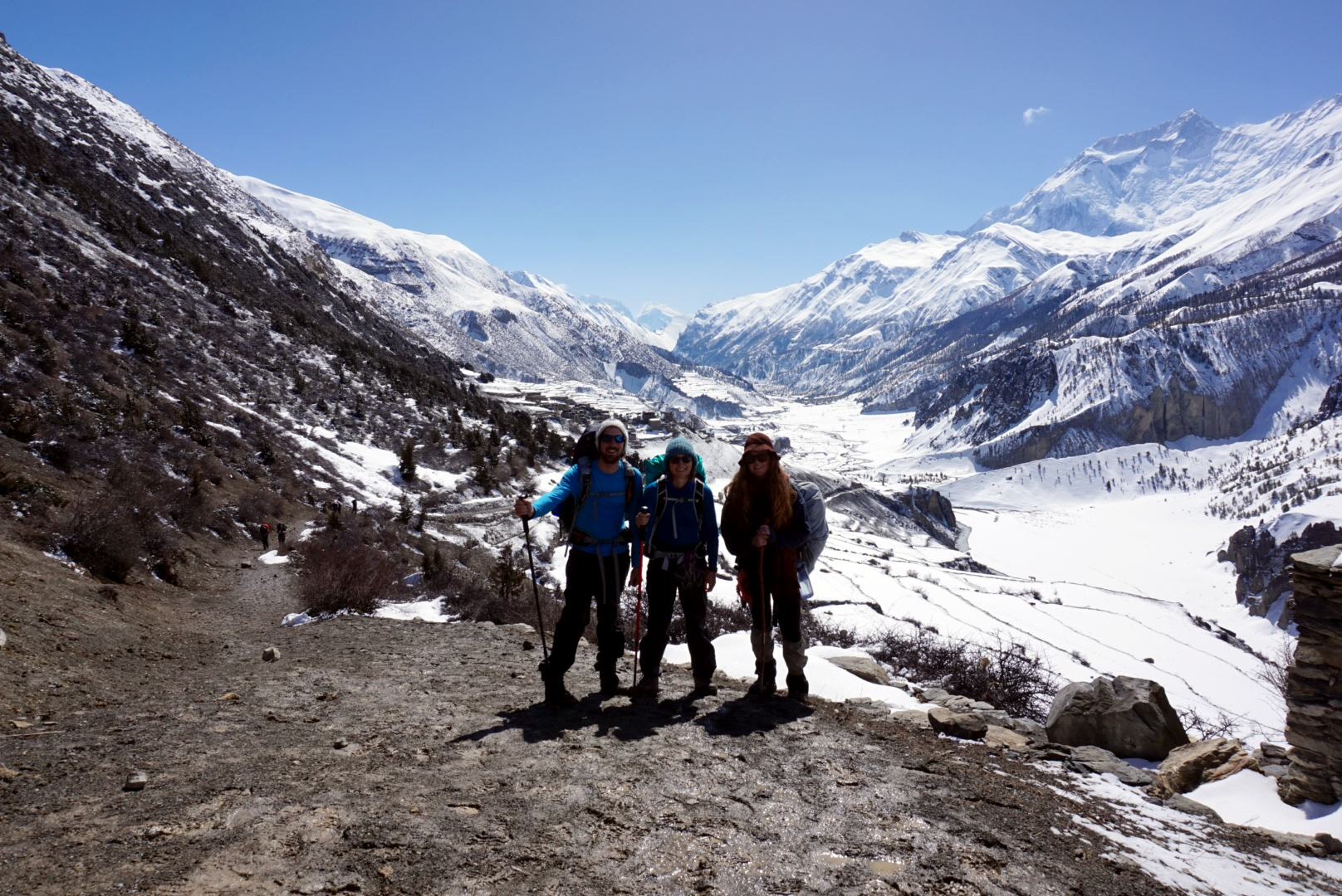
Chame 2670m to Lower Pisang 3200m - 75km
After a nutty breakfast of snickers roll and peanut butter porridge, we set off. Louise wasn't feeling good and there was talk of staying here one more day, but after asking the guest house owner he said he was expecting a large group today and so didn't have room for us. Instead we opted to share out her belongings so that her bag wasn't too heavy. She had a quick check up with Doctor Remi who gave her some advice and medication. We all decided we love Remi.
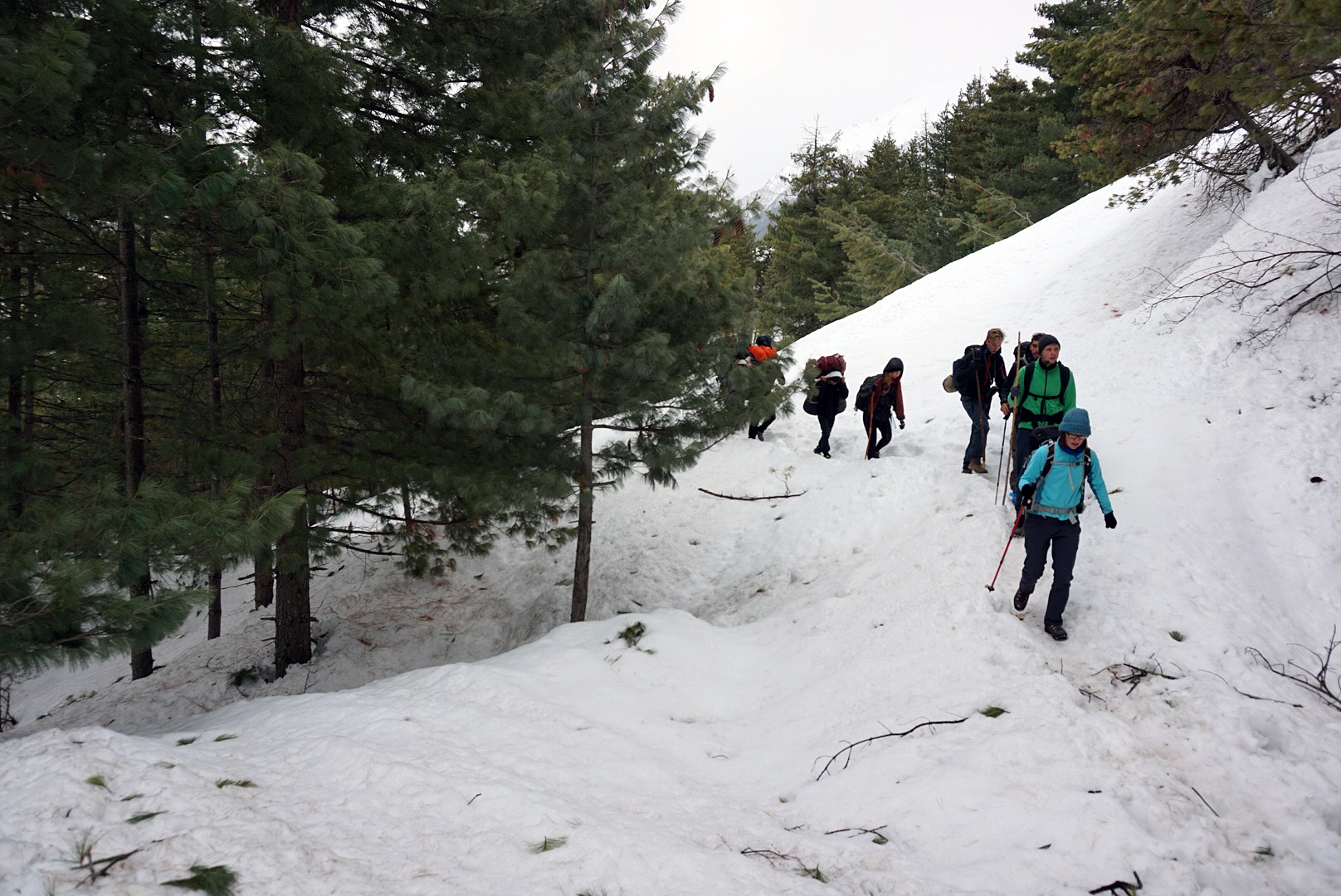
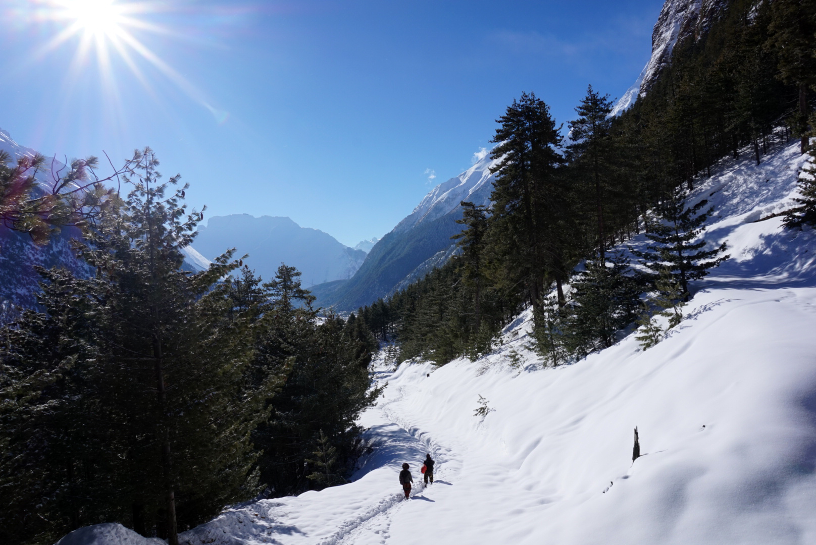
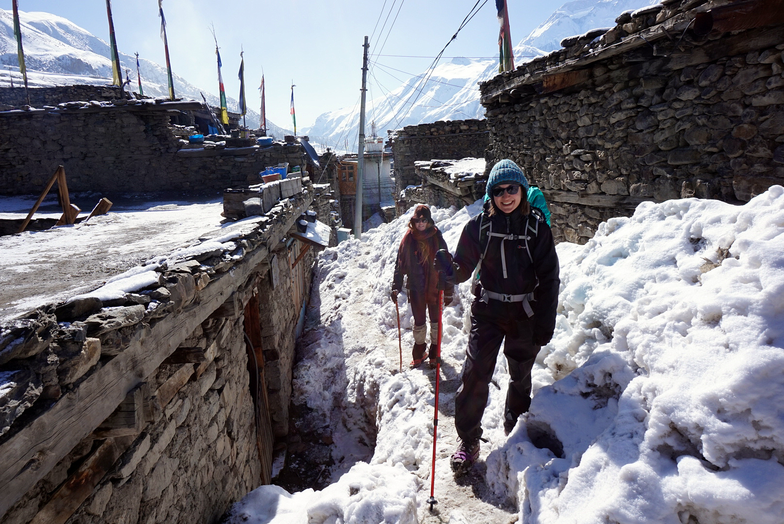
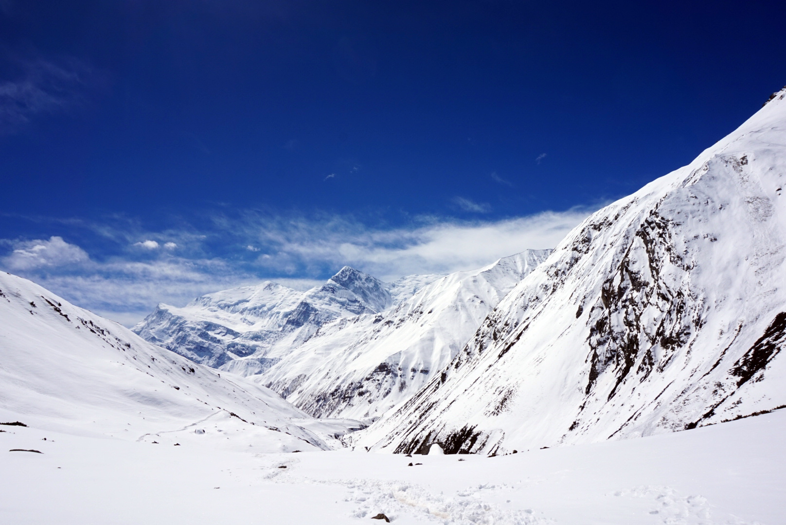
Today was the day we broke through the snow line. The road was now lost below a blanket of snow and ice. It started to feel like we were really in the mountains, not viewing them from the sidelines.
We spent the morning twisting and turning through a beautiful pine forest, (it smelled and looked like Christmas) the snow about 6 inches deep but with a well trodden path making things easier. We stopped for lunch in a small brightly coloured tea house with dramatic views of the white snowy slopes. The fire was roaring in the eating hall and so it was lovely and cosy. We started talking to another Israeli called Niev, he was a friendly chap and asked if he could tag along with his porter.
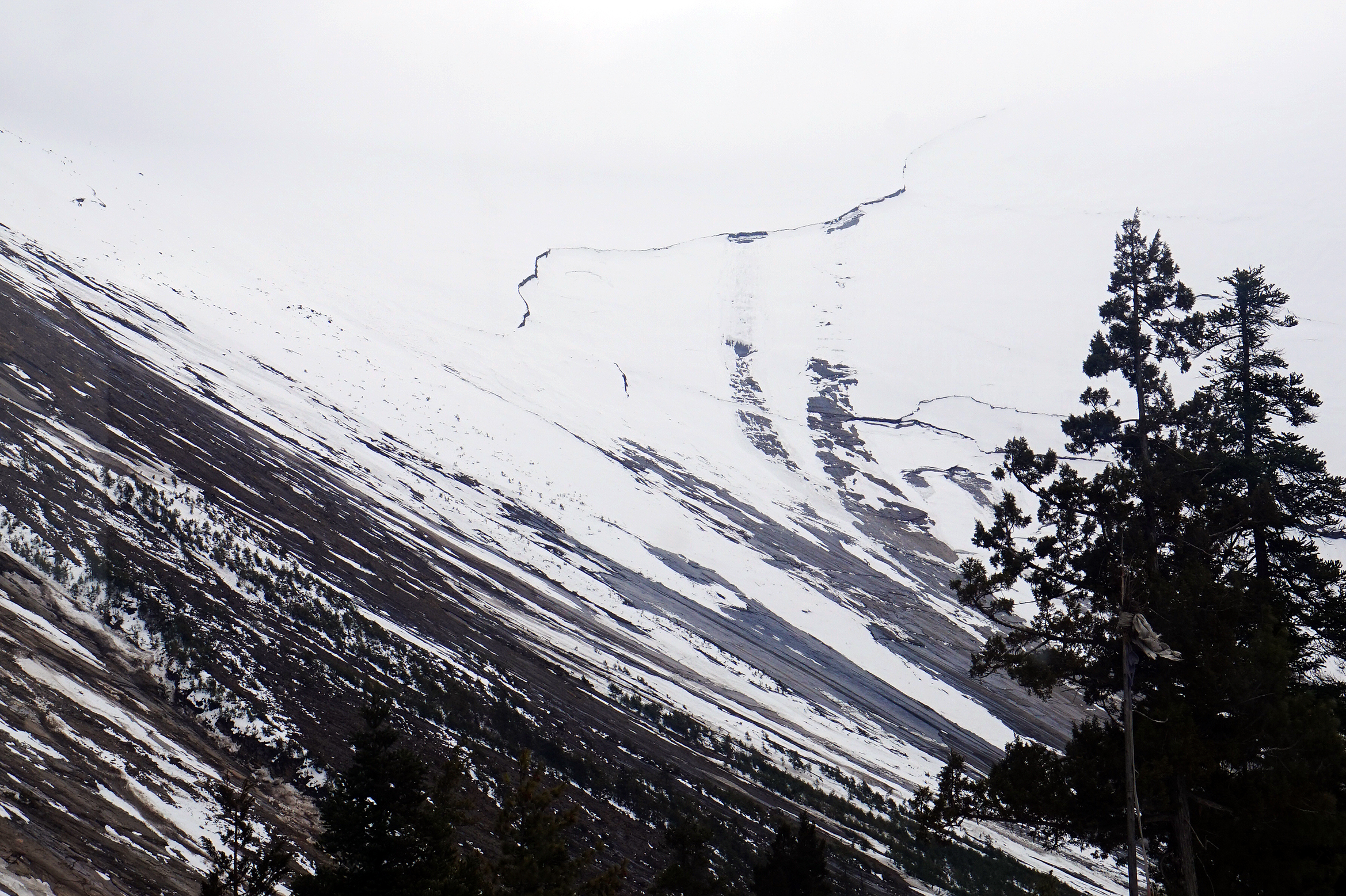
After lunch we carried on, the view was dominated by a gigantic mountain ridge towering hundreds of meters above. It was perfectly covered with snow, except for one huge crack zigzagging diagonally across its face.
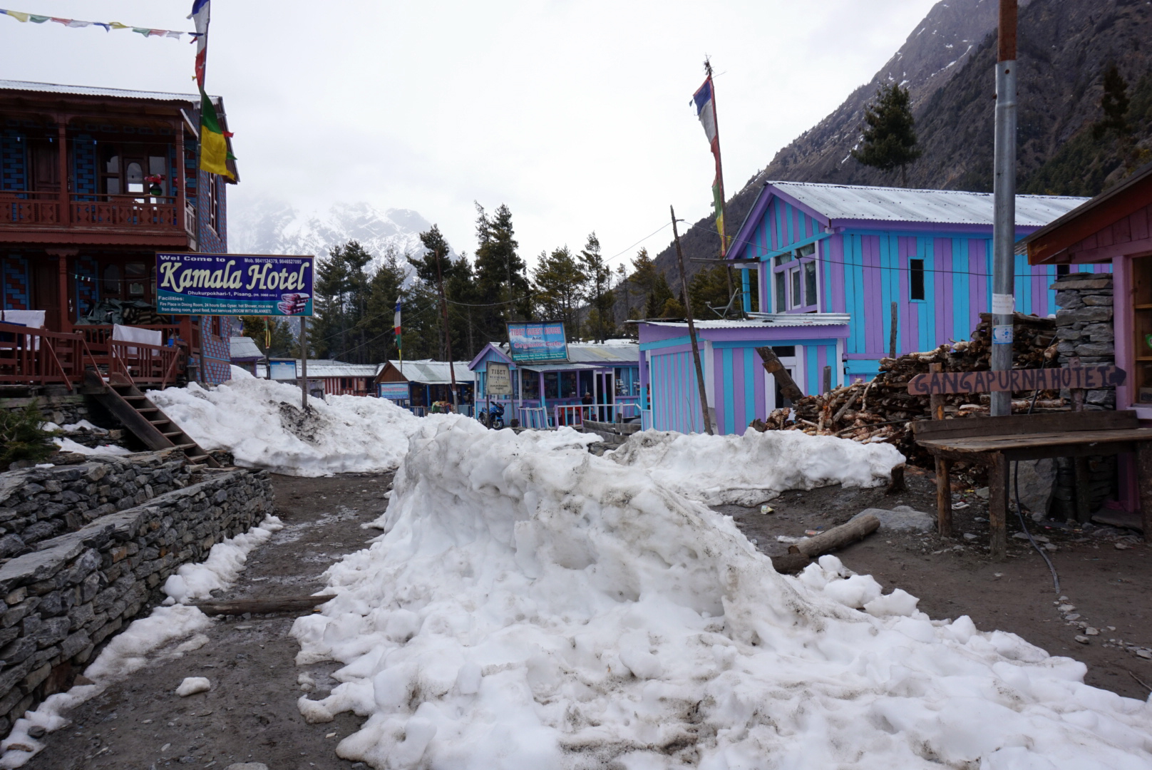
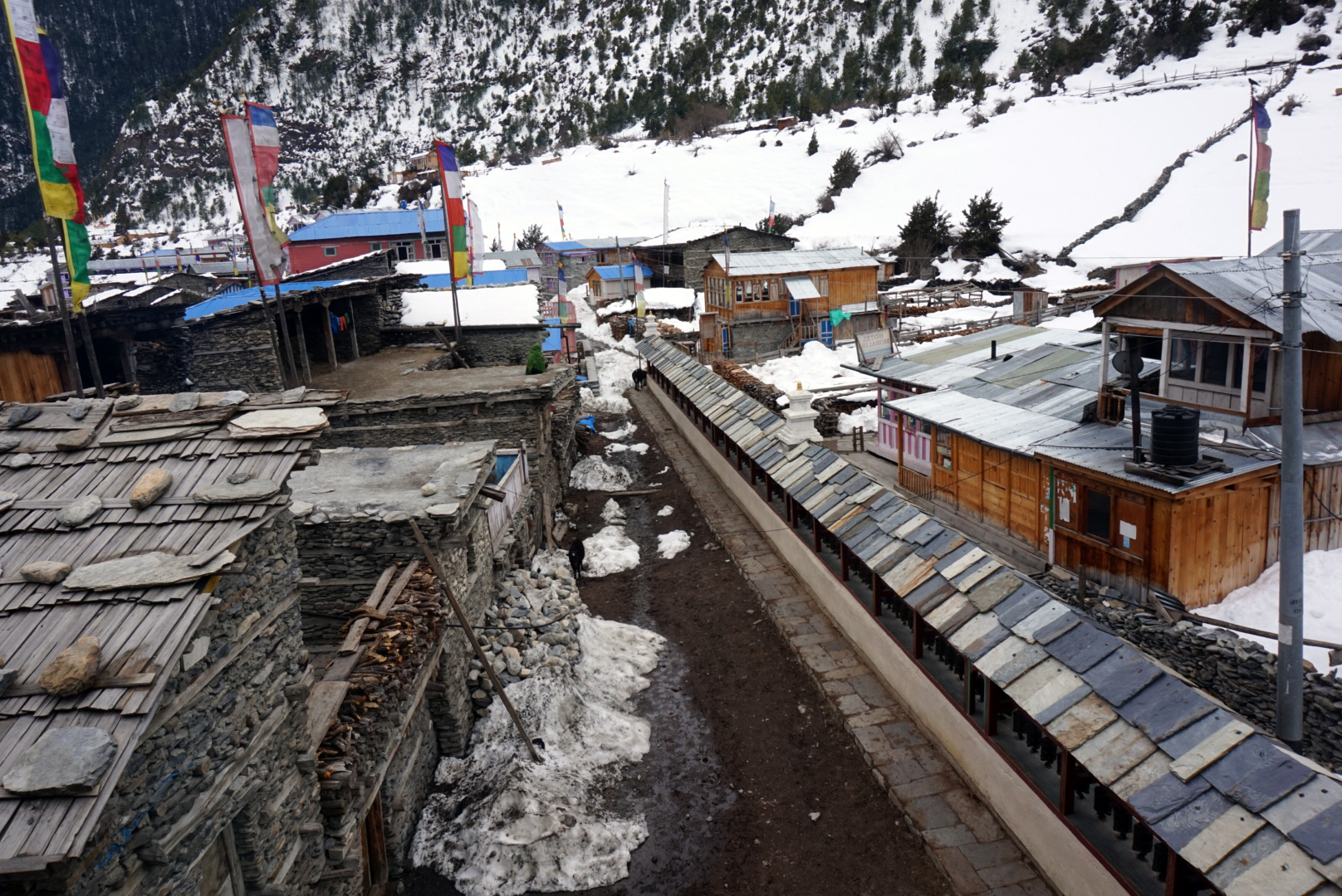
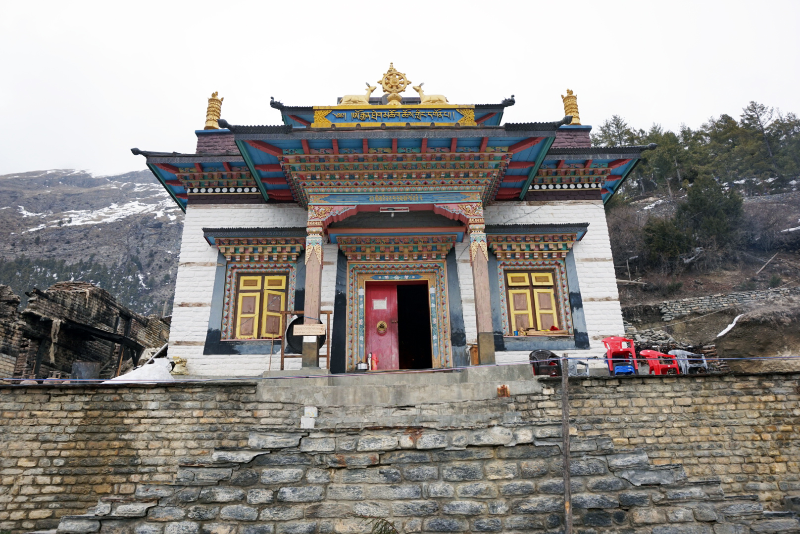
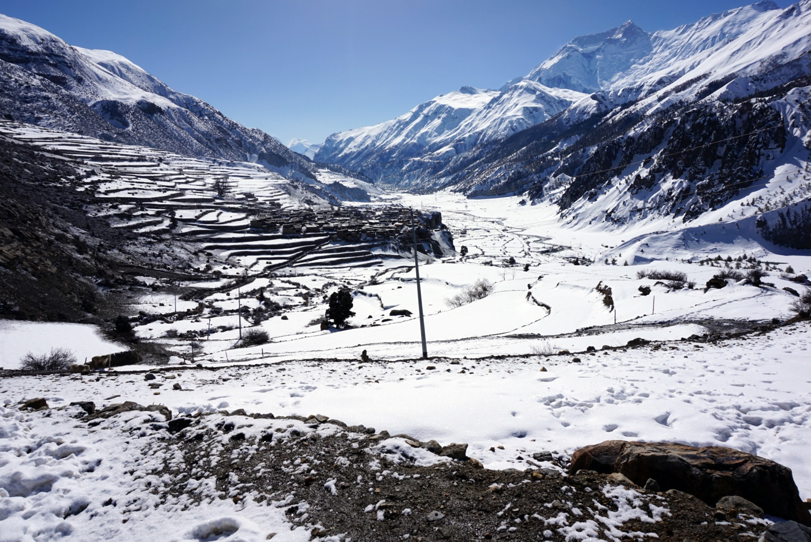
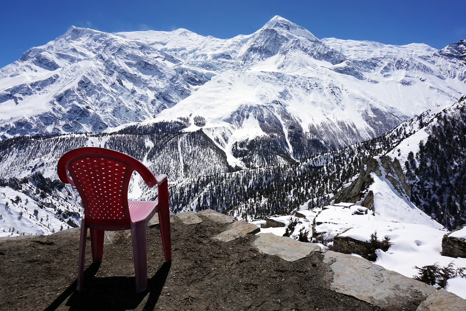
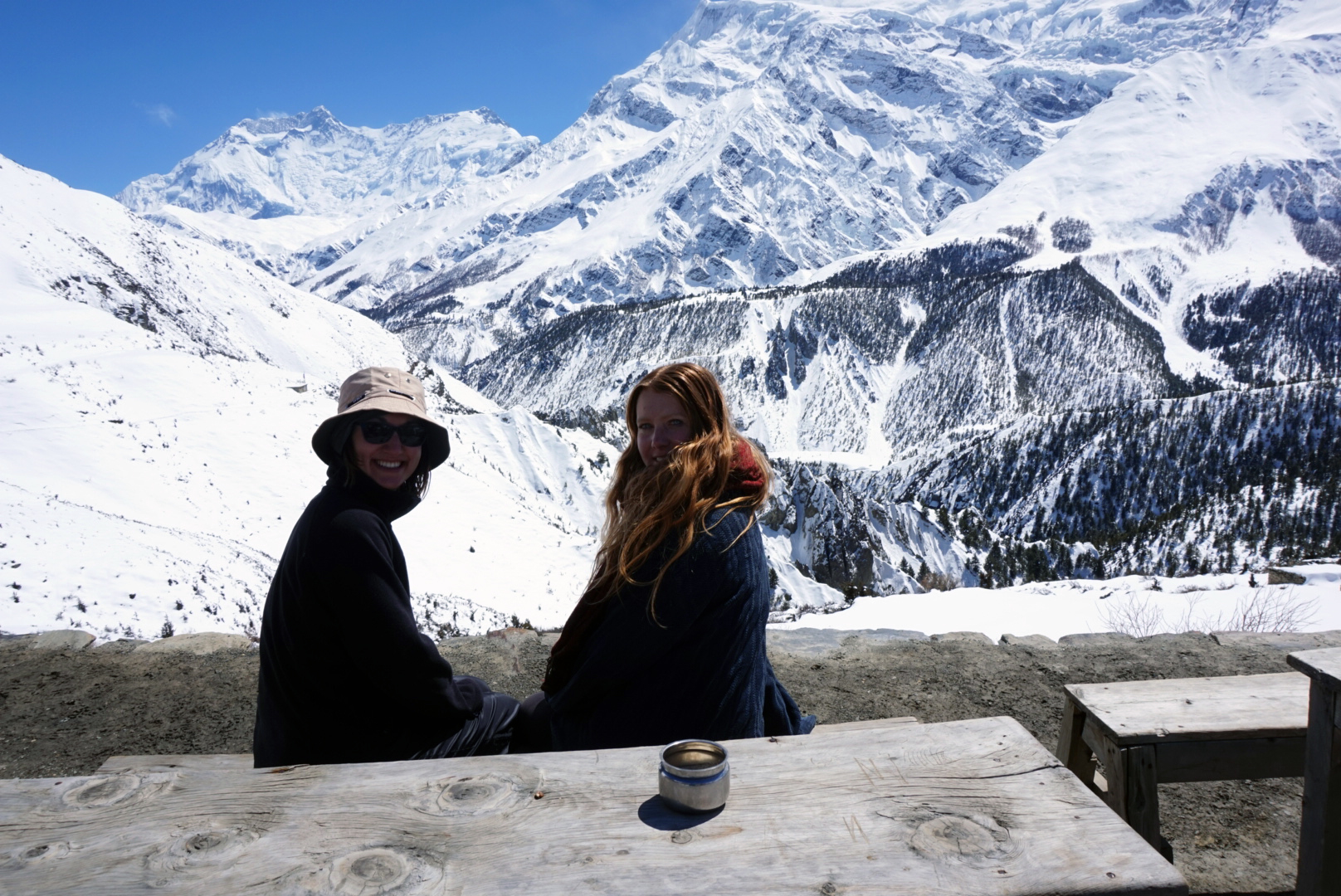
We got to Lower Pisang and found a lovely guest house with a great common room where we could all fit around a giant table. In the afternoon to help us acclimatise a little better we visited the Buddhist monastery perched on the top off small peak on the far side of the valley in Upper Pisang. There was a Buddhist monk chanting inside, creating a very peaceful atmosphere. On old lady appeared from nowhere and offered us all tea. It tasted amazing, like nothing I had tasted before. Thick gloomy clouds were gathering on the far side of the valley as small flakes of snow started dancing on the breeze. We hiked back down to take refuge by the glowing stove in the guest house. Eli said it was the first time he had seen snow fall.
DAY SEVEN
Lower Pisang 3200m to Humde 3280m - 82km
We left a little later today round 8am and after only half an hour of walking snow began to fall. We had hoped to make the journey all the way to Manang, but decided instead to reach the halfway village Humde. Walking through the snow was pretty tough and when it started to get heavier we got worried. Thoughts of the snow storm in October crept into our minds, and Niev's porter seemed really on edge, making the whole situation suddenly feel a lot more serious.
We climbed over quite a few avalanches that had buried the road and anything else in their wake. The trees were poking out through the snow, half buried and knocked forward by the force of the snow. This was a sobering sight and to add to the drama we heard from a treker returning from Manang that a porter had been caught in an avalanche earler that day and was in hospital.
We met some locals going the other way who said Humde was only 45mins away, so we decided to push on and get there, as it was much closer now than it was to go back to Lower Pisang. Once there, we would decide whether or not to continue. We arrived, found rooms, and had a long nap to recuperate. When we made it down to the common room, we found the group sat around the fire in the kitchen as the owners had kept delaying building a fire in the main room. It was below freezing and so all being huddled together round the stove kept the cold at bay. The big boss lady came in and rearranged us all so that she had the best spot by the fire, and eventually they made a fire for us in the dining hall! We were sternly told at 7.50pm that it was bed time! So off we went trotted like naughty children who had stayed up too late. None of us were brave enough to defy the big boss lady.
DAY EIGHT
Humde 3280m back to Lower Pisang 3200m - 89km
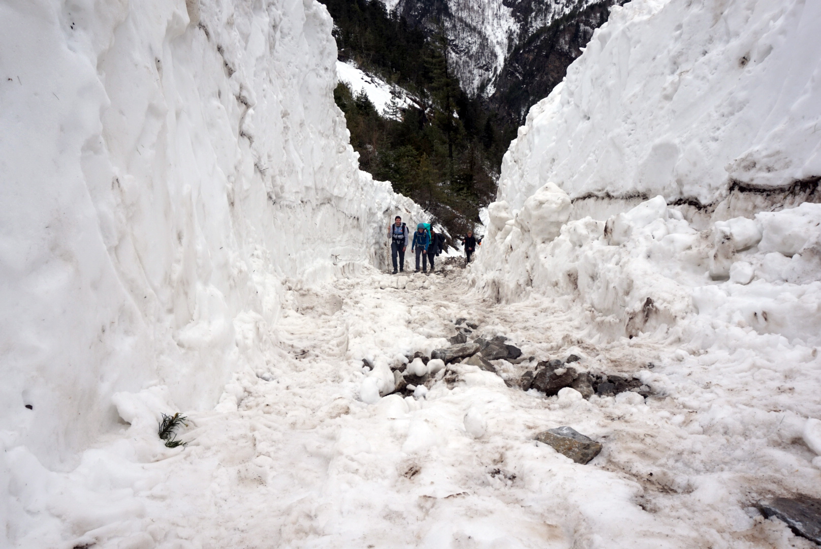
We awoke to find it had snowed about 2 or more foot in the night. This was heartbreaking as it meant the sensible thing to do was to turn back. We discussed our options as a group, and kept coming back to the fact that we were all inexperienced in these conditions and that we'd heard that the snow was forecast for 5 days straight. We were worried that if it carried on in this way, we could get stranded here - which we did not want - and decided it was safer to get back down to a lower height. We were also very aware that it is best to travel in the morning, as the sun warms up the mountains throughout the day, meaning avalanches are much more likely in the afternoon.
As we were the first to carve out the path the going was slow. If you stepped off the trodden down icy path, you suddenly found yourself waist deep in snow. The guys at the front did an excellent job of following the indentation of the old path and getting us back to Lower Pisang. However on the way down, we passed many people going the other way, which started to sew seeds of doubt in our minds... We decided we'd see what the weather did, but if it looked clear, we were going back up!!
We spent a lovely evening in the same guest house we had stayed in 2 nights previously. We knew there was a possibility that some of the group would not want to continue up tomorrow so we partied - Annapurna style - with Snickers rolls and an early bed time!
DAY NINE
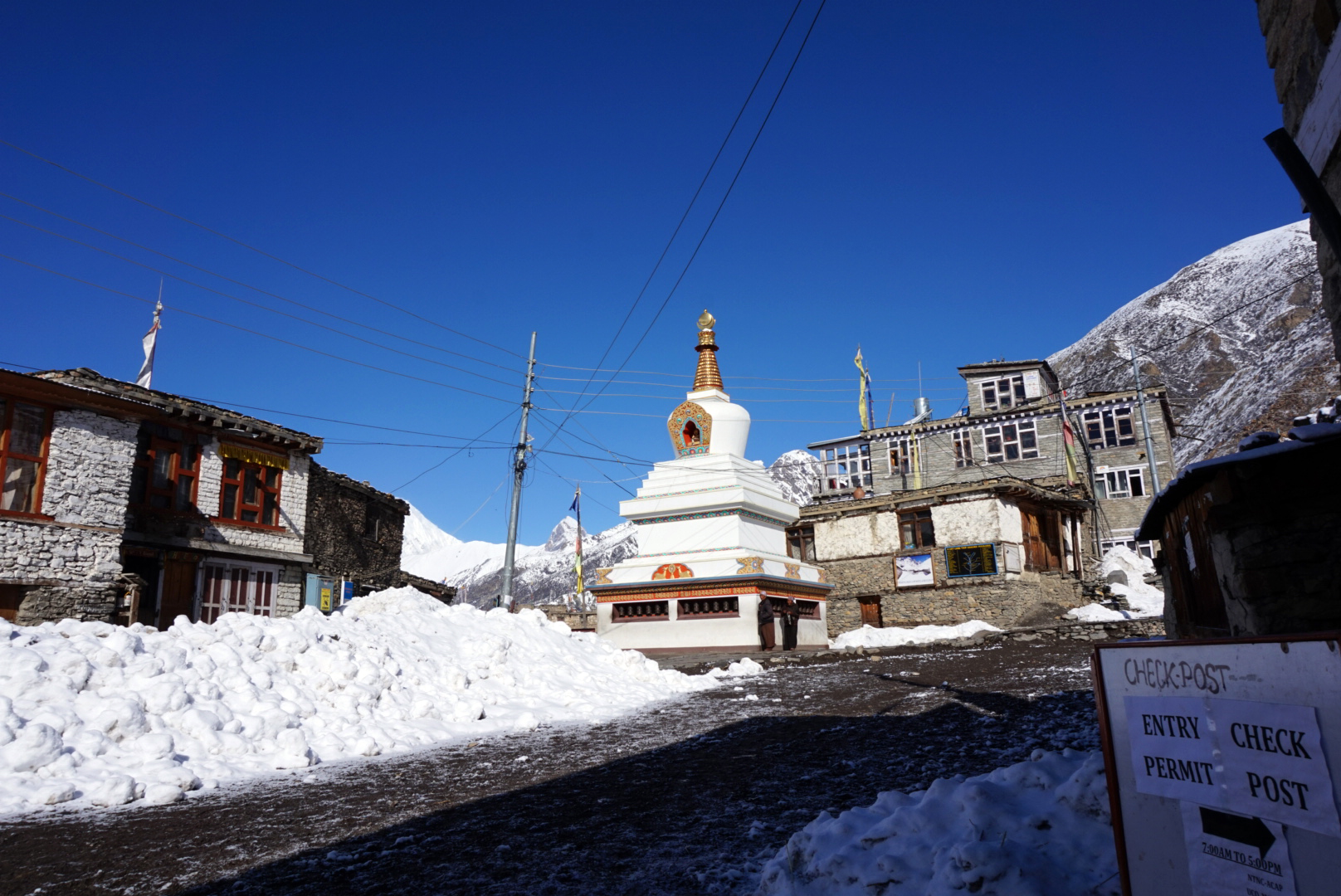
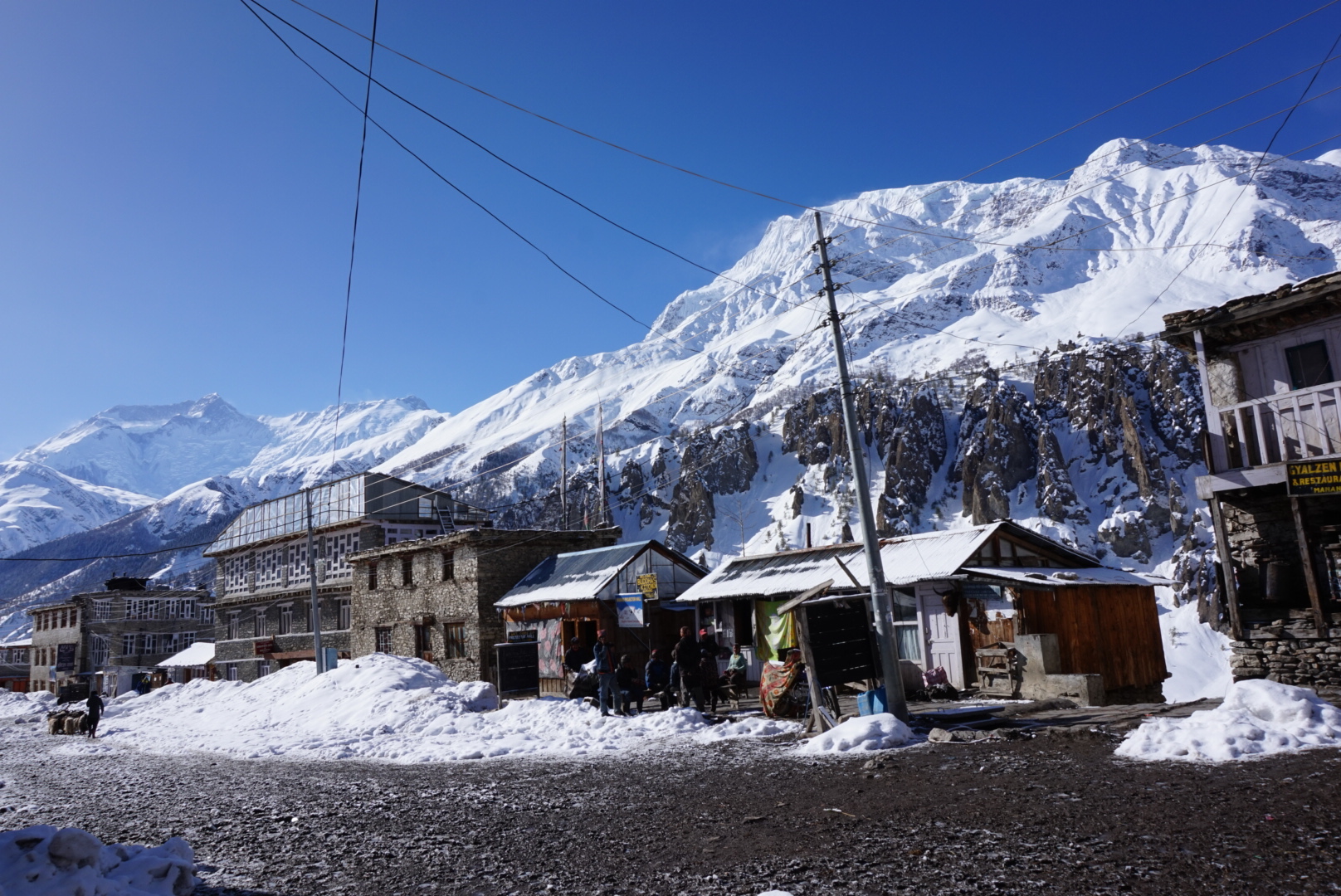
Lower Pisang 3200m to Manang 3540m - 104km
Today we decided to give it one last go. We tried to get some reliable information but up in the mountains it is all rumours, although the general trend was that the weather was to be good for a few days. Sadly we couldn't persuade Steve, Du and Rasmus to carry on, as they had made up their minds to go back down. The fellowship was breaking up.
We made it back to Humde in really good time, in 2 hours 10 mins, when it had taken over 3 hours yesterday, as we were not having to clear the path. After a short breather and a restock of snickers we were off again.
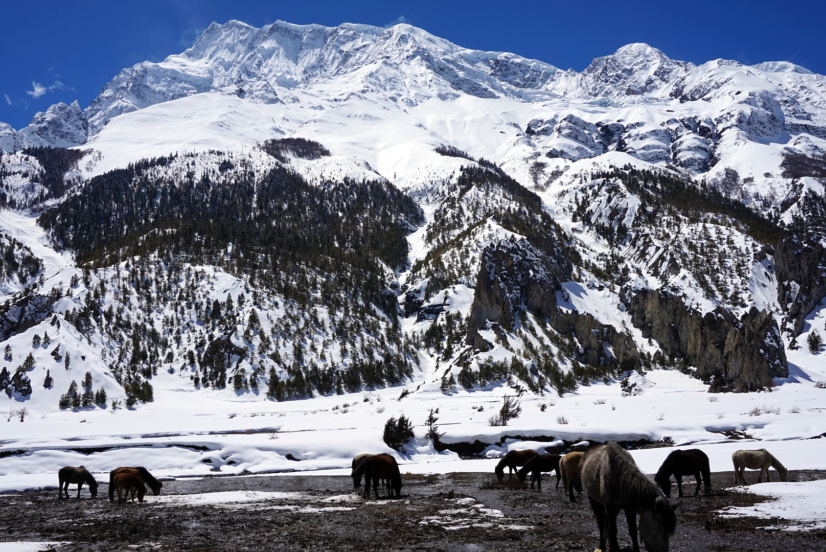
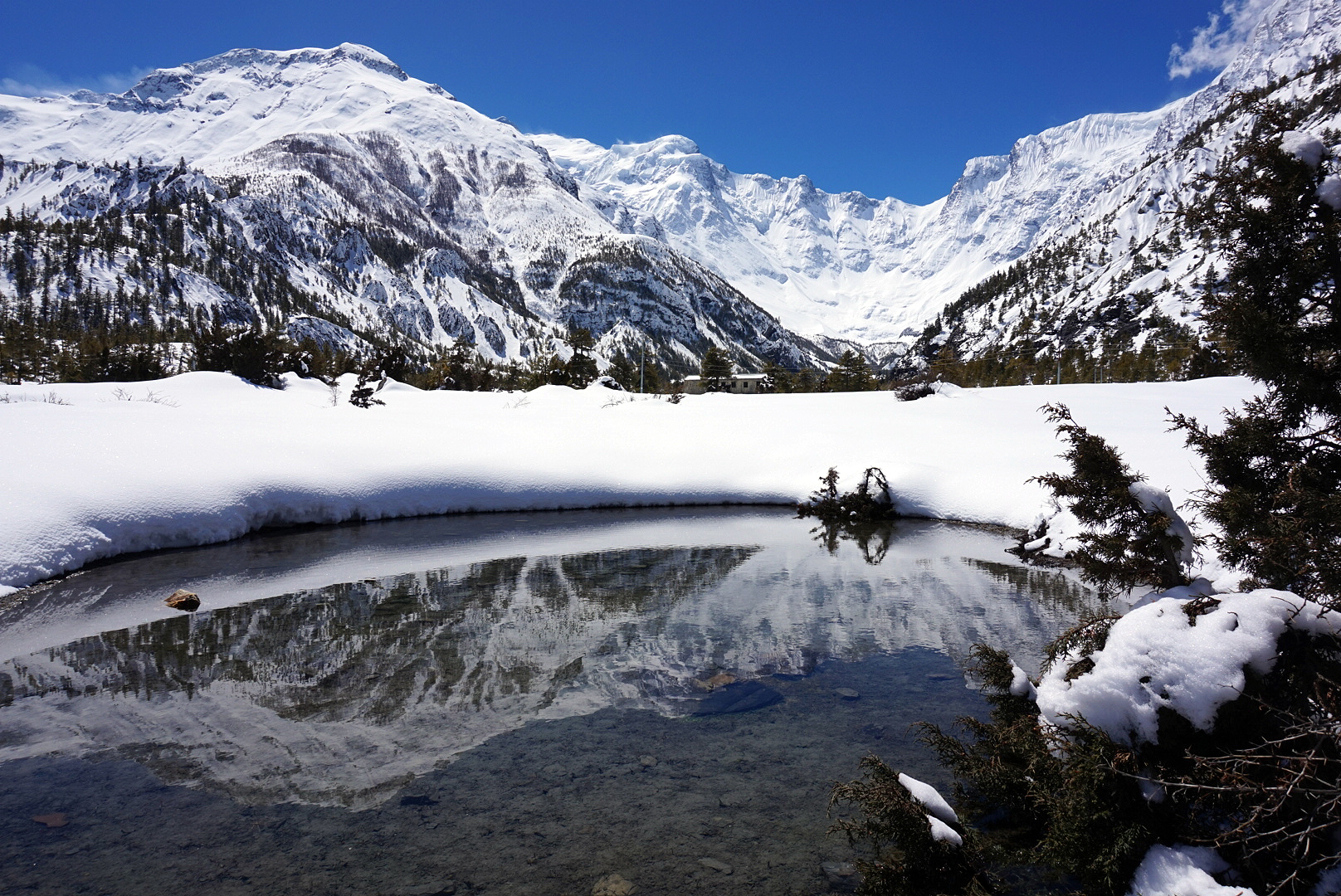
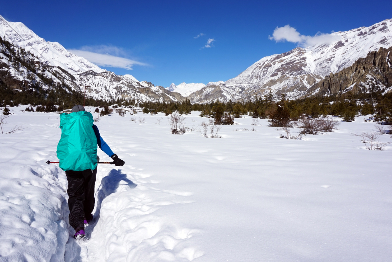
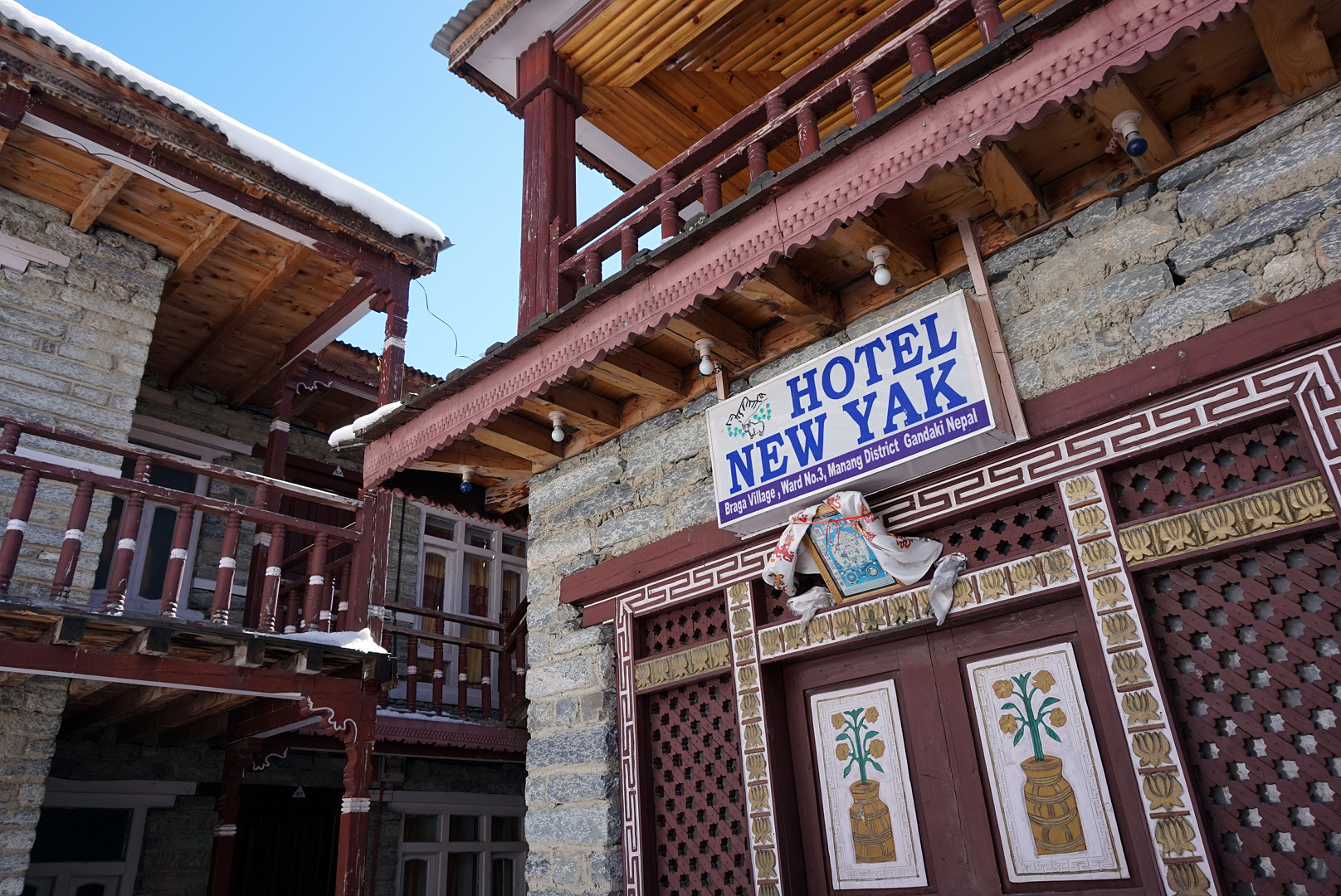
The scenery we past on route to Manang was almost cinematic, snow evaporated off the magnificent peaks above creating swirling white clouds over an unspoilt blue sky, whilst crystal clear lakes below reflected the raw yet beautiful landscape, so you could enjoy it all over again. We reached Manang by 1.30, after stopping along the way for an egg break, a Mars break, and a warm chocolate roll from a bakery in Baraca.
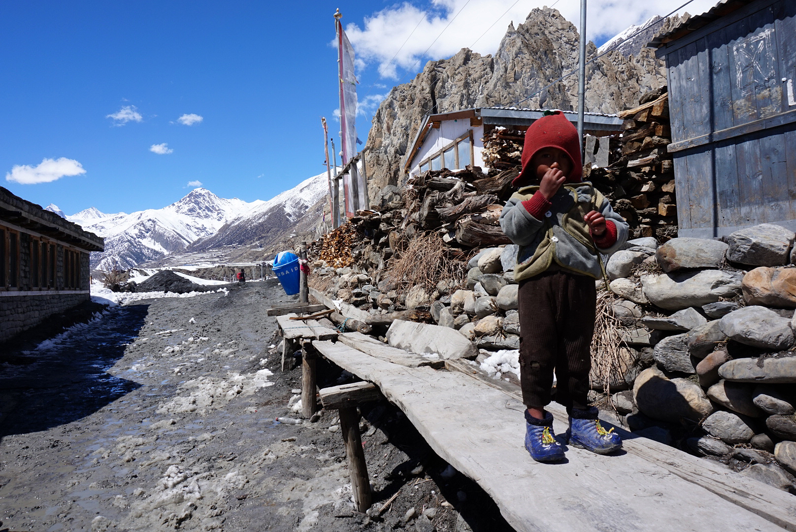
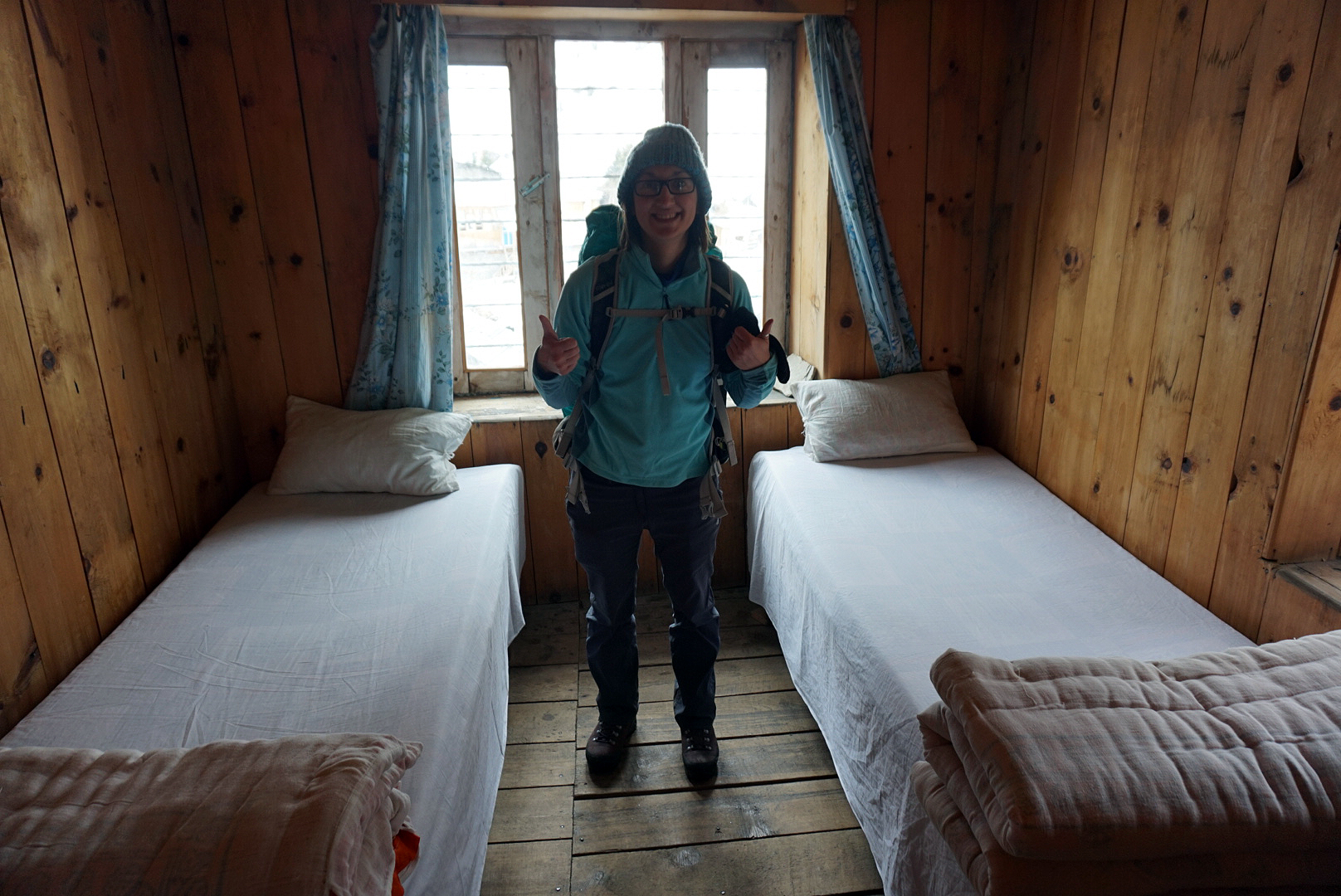
We couldn't believe we had made it, Manang had seemed so unreachable just a day or two ago, yet here we were. The views we saw getting here were epic, it was definelty the best day of the trek so far. And the room! The room was a delight, with our own en suite squat toilet!
We went to doctor Remi's lecture on altitude sickness and got scared shitless of all the things that could happen to us in the next few days. However, it was very informative, and we felt like we were much more prepared for the adventure that lay ahead. Every time we saw a helicopter in the next few days, we knew that that was another very sick person being airlifted off the mountain, and we had seen quite a few over the last couple of days.
In the evening we had a night out to the Manang Projector House - a tumble down shed with a projector, with a few rows of yak skin covered benches. We saw 7 years in Tibet, and enjoyed our free tea and popcorn included in the 250rupee entrance price, bargain!
DAY TEN
Manang rest day
We had a much needed lie in until 9, although we were both definitely noticing the affects the altitude was having on our nights sleep. One of the side affects of Diamox (a tablet to prevent altitude sickness) is that it makes you pee more, combine this with drinking so much water during the day to stay hydrated, and it's amazing we actually got any sleep at all. The Diamox also makes you fingers, toes and face tingle, which was an interesting sensation to have when you're trying to walk.
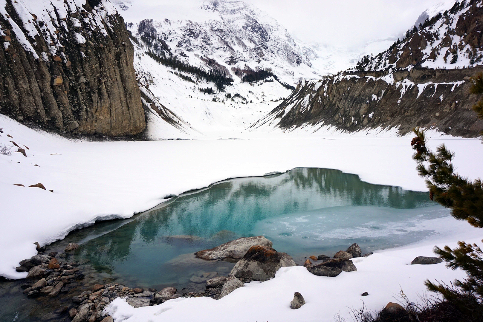
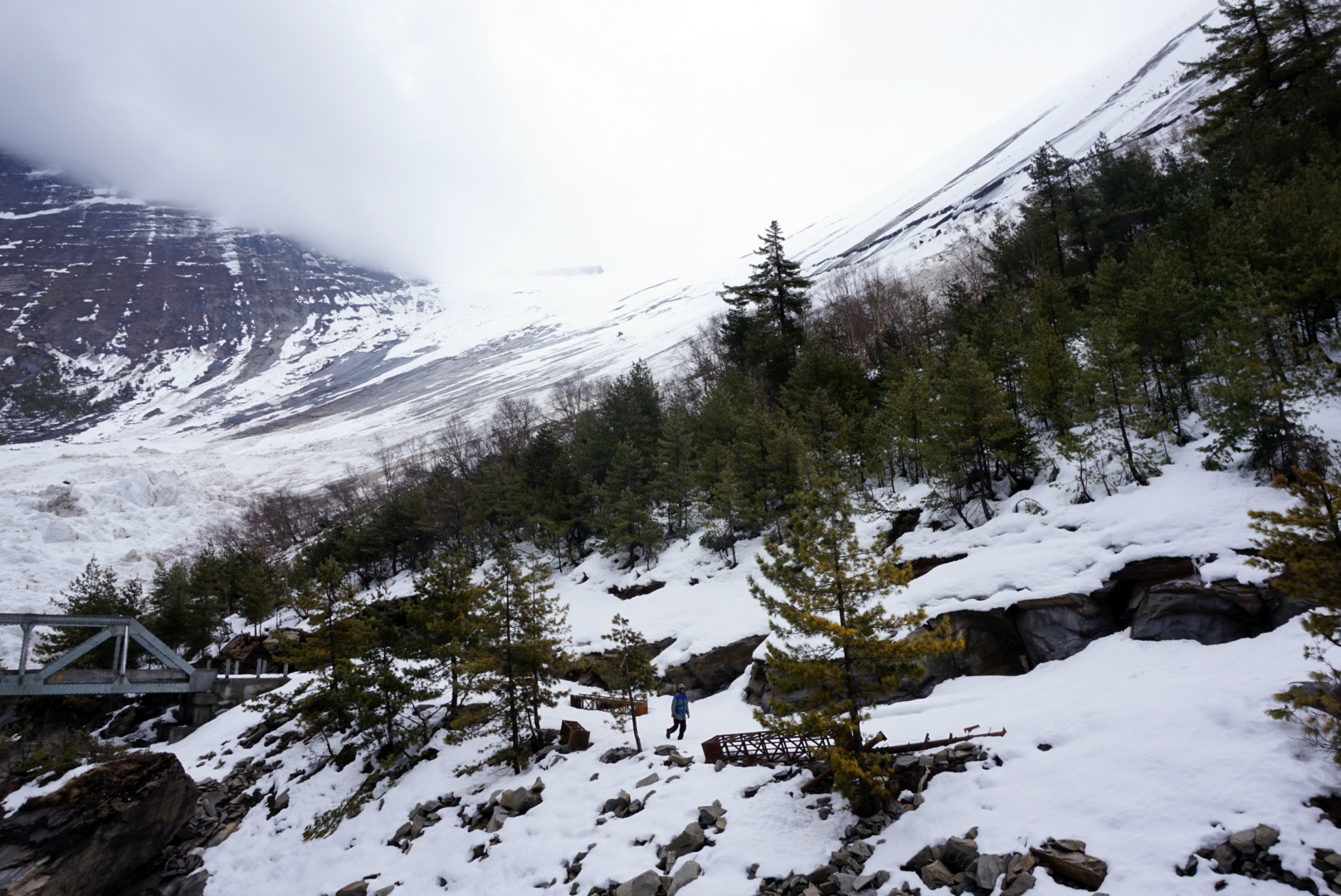
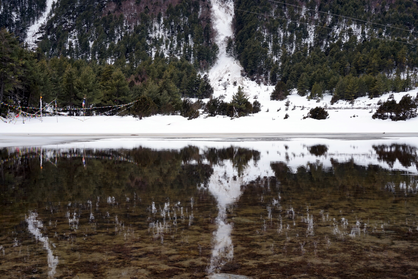
We took a short walk around Gangapurna Lake which is nestled at the bottom of the mountainside on the far bank of the river. Heavy clouds were building over the Gangapurna Glacier which hung above the lake and soon the snow was falling. For how long, we didn't know we just had to sit it out. W
e went back to the projector house again, this time to see Slumdog Millionaire, to get us in the mood for India and to sit out the storm. After the film it was still coming down so we turned in for an early night in preparation for tomorrow, hoping the storm would pass quick and scatter lightly.
DAY ELEVEN
Manang 3540m to Yak Kharka 4050m - 113km
Today was Bhrett's birthday. What a crazy place to turn a year older. Unfortunately Louise had been really poorly again in the night and the thought of continuing on seemed out of the question. So Eli, Louise and Ellen decided to stay in Manang for a day to see if things improved, but most likely would head back down. It was a shame we had to part ways like this after spending so long with them, Eli being a true gentleman insisted on helping them back down but insisted we three continue. It wasn't the best way to start Bhrett's birthday, but the excitement of what lay ahead was enough to lighten the mood as we headed for the check post en route out of the village.
The skies were clear and thankfully it had not snowed all night. This was brilliant news and meant we could start our journey to the next village and more importantly the pass (if the weather held). Only a few days ago we had abandoned all hope of the pass and just making our end goal Manang seemed impossible.
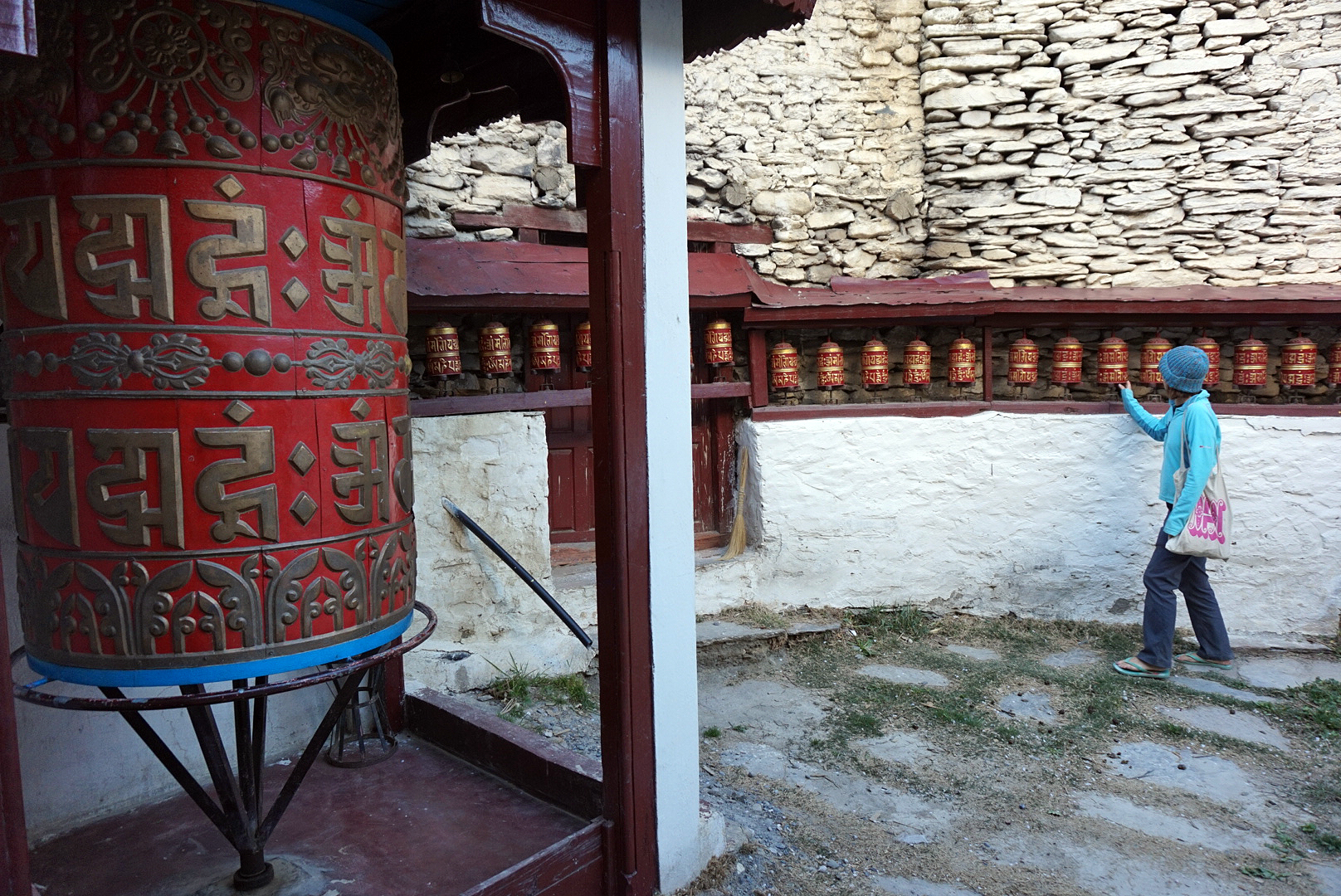
The guard in the check post said it had taken them 16 hours, but a group of people had made the pass the day before and it was now open. Excitedly we headed out into the snow making sure to spin every Tibetan prayer wheel we past on the way to build up our luck and karma.
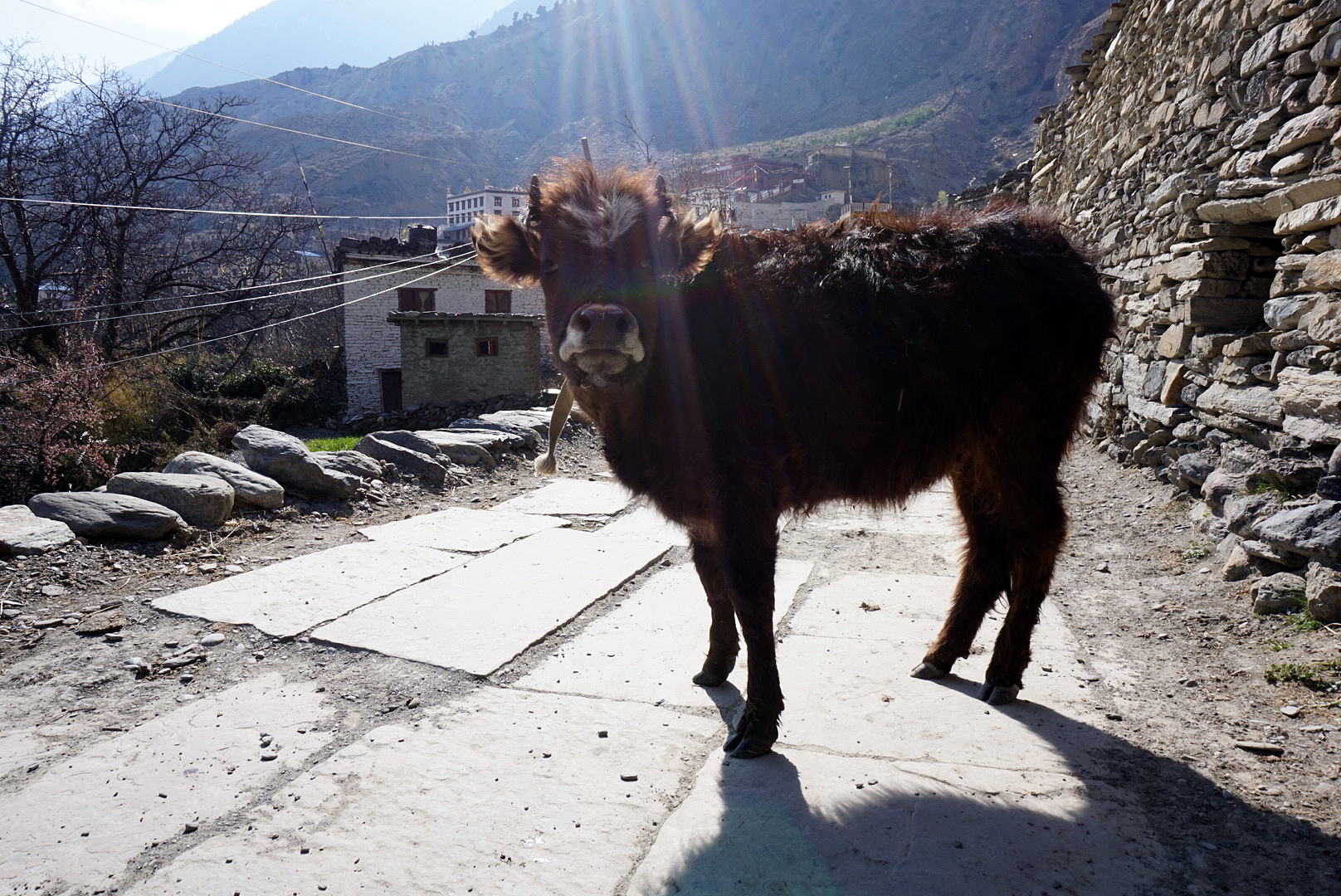
With sticks and crampons biting into the snow coated lanes of Manang we got moving. At times the snow that had built up was over one storey high and still yak and goat heards were very rudely charging through the narrow paths without a care in the world. Soon the village was a small cluster of dots below encased in white. Whilst taking a few souvenir photos we met a couple of Brits called Hat and Steve, after taking pictures for each other we headed off. No doubt we would see them again.
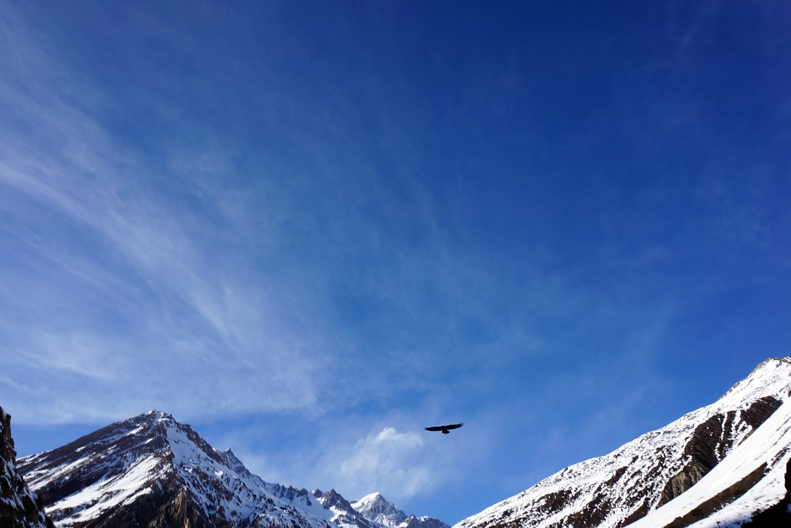
After about a 400m climb Helen successfully fainted, she had tried a couple of times earlier in the trek, but this time she really nailed it. We spent a while lying in the snow drinking water and eating Snickers. Everyone that past from trekers and porters to locals going about their day stopped to make sure we were okay. Half an hour or so later we came to the conclusion it was a bit of everything, mild altitude sickness, exhaustion, dehydration and too much time in direct sun. (It's super strong up here and there is less atmosphere to filter its intensity) We were closer to the next village than the last so we let Helen take the lead setting the pace and plodded on till lunch. The view from the little hut we ate in was theatrical. We sat inside by a massive window overlooking endless snow covered peaks and valleys shining in the bright sunshine which cast dramatic shadows on the lower landscape. Giant birds of prey were also circling down in the valley gliding smoothly on the light mountain breeze. To say the view was very picturesque would be an understatement. We hung out on the roof for a bit before we left, just to enjoy the view from a different setting.
We made it to Yak Kharka round 4ish and
checked into the first tea house. It happened to be the same place the Brits we met earlier were staying. We settled in to a night around the fire playing cards with a porter we keep bumping into. We really felt like we were deep in the Himalayas now. Mountains encircled every view. The thought of actually making the pass was growing more real, which was as petrifying as it was exciting.
DAY TWELVE
Yak Kharka 4050m to Thorang Phedi 4450m - 119km
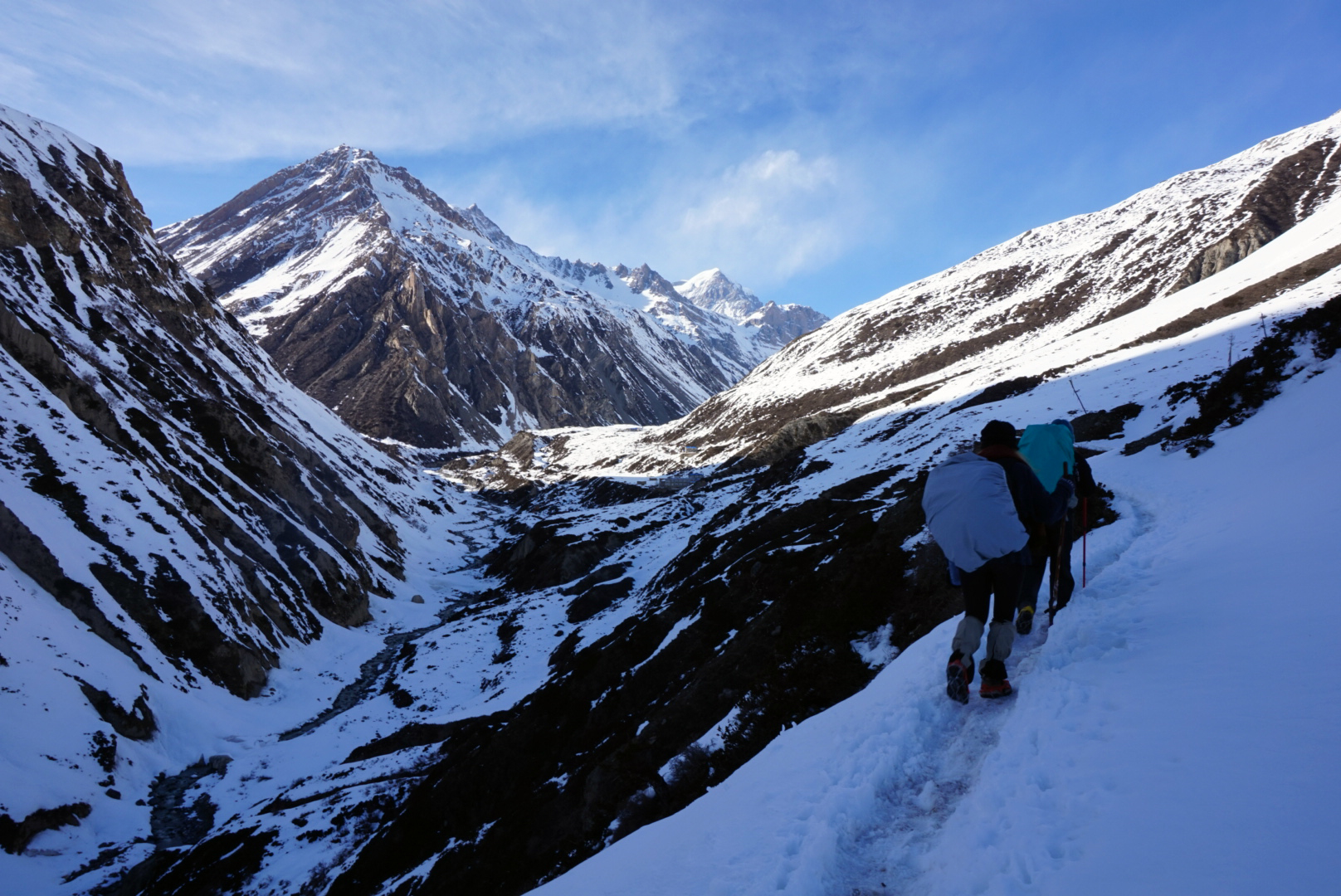
We set off round eight and instantly were all alone in the mountains. No people, no buildings, just us three plodding on through a Himalayan postcard.
The path at times was very sketchy! A foot wide path in deep icy snow followed the contours of the ridiculously steep mountain side. One wrong step and you would be on you way down to the boulder filled river below.
Just when we thought it couldn't get any more sketchy we had our first lesson in yak etiquette. A local yak using the path happened to be treking the other way (Probably was worried about making the pass too and was on his way back) After a polite standoff for a couple of minutes the yak gracefully steped aside to let us by, straight away sinking deep into the untrodden surrounding snow. We thanked him profusely and were on our way.
After our incident with the yak and numerous precarious pathways we saw a sign that every weary traveller after six hours of hiking wants to see. "Landslide area, tread carefully". The path was again very narrow with a sheer drop down to the river on the right and loose rock towering above on the left. Often small rocks would fly by (we just prayed no big fuckers fell). One slightly misplaced foot and the path would give way sending rock and shale down below. I don't think the three of us have trodden that carefully in our lives or ever will again. After just short of an hour the path levelled off and two tea houses were visible. We had made it to Thorong Phedi, thank God (or I guess Buddha out here.)
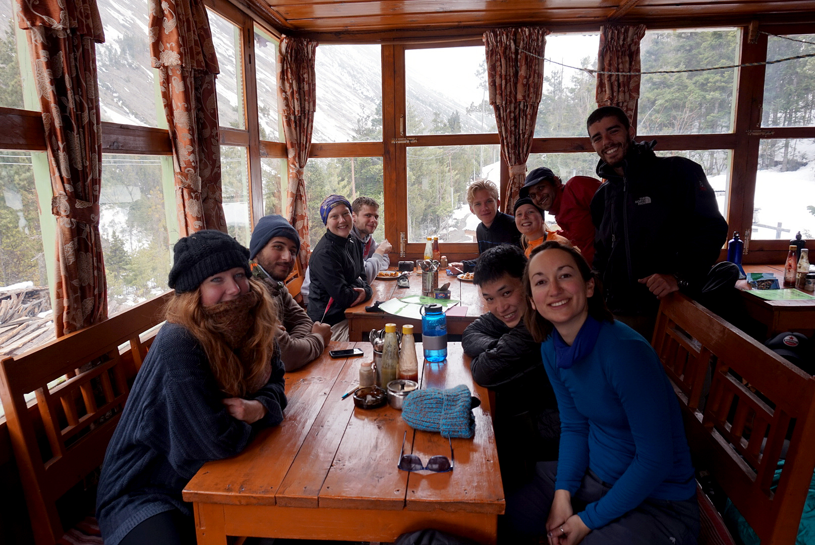
We crowded around the fire in the evening where they were burning dried yak shit. (Supprisingly hot and not stinky) there were quite a few familiar faces gathered we had seen from time to time along the way. Everyone was exchanging stories and making friends. It is much safer to cross the pass knowing a few of the people around you, as you can all look out for each other.
So far we three seemed pretty fine with the altitude, other than Helen's little blip a few days back. The anticipation of what lay in store for us tomorrow was immense, along with the extreme tiredness that you can only feel after hiking for 12 days straight. Tomorrow we would be taking on the pass.
DAY THIRTEEN
Thorong Phedi 4450m to Thorong La Pass 5416m to Muk
tinath 3760m - 135km
We awoke at three long before the dawn. The black mountains were barely visible against the twinkling night sky. The amount of stars was astonishing and were the only signpost to mark where the mountains ended and the sky begun. After unsuccessfully trying to photograph them, frozen fingers and a frosty lens forced us to give up and take refuge by the yak shit stove in the tea house common room. Unfortunately it was not alight, so hugging an urn of tea and a bowl of porridge had to suffice.
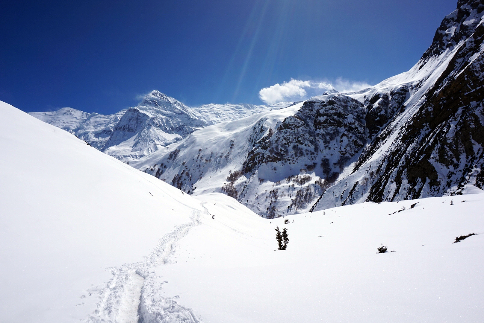
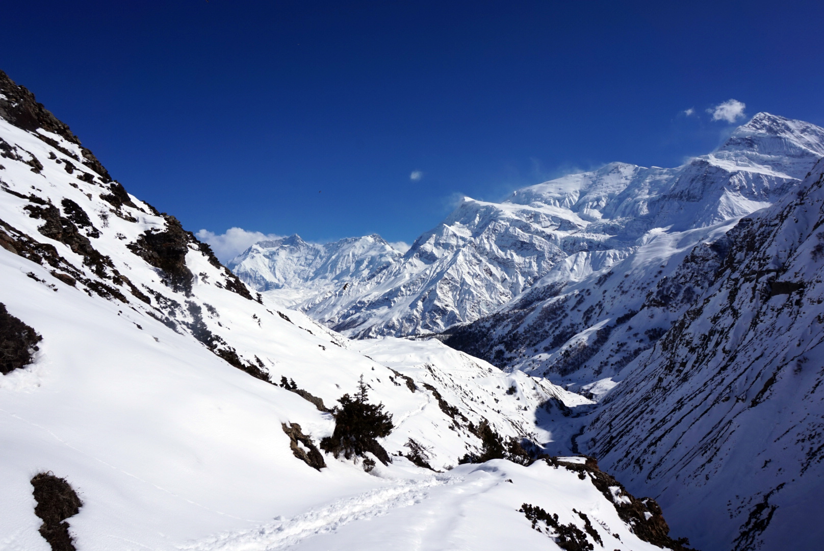
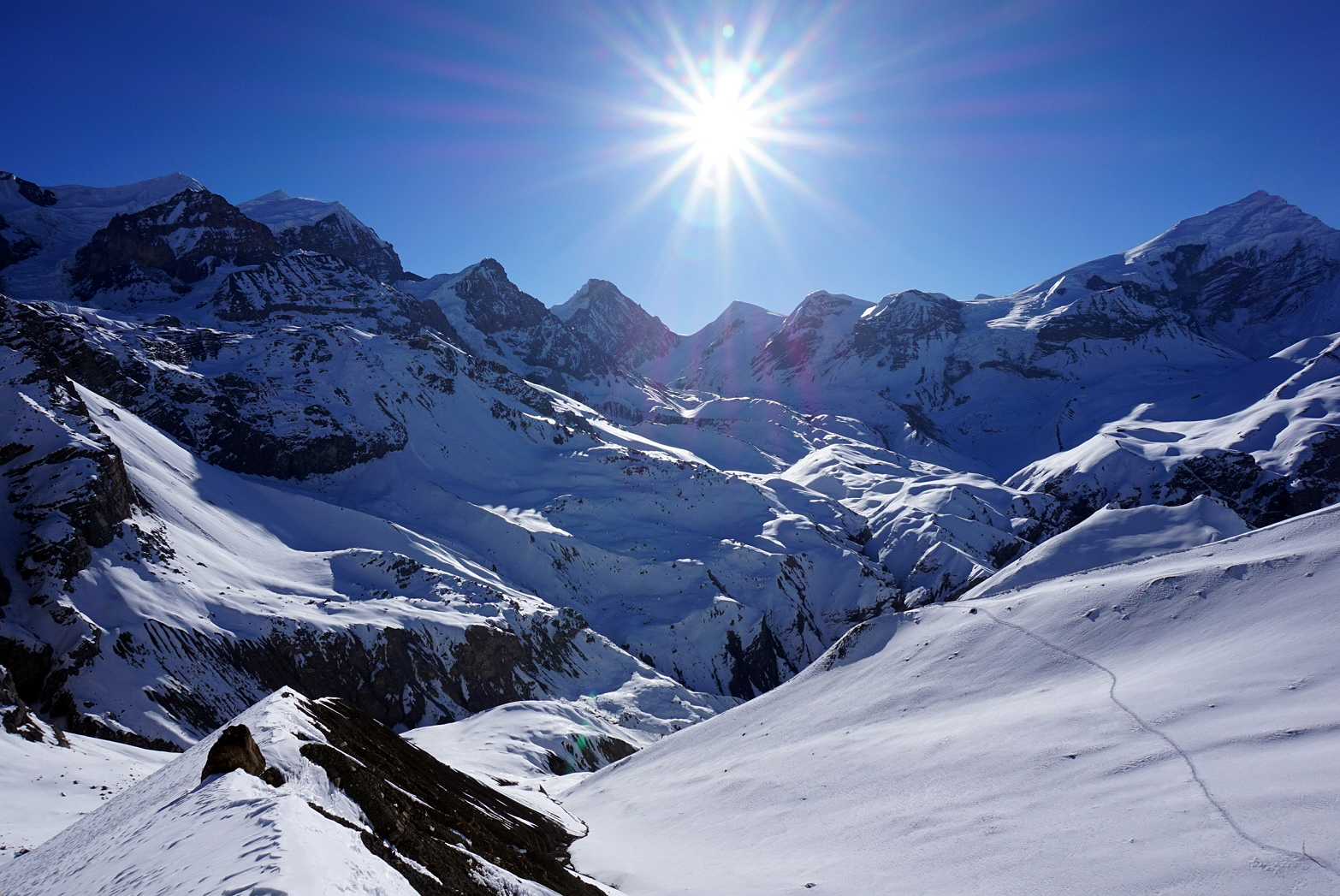
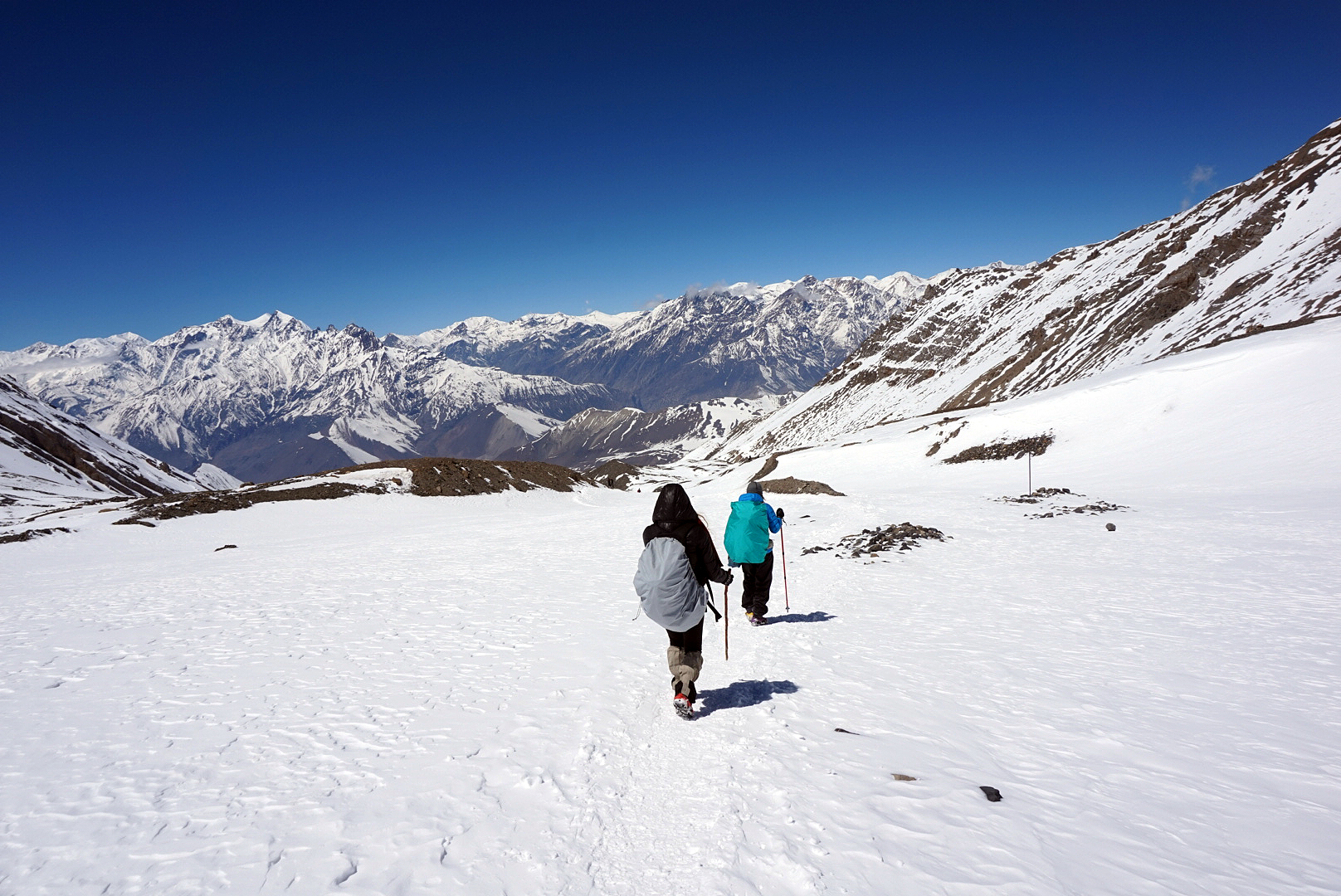
It was in the -20 degrees something region outside and we heard a guide in the corner briefing his party on the effects of frost bite. Not what you want to hear at 4am. We set off into the night wearing pretty much everything we had brought, complete with shimmering head tourches to illuminate the way and crampons to hold us onto the steep icy path. We had to constantly wriggle our hands and toes to make sure they were still there as we slowly ascended up into the dark unknown land above. Soon the lights of the tea house had vanished far below, however every now and then you caught a glimpse of the beams of other people's head torches bobbing somtimes above, sometimes below turning the darkness into a dot to dot puzzle. We had no idea how high up we were or how far we had to go. Every now and then large boulders would come into view, forcing the path to twist and turn. Our destination at the summit of this first climb was high camp, the last tea house before the pass. As we climbed on, dawn started to paint the jagged white peaks that surrounded us. Light blues, greens and purples turned to warm oranges, pinks and reds. It really was a breathtaking sight, especially with the moon still high above the twinkling lights of fellow trekkers below. As much as we have tried to capture this moment in words and with pictures, it really is something beyond documentation, that sight will be ingrained in our minds forever.
After roughly an hour, the welcoming glow from high camp came into view. We piled in to warm up and found quite a few familiar faces we were talking to the night before huddling inside. An American girl we kept leapfrogging with over the past few days wasn't feeling too good and was getting a helicopter out. This sounded very appealing. Ten minutes later we were trudging back out into the ice and snow, helicopter-less, and with a slow five hour plod to reach the pass. There were roughly thirty people attempting to cross the pass that morning, however due to everyone having their own pace you never tended to get stuck with big groups and at times it felt like it was just us three musketeers.
After a couple of hours we were getting to the point where it would be too far to turn back. Helen had a bit of a freak out, but after lots of encouragement from me and Bhrett she held it together and marched on. Shortly after, we came to a very precarious landslide area. Small rocks were constantly tumbling and even though it was shorter than yesterday's landslide area, this was much sleeper, the path had completely gone and the larger unstable rocks above could give way at anytime. There was no way across without using your hands and keeping you centre of gravity low. I worriedly glanced at Helen thinking this might be the limit of her nerve, but without a word she calmly took the lead, grabbed the rock and elegantly traversed the fucker. It was similar to bouldering in London except with numb hands and toes and a ten kilo backpack hitching a lift.
We were now roughly two and half hours from the pass if we had kept a steady pace.
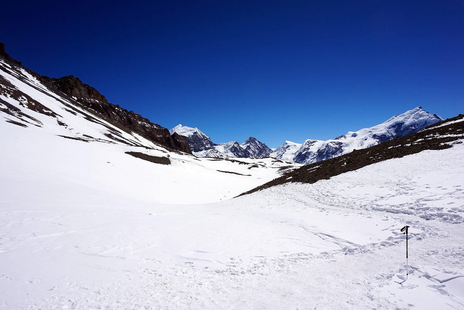
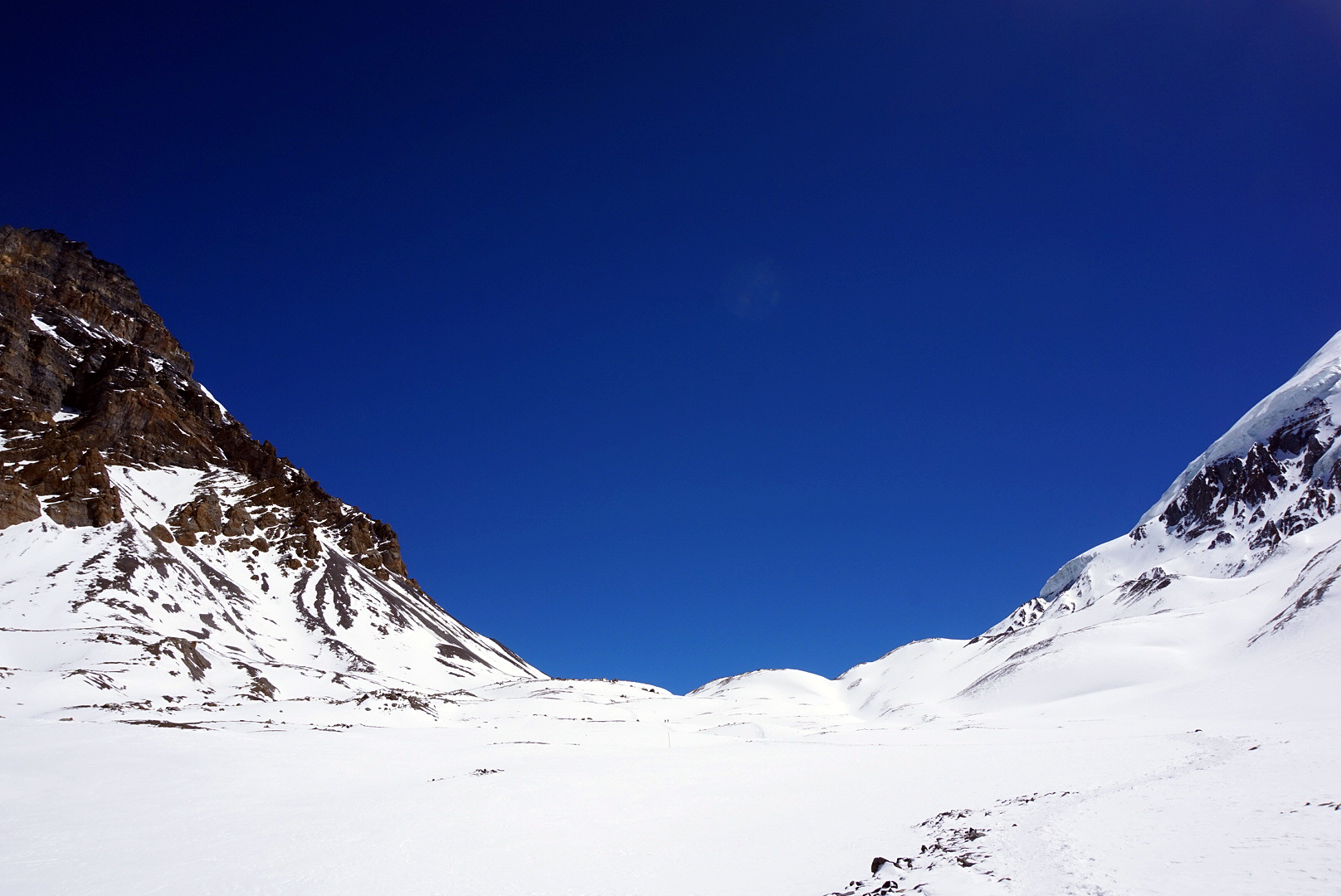
The endless snow, gigantic peaks and shimmering glaciers were a stark reminder of how remote we were. Nothing we had ever experianced has ever even come close. Every step felt like ten, the air was thin, the relentless sunlight blinding. For two countryside folk from an island where the highest peak ain't much over 1000m, we were well and truly out of our depths, plodding at a snails pace ever closer towards the worlds highest mountain pass. It was hard to get your head around, so we decided not to and just ate Mars bars instead. Turning back, the narrow meandering path we had followed looked like nothing more than a silver snail trail, small and fragile against the colossal might of the Annapurnas.
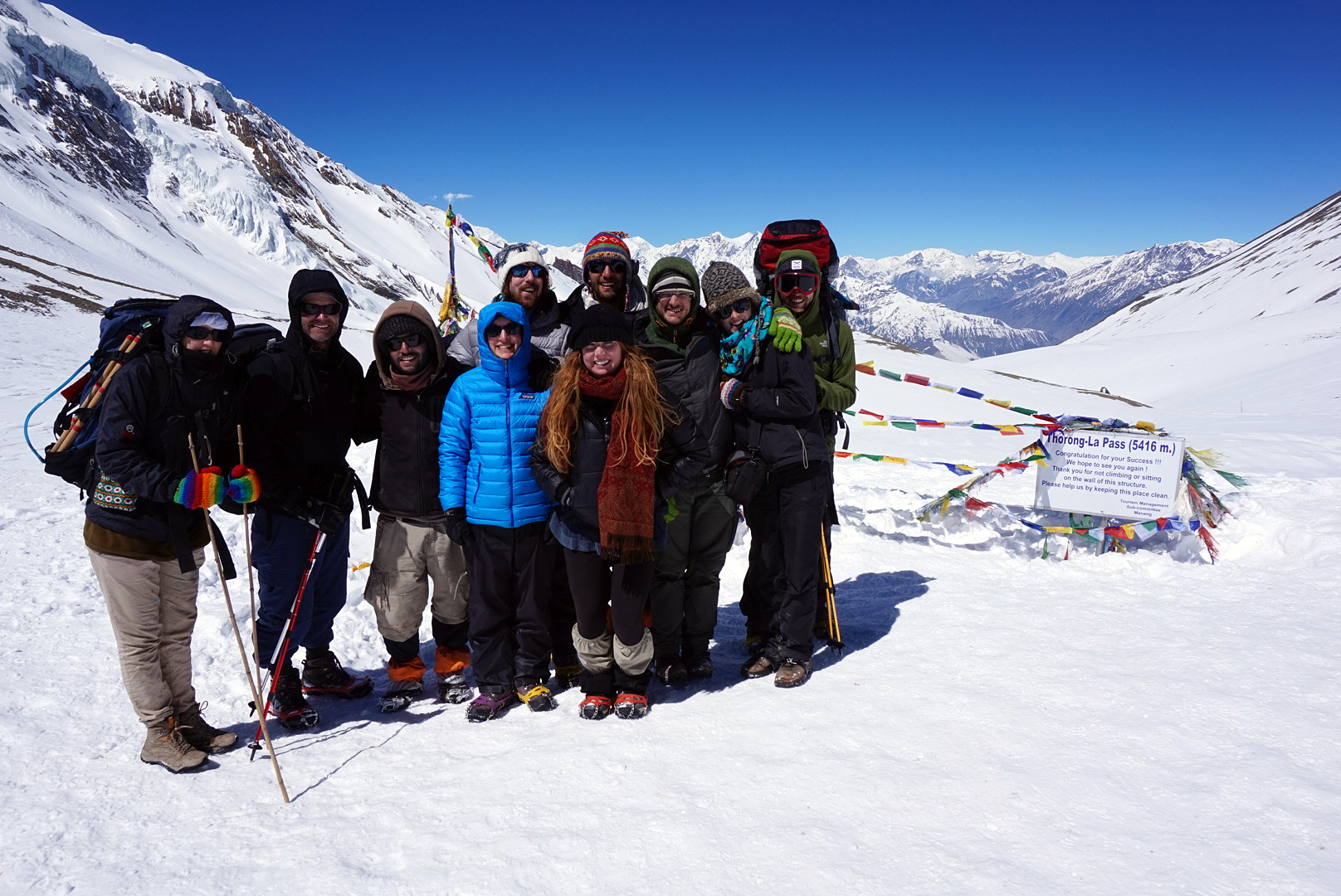
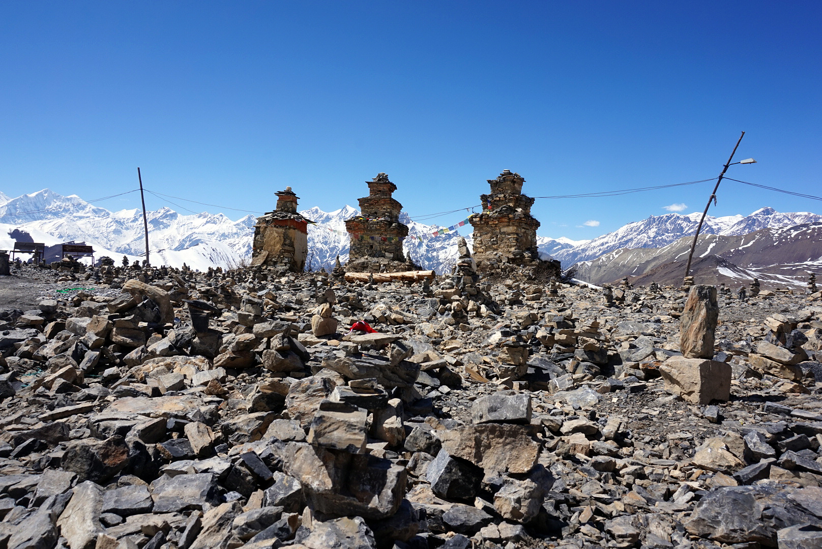
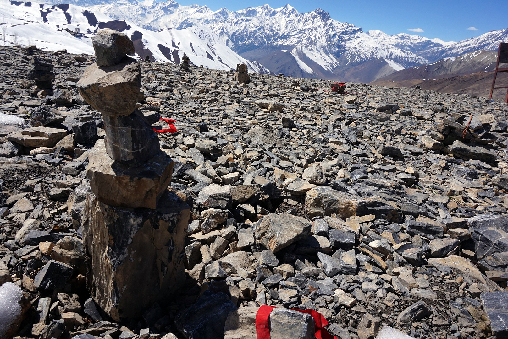
The last hour was really tough. Our pace grew slower and moral was beginning to drop. We should be there by now! Every ridge revealed a bend, every bend revealed a ridge. Just when we were reaching breaking point we noticed a cluster of figures gathered on top of the next ridge. As we drew closer, the colourful and most welcoming sight of the prayer flags came fluttering into view, it was the pass!
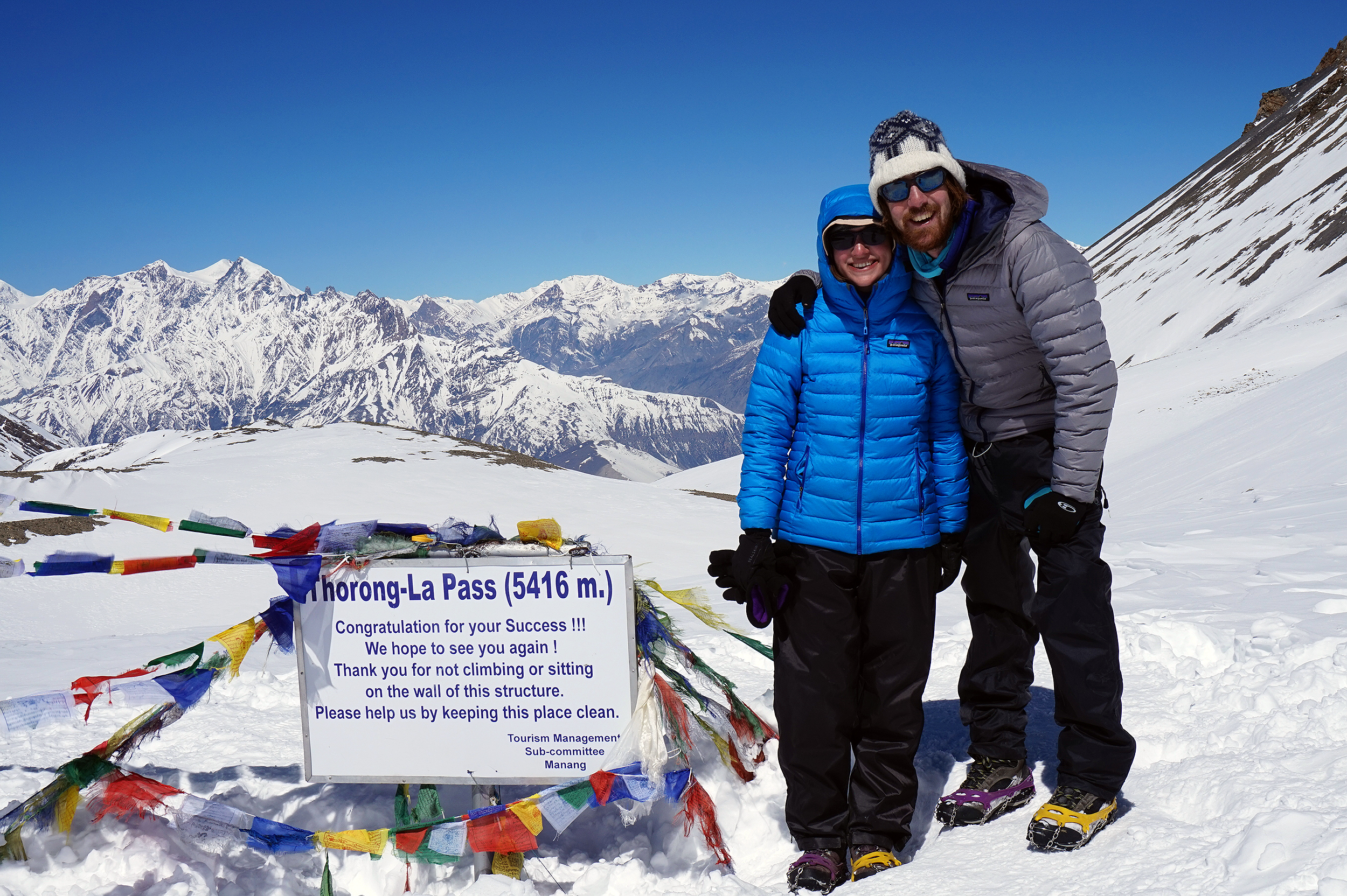
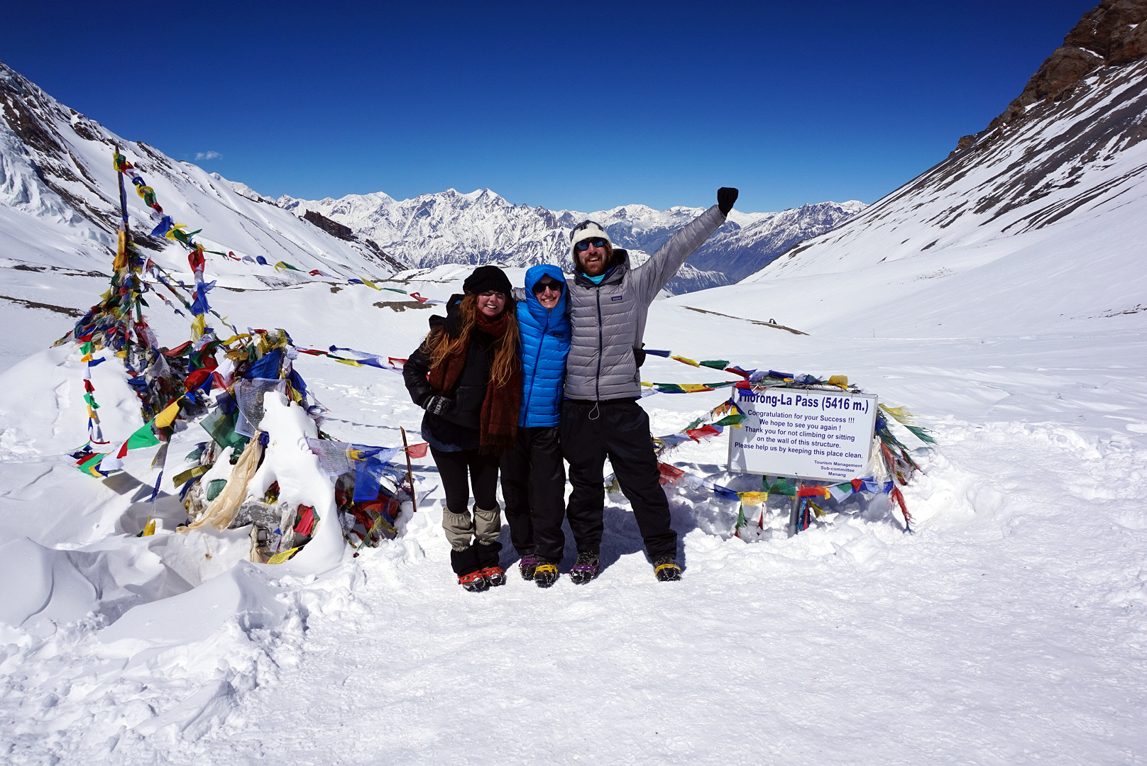
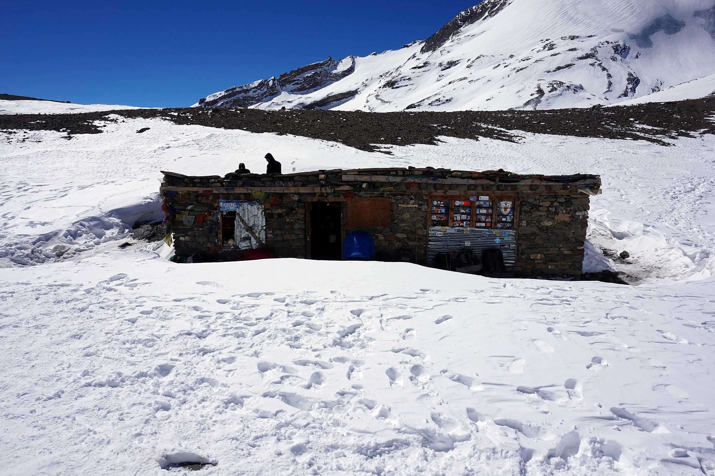
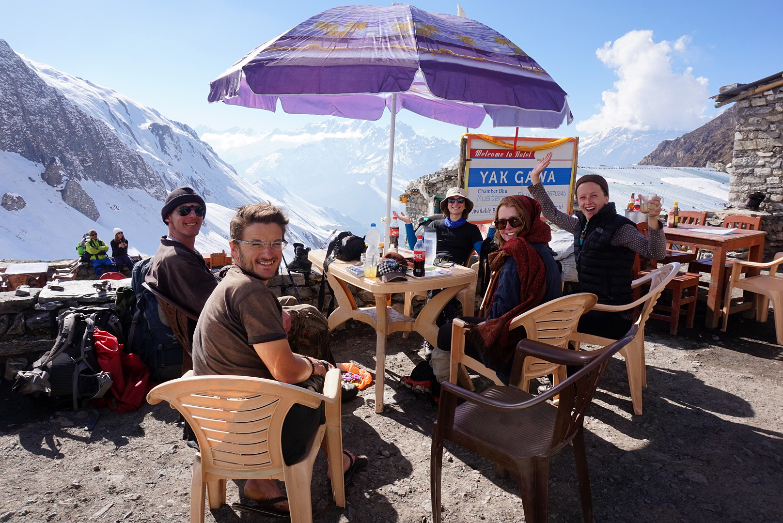
We had made it, standing 5416m on the roof of the world! It was very emotional, everyone was hugging and congratulating one another. Me and H were at first speechless, the incredible magnitude of what we had accomplished and where we were was hard to believe. We fucking did it! Thorong peak 6144m and Yakawkang 6482 towered above us to our left and right, behind was a long curveatious valley encased in snow and ice, and in front, a view to end all views as the majestic snow covered mountains that framed the pass dropped down a steep valley to the blue and purple peaks on the horizon. We took some souvenir photos by the Thorong La sign to prove to ourselves more than anyone that we had made it. Most astonishing of all was that up in this frozen world that felt a million miles from anywhere, there was a tiny little tea hut, part buried in snow. We popped our heads in to find a young lad serving hot tea on a small gas stove. We squished in and warmed up over a cup, congratulating fellow trekkers and exchanging stories.
After half an hour or so at the pass it was time to head off. Apparently it's not a good idea to hang around past eleven as the hot sun and building winds greatly increase the risk of avelanches. It was all well and good we had made the pass but the sobering thought of the six hour icy descent was not appealing. At first we slowly picked our way down the steep slopes, but we kept slipping over, even with the crampons. Every now and then our poles or even an entire leg would disappear beneath the snow if you misjudged your footing. We caught up with the Brits who had taken to just sliding down the steeper descents on their arses. This seemed like a splendid idea and soon we were all covered in snow with black and blue arses. Still our pace had doubled and the hot scorching sun seemed less intense.
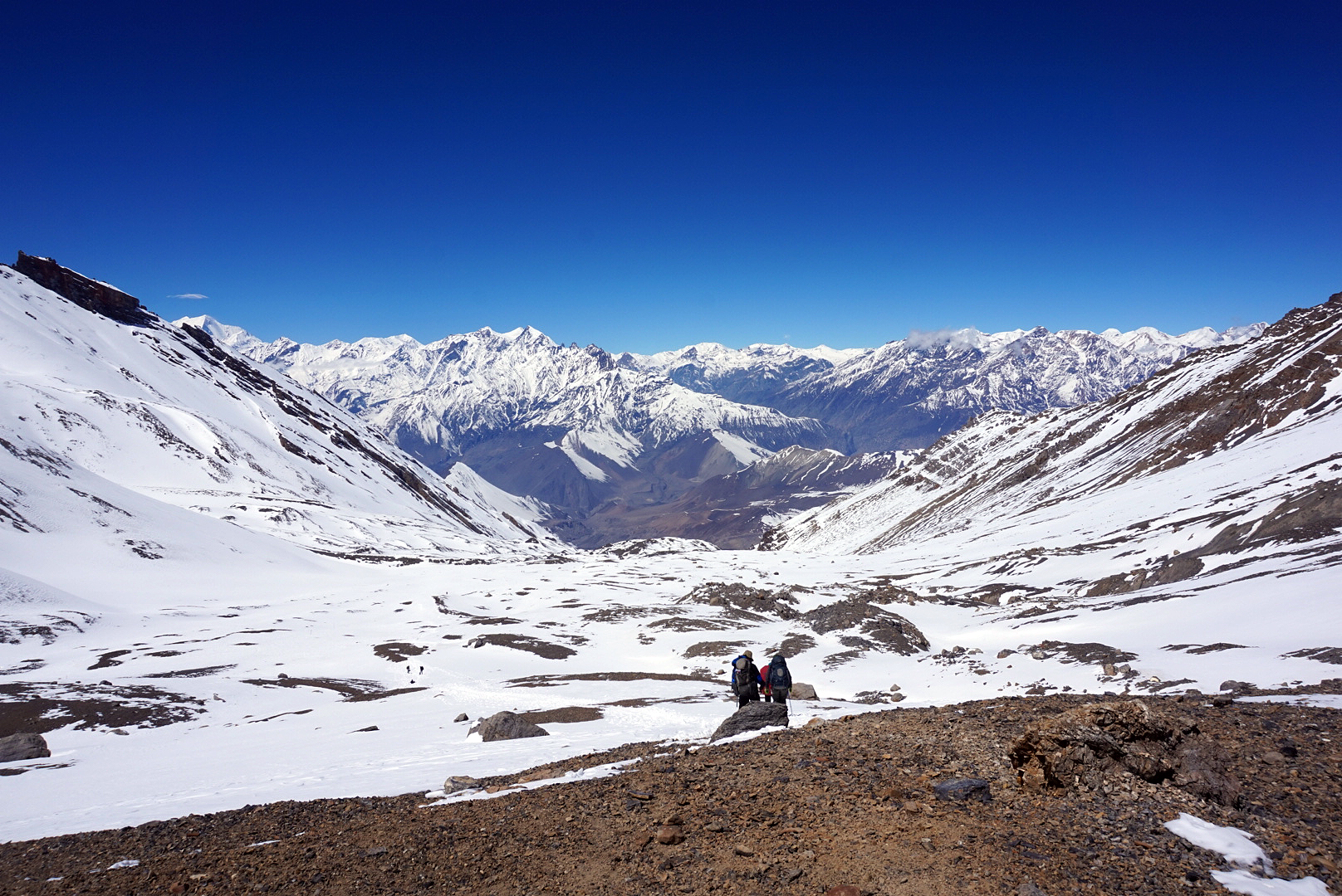
After what seemed like forever a tiny cluster of shiny tin roofs revealed themselves at the foot of the pass. It was a small village called Charabu. We practically fell into our chairs, kicked off our boots and crashed out in the shade. The Brits and a couple of other folk had stopped too for a bite to eat and a breather as well.
After roughly an hours recovery we begrudgingly re-booted and started off on the final leg of the day to the village of Muktinath. The Brits walked with us as did a quiet German chap called Harold. We successfully managed to get lost walking on the wrong side of a deep gorge carved by the melting snows from the pass. After about half an hour of head scratching, me and H worked out the route and lead our tired little party across the gorge and round the mountain bend revealing the colourful buildings of Muktinath below.
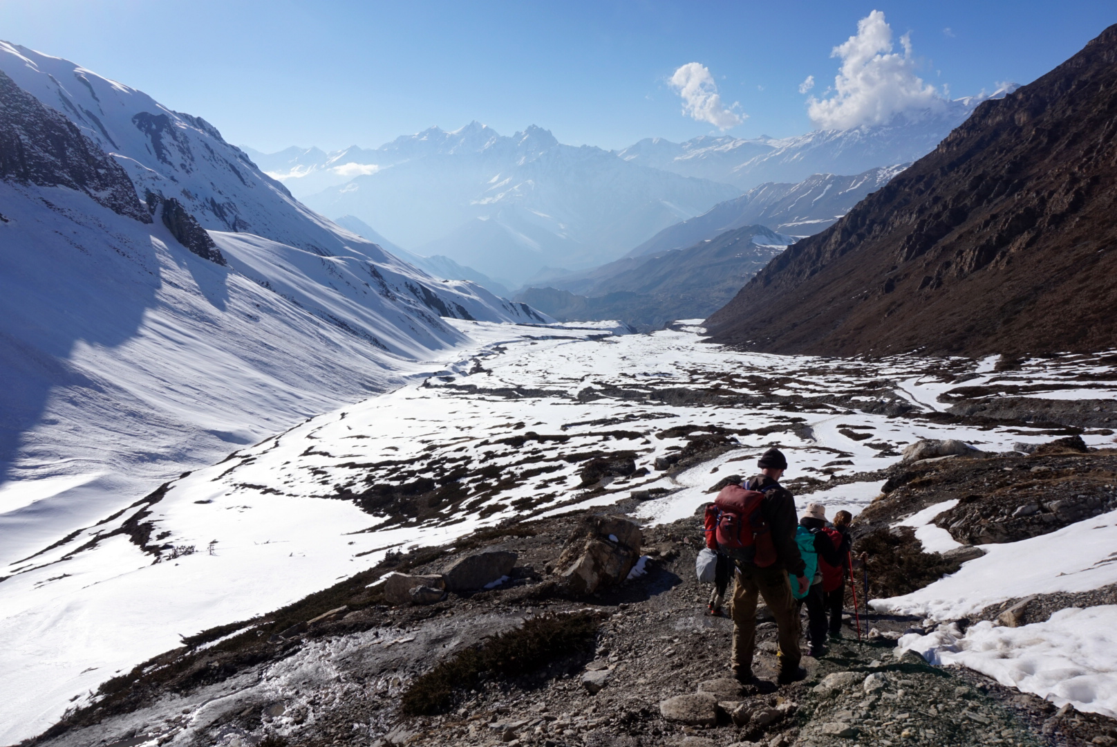
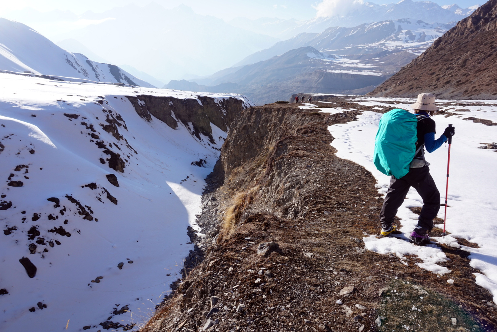
After a fourteen hour day this sight was magical, and to put the cherry on the cake the sun had started to set behined the distant peaks bathing the village in a warm glow as the sky turned pink. It was a great reward and the perfect way to end a truly once in a lifetime experience. Unfortunately our camera was as worn out as we were and when trying to capture what would have been the most beautiful image of the trip, it informed me the battery was exhausted and politely turned itself off. We quickly headed for the first guest house and did the same.
DAY FOURTEEN
Muktinath rest day
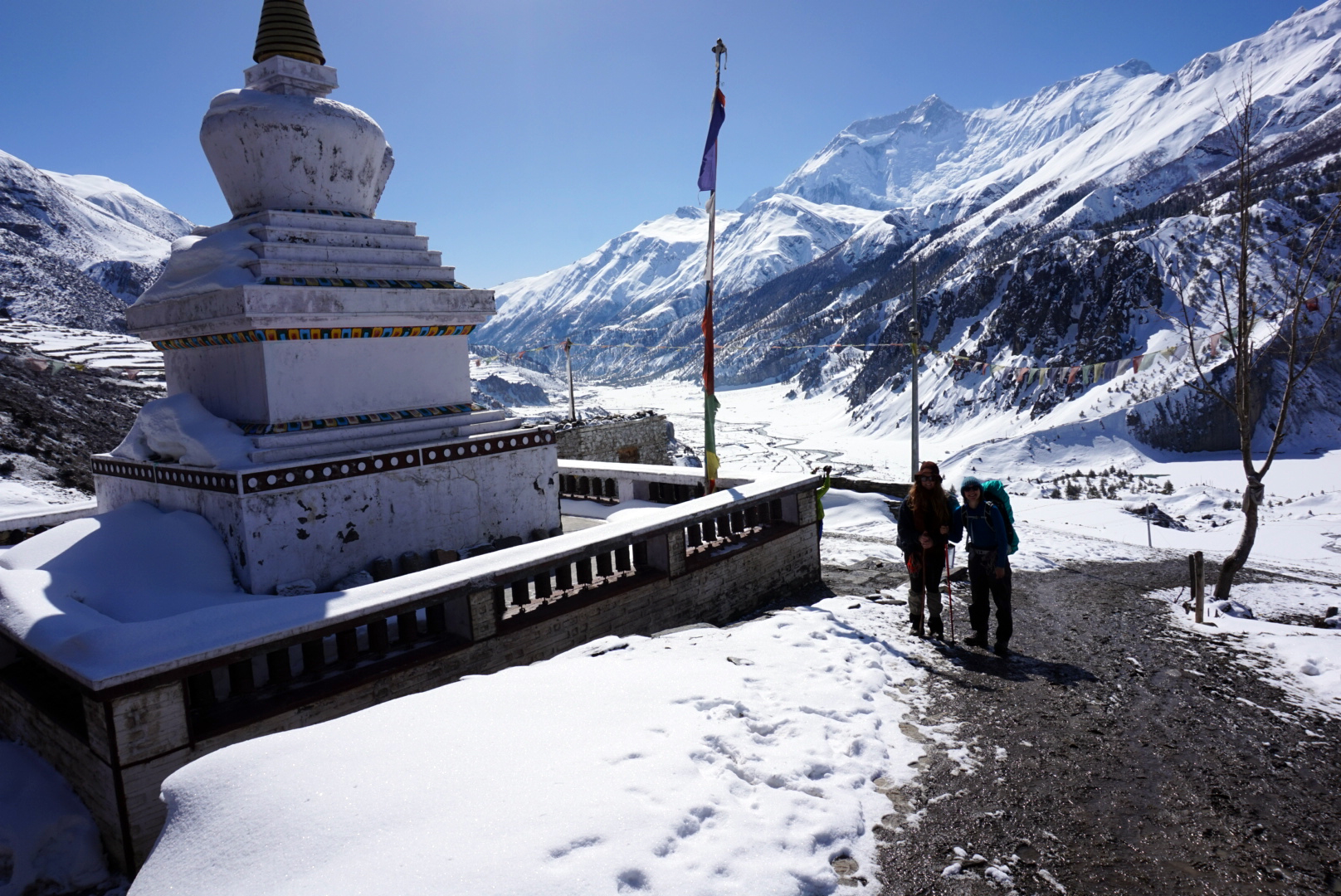
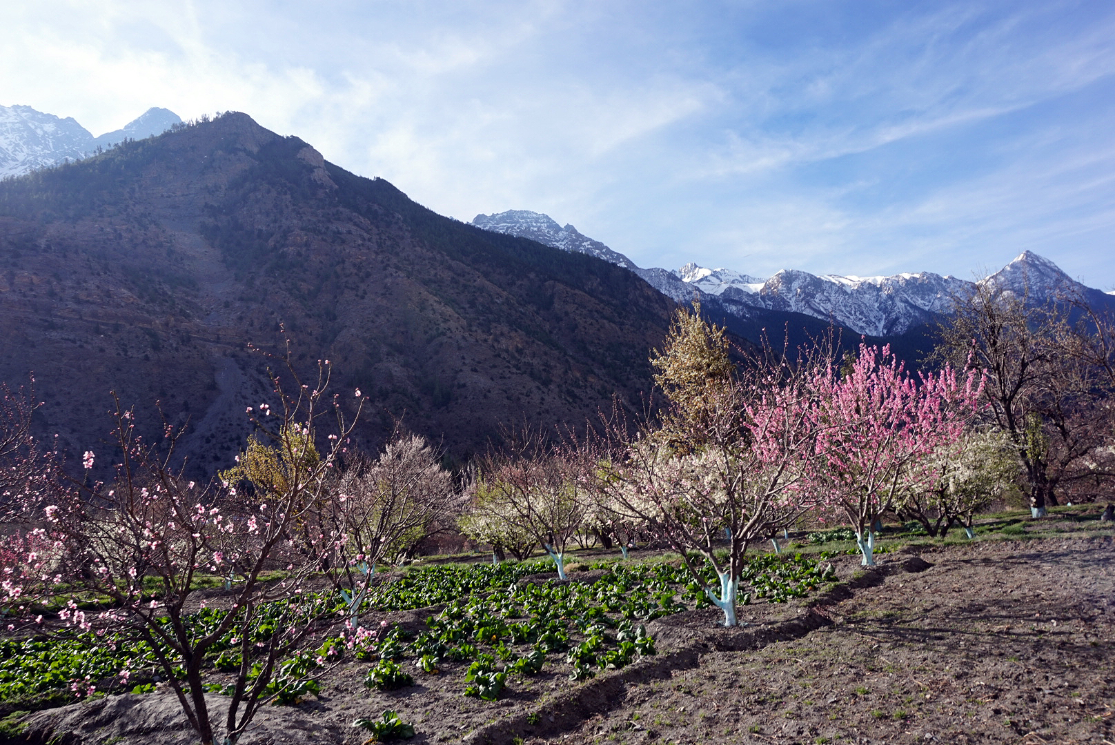
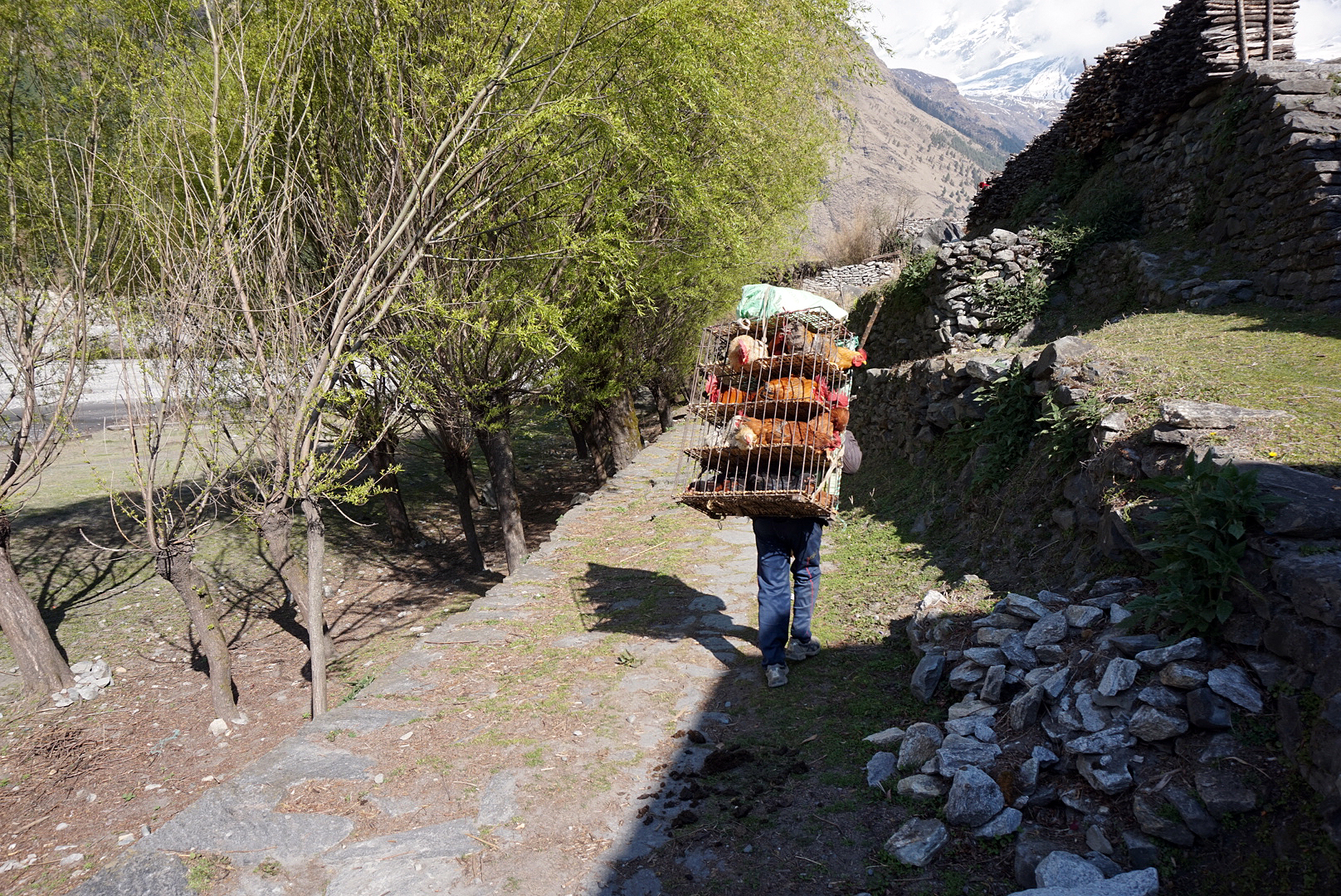
We awoke to a very well earned rest day. From the window, Daliguiri (8167m peak) was towering proudly in the distance, radiating an orange mist in the warm morning sun. We rewarded ourselves with posh coffee and chocolate pancakes for brekkie, before catching up on our washing. As far as doing the washing goes, doing it on a rooftop in the sunshine with a 360 Himalayan view is not bad at all.
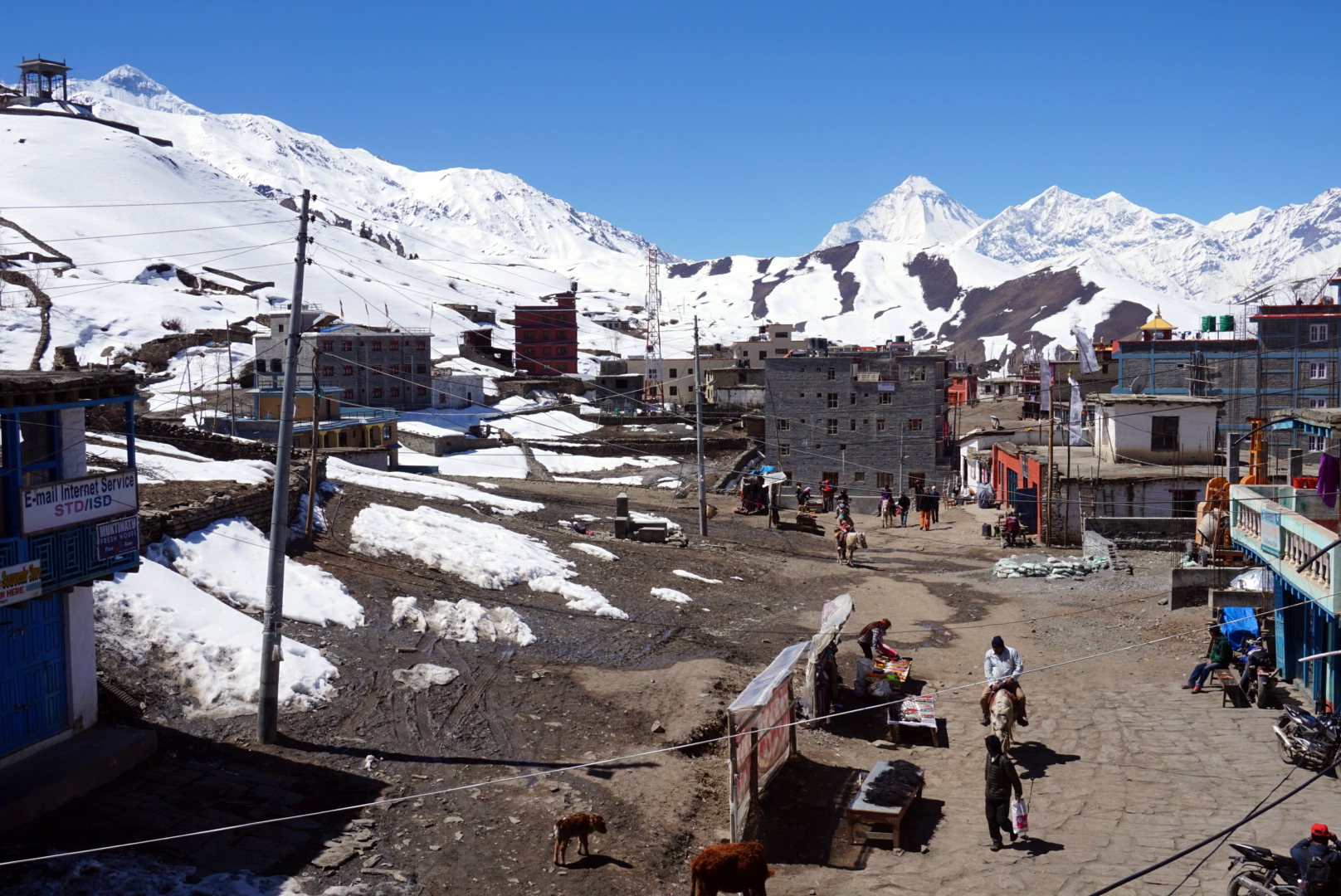
When we felt up to it we went for a little explore. We were staying in a place called Ranipauwa right next to Muktinath. Muktinath is the name of a walled cluster of temples that is one of the most holy places for Hindus to visit. Thousands make the pilgrimage every year. We went in for a wonder. Amongst other things, in the centre is a sacred grove of Poplar trees. Legend has it that they sprouted from the walking sticks of 84 great magicians on their way to Tibet.
DAY FIFTEEN
Muktinath 3760m to Kagbeni 2810m - 145km
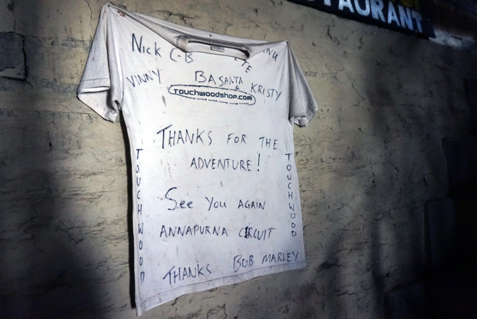
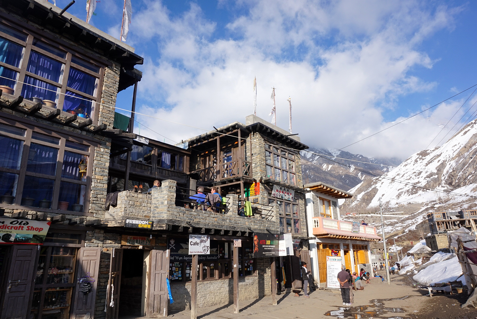
We were up by seven and out by eight. On our way out I had to ask... What's the story with Bob Marley. The owner said back in the sixties many rockstars came to Nepal to smoke marijuana as it was legal in Nepal then. Bob had stayed in a small three roomed guest house on this spot at that time. However the building and entire town had changed unrecognisably since those days.
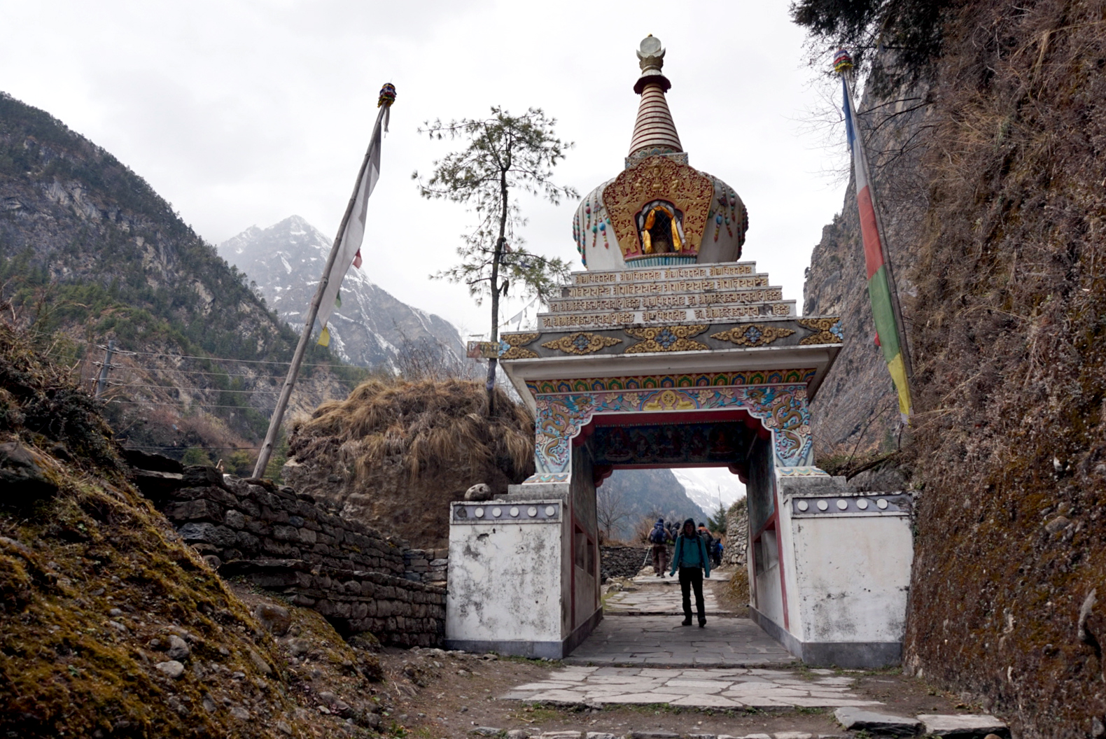
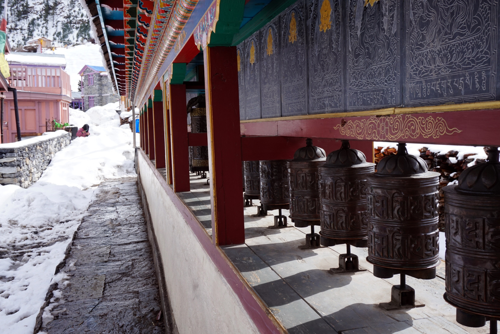
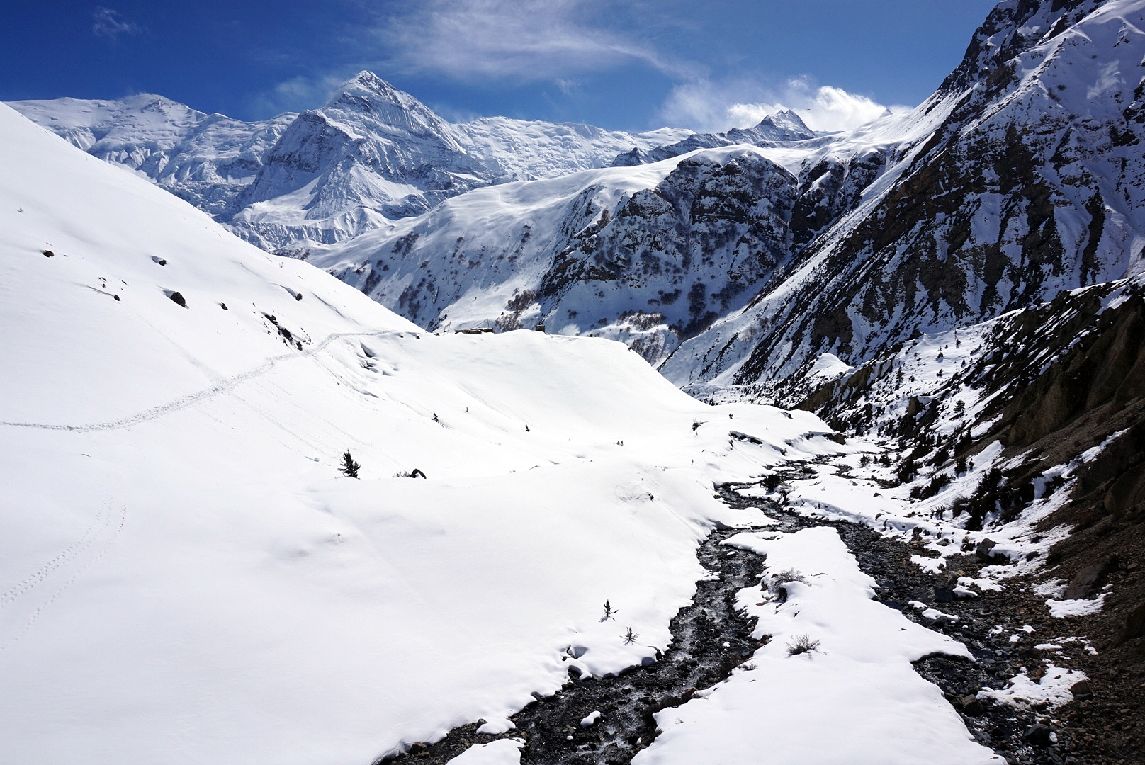
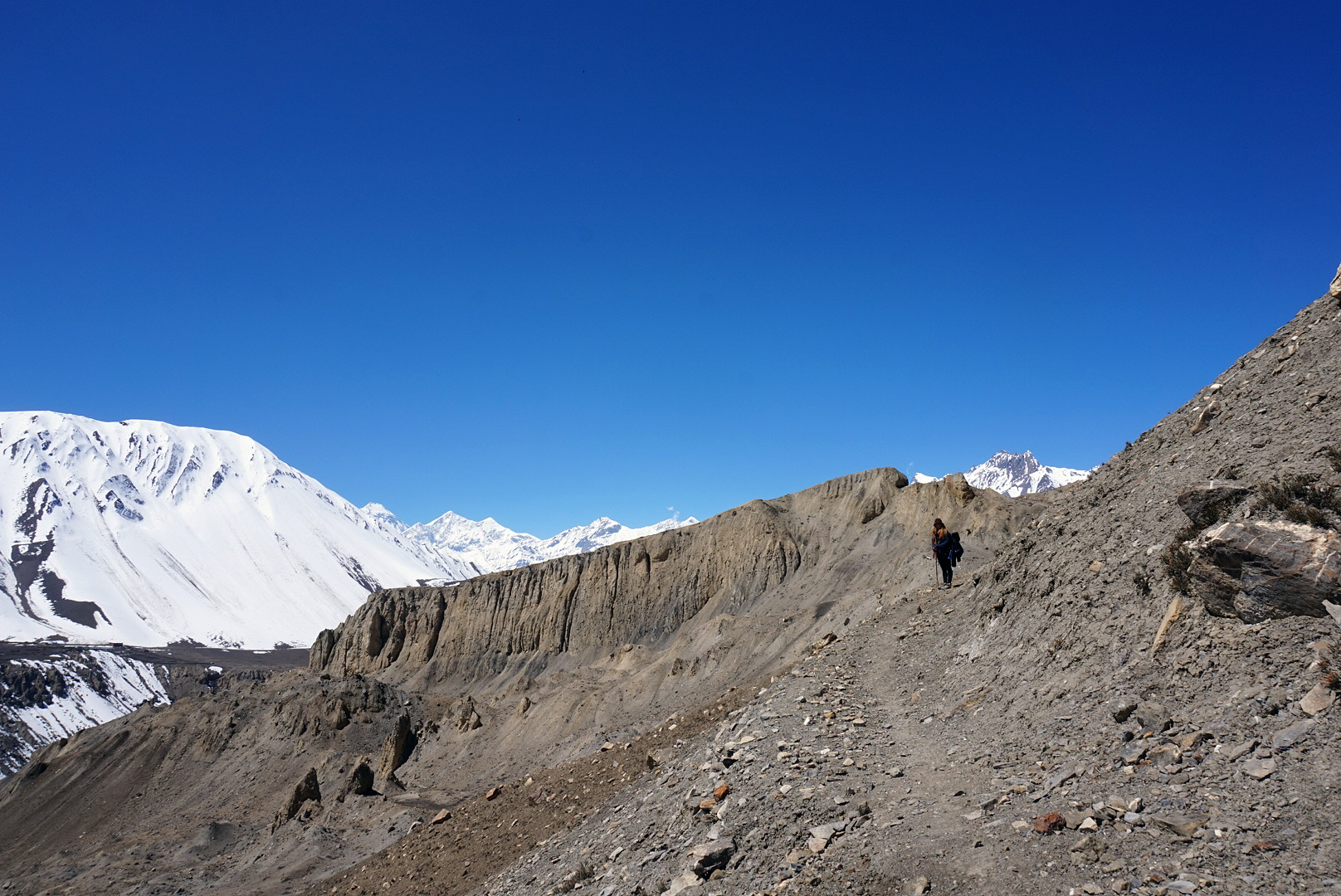
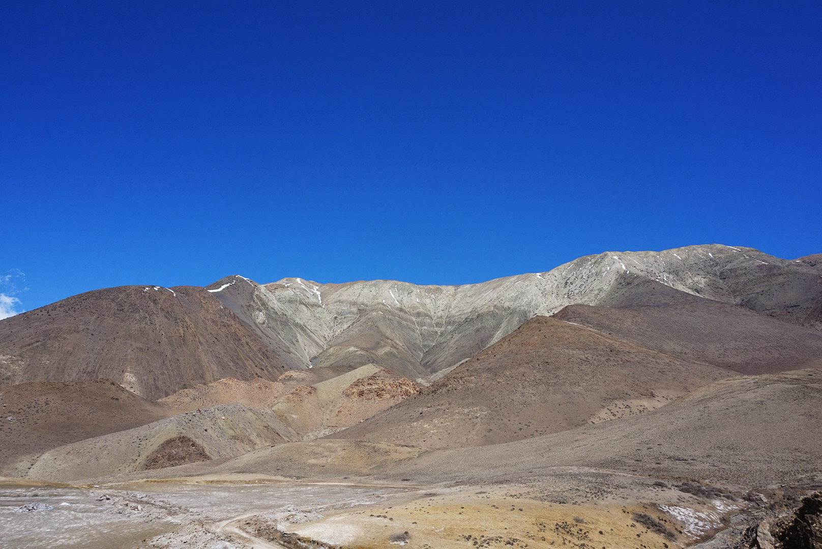
We set off to to Kagbeni via the long route avoiding the road. The route passed through many villages that were heavily influenced by Tibetan culture with dozens and dozens of prayer wheels dotted about where ever they could fit. We passed through a slightly bigger town with an old monastery in the middle. We climbed the steep snaking walk way and were rewarded with our last view looking back at the pass. It was a magnificent sight, especially as we had conquered it two days before. However I was happy to be descending out of winter.
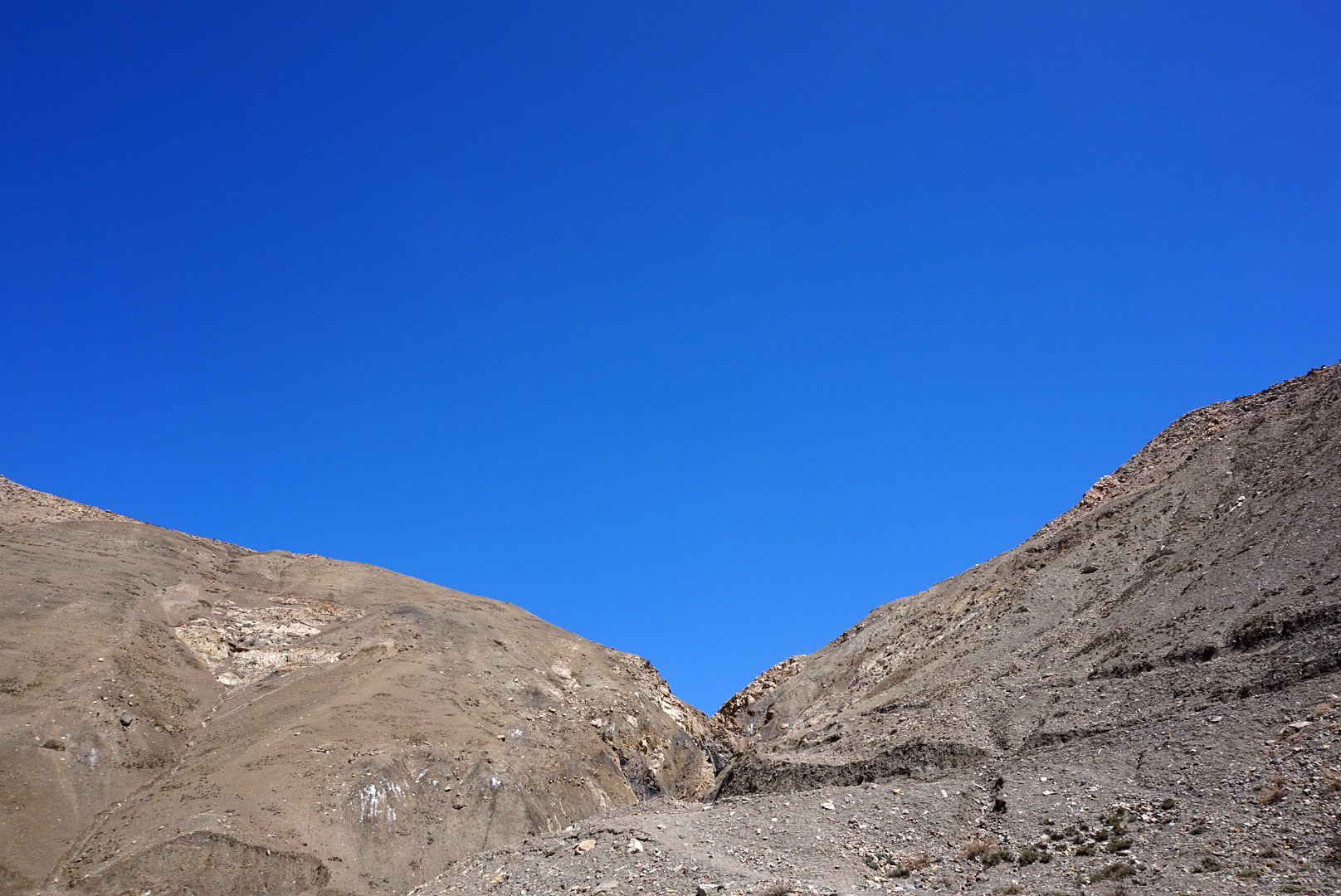
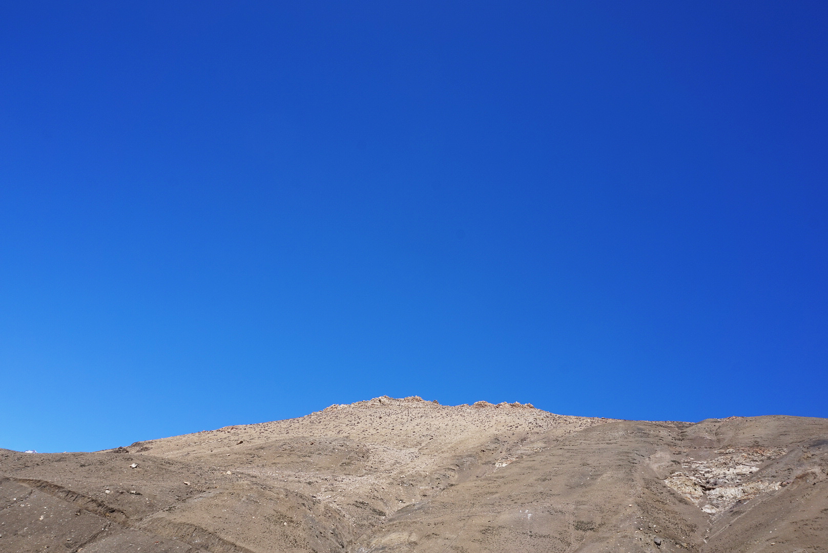
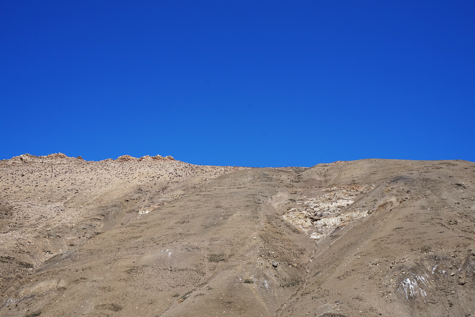
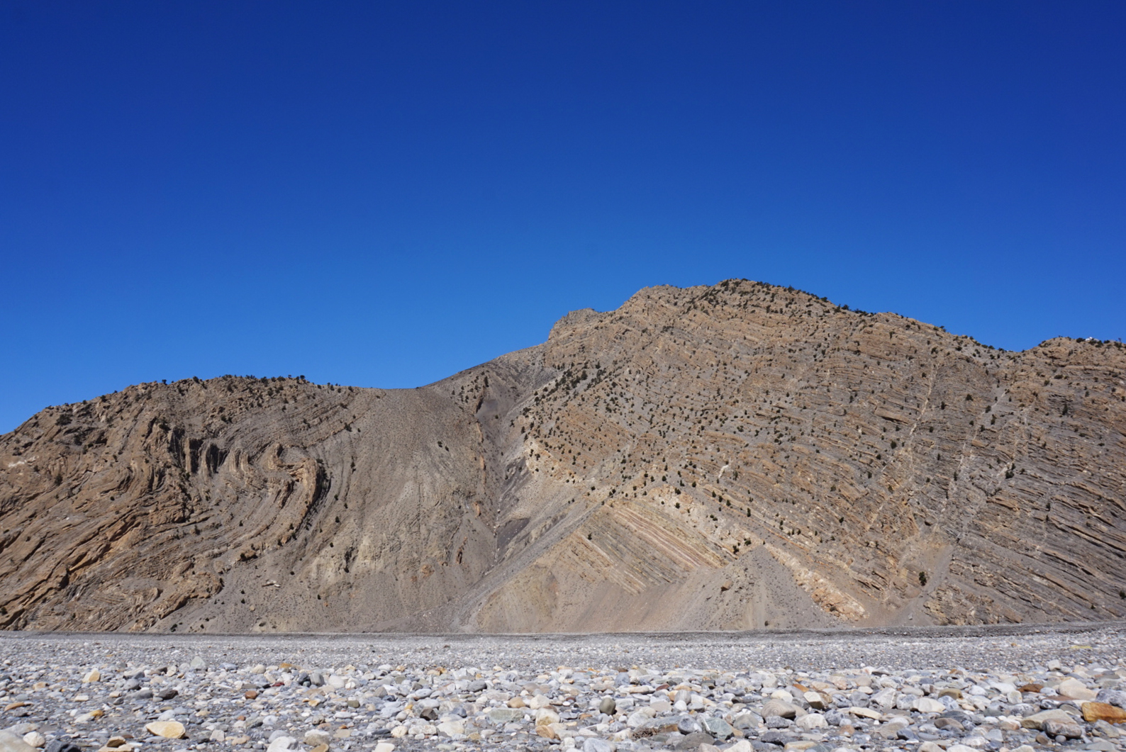
The landscape became more and more barron on the south facing slopes of the mountains. At times it looked almost like Mars, with vibrant orange rock and dust towering up to the heavens. Every now and then a snow covered peak would jump from round a corner to remind you where you were. Some of the views were an incredible mash up of dessert and mountain.
We carried on for a few hours until we saw a small riverside village surrounded by lush green rice paddies. At first we thought it was Kagbeni, but later learned it was Mustang. You need a special permit to go there and I think it is super expensive. Being the gate way to Tibet / China, both the Nepalese and the Chinese are very careful about who can visit the area.
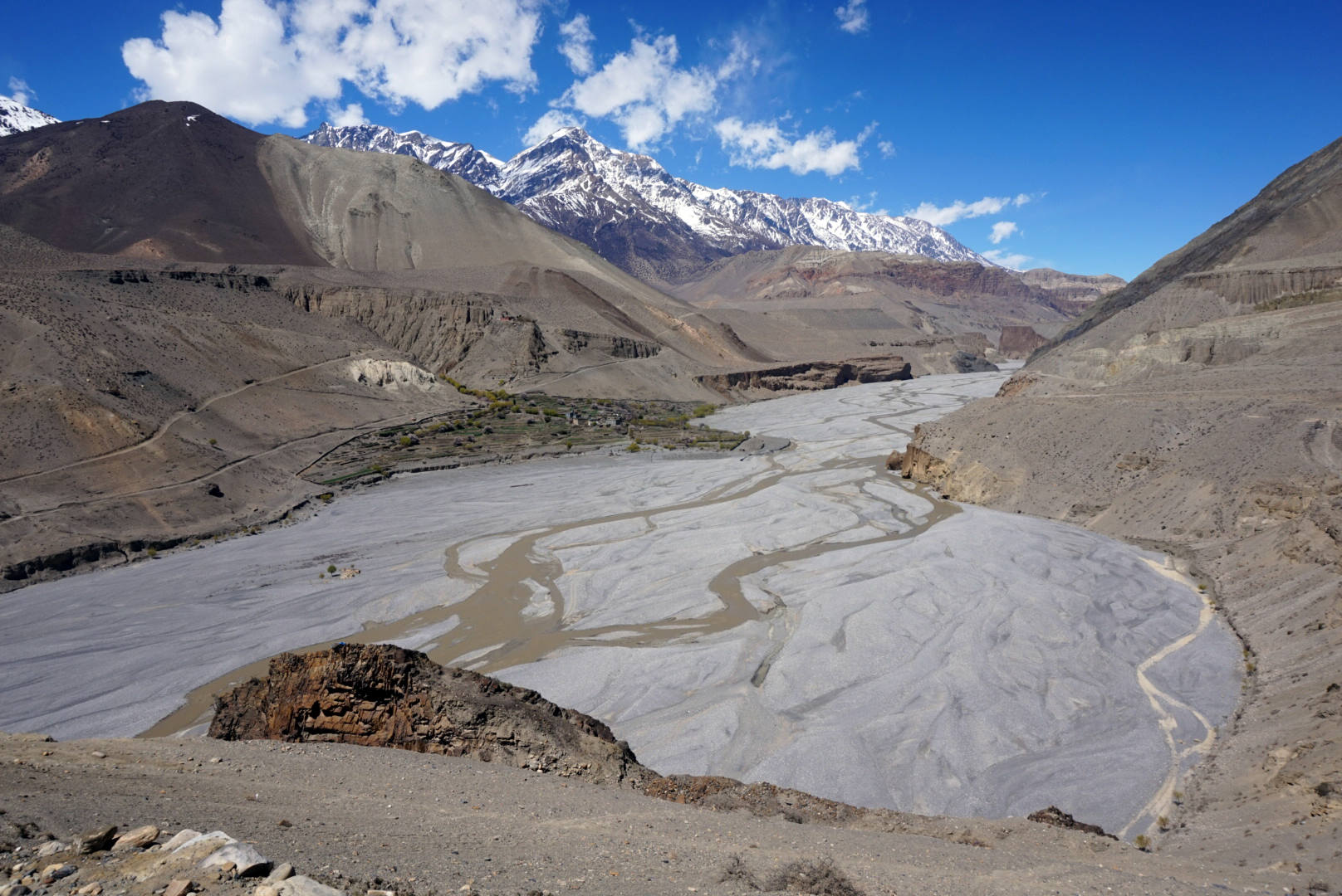
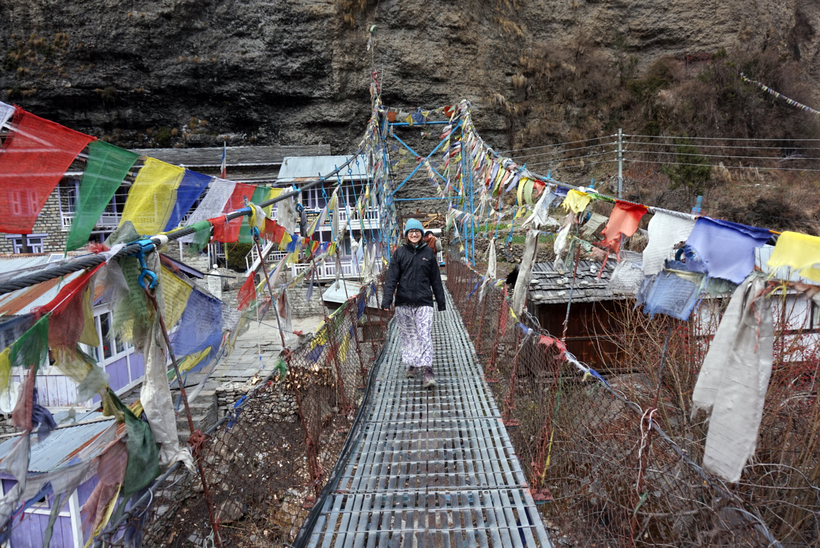
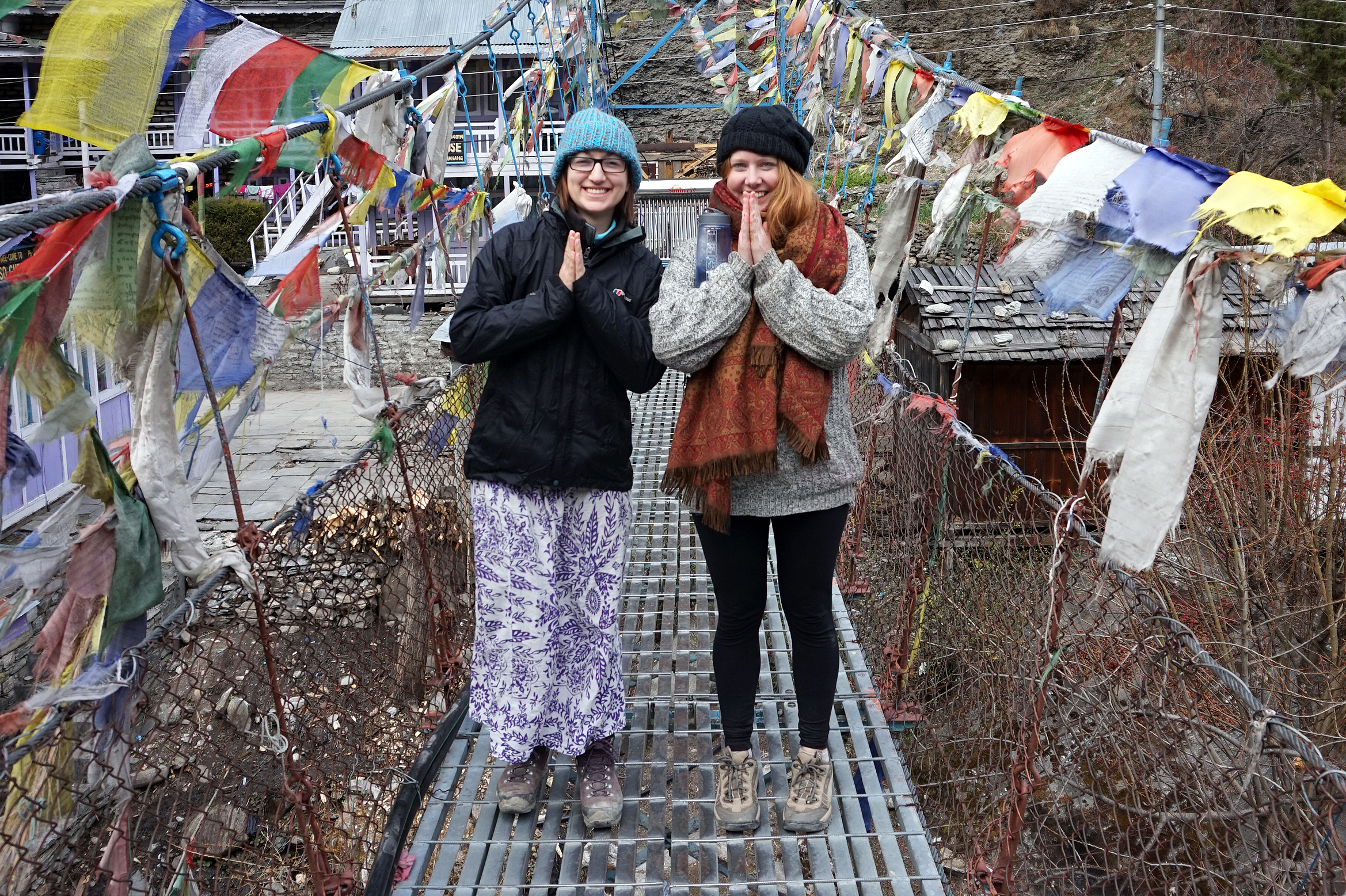
We rounded another dry rocky corner to see the jaw dropping sight that is Kagbeni.
It is a small rustic town, situated next to the river at the bottom of a mountain valley. The town is surrounded by vibrant green farming land, which is in turn surrounded by a dusty orange Mars landscape, which is in turn surrounded by our old friends, the snowy peaks of Annapurna. Just to top things off the sky was super clear and blue. We had to use our climbing skills again to get down to the town and soon we were wondering the maze of little rustic streets.
We were now with a new group of people who we befriended whist crossing the pass. Gizzella from Spain, Leo from Israel, Puja from Dubai, Phil from NZ, Lucas and Harold from Germany and our two British friends Hat and Steve.
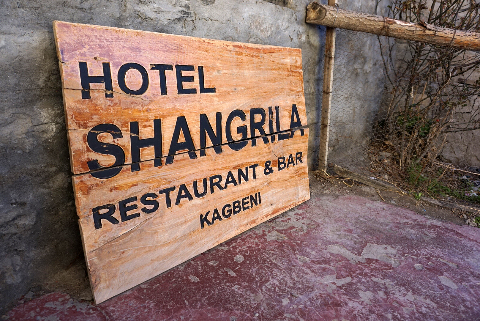
We checked into the Shangri La Guest House which was a lovely little place. The food was good, price right and the view from the cafe could never be done justice with camera or paint. Just round the corner was (I kid you not), a Yak Donald's!
The atmosphere on this side of the pass is much more relaxed. Without the apprehension of the pass looming plus the uncertainty of it even being open, you can just take it slow, not worry and eat Yak.
DAY SIXTEEN
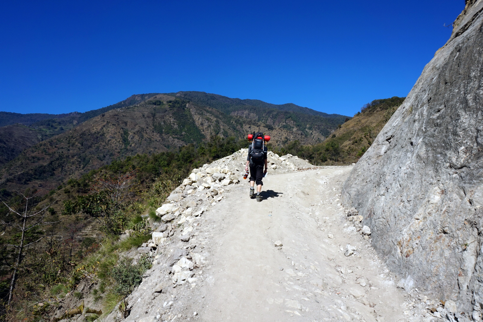
Kagbeni 2810m to Marpha 2670m - 160km
We let ourselves go in the morning with a full English breakfast. It was definitely not English, however it was pretty dam tasty and I was full. We headed out into the morning sun following the growing trickle of a river happily carving its path through the white flood plane valley. Our first destination was the larger Town of Jomsom. It is a bit of a transport hub and due to time constraints quite a few of our new ensamble had to catch jeeps to make flights.
We made it to Jomsom around eleven and rewarded ourselves with a three hour lunch. There isn't much going on in Jomsom except it's bus station and airport. The highlight is the guest house where Jagger and Hendrix apparently graffitied on the wall when they were passing through. Not a bad reason to visit but mostly it is used by Hindus flying in to make their journey to the temples of Muktinath.
After another long farewell and lots of hugs and pictures, Bhrett, Helen and I were back on the road again along with just Phil, Lucas and Harold who raced off ahead. Our destination was the beautiful, white stoned town of Marpha.
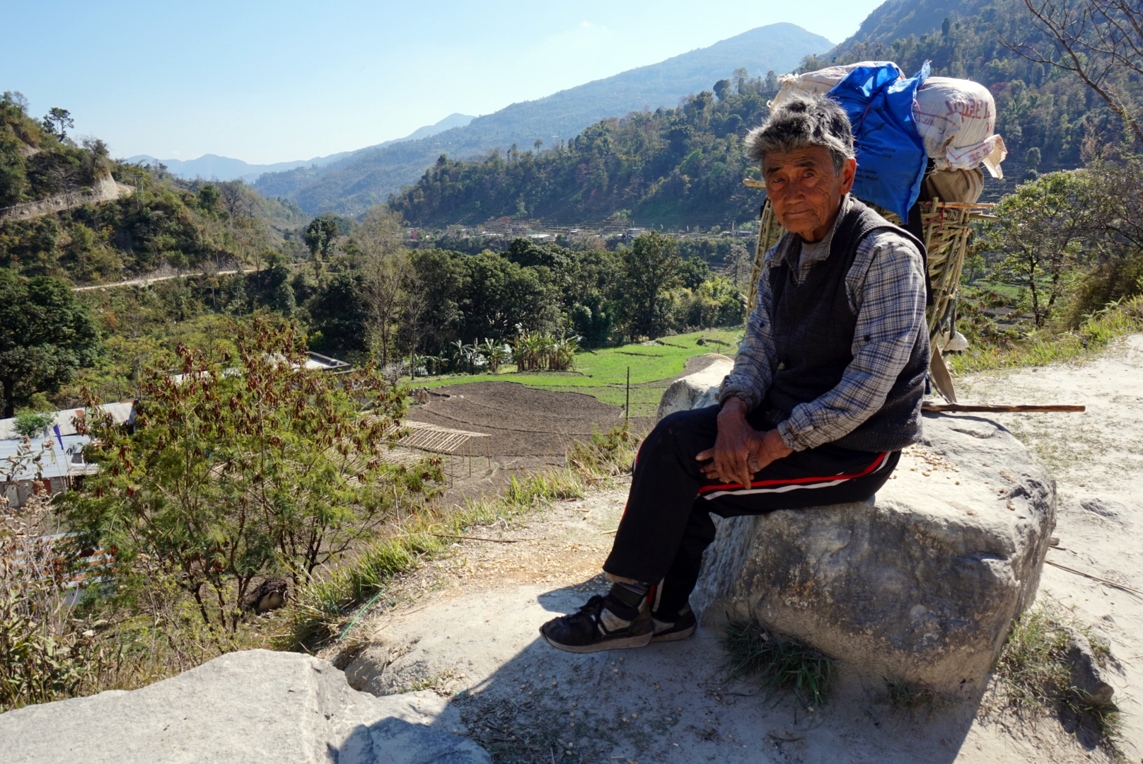
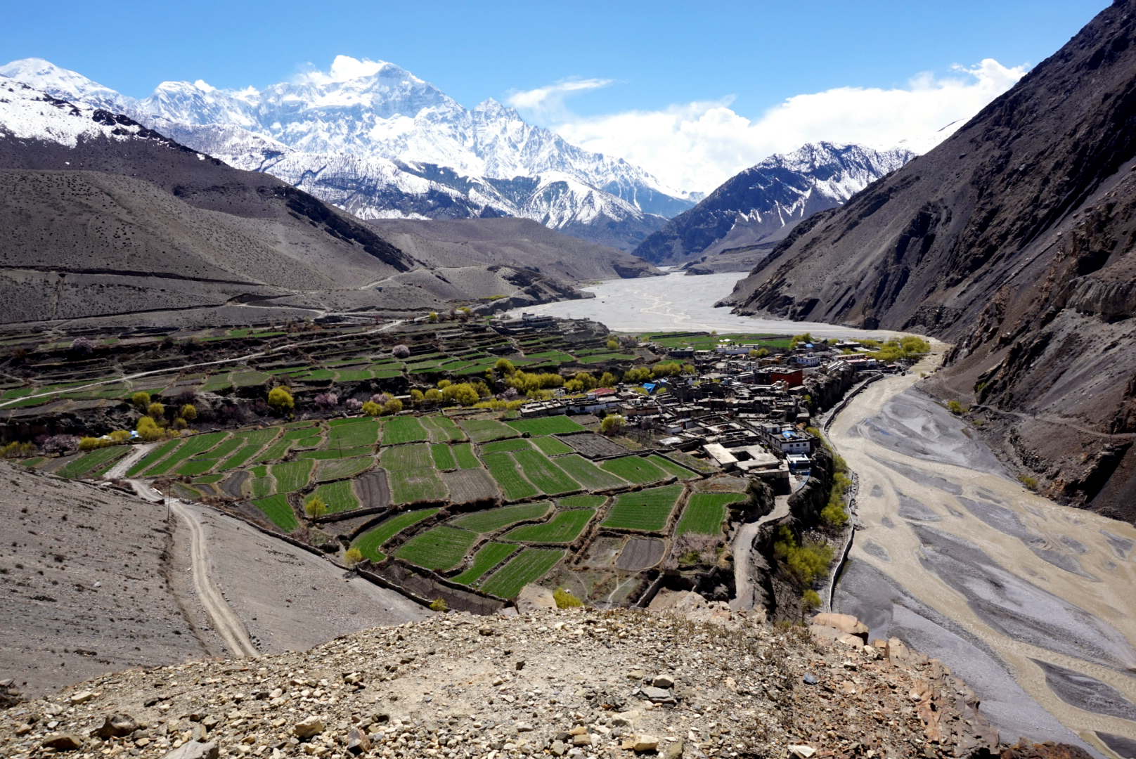
We started walking down the road (dusty crumbly track) on the side of the valley following the river. It's nicknamed the windy valley, and we can definitely see why. Massive gusts whipped around us blowing anything and everything up into mini tornados that were actually quite pleasing to watch. However the road was not pleasing as the dust became unbearable. We started talking to a group of local porters who lead us away from the dust, onto the floodplain in the centre of the valley. We followed this all the way to Marpha. They were a nice bunch, pointing out the mountains to us and talking about what they wanted to do with their livers. The lad we were talking to wanted to become a guide. It's a very good job to have out here, but being a porter is also pretty good, but you are expected to carry in excess of 20 kilos.
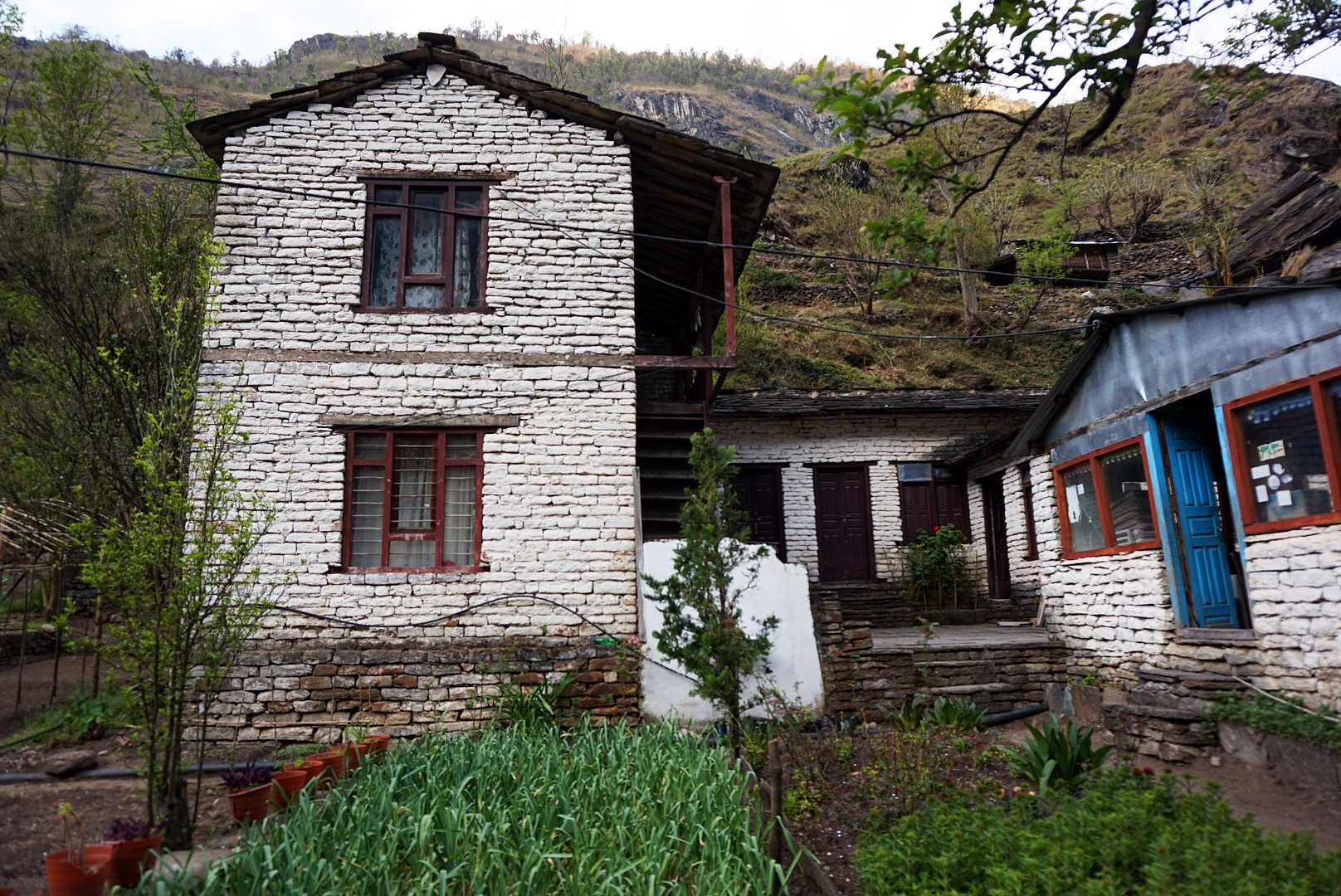
Marpha came in to view as we rounded one final corner tucked away into a corner of the hillside out of the winds might. Like Kagbeni it too was surrounded by thriving green farmland. Mainly apple orchards. It is a very scenic place. White stone buildings offset against a rich green hillside looked almost European. Maybe South France or parts of Italy. We slowly ambled through the narrow streets passed lovely little cafes and Tibetan gift stalls. The tea house we stayed in was one of the best by far. Clean rooms, good food at a good price and a glass dining room that overlooked the orchards. Plus we were able to rediscover the simple pleasure of a hot shower.
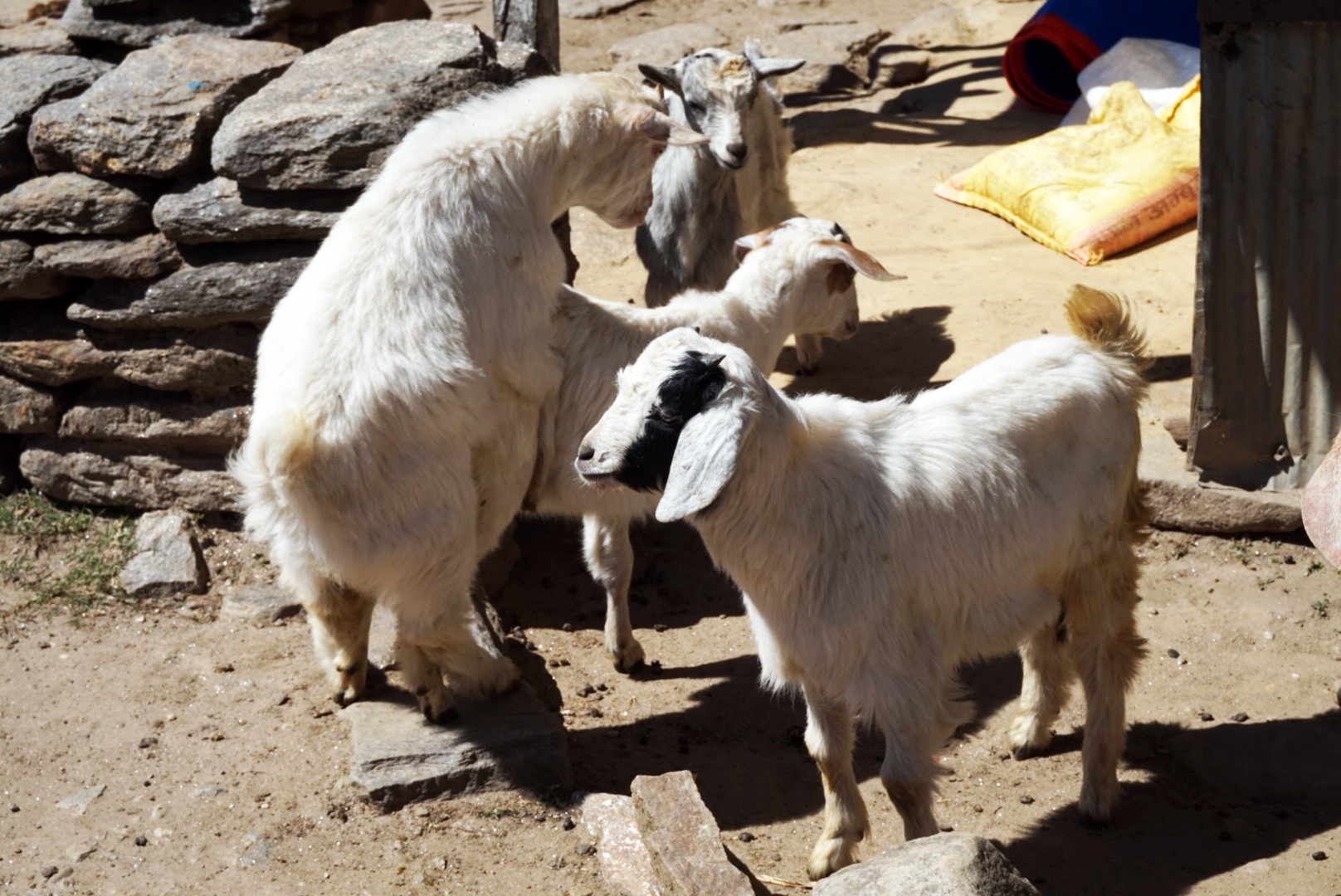
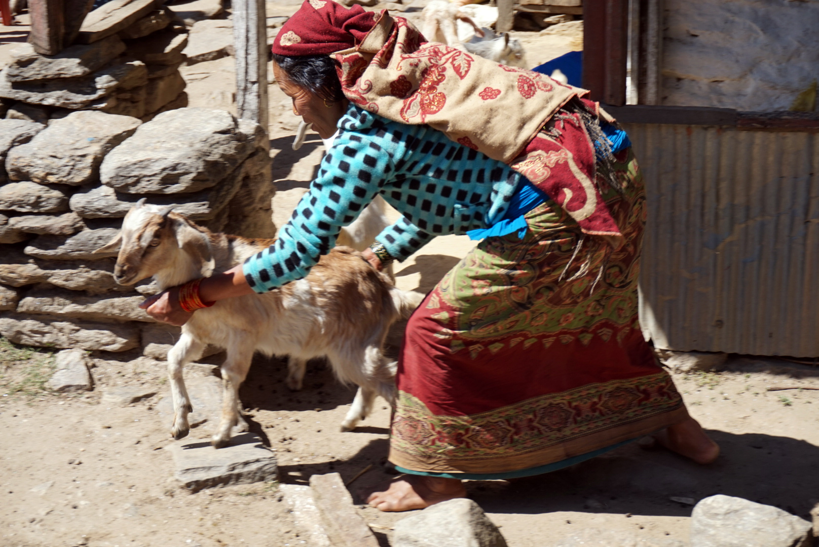
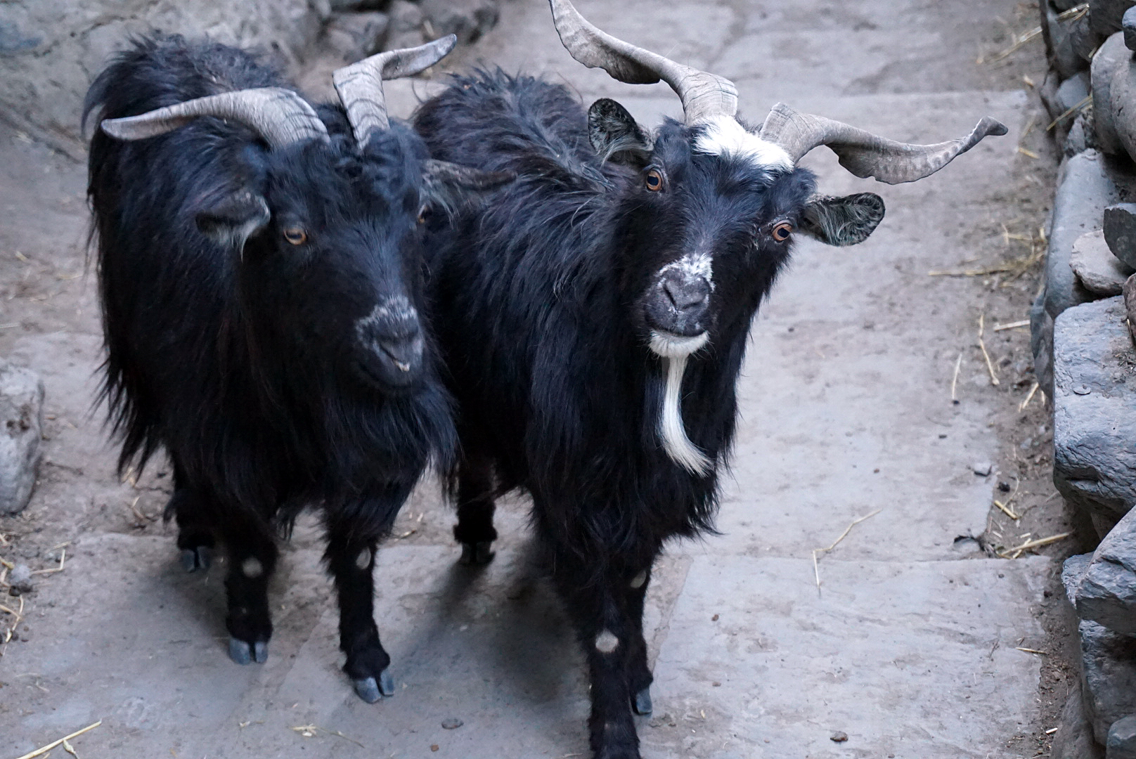
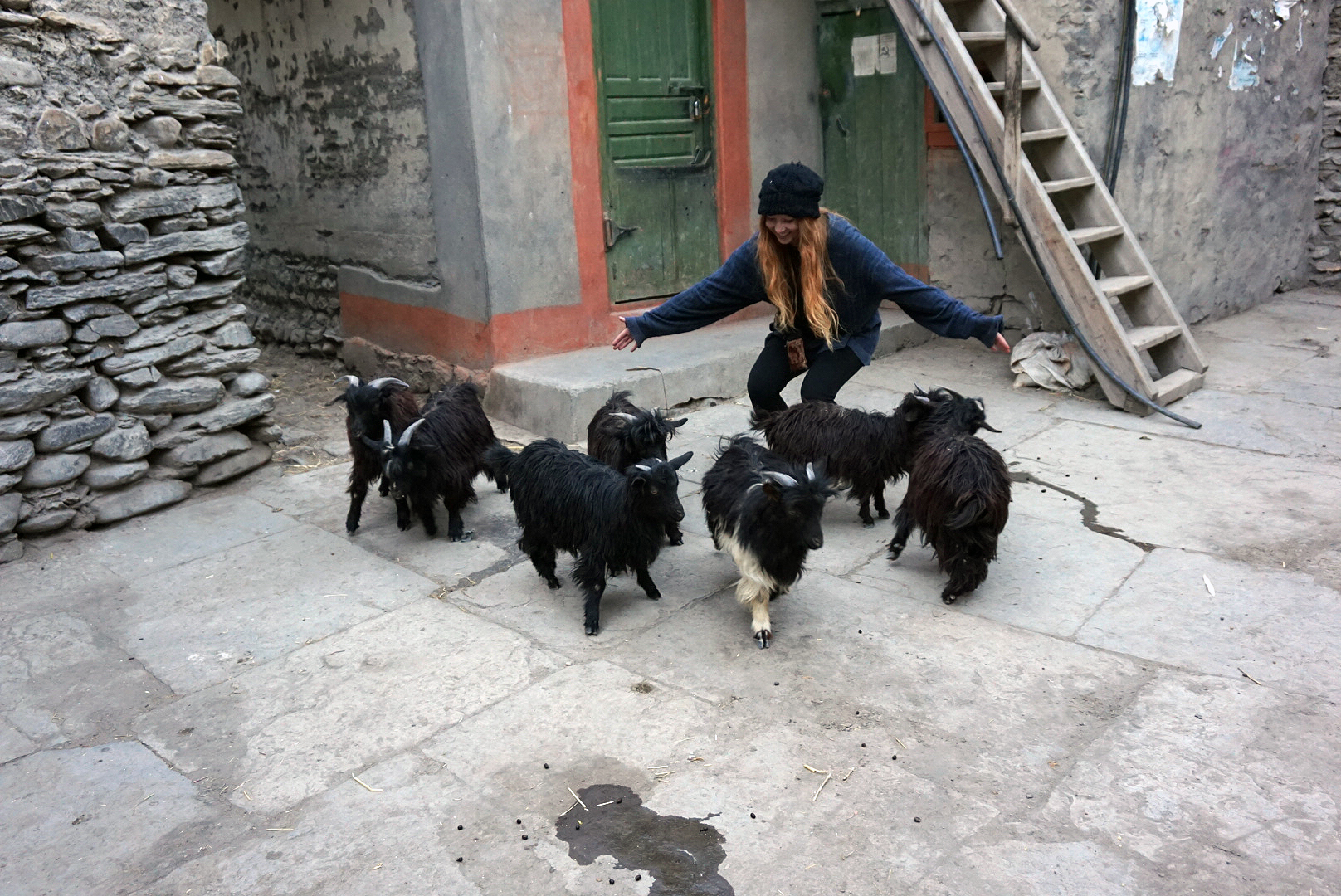
We explored the narrow streets in the afternoon, and climbed the tall painted staircase up to the Buddhist monastery. The view was fantastic, however we were more interested by a goat shepard trying to round up his goats for the night. They were everywhere in the narrow labranth of alleys and houses to the back of Marpha. Some climed the hillside, others trees. Some were on people's roofs or even went in to people's houses. We were completely transfixed for a good half hour or so, who needs telly.
In the evening we played cards and drank home brewed apple cider. I have tasted nothing like it. So sweet and smooth. New lesson, when in Marpha buy cider, some to drink now and some for later. We didn't by extra and regretted it for the rest of the trip.
DAY SEVENTEEN
Marpha 2670m to Larjung 2550m - 171km
We guzzled our orchard view breakfast round seven and were walking the narrow white street by eight. We crossed over to thick woodland on the far side of the valley crossing the river via stepping stones. It was nice to be in the shade with the already strong sun and clear skies. The mountains still gazed down on us from the heavens and the air was filled with the smell of pine. The track snaked through the woodland illuminated by hazy sun rays and dappled light. There were a few very steep climbs but compared to the dusty track of yesterday this was a dream.
Blisters were starting to get the better of us and our pace almost grinded to a halt. We were amazed our tame London feet had survived this long. We saw the village of Larjung on the far side of the valley in the distance. As welcoming as this was, it took a while to work out how to cross the river. The trickle had become a fast moving torrent, not particularly wide but not stepping stone friendly. We eventually found some sketchy little bridges, no more than a couple of planks of wood. We tentatively crossed one by one and entered the practically deserted, sleepy village of Larjung, checking in to what seemed like the only guesthouse showing signs of life.
After a massive Dal Bhat and equally massive nap, we three decided to stay put for the afternoon. We said our farewells to the other three and they set off in the heat of the afternoon. We on the other hand ordered weird local alcohol and pudding. Both were rubbish. After many rounds of shit head and one (and only one) game of pairs, we turned in for the night. There is really not a lot to do in Larjung.
DAY EIGHTEEN
Larjung 2550m to Rupse Chhahara 1630m - 190km
A Tibetan breakfast & Masala tea seemed like the perfect combo and we were back on the road by half seven. The afternoon off had revived us, except for the dam blisters. A few strips of duct tape round a few toes made walking bearable and we were good to go. We carried on along the road that hugged the riverbank making good time. The valley was very wide and behind the near lush green slopes was the bright white peaks of Annapurna 1
8,091m
to the east and Dalagiri
8,167m
to the west. This is called
Kali Gandaki Gorge and is the deepest valley in the world
5,571m from top to bottom.
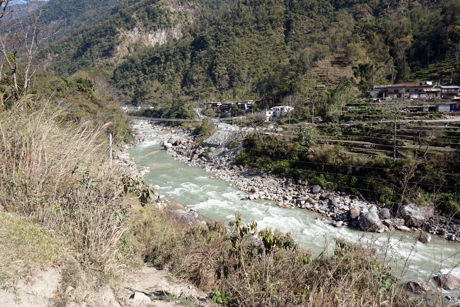
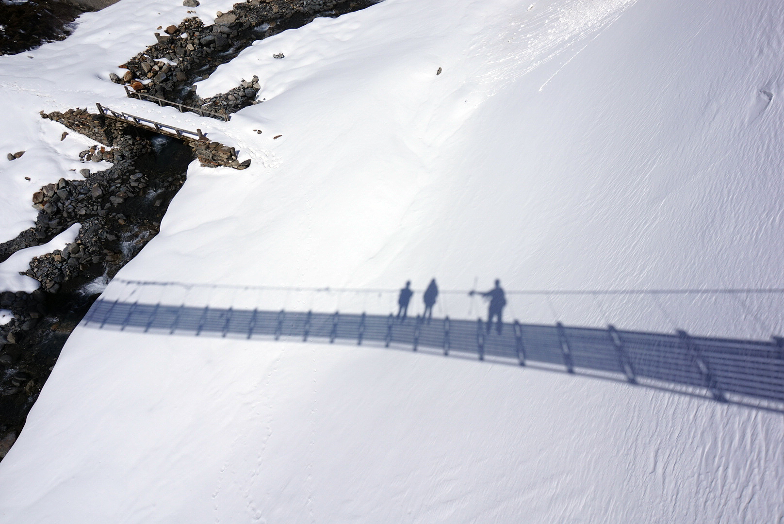
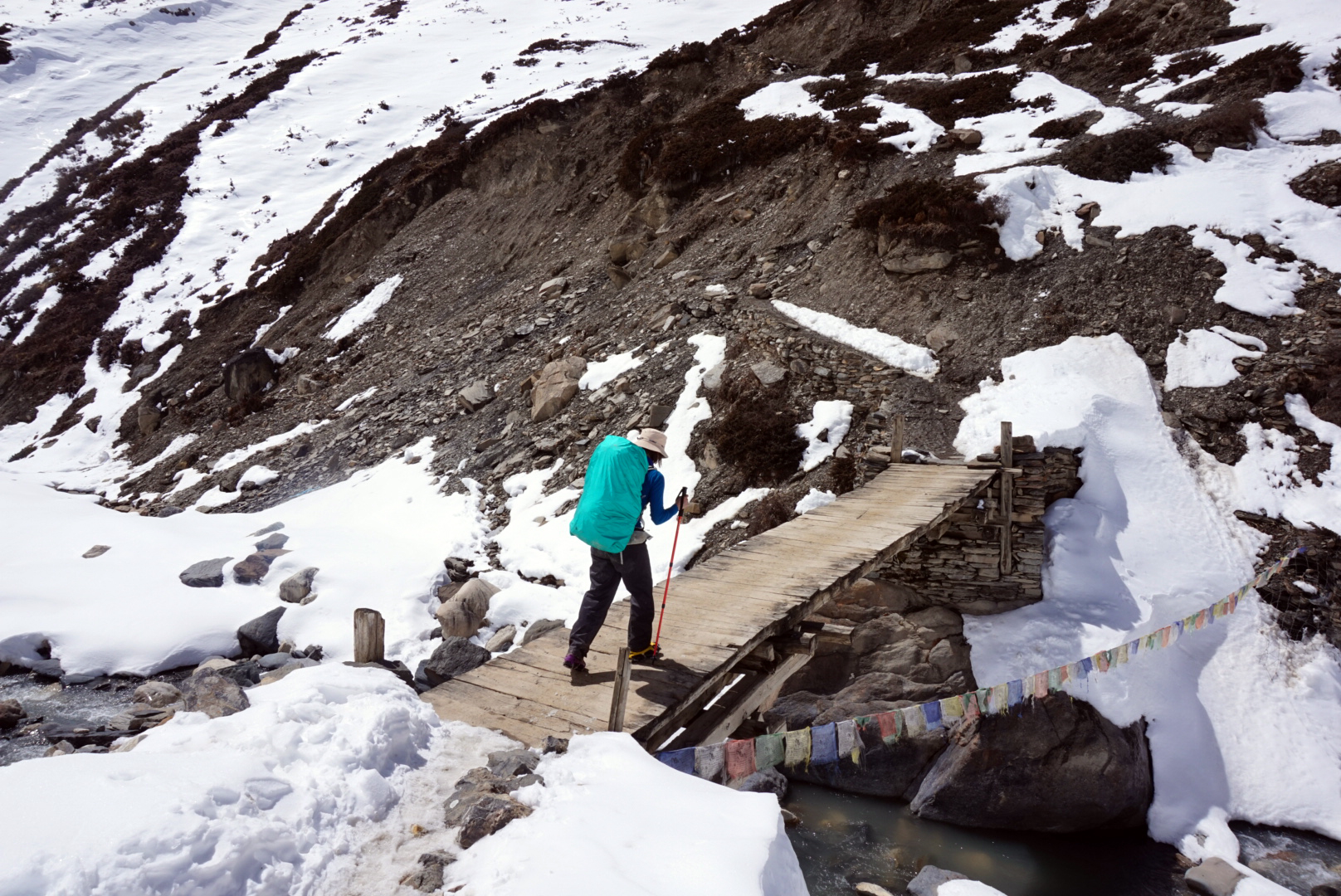
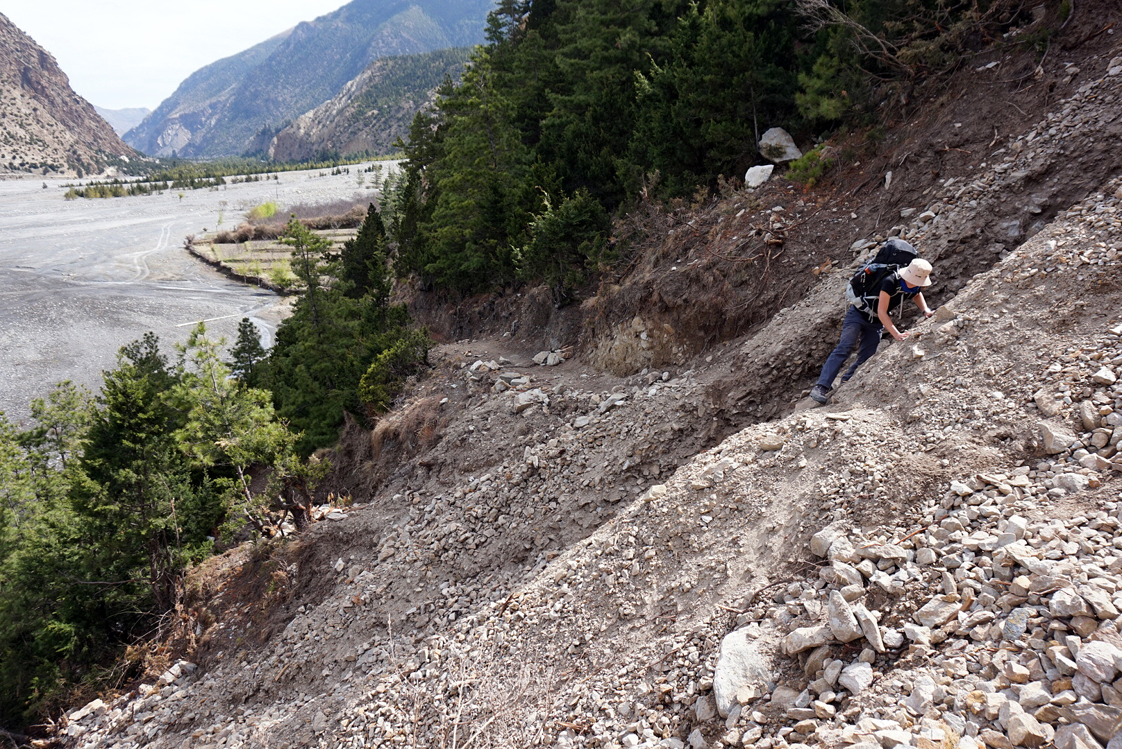
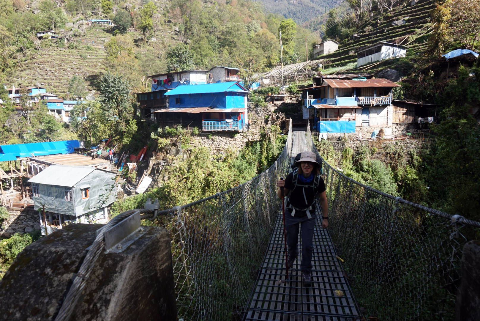
Further down the valley we took some side trails off up above the road into twisty pine and bamboo covered woodland. The trail looked and smelt amazing. We passed through the village of Ghasa for a bite to eat and after searching the village for home brewed cider left glum and sober. With freshly stamped permits we headed off into the afternoon. We crossed a rediculously massive suspension bridge that joined a small cliff path that followed the east bank. T
he happy little trickle was now a mighty ferocious river.
We passed through some tiny villages as we plodded in to the evening. The circuit route keeps being tweaked to avoid the new roads, so tiny villages on the far side of the river suddenly find themselves with new trekkers passing through, and unfortunately villages such as Larjung (once a bustling travellers village) loose theirs.
We had heard from a couple of local folk there is a good place to eat and stay on the opposite side of the river next to a big waterfall. We found the waterfall round six ish and noticed a couple of small buildings on the edge of the hillside bend below. It didn't look much but we were knackered and hungry. The first place we looked had no natural light or power and was quietly tucked away behind some massive boulders. We decided it looked far too much like the setting of a horror movie so politely declined and walked rounded the bend in the hillside. Luckily five minutes round the corner was a beautiful picturesque stone and slate rugged guest house built round a small courtyard and colourful vegetable garden. This was much better and within no time we were settled in for the night. Our room looked out down the valley and river. A lightning storm had rolled in over the peaks in the distance, illuminating the jagged mountain tops for split seconds before disappearing into the night.
DAY NINTEEN
Rupse Chhahara 1630m to Tatopani 1190m - 197km
I love this little place, it is so tranquil and beautiful especially with the sounds of the waterfall echoing behind. I rose early and had a quiet coffee outside in the garden watching the valley wake up. The owners here are lovely and really looked after us.
After breakfast we were back on the road and in no time found a rickety wooden bridge to get us back on to the trail on the far side of the waters. We made good time in the cooler morning air, passing through some stunning scenery and villages. One of which was called Narchyang, and was sat up in the lush hills above the main trekking route about fifteen minutes short of our end destination Tatopani. The blanket of vegetation that surrounded the village was rich in colour with crops and foliage flourishing all over the place. This was complimented by the brightly painted wooden houses that were dotted throughout the hillside. If you're walking to Tatopani, the side trail up to Narchyang is definitely worth the climb.
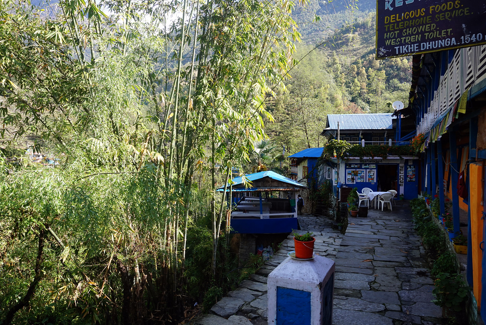
We got to Tatopani by lunch and dived into a rickety tin shack for lunch just as the heavens decided to open. It was the first rain we had seen in weeks. If you are a true Brit you notice things like that and make a point of grumbling about it. The sun sauntered back an hour or so later (nothing happens fast out here) and we went in search of Tatopani's famous natural hot springs. Tato means hot and pani means water. There were two springs, one was so hot it was unbearable but the other was just right. There was a small bar next to them so we ordered some beer and chilled out for about three hours or so, exchanging travel stories with other trekkers. As it turned out, very few were coming down from the pass and the majority were on their way up to Muktinath. After nineteen days of walking it was amazing. We even got free popcorn with the beer weirdly. Our roof for the night was the Kalagandaki guest house, it was cheep but not that cheerful. Maybe give it a miss, however Tatopani is lovely though and there were some other nice looking places to stay. The river valley narrows forcing the village up onto a small rocky street sat all higgledy piggledy on the hillside. It's full of little shops and tea houses, you can also get great samosas from a little old lady in the centre.
DAY TWENTY
Tatopani 1190m to Phalate 2270m - 209km
After a sleepless night, thanks to a large loud family in the next room, headlined by a barking dog, we grumpily rose and bid farewell to Tatopani. The sun was out, the sky was clear. For the first time this was a trifle annoying as the climb was fucking steep and the shade was really good at alluding us. Still we strode on through the almost tropical landscape, with rice paddies and other crops reflected the sun's light saturating the stepped hillside in colour. The going was steep and after roughly four hours we stopped at the first tea house in the village of Shikha for lunch.
We sat and ate in a little open sided hut precariously balanced on bamboo stilts. It was perched above a steep twisty valley stretching off into the distance to the hazy feet of the soaring distant mountains. It was a rediculously beautiful spot with tiny farms and villages sprinkled across the patchwork quilt hillside of greens, yellows, reds and purples. We also seemed to have gained a dog, who followed us from the last village an hour our so back. We named him Harold.
We left after the midday sun had chilled out a bit, hiking further up the mountainside through more quaint, rustic villages with more brightly painted features. We all tired fairly quickly from the steep path and the shit sleep the night before.
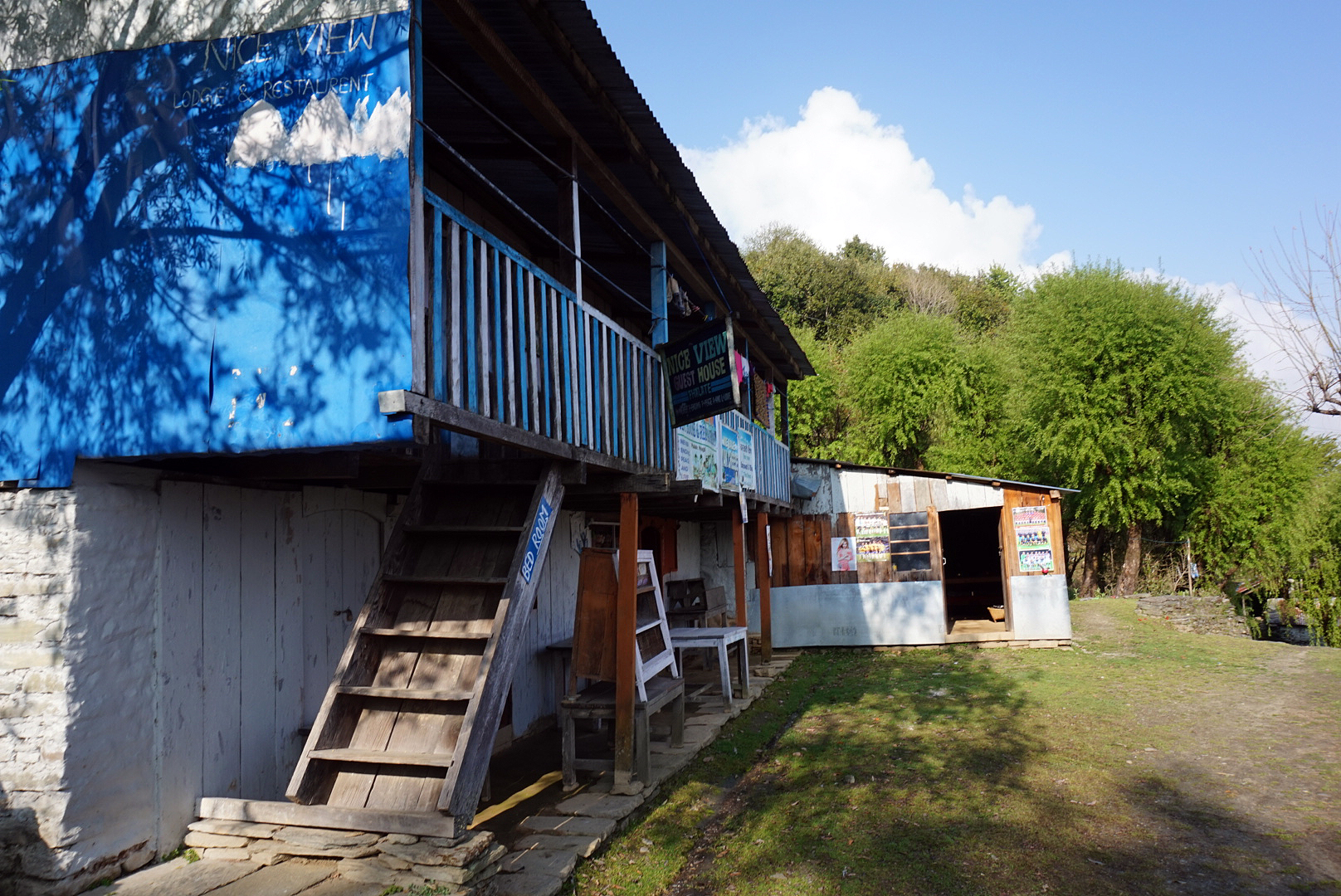
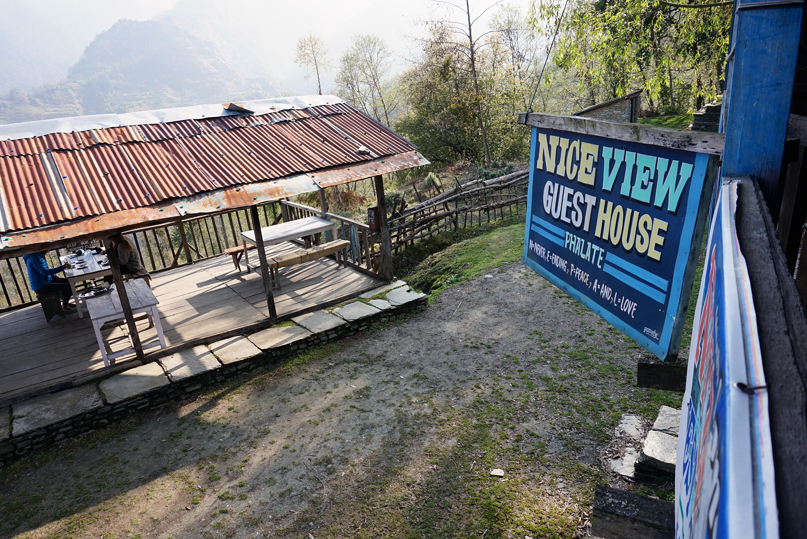
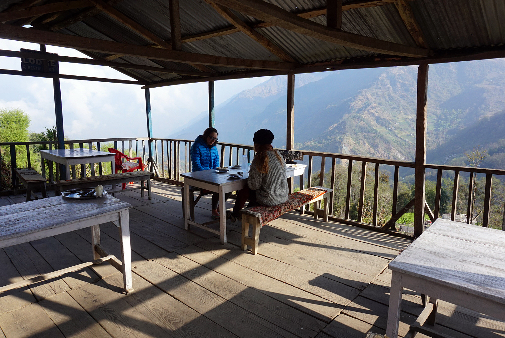
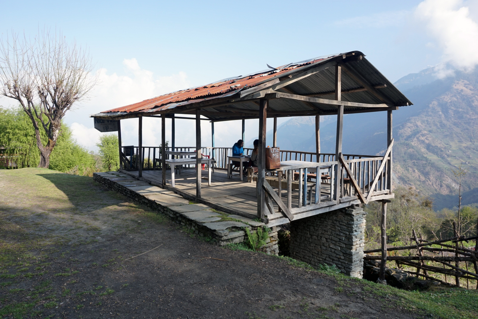
Helen seemed to have picked up a bug that was not helping at all, in fact it was doing the complete opposite. We decided to
settle a few hours short of our original destination of Gorapani, in a village called Phalate. Our host for the night was the imaginatively named 'Nice View Guest House', to give it credit the view blew away the view of anywhere else we have stayed. However the rooms were pretty basic, It was like spending the night in a wonky wooden treehouse.
DAY TWENTY ONE
Phalate 2270m to Ghorepani 2860m - 214km
We had a massive lie in this morning and woke at the unheard of hour of 7:30. (Rock'n'roll) The warm morning light had already burnt away the dawn mist, flooding the hillsides with warm colours. Helen wasn't feeling that good
and mixed with no appetite from the day before we contemplated staying put for the day. Unfortunately besides the grand view the rickety guest house was not the best place to feel unwell as there was hardly anything on the menu available to eat except spicy dal bhat and the rooms were very basic. I won't go into detail about the toilet. After breakfast we decided to take it slow and see how far we got.
After a couple of hours we passed through the rustic village of Chitre. Unlike most of the villages we had passed through this was dotted on many different levels, sprawling across a massive hillside. The trail was steep but luckily carefully positioned boulders had been cobbled together to make steps up the steepest parts.
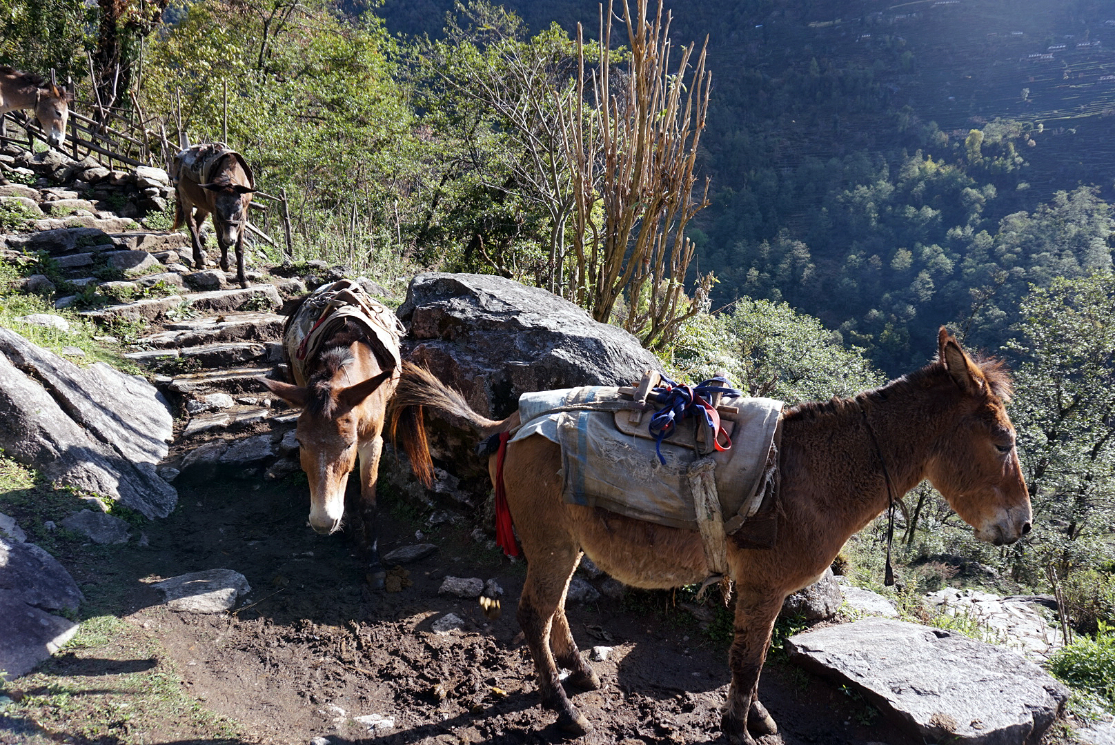
Shitloads of mules kept passing us heavily laden with large bags of rice and other goods. They are apparently called mule trains and have been used for centuries to carry goods up and down to Ghorepani. They stop at the large water troughs at the top of the infamous steps up to Ghorepani which is how the village got its name. (A place for watering horses) We followed the mules up into the sky, it was hot hard work. We reached the top and checked in to the Hungry Eye Guest House, just set back from the centre of the village. It is a quaint little place and the owners really looked after us. Plus our room had a panoramic mountain view, unfortunately the clouds had gathered and a storm rolled in masking the summits. The lightening flashes were epic, creating ethereal shadows and shapes in the misty sky. We just had to hope that the storm would pass so we could make the dawn climb to Poon Hill to see the sun rise.
This village was very different to the others. It was so busy compared to the rest of our journey. I think a lot of people make shorter treks to Poon Hill which constantly keeps the guest houses of Ghorepani busy and full. It seems there are a lot more porters and guides here too. It was very tempting to get a porter to help us with the final couple of days!!
DAY TWENTY TWO
Ghorepani 2860m to Ulleri 1960m - 220km
We rose at 4:45 to make the dawn 1000m ascent to Poon Hill. After the ice and snow of the pass, the nicely stepped path was a doddle. We kept a slow pace as H was still recovering and made it to the top for sunrise. Unfortunately the dawnlight revealed a lot of mist that hung in the air sheilding the majority of the view. Every now and then there would be a small break in the cloud revealing the magnificent mountains that lay beyond, however as soon as they appeared they wrapped themselves up again in the gloomy vail. It was still nice to have seen the top even if we didn't see the famous views. Luckily a day before leaving Pokhara we scaled Saragkot at sunrise (a small peak just north of the city). The view of the Himalayas were truly magical, so not seeing the view from The Poon was not as big a disappointment as it could have been. It was starting to drizzle, so we headed back down to bed.
We waited to see if the rain would bugger off by drinking coffee and eating banana pancakes. Rather than getting better it got positively worse. We noticed the local porters were covered head to toe in giant heavy duty plastic bags with just their feet and legs poking out the bottom. Their silhouette looked a bit like a chicken with the unusual shape created by the covered rucksacks on their backs. We decided to follow suit and within minutes, three human-sized chickens wobbled out into the storm, singing rain inspired songs on their way down the path. We reached Ulleri for a late lunch which became the whole night (This seemed to be happening more and more). The guest house looked over another valley which seemed to have permanently shifting cloud gliding along far below us.
We settled in by the fire talking to other travellers. One group that came in were from Birmingham. It was comforting to hear the accent again. (I never thought I'd say that)
Sorry there are no photos from day twenty two, but it really was bucketing it down that day, and the camera would have been destroyed.
DAY TWENTY THREE
Ulleri 1960m to Nayapul 1070m - 229km
A rising sun in a clear sky woke us round six. This was a thankful sight as it meant we didn't need to walk in the rain looking like plastic chickens again. To get from the village of Ulleri to Tikhedunga you need to descend around 3500 steps that zigzag down the sheer hillside disappearing into the flourishing tropical vegetation below. It was had on the knees going down but not as hard as it looked for the organised groups on shorter treks heading up. I felt sorry for the poor guides hauling up all their stuff, however I'm sure they were getting paid handsomely for it. We ambled down for about an hour until we reached a suspension bridge crossing a rocky stream bubbling along at the bottom of the valley.
Once on the other side we hiked up for about ten mins reaching one of the most beautiful villages yet. The tea houses, stalls and bakery's of Tikhedunga were immaculate, the vibrant painted buildings were nested back into an equally vibrant woodland, peering over vast rice paddies stretching off into the distance. I would have loved to spend some more time here, rather than just passing through but the days were beginning to take their toll and the thought of a large gin and long doze in Pokhara was enough to convince me to carry on.
We walked on through the epic landscape accompanyed by two playful dogs. They lead us to the village of Birethanti. (The second to last village of our trek) I suddenly got a little sad that our simple Himalayan lifestyle was coming to an end, so to eek out a little more time we sat on the balcony of a wonky little bakery to reminisce and prepare ourselves for the hustle and bustle of Pokhara.
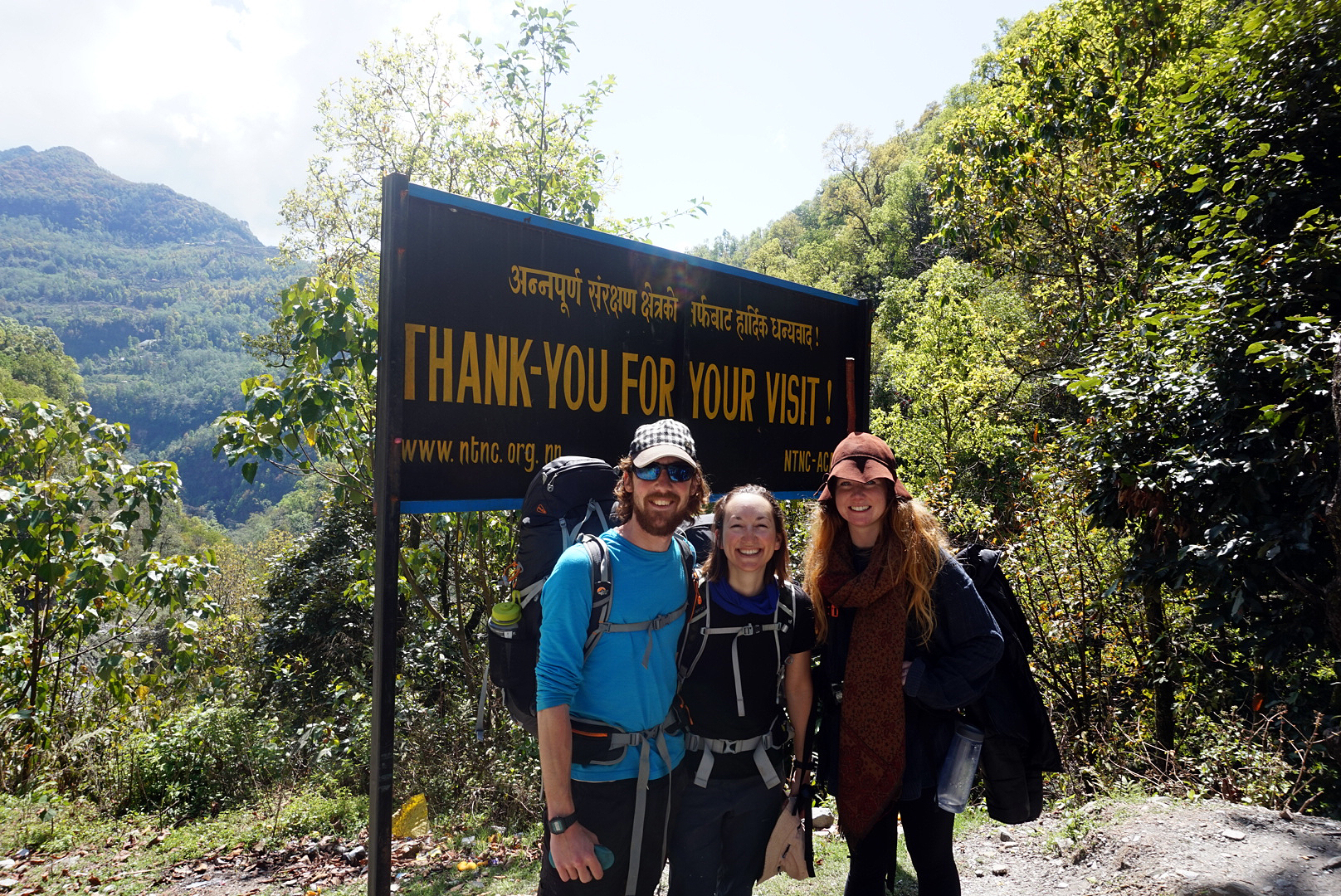
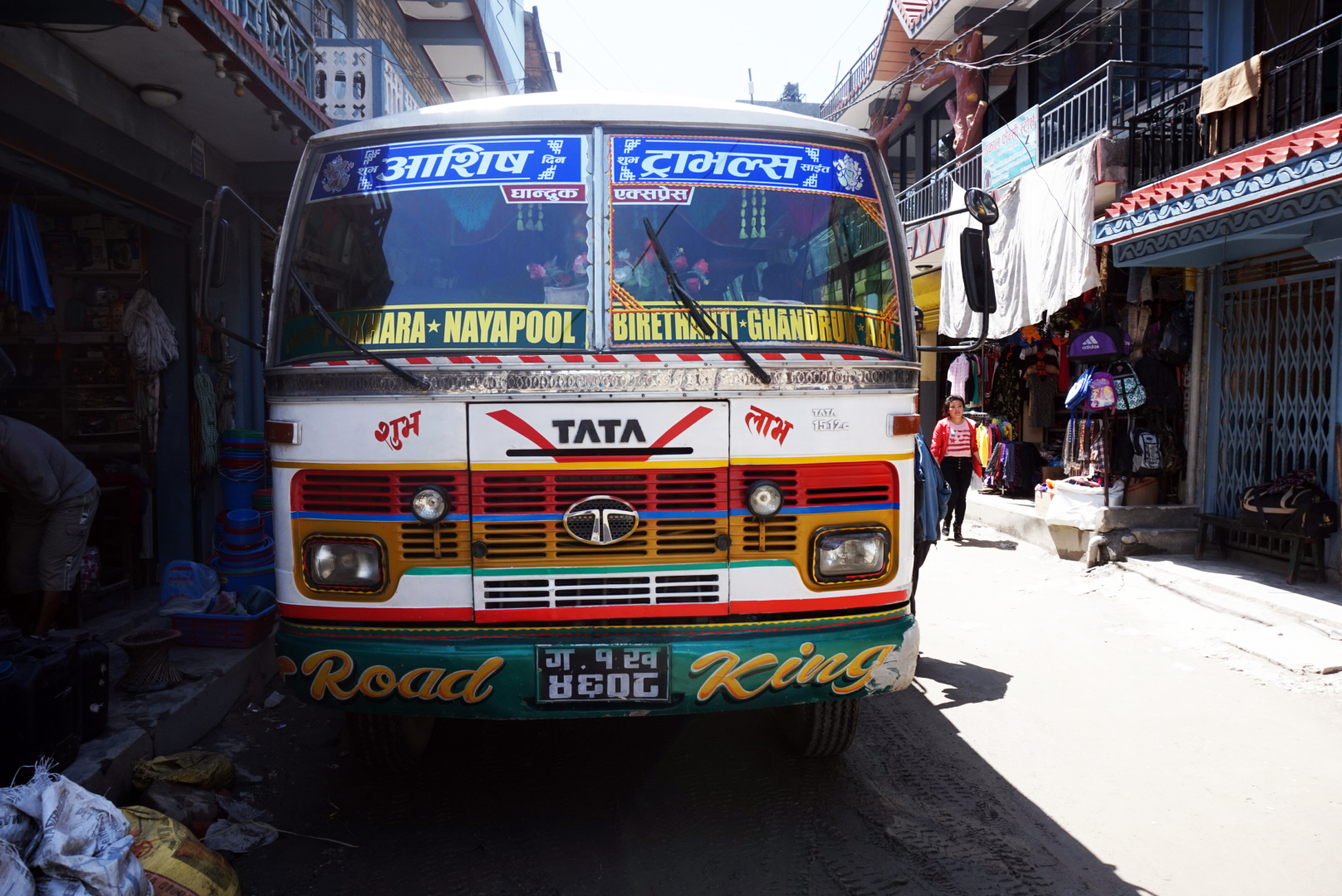
We got our permits stamped for the final time crossing a prayer flag coverd bridge leaving the Annapurna conservation area behind us. It was a sad moment but we instantly cheered ourselves up by deciding to get massages as soon as we got to Pokhara. We got to Nayapul round twelve (ish) which was set around a dusty road. This was the last village of the trek, our goal, our reward. We were surprised to see no flags, no fan fair, no television cameras, just a sleepy bus station and a grubby cafe. We manage to pile onto a local bus for about a quid, for the two hour journey to Pokhara. I ended up being squished between the gear stick and a Nepalese family. The winding roads, blaring Nepalise pop music and crazy driving was a massive shock after our quiet life. In fact the Nepalese buses deserve a post of their own (stay tuned).
We realised our visas for Nepal ran out that day so we had to swing by the imagination office before we could reward ourselves with booze, food and massages. Back at Kiwi Hostel where we started our Himalayan adventure, Du (our Danish friend we met in Kathmandu and who trekked with us for the first half) was in the dorm. Since leaving us he had treked to Annapurna base camp. It was nice to see him and we all went out for beers and pizza to exchange stories.
Next stop Everest via a massage and a large Gin.